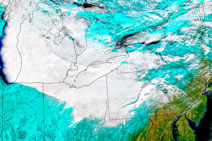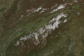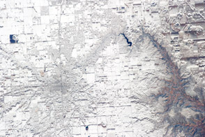
After several mostly uneventful months of winter, the densely populated northeastern United States was buried in mounds of snow and blasted by gale-force winds on January 28-29, 2022. Twelve states from North Carolina to Maine received measurable snowfall from the nor’easter; eight of them had towns report more than a foot (30 centimeters) of snow.
Due to the moderating effect of warmth and moisture from the ocean, coastal areas often see less snow during winter storms. But in this case, the New Jersey shore, Long Island, and coastal New England from New London to Cape Cod to Boston drew the greatest snowfalls, with some areas seeing the flakes fly at rates up to 3 to 4 inches per hour. According to National Weather Service (NWS) reports, more than 21 inches of snow were measured in Providence, Rhode Island; 29 inches fell in Norton, Massachusetts, 30 in Quincy; and 22 inches dropped on Norwich, Connecticut. Boston tied a record for the most snowfall in a 24-hour period with 23.6 inches, and Islip, New York, had its second-highest daily total (23.2 inches).
The potent nor’easter also brought strong winds sometimes approaching hurricane force. The NWS determined that blizzard conditions were reached in multiple locations in Rhode Island and Massachusetts, affecting as many as 11 million people. A blizzard is defined as a period of at least three hours with falling snow, persistent wind gusts above 35 miles (55 kilometers) per hour, and visibility below 0.25 miles (0.4 kilometers). Marshfield, Massachusetts, endured such conditions for 12 hours, Newport for 9.5, and Boston for 7.5. Wind gusts reached the strength of a category 1 hurricane on Cape Cod, Cape Ann, and Nantucket.
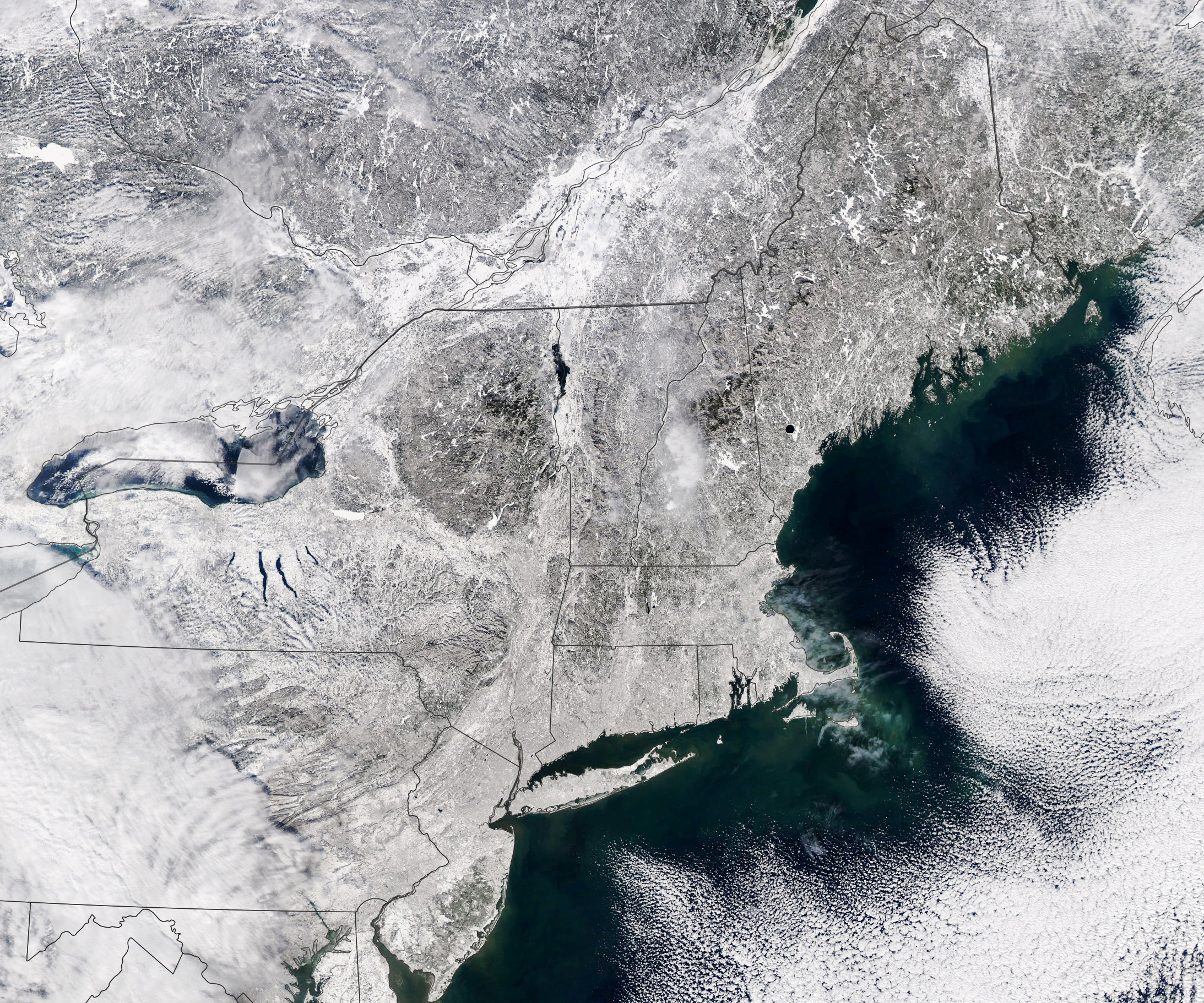
The combination of fierce winds and abundant snow forced the cancellation of nearly all airplane and train travel in the region. More than 100,000 people lost electricity during the storm, though nearly all had the lights back on by the morning of January 31. The Moderate Resolution Imaging Spectroradiometer (MODIS) on NASA’s Aqua satellite acquired a natural-color view (above) as people shoveled their way out on January 30, 2022.
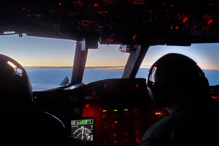
While millions of people hunkered down below, a small team of NASA-funded scientists flew over and into the storm to make measurements and better understand the evolution of winter storms. The multi-year Investigation of Microphysics and Precipitation for Atlantic Coast-Threatening Storms (IMPACTS) mission is the first comprehensive study of snowstorms across the Eastern United States in nearly 30 years. The science team includes researchers from NASA, several universities, the National Center for Atmospheric Research, and the National Oceanic and Atmospheric Administration (NOAA). NASA scientist Adrian Loftus shot several photos (above and below) in the late afternoon on January 29 while serving as mission scientist on NASA’s P-3 Orion research plane.
“Snowstorms are really complicated storms, and we need every piece of data—models, aircraft instruments, meteorological soundings—to really figure out what’s going on within these storms,” said Gerry Heymsfield, a deputy principal investigator for IMPACTS and a scientist at NASA’s Goddard Space Flight Center.
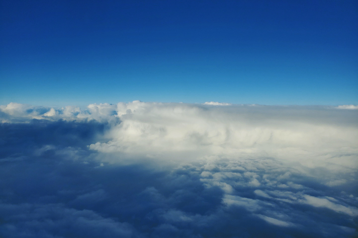
In recent winters, the team has been tracking rain and snow storms across the Midwest and Eastern United States in two NASA planes equipped with scientific instruments. With a high-altitude ER-2 flying above storms and the P-3 flying within the clouds, scientists have been collecting data about snow particles and the conditions in which they form. Scientists have also been measuring cloud properties from below using ground-based radars.
Storms often form narrow structures called snow bands, said Lynn McMurdie, principal investigator for IMPACTS and an atmospheric scientist at the University of Washington. One of the main goals is to understand how these structures form, why some storms do not have snow bands, and how snow bands can be used to predict snowfall.
NASA Earth Observatory image by Lauren Dauphin, using MODIS data from NASA EOSDIS LANCE and GIBS/Worldview. Photographs by Adrian Loftus, NASA GSFC. Story by Michael Carlowicz with Sofie Bates, NASA Earth Science News Team.