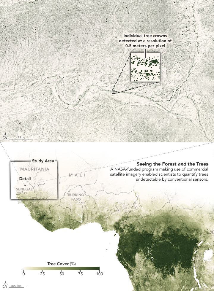
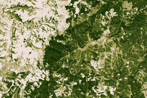
Trees play a vital role in Earth’s carbon and water cycles. They also contribute food, firewood, and other resources important to human activity. But while forests are easy to spot from above, smaller stands of trees have often gone undercounted because they have been harder to detect with the satellite imagers usually available to scientists.
Now an international team of scientists has used artificial intelligence and commercial satellites to identify an unexpectedly large number of trees spread across arid and semi-arid areas of western Africa. These drylands were previously classified as having little to no tree cover, but new analysis techniques proved otherwise. The findings could help scientists better understand and quantify the role drylands have in the storage and cycling of carbon.
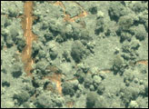
The research team used the Blue Waters supercomputer at the University of Illinois and an artificial intelligence technique called “deep learning” to map the trees. Led by Martin Brandt of the University of Copenhagen, the team first spent a year examining commercial satellite imagery by eye and identifying 90,000 individual trees in order to build a training dataset for the computer. Ankit Kariryaa of the University of Bremen led the development of the deep learning computer processing.
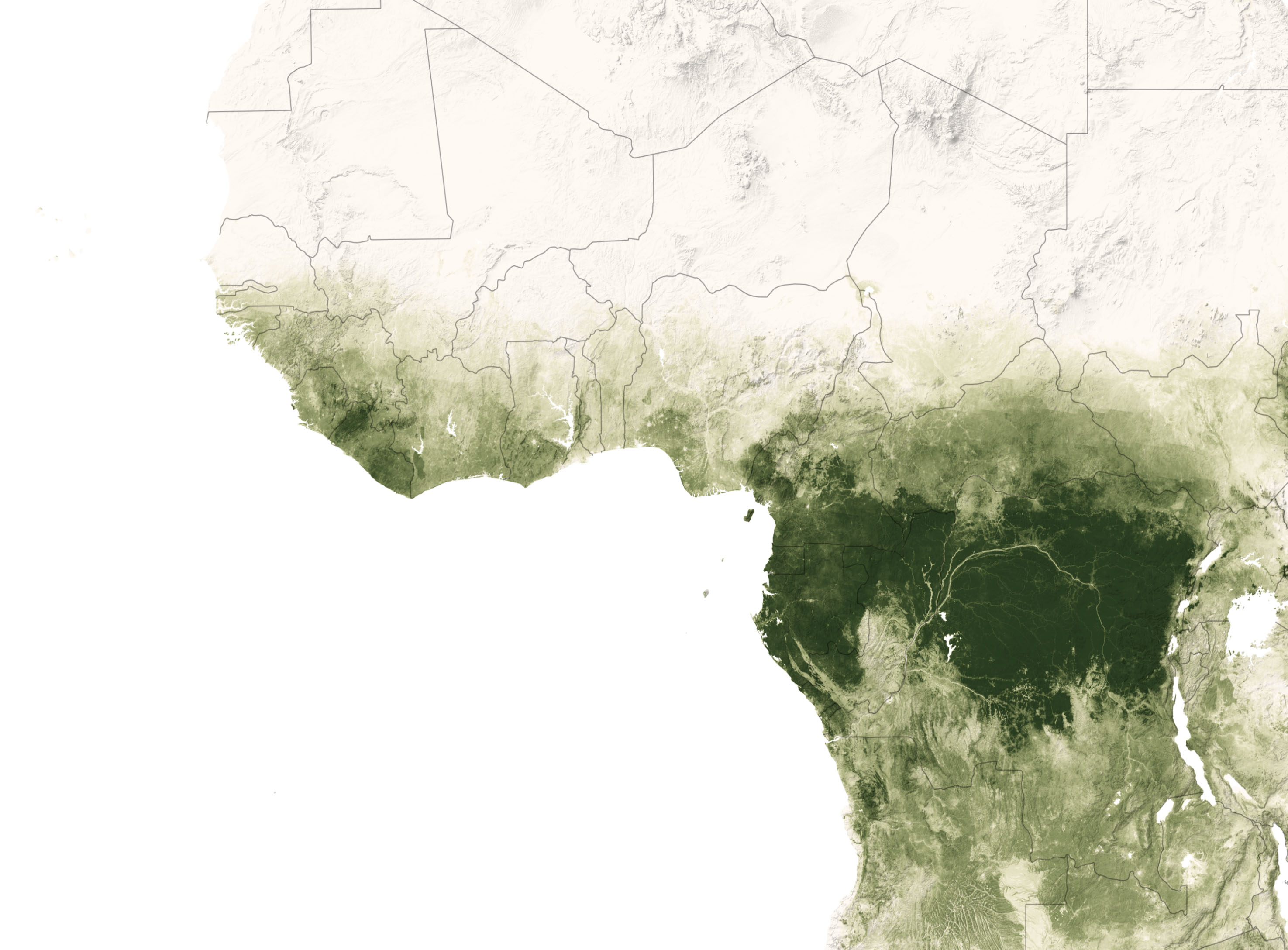
Once Brandt and colleagues developed and tested their dataset, Blue Waters—one of the fastest supercomputers in the world—took just a few days to identify nearly 2 billion trees across 1.3 million square kilometers (500,000 square miles) of sub-Saharan Africa.
Previous land cover mapping studies of the region relied on satellite imagery with 10– or 30–meter resolution (the distance visible within each pixel). Such studies classified large swaths as grassland or bare soil whenever trees covered less than 20 percent of the land area.
For the new study, Brandt and colleagues used commercial, high-resolution (0.5 meter) imagery from DigitalGlobe satellites, including QuickBird-2, GeoEye-1, WorldView-2, and WorldView-3. Brandt gained access to the images through the Commercial Smallsat Data Acquisition (CSDA) program, which acquires data from commercial sources that can support NASA’s Earth science research and application goals.
Brandt’s machine-learning method identified 1.8 billion individual trees standing outside of areas classified as forests. It also measured the crown diameter of each tree. Tree cover was, predictably, higher in areas with more rainfall. “The canopy cover increases from 0.1 percent (0.7 trees per hectare) in hyper-arid areas, through 1.6 percent (9.9 trees per hectare) in arid and 5.6 percent (30.1 trees per hectare) in semi-arid zones, to 13.3 percent (47 trees per hectare) in sub-humid areas,” the researchers wrote in Nature. “Although the overall canopy cover is low, the relatively high density of isolated trees challenges prevailing narratives about dryland desertification and even the desert shows a surprisingly high tree density.”
Mapping trees outside of forests at this level of detail would take months or years with traditional analysis methods, so the use of very high-resolution imagery and machine learning represents a significant breakthrough. The next steps for the research team include expanding their study area to survey more of Africa and estimating the carbon contained within these trees. “We don’t know much about the role of these dryland areas in the global carbon cycle,” said Brandt. “This research is a step towards filling that knowledge gap.”
Brandt and colleagues have published their dataset—which includes the location and crown diameter of trees in western Africa—through the Oak Ridge National Laboratory Distributed Active Archive Center (ORNL DAAC). Users can also find it through a NASA Earthdata search.
NASA Earth Observatory images by Joshua Stevens, using data courtesy of Brandt, Martin, et al. (2020), and Landsat data from the U.S. Geological Survey and Global Forest Watch. Story by Emily Cassidy, NASA ESDS Science Writer, with Jessica Merzdorf and Mike Carlowicz.
© All Rights Reserved: Use of IKONOS, GeoEye, QuickBird and WorldView imagery must be coordinated with Maxar.


