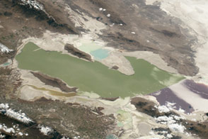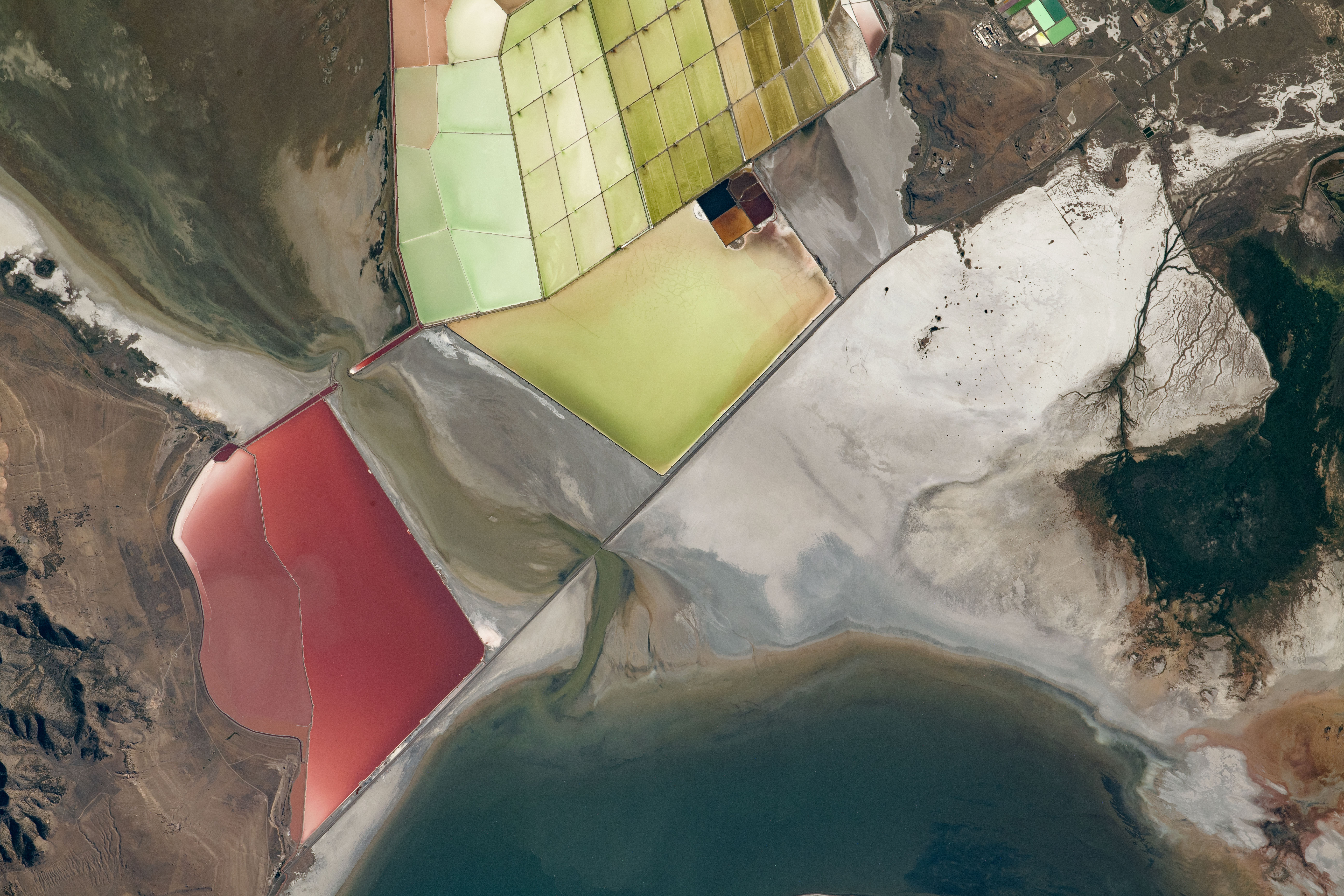
While passing over northern Utah, an astronaut onboard the International Space Station (ISS) captured this photograph of an eastern portion of the Great Salt Lake. Water and sediment flow from Bear River Bay, past salt flats, and into the Great Salt Lake. These colorful salt flats are nestled between the Promontory Mountains and an industrial area to the east. Much of the light-colored area adjacent to the salt pans is dried lakebed.
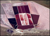
Named for the method of mineral extraction, solar evaporation ponds are key to this area’s industry. These shallow, man-made salt pans slowly evaporate water, crystalizing minerals and making it easier for them to be bulldozed, collected, and processed for sale. Ranging from blue and green to orange and red, the color of each salt pan is dependent on the concentrations of salt, bacteria, and algae. In general, blue-hued ponds have lower salt levels than red or orange ponds.
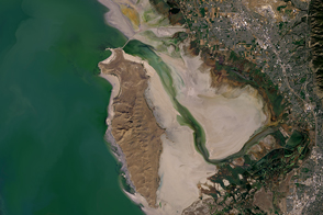
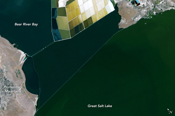
The second image, acquired by Landsat 5, depicts the same location in July 1985. The watersheds supplying Great Salt Lake experienced abnormally high amounts of precipitation throughout the early 1980s, causing the lake to rise to its historic high water elevation of 4,211 feet (1,284 meters) in 1986. Compared to the astronaut photograph, the Great Salt Lake was about 18 feet (5 meters) higher at the time, and many salt flats had a blue-green hue, indicating lower salinity and higher water levels. Due to years of drought and increasing human water use, the Great Salt Lake has since experienced significant reductions in water levels, leading to more exposure of lakebeds.
Astronaut photograph ISS063-E-40184 was acquired on July 5, 2020, with a Nikon D5 digital camera using an 800 millimeter lens and is provided by the ISS Crew Earth Observations Facility and the Earth Science and Remote Sensing Unit, Johnson Space Center. The image was taken by a member of the Expedition 63 crew. The image has been cropped and enhanced to improve contrast, and lens artifacts have been removed. The International Space Station Program supports the laboratory as part of the ISS National Lab to help astronauts take pictures of Earth that will be of the greatest value to scientists and the public, and to make those images freely available on the Internet. Additional images taken by astronauts and cosmonauts can be viewed at the NASA/JSC Gateway to Astronaut Photography of Earth. Caption by Sara Schmidt, GeoControl Systems, JETS Contract at NASA-JSC. NASA Earth Observatory image by Lauren Dauphin, using Landsat data from the U.S. Geological Survey.