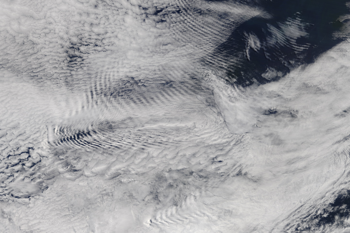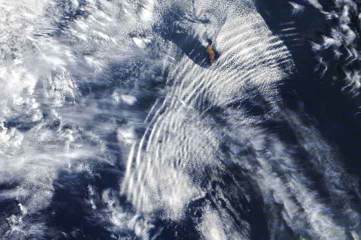
On the night of May 10, 2020, a layer of marine stratocumulus clouds hung low over the South Atlantic Ocean off the west coast of Africa, as is the case many nights. The cloud type commonly forms here because cool water at the ocean surface chills the air immediately above the water, causing water vapor to condense and form clouds. But the clouds that night, made visible in satellite images by reflected moonlight, displayed some particularly complex and beautiful wave patterns.
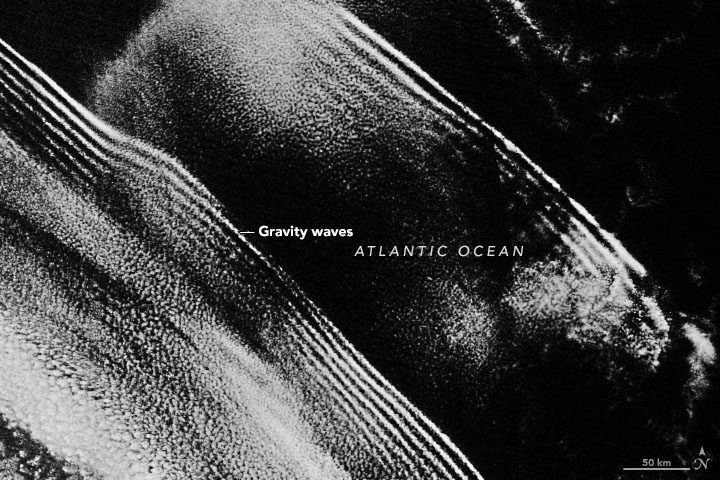
The phenomenon has similarities to waves moving through an ocean or lake. Waves form when water is disturbed—pushed upward by things like wind or a boat—and then pulled downward again by gravity. Waves also form in the atmosphere when air is disturbed—pushed up by things like mountains or islands, storms, or interacting air masses—and then gravity causes the air to fall again. Clouds can form at the crests of these waves, occasionally making the structures visible to human eyes. But given that the systems can span thousands of kilometers, they are perhaps best viewed from space.
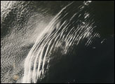
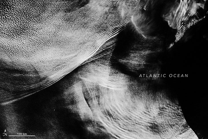
These nighttime images, acquired on May 10 with the Visible Infrared Imaging Radiometer Suite (VIIRS) on the Suomi NPP satellite, show gravity wave clouds off the coasts of Angola (top) and South Africa (second image). The VIIRS “day-night band” detects light in a range of wavelengths from green to near-infrared and uses filtering techniques to enhance dim signals such as gas flares, auroras, wildfires, and reflected moonlight.
Based on the images alone, it is not possible to know exactly what caused the waves that night. “There are multiple known sources of gravity waves in low-altitude marine clouds,” said Sandra Yuter, a scientist at North Carolina State University who has studied the phenomenon. She notes that gravity waves off the west coast of Africa are often triggered by large and tall thunderstorms, and by the interaction of offshore winds with a stable layer of air over the water. In this image, the gravity wave clouds near South Africa might have been provoked by storms farther south.
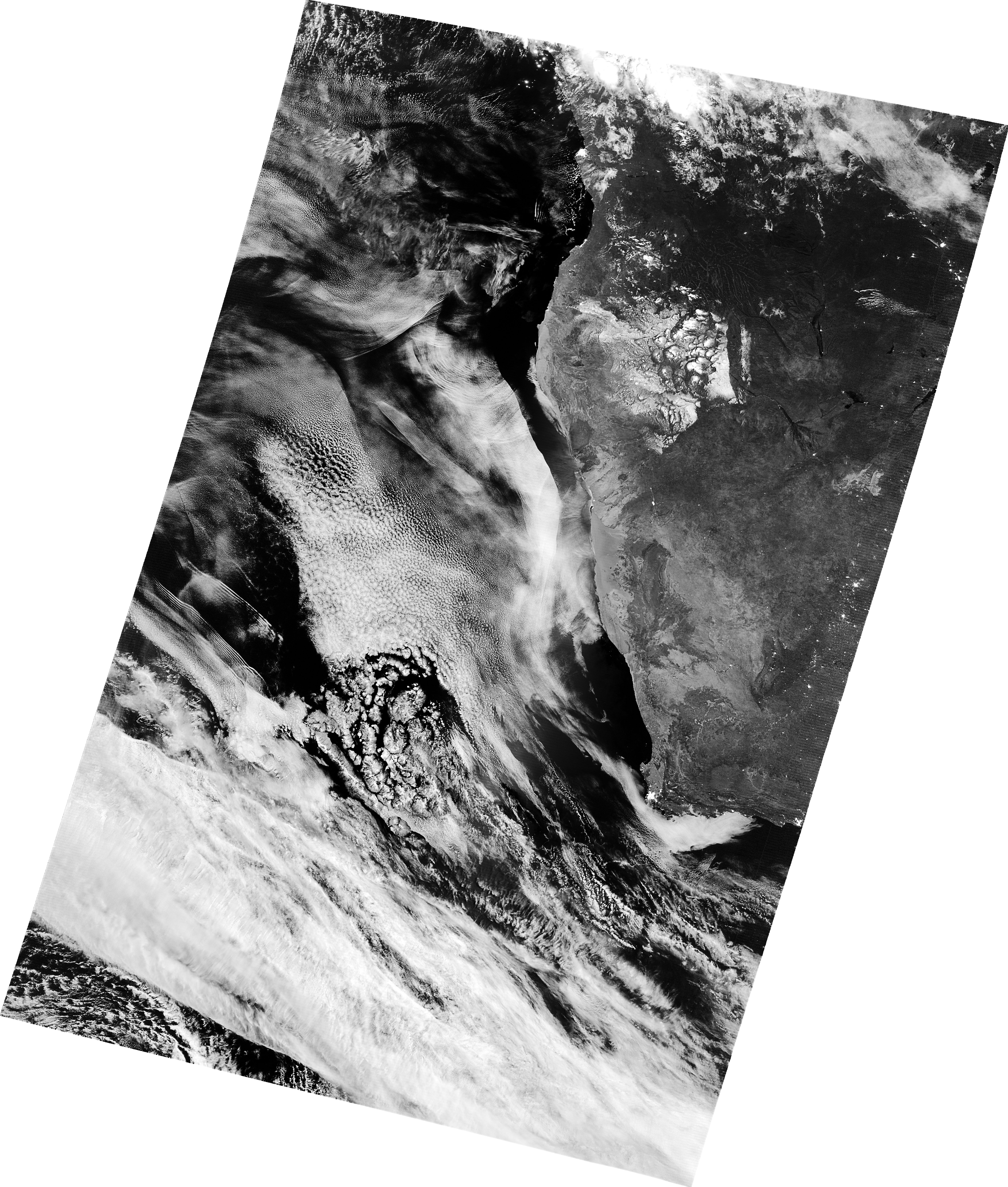
The complex wave clouds near Angola suggest that there could be a variety of sources. Note the particularly abrupt edge between clouds and clear sky to the lower right. According to Yuter, that feature is likely due to “cloud erosion.” Marine layer clouds are thin and sit low in the sky—just a few hundred meters thick and topping out at about 2 kilometers in altitude. If gravity waves can mix enough dry air from above the cloud layer into this thin cloud layer, the relative humidity drops and the cloud layer dissipates.
One satellite snapshot in time makes it difficult to tell if cloud erosion is taking place here. Yuter has studied sequences of images, however, showing that these sharp transitions can be thousands of kilometers long. Moving westward at 8-12 meters per second, they can clear out the clouds more than 1000 kilometers from the coast of Africa.
NASA Earth Observatory images by Joshua Stevens, using VIIRS day-night band data from the Suomi National Polar-orbiting Partnership. Story by Kathryn Hansen.