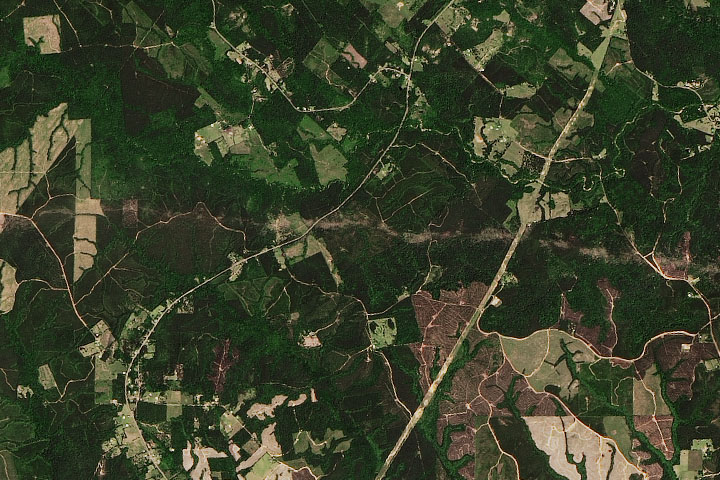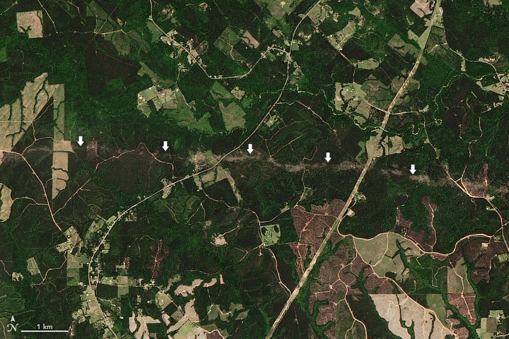
On April 22-23, 2020, powerful thunderstorms blew across eastern Texas and western Louisiana and spawned several tornadoes, including some that caused severe damage.
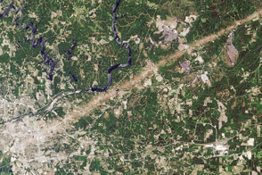
The Operational Land Imager (OLI) on Landsat 8 acquired this image showing the trail of damage caused by an EF-2 tornado that tore through Jasper and Newton counties in Texas. According to the National Weather Service, the storm had peak winds of 130 miles (210 kilometers) per hour. It damaged roofs and snapped trees along a track that extended 37 miles (60 kilometers). While this tornado passed through a rural area and caused no injuries, the same supercell storm system spawned several other tornadoes, some of which caused injuries, deaths, and severe damage to homes in several places in the region.
Scientists with NASA’s Earth applied sciences disasters program work regularly with National Weather Service offices to locate satellite images that can aid in damage assessments after tornadoes touch down. “This particular tornado was not a big newsmaker in comparison to some of the others, but the image really showcases how satellites can be useful for quickly assessing damage in rural areas that can be impossible for people on the ground to reach quickly,” said Lori Schultz, a University of Alabama research scientist based at NASA’s Marshall Space Flight Center. “The satellites can be really useful for filling in the gaps.”
NASA Earth Observatory images by Joshua Stevens, using Landsat data from the U.S. Geological Survey. Text by Adam Voiland.