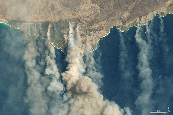
On January 9, 2020, the Operational Land Imager (OLI) on Landsat 8 acquired natural-color observations of burned land and thick smoke covering Australia’s Kangaroo Island. According to news reports, at least 156,000 hectares (600 square miles, nearly one-third of the land area) have burned and 50 homes have been destroyed on the island of 4,700 people.
NASA Earth Observatory images by Lauren Dauphin, using Landsat data from the U.S. Geological Survey. Caption by Mike Carlowicz.