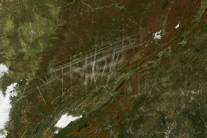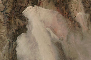
A thin veil of dust blows across the low-lying region south of the Parapeti and Guapay (Grande) Rivers in southern Bolivia. An astronaut shot this photograph as strong winds blew parallel to the Andean foothills over a dried riverbed, creating streaks of airborne sediment. While the dust obscures much of the land below, blocky plots of deforestation and agricultural development are visible along the rivers through the haze.
The winter season in the Bolivian lowlands—May to October,—is often hot and dry. With little to no rainfall, the rivers dry up and become vulnerable to aeolian processes such as wind erosion and transport of sediments as dust plumes. Strong winds can keep the sediment aloft for long periods of time, leading to transport and deposition further to the south.
The Andean foothills act as a barrier, preventing the airborne dust from traveling west. However, there is little need for it on the other side of the mountains. To the west of the area in this image, the large salt flats of Bolivia provide material for far greater dust storms.
Astronaut photograph ISS056-E-156989 was acquired on August 23, 2018, with a Nikon D5 digital camera using a 122 millimeter lens and is provided by the ISS Crew Earth Observations Facility and the Earth Science and Remote Sensing Unit, Johnson Space Center. The image was taken by a member of the Expedition 56 crew. The image has been cropped and enhanced to improve contrast, and lens artifacts have been removed. The International Space Station Program supports the laboratory as part of the ISS National Lab to help astronauts take pictures of Earth that will be of the greatest value to scientists and the public, and to make those images freely available on the Internet. Additional images taken by astronauts and cosmonauts can be viewed at the NASA/JSC Gateway to Astronaut Photography of Earth. Caption by Sara Schmidt, GeoControl Systems, and Andrea Meado, Jacobs Technology, JETS Contract at NASA-JSC.