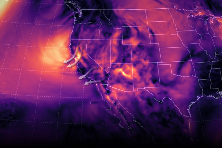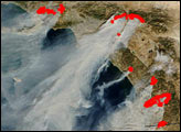
Fueled by hot weather, low humidity, and bursts of strong easterly and northeasterly winds, several large wildfires ignited along the West Coast of the United States and Mexico in late October 2019. Seasonal Santa Ana and Diablo winds blew in from hot, dry areas and accelerated down mountain ranges, creating conditions where a few sparks and small brush fires could quickly get whipped up into large conflagrations.
U.S. weather and fire forecasters delivered “red flag warnings” to Californians, predicting extreme fire-promoting conditions through October 29 in various parts of the state. On October 25, forecasts for Northern California called for steady 25 to 45 mile per hour winds and humidity between 9 to 16 percent. In Southern California, temperatures were expected to range from 87 to 97 degrees Fahrenheit (30 to 36 degrees Celsius), with humidity between 2 and 9 percent and winds gusting as high as 65 miles per hour.
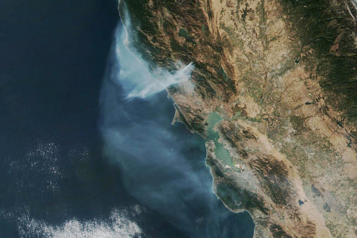
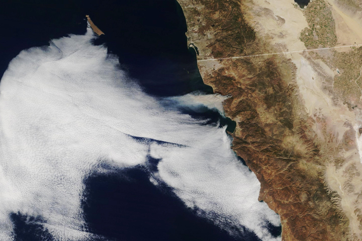
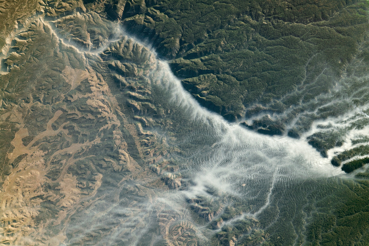
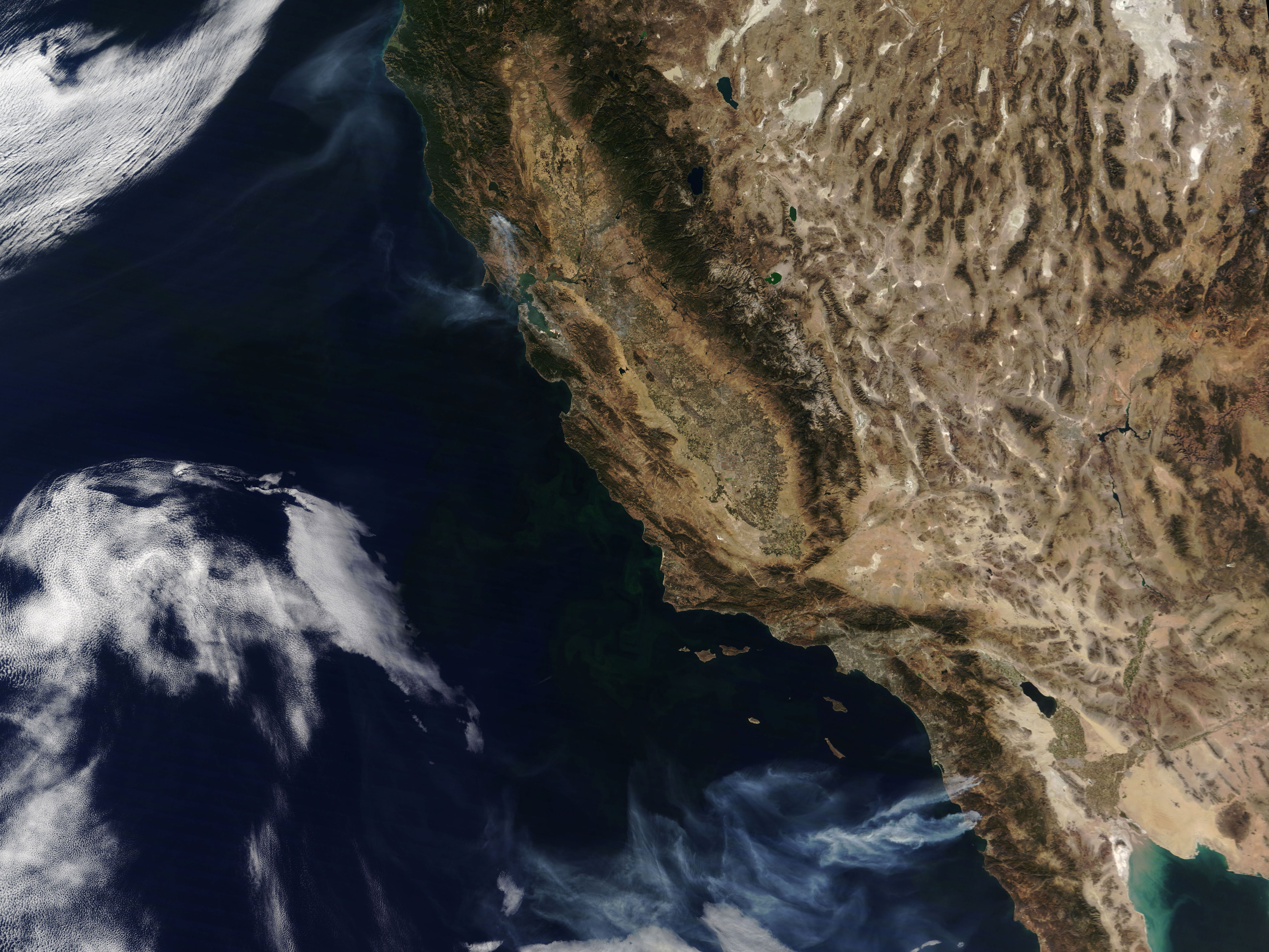
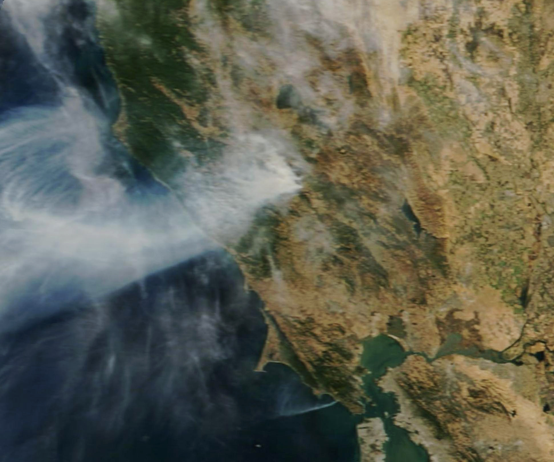
On October 25, 2019, the Moderate Resolution Imaging Spectroradiometer (MODIS) on NASA’s Terra satellite acquired a natural-color image (top) with a wide view of fires near the Pacific Coast. The second image, also from Terra MODIS, focuses on the smoke plume from the Kincade fire in Sonoma County as it appeared on October 24. Images captured that day by the GOES East weather satellite show the wind-driven circulation of clouds and smoke from the fire.
The Kincade fire, which first ignited on October 23, raged across remote, steep terrain that was difficult to access. At least 2,000 residents of Geyserville were evacuated, and thousands of people in the region went without electric power due to planned blackouts (intended to prevent electricity-sparked fires). At 9:30 a.m. on October 25, Cal Fire reported that 21,900 acres had burned in the area, 49 structures had been destroyed, and 735 were threatened. The fire was 5 percent contained.
North of Los Angeles, the Tick fire grew explosively on October 24 near Santa Clarita. Though it had burned just 4,300 acres and could barely be detected by satellite on October 25, the Tick fire spread close to suburban residential areas, jumping across Highway 14 and threatening 10,000 homes, businesses, and other structures. At least 40,00 local residents were told to evacuate. CalFire reported that the fire was 5 percent contained as of 7 a.m. Pacific Time on October 25.
Recent research has shown that fires in California have grown more frequent and larger in recent decades due to rising temperatures. Annual burned area in the state increased by 405 percent from 1972 to 2018.
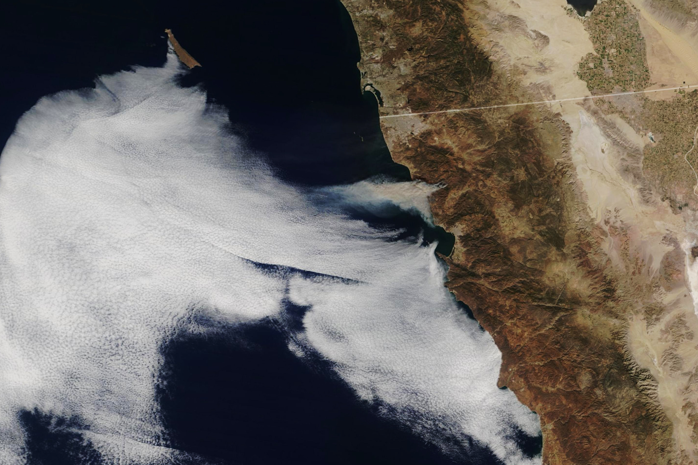
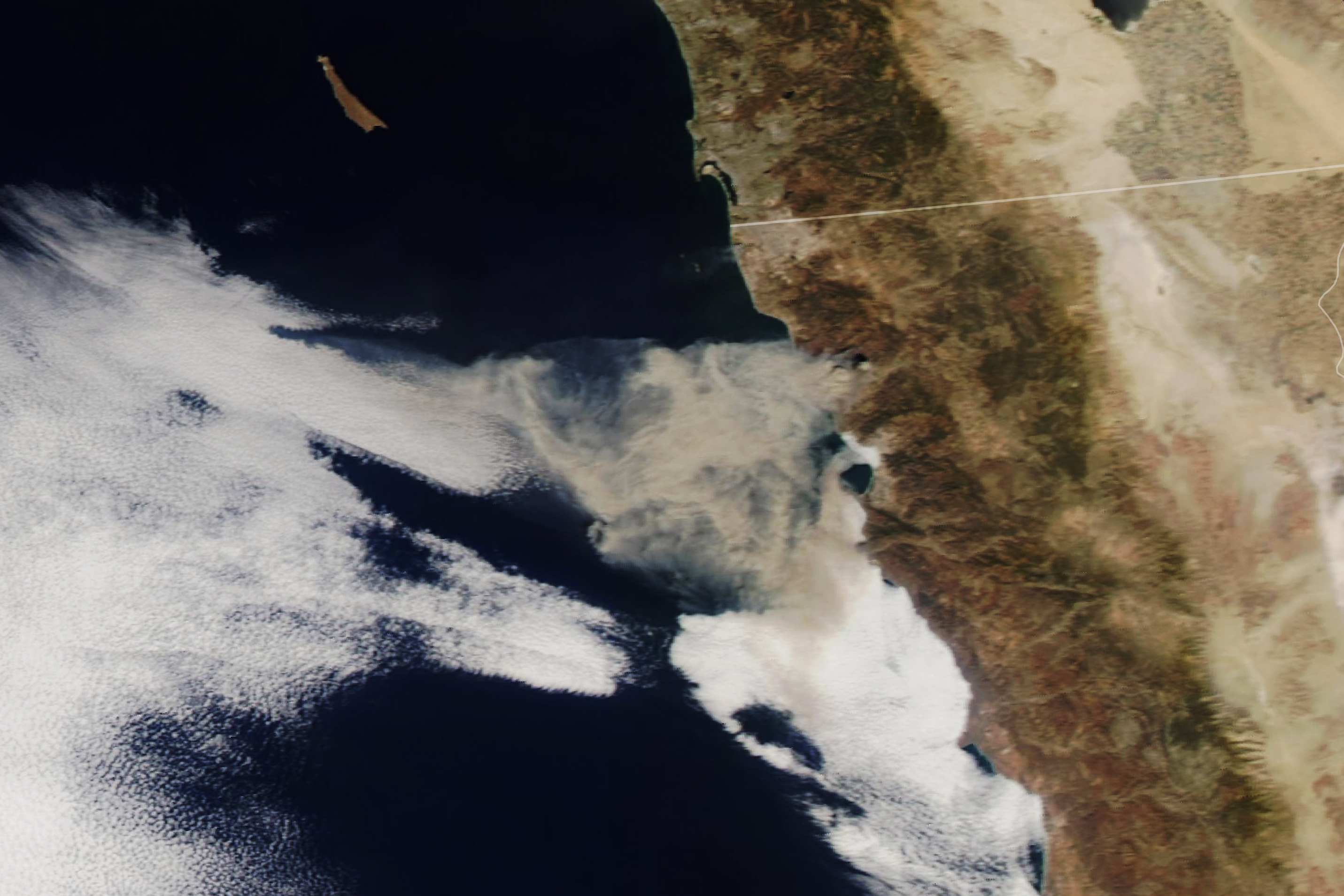
Across the border in Mexico, a fire broke out on October 24 along the northwest coast between Tijuana and Enseneda, near the beach resort town of Rosarito. By the end of the day, the smoky fire had spread across 7,100 acres and was 25 percent contained, according to the Baja California Civil Protection Office. The Moderate Resolution Imaging Spectroradiometer (MODIS) instruments on NASA’s Terra and Aqua satellites acquired images of the fires in the late morning and early afternoon of October 24. GOES East also captured time-lapse images showing the growth of that plume.
Working together with the National Oceanic and Atmospheric Administration, the U.S. Forest Service, and other federal and state agencies, NASA regularly collects and analyzes fire and air quality data with a constellation of satellites and a small fleet of planes. The goal is to help detect and map the extent, spread, and impact of forest fires. In particular, remote sensing provides a strategic, big-picture view of events, while also detecting fires in far-flung regions.
NASA Earth Observatory images by Lauren Dauphin and Joshua Stevens, using MODIS data from NASA EOSDIS/LANCE and GIBS/Worldview. Story by Mike Carlowicz.