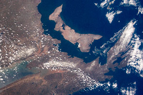
Using short camera lenses to obtain wide fields of view, an astronaut on the International Space Station (ISS) focused on the intricate coastline of Nova Scotia in eastern Canada. These two images of this peninsula, taken from different directions, give a sense of the astronaut flight experience. From an orbital perspective, the same feature on Earth’s surface can look very different in just a minute or two.
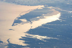
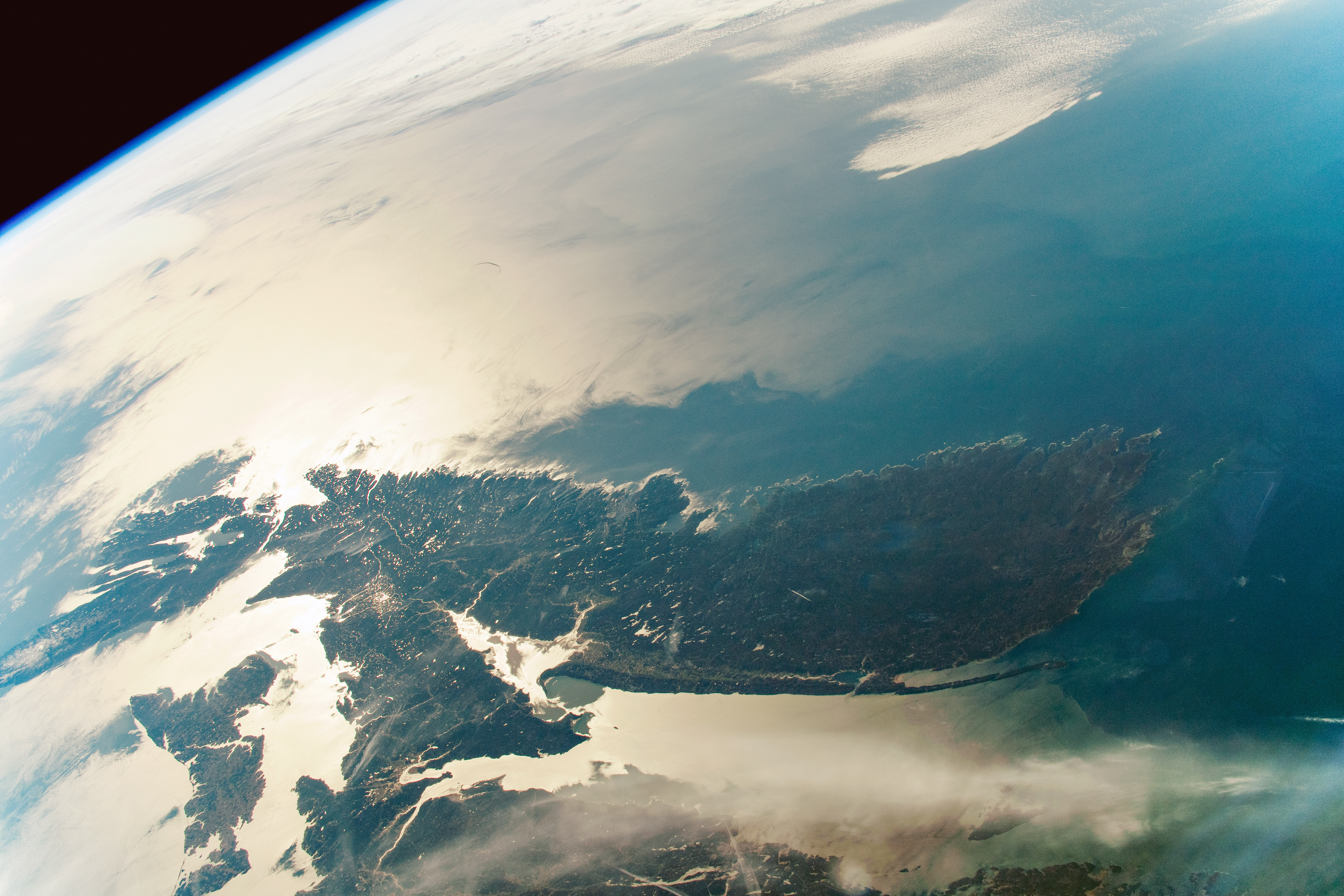
The first photograph shows Nova Scotia to the east of the space station, contrasted against the brilliance of the Sun reflecting off of the Atlantic Ocean. “Sunglint” images like this can highlight fine coastline details: Nova Scotia’s shoreline, northern arms of the Bay of Fundy, and the outline of Prince Edward Island.
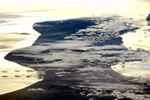
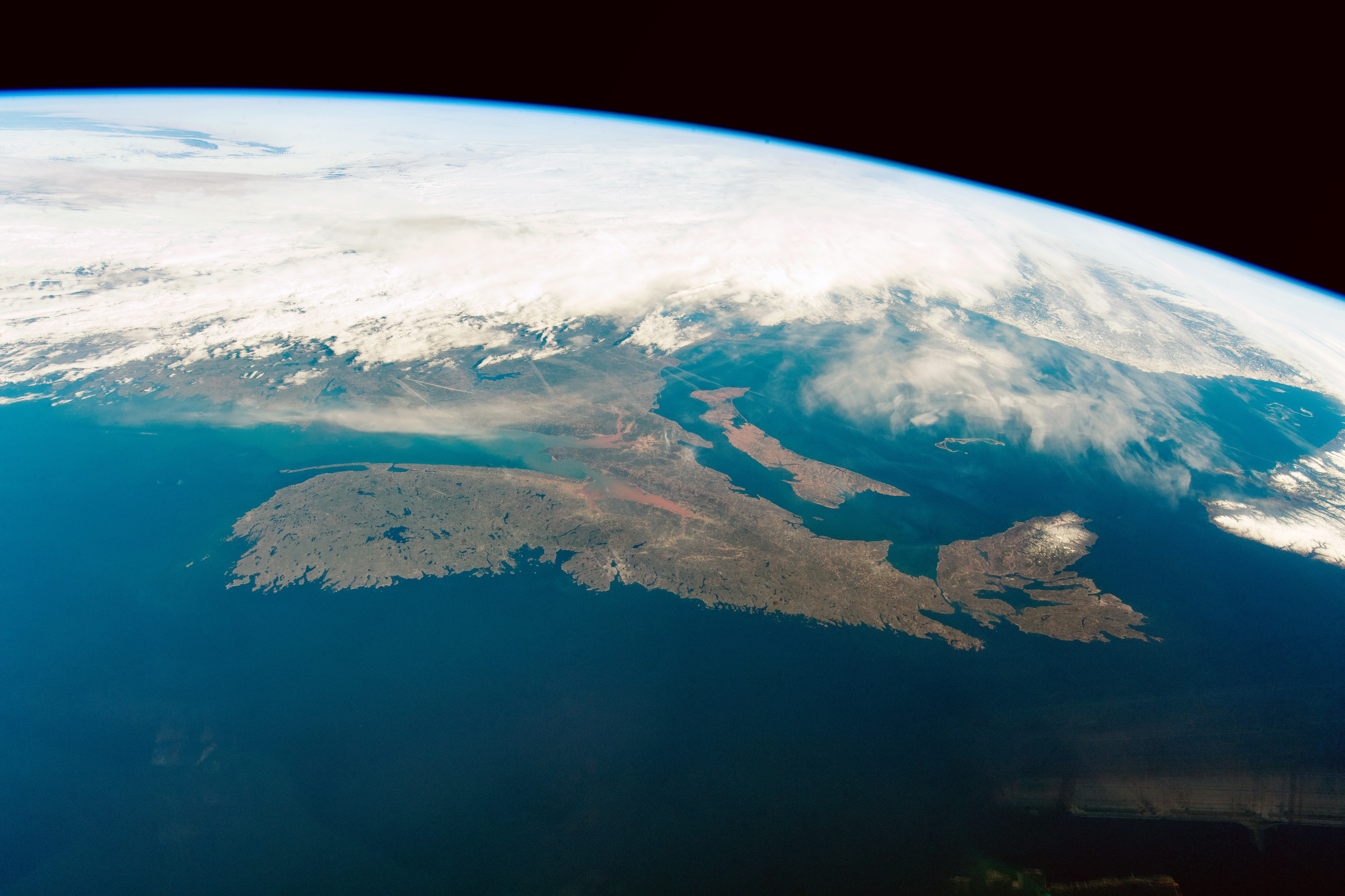
Taken 2 minutes and 18 seconds later, the second view is not only reversed—north to the right instead of the left and the Atlantic in the foreground—but the Sun is behind the camera and there is more color contrast. Land surfaces are brighter than the sea surface, which appears in a generally uniform color. The rounded southern end of Nova Scotia is prominent, having been almost lost to view in the first image. Coastline detail is much reduced. The warm tone of sediment at the head of the Bay of Fundy has become visible, and a hint of snow is visible at the northern end of the peninsula.
The two images also appear at slightly different scales due to the astronaut changing the focal lengths of the lens. The glint image is taken with a longer lens (50 mm), making the Nova Scotia peninsula seem bigger and closer than it does in the later image (35 mm). This is despite the fact that the first image was taken from 600 kilometers distance and the second from about 350 kilometers away (relative to the orbital position of the ISS).
With the different play of light, a ghostly reflection of what may be an ISS solar array is visible at lower right in the second image.
Astronaut photographs ISS059-E-59135 and ISS059-E-52689 were acquired on May 7, 2019, with a Nikon D5 digital camera using 50 and 35 millimeter lenses (respectively) and are provided by the ISS Crew Earth Observations Facility and the Earth Science and Remote Sensing Unit, Johnson Space Center. The images were taken by a member of the Expedition 59 crew. They have been cropped and enhanced to improve contrast, and lens artifacts have been removed. The International Space Station Program supports the laboratory as part of the ISS National Lab to help astronauts take pictures of Earth that will be of the greatest value to scientists and the public, and to make those images freely available on the Internet. Additional images taken by astronauts and cosmonauts can be viewed at the NASA/JSC Gateway to Astronaut Photography of Earth. Caption by M. Justin Wilkinson, Texas State University on the Jacobs Contract at NASA-JSC, and Susan Runco, ARES, NASA-JSC.