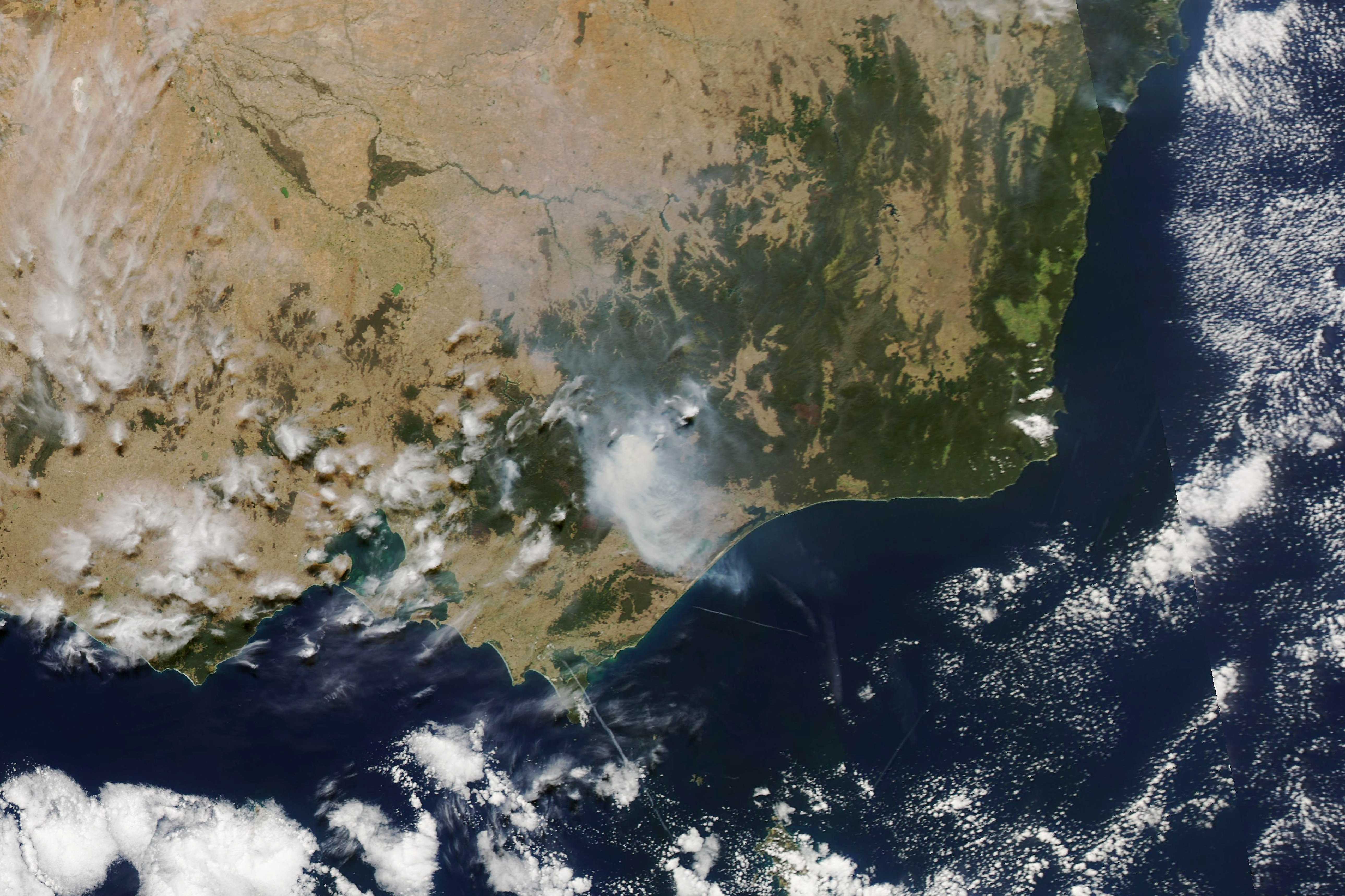
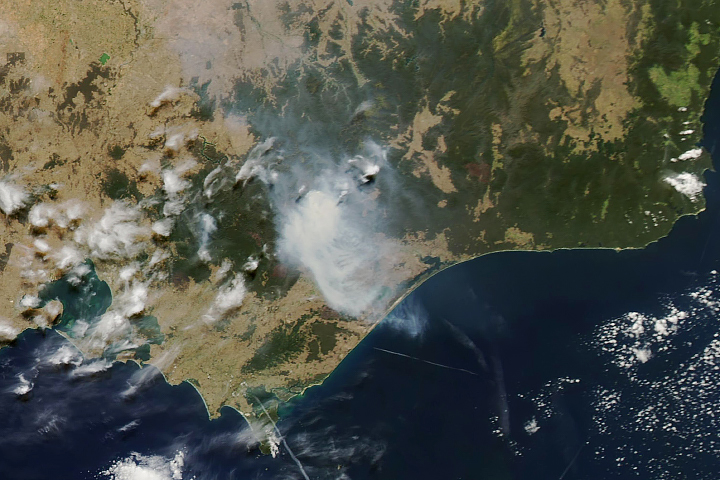
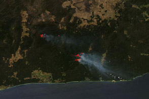
In early March 2019, a rash of bushfires sprouted across the Australian state of Victoria, particularly in the hills east of Melbourne. Government officials noted at least 380 small and large fires burned in the state in the first week of the month, with the vast majority caused by lightning.
An estimated 70,000 hectares (270 square miles) of land burned, with significant fires raging in Bunyip State Park and around Licola, Dargo, Gippsland, and Yinnar South. News agencies reported that the entire town of Tonimbuk was wiped out by fire. Few fatalities have been reported in the state, as government agencies ordered evacuations.
The fires came particularly late in the season for Victoria, though they were not surprising. Months of intense summer heat and long-term drought have parched much of the landscape and primed the vegetation for burning.
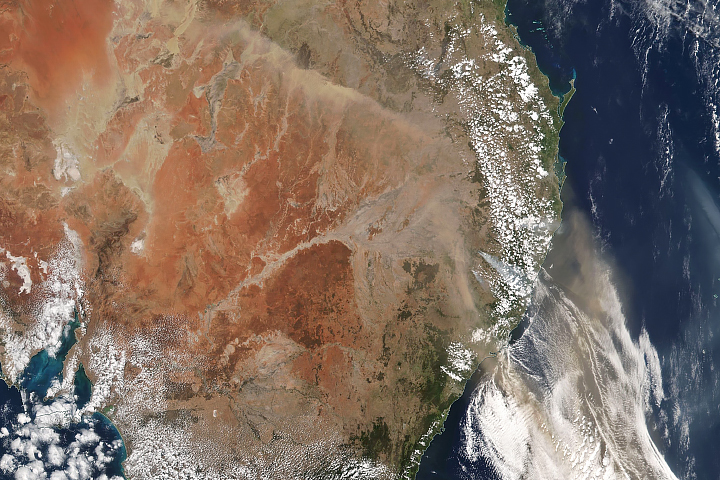
The Moderate Resolution Imaging Spectroradiometer (MODIS) on NASA’s Aqua satellite acquired a natural-color image of smoke over Victoria on March 7, 2019. Government agencies reported 18 fires were still burning in the state that day, despite two days of rain and cooler weather.
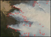
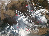
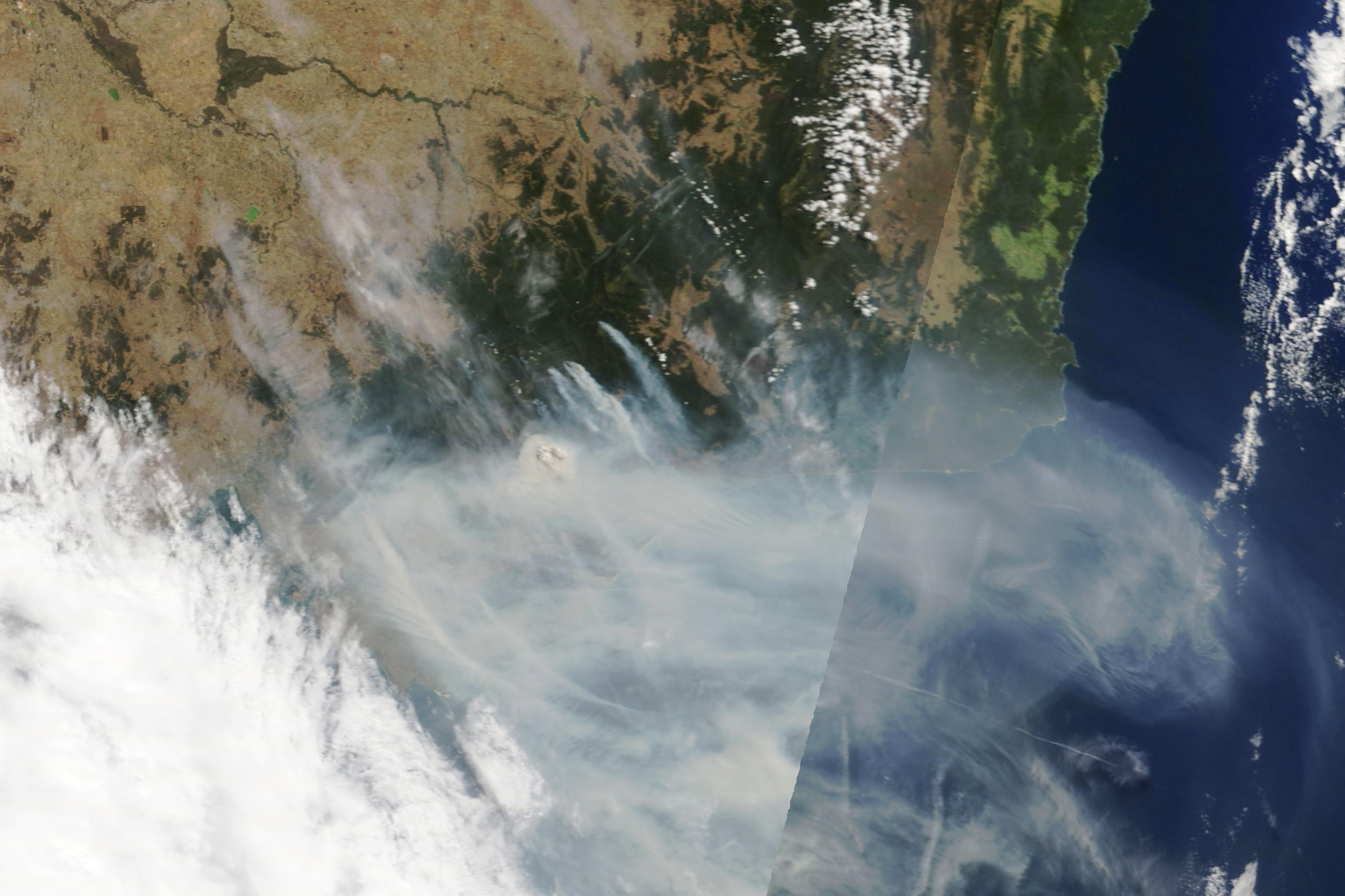
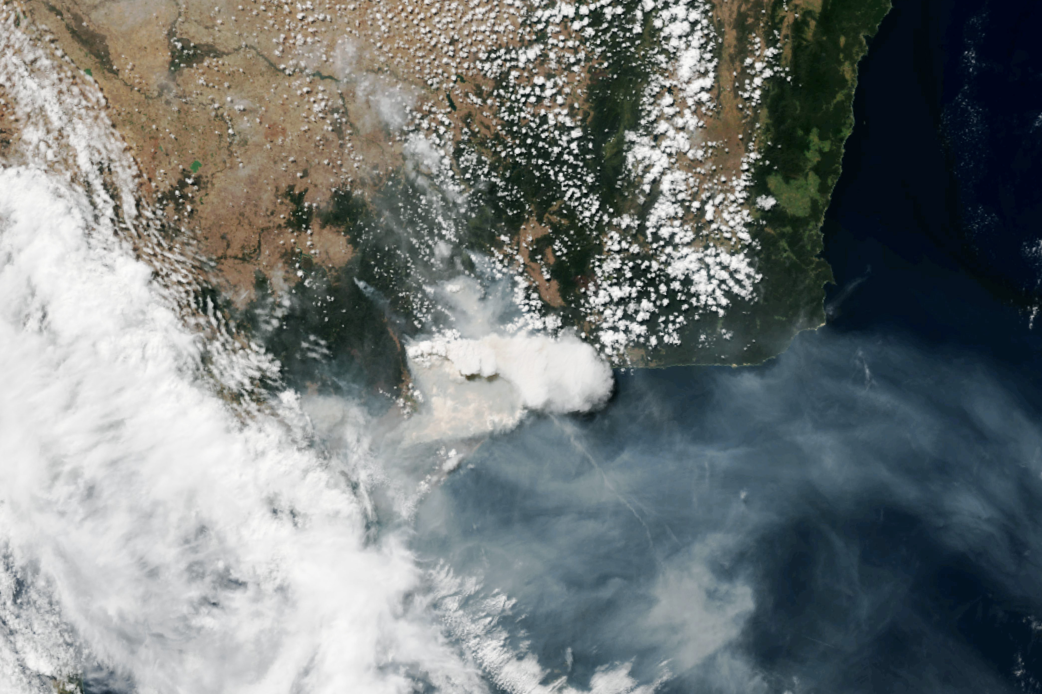
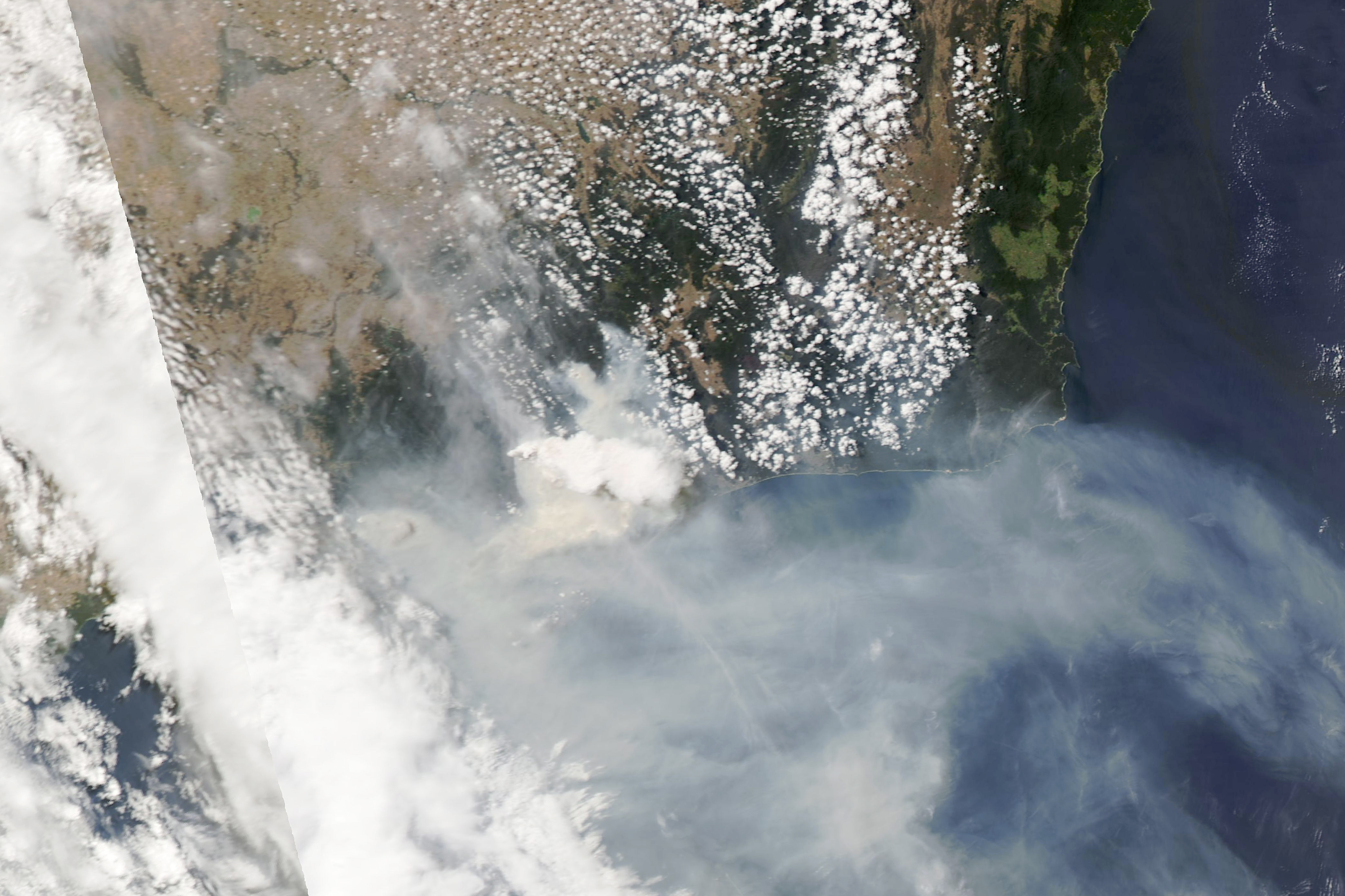
The natural-color images below were acquired within a span of four hours on March 3, 2019. The first image comes from the MODIS instrument NASA’s Terra satellite; the second from the Visible Infrared Imaging Radiometer Suite (VIIRS) on Suomi NPP; and the third from Aqua MODIS. The trio appears to show the formation of bright, tall pyrocumulus clouds. Ground-based photos (here and here) posted by the Australian Bureau of Meteorology seem to affirm that classification.
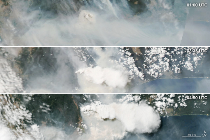
These tall, cauliflower-shaped clouds—sometimes called “fire clouds”—appear as opaque white patches hovering over smoke in satellite imagery. Pyrocumulus clouds form when heat from a fire forces air to rise quickly, which leads to cooling at high altitude and condensation of water vapor into clouds. Under certain circumstances, pyrocumuli can produce full-fledged thunderstorms, making them pyrocumulonimbus clouds.
NASA Earth Observatory images by Lauren Dauphin, using MODIS data from NASA EOSDIS/LANCE and GIBS/Worldview and VIIRS data from the Suomi National Polar-orbiting Partnership. Story by Mike Carlowicz.


