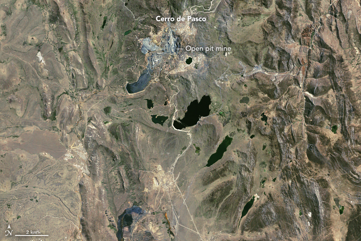
Perched at 4,330 meters (14,210 feet) above sea level, Cerro de Pasco in central Peru stands among the highest cities in the world. It is also one of the most polluted.
Traces of lead in the sediments at the bottom of nearby Lake Llamacocha indicate that the Wari Empire mined and smelted silver here as early as 600 A.D. When Incan and Spanish empires controlled the city in later centuries, Cerro de Pasco continued to be a major source of silver, copper, zinc, and other metals.
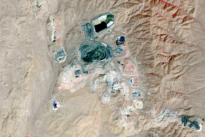
For much of the city’s history, miners worked in hundreds of small-scale silver mines scattered widely in caverns and underground tunnels throughout the area. By the 1950s, most of the small mines had been closed and replaced by large open-pit mines, including one near the center of the city.
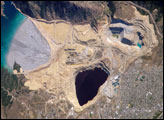
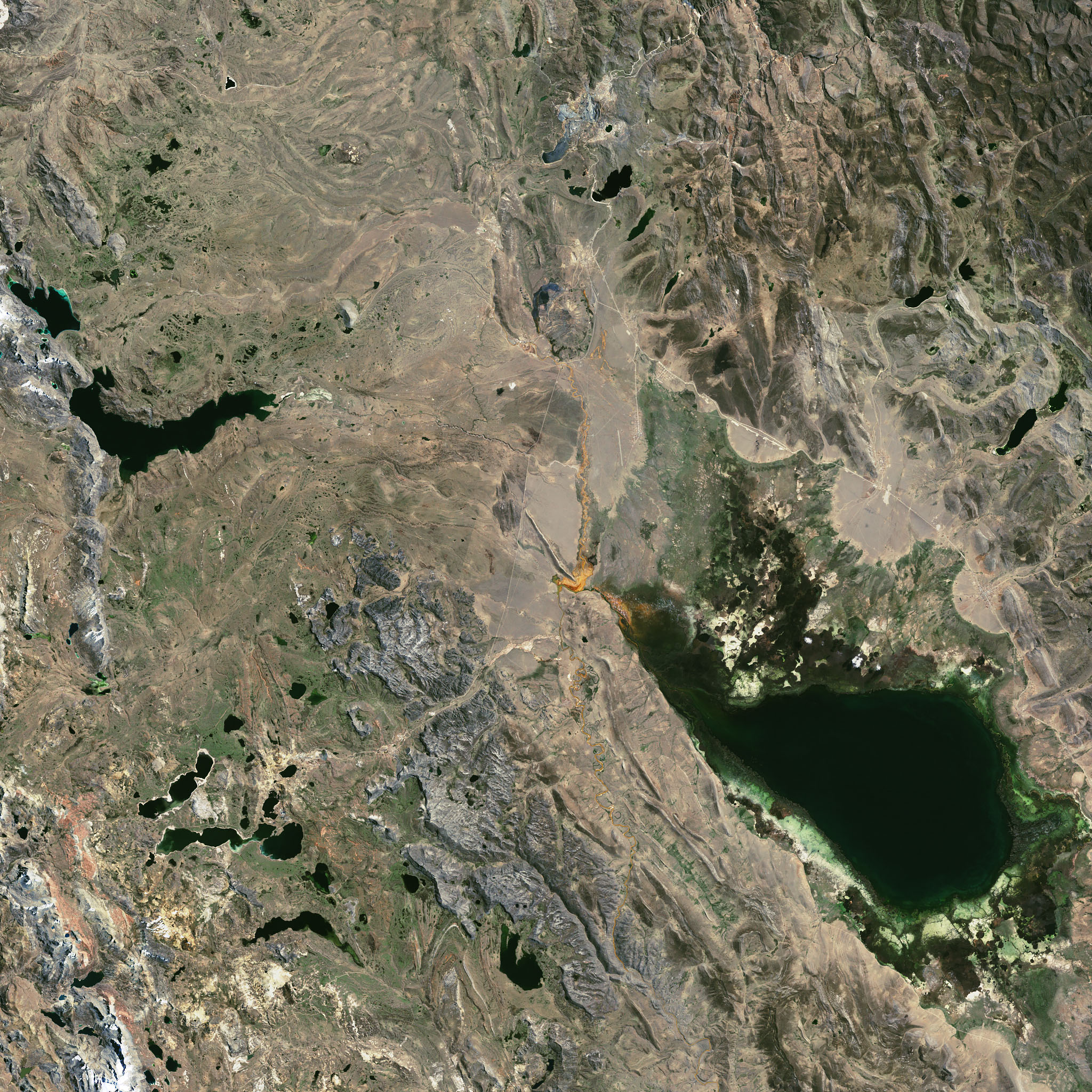
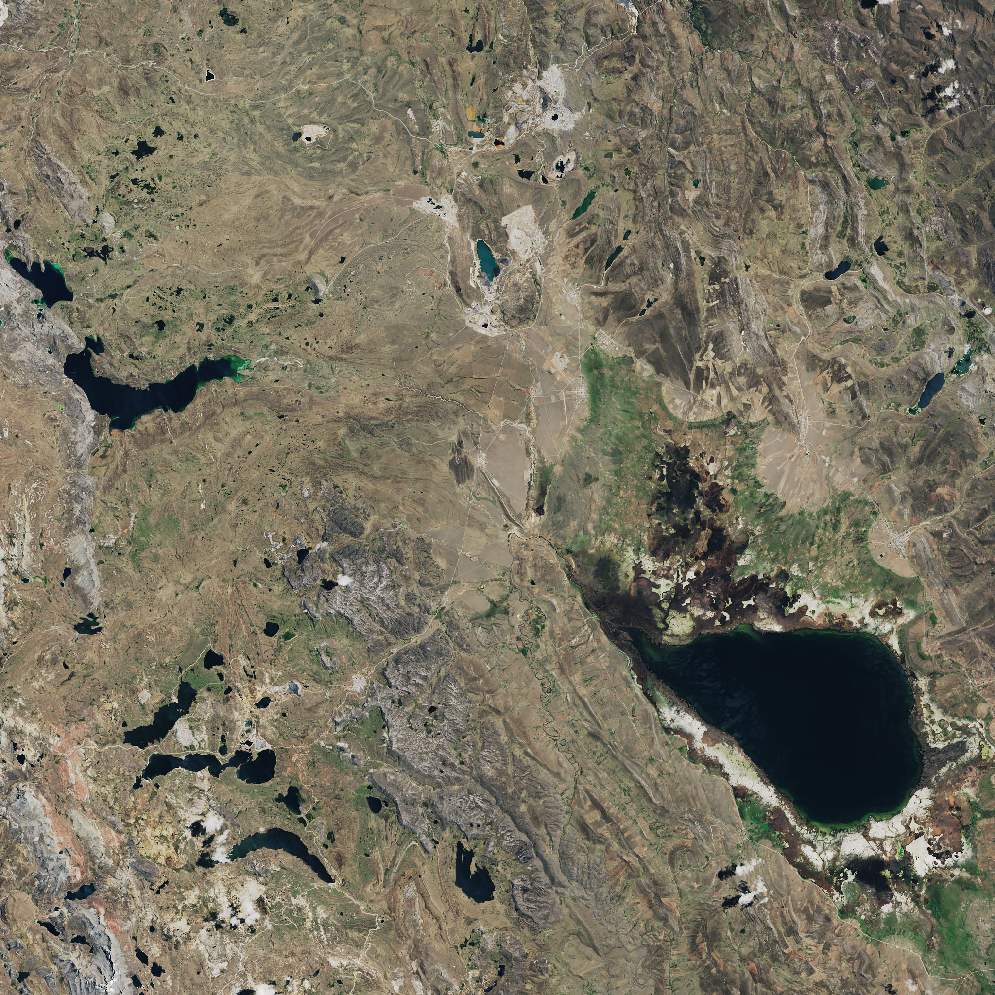
The Thematic Mapper on Landsat 5 captured an image of Cerro de Pasco and its surroundings on September 7, 1985. The second image, acquired by the Operational Land Imager (OLI) on Landsat 8, highlights how much the area had changed by October 1, 2017.
As the pit deepened and widened, it began consuming bits of the surrounding city, including historic neighborhoods once dotted with embassies and consulates. By 2018, the pit was more than 1 kilometer wide (0.6 miles) and deep enough to hold the Empire State Building. A second open-pit mine to the south of the city, near Colquijirca, also expanded significantly.
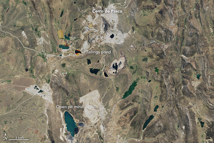
Managing and storing waste rock, overburden, mine tailings, and mine water is a key challenge for any mining operation. (Waste rock and overburden are the excess rock and soil unearthed while reaching ore. Tailings are waste materials, often pulverized rock, leftover after the most valuable metals have been extracted from the ore. Mine water is collected in pits after being used during several parts of the mining process. Tailings are often stored as slurries with mine water in sealed containment ponds or dried and stacked in piles.)
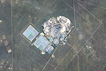
Several tailings ponds are visible southwest of the city; the colorful Quiulacocha tailings pond is one of the most noticeable. Though new tailings have not been added since 1992, it appears reddish-brown because acidic water seeps in from a waste rock dump (just to the northeast) that is rich in pyrite. As pyrite reacts with air and water, it yields sulfuric acid and dissolved iron, which gives the water a rusty color. This mine drainage is also rich in arsenic, lead, copper, zinc, and some harmful heavy metals.
These contaminants do not necessarily stay contained in tailings ponds. A research group led by Donald Rodbell of Union College and other teams of scientists have documented widespread heavy metal contamination of the water, dust, and sediment well beyond these tailings ponds. In particular, scientists found that the sediment in the upper 50 centimeters (20 inches) of Lake Junin, part of a wildlife preserve south of Cierro de Pasco, contains extremely high levels of copper, zinc, and lead. The contamination comes from polluted waters that flowed down the San Juan River, pooled behind the Upamayo Dam, and backed up into Lake Junin. The image acquired on September 5, 1985, is an example of this happening.
Unusually high levels of lead also show up in soils, streams, animal tissues, and even the blood of Cerro de Pasco residents. In fact, lead contamination is so widespread that the Peruvian ministry of health declared a “state of environmental emergency” in 2012.
“What has happened at Cerro de Pasco is truly an environmental and public health disaster,” said Rodbell.
NASA Earth Observatory images by Joshua Stevens, using Landsat data from the U.S. Geological Survey. Story by Adam Voiland.