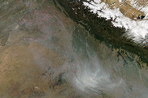
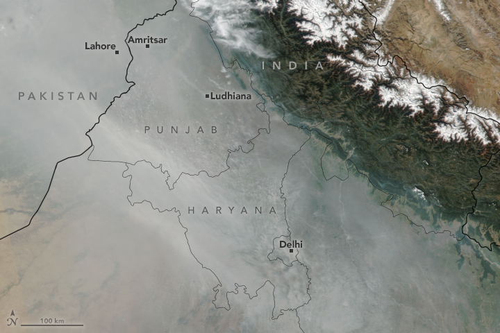
Hazy skies have become an autumn tradition of sorts for the residents of several states in northern India. Each October and November, usually around the time of Diwali celebrations, a pall of smoke hangs over large swaths of the Indo-Gangetic Plain.
While industrial pollution contributes to the haze, most of it comes from crop-burning—especially in the states of Punjab and Haryana, where rice and wheat are widely grown. Burning typically peaks during the first week of November, a time when many farmers set fire to leftover rice stalks and straw after harvest, a practice known as stubble or paddy burning.
Stubble burning is a relatively new phenomenon in northern India. Historically, farmers harvested and plowed fields manually, tilling plant debris back into the soil. When mechanized harvesting (using combines) started to become popular in the 1980s, burning became common because the machines leave stalks that are several inches tall. Burning is considered the quickest and cheapest way to clear the debris and prepare for the wheat crop.
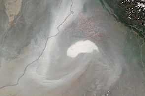
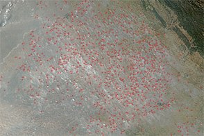
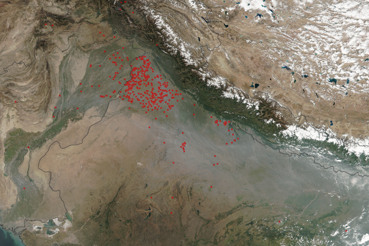
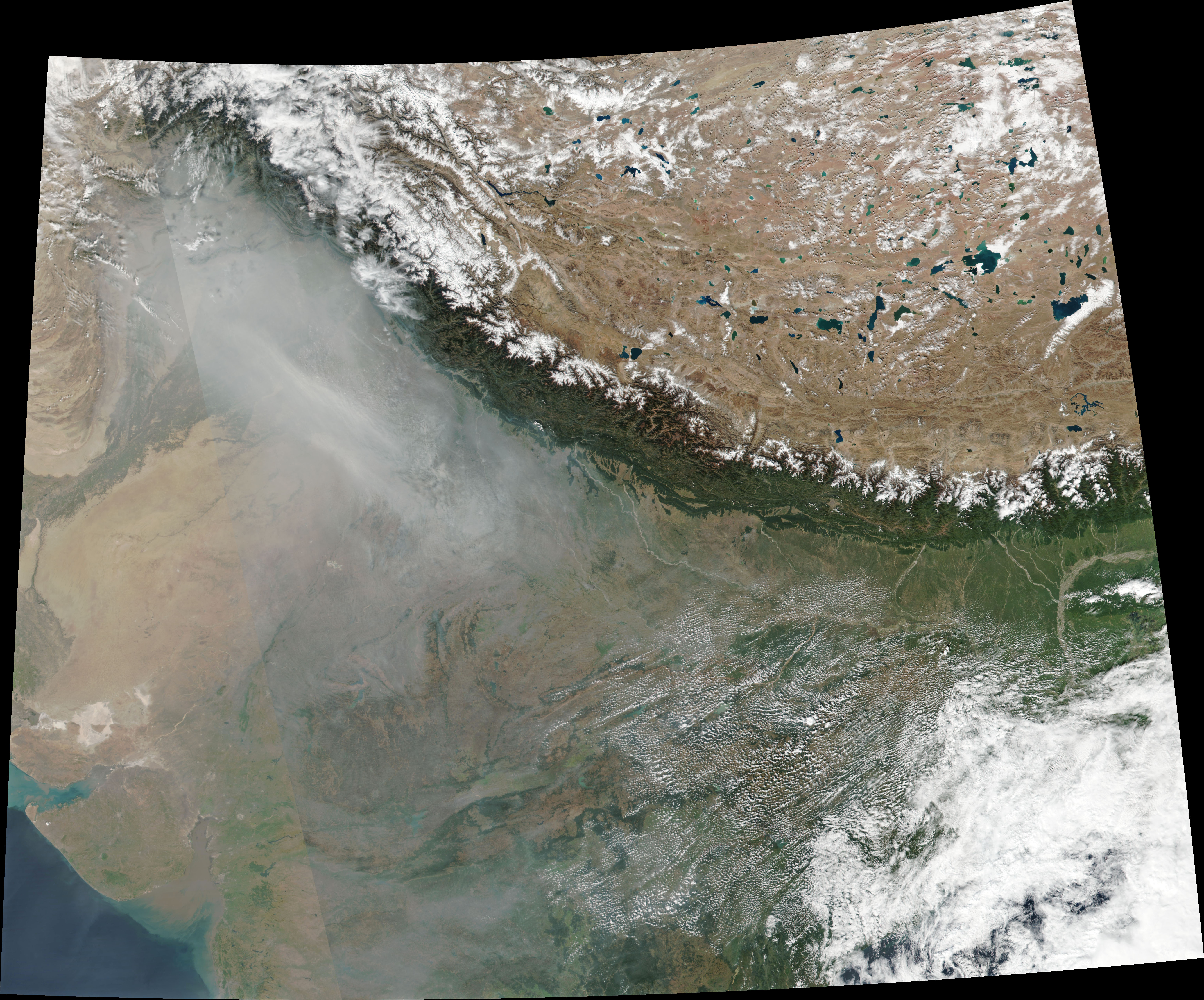
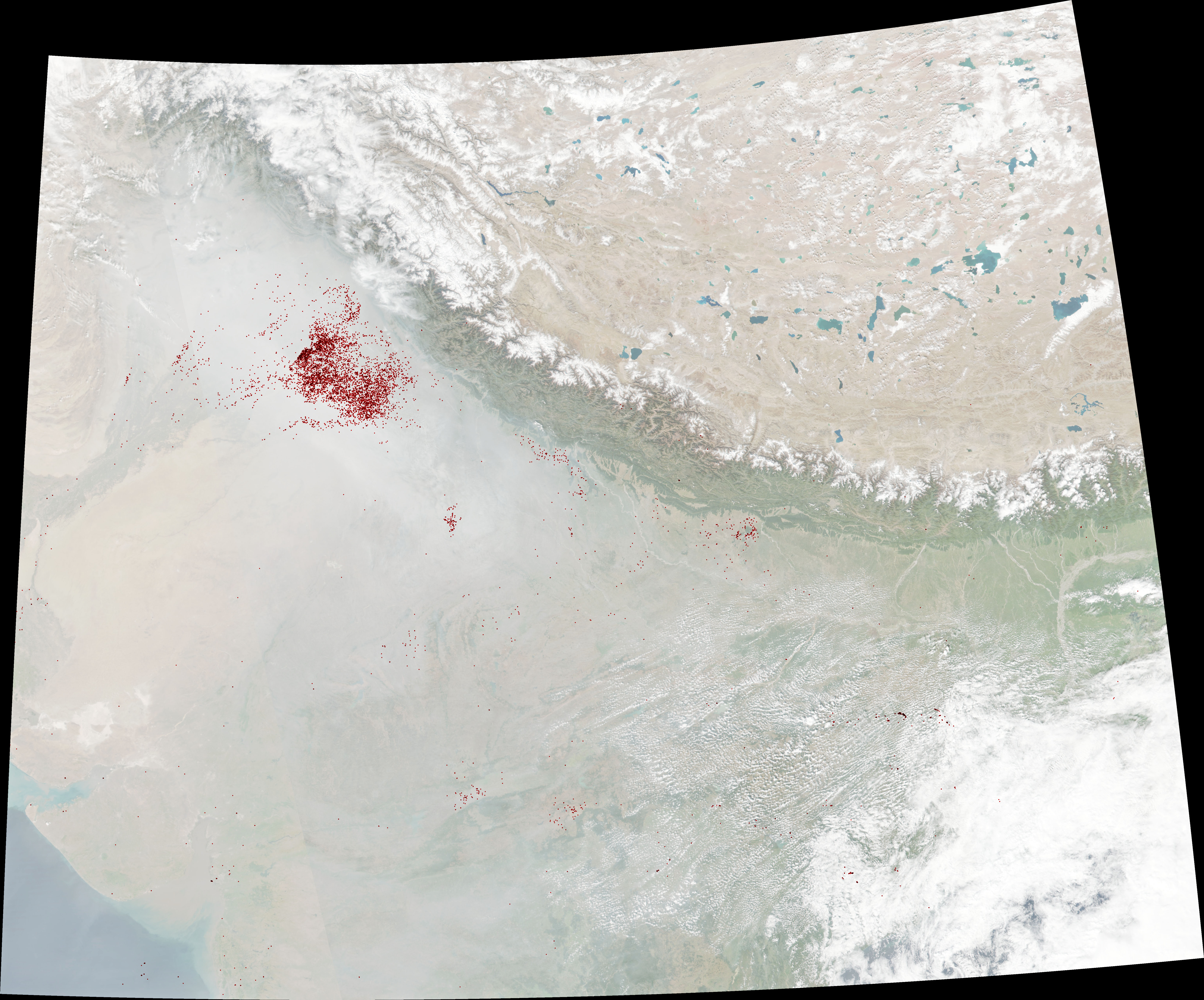
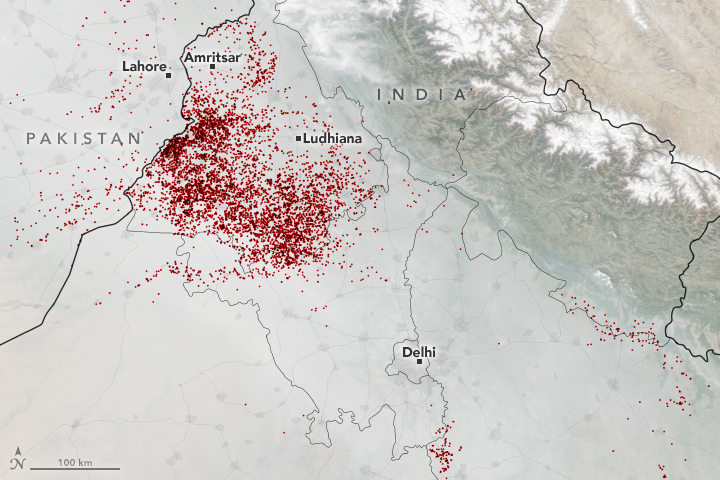
This year, Earth-observing satellites began to detect significant numbers of fires in early October near the town of Amritsar. By the end of the month, large numbers of fires burned across much of the states of Punjab and Haryana. The Visible Infrared Imaging Radiometer Suite (VIIRS) on the Suomi NPP satellite captured a natural-color image on the afternoon of October 31, 2018. The map (second image) shows the locations of fires detected by VIIRS during a 48-hour period from October 30 to November 1.
Despite efforts to curb the practice, crop burning is growing more common with each passing year. NASA’s Aqua satellite found a roughly 300 percent increase in the number of fires in the Indo-Gangetic Plain between 2003 and 2017, according to an analysis authored by Sudipta Sarkar, a scientist at NASA’s Goddard Space Flight Center.
“It is easy to come up with regulations on paper, but you have to remember that many of these farms are relatively small-scale operations,” said Sarkar. “Without cheap, easy alternatives, there is little incentive for farmers to stop burning.”While smoke from the fires has the most direct consequences in northern India, Sarkar and colleagues found that harmful particles and gases regularly traveled several hundred miles from the source, sometimes affecting central and southern India.
More widespread availability and use of farm equipment that removes the stalks and shreds the debris could eventually reduce farmers’ reliance on burning. But in the short term, people and other cities downwind ought to be prepared for more smoke.
“The fire counts are rising, and so are particulate matter (PM2.5) levels in New Delhi,” said Hiren Jethva, a Universities Space Research Association scientist based at NASA’s Goddard Space Flight Center. He tracks the burning with several satellite sensors each year, and he recently noted: “The peak this year is expected to be between October 31 and November 6. Be prepared and take a good care of yourself, northern India.”
NASA Earth Observatory image by Joshua Stevens, using VIIRS data from the Suomi National Polar-orbiting Partnership and the Fire Information for Resource Management System (FIRMS). Story by Adam Voiland.