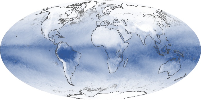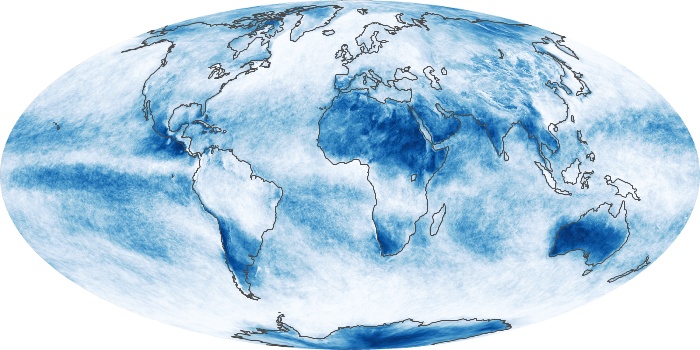
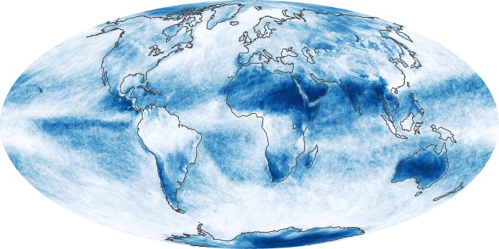
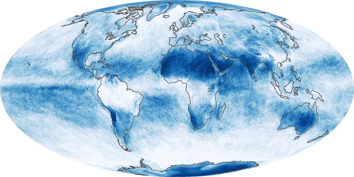
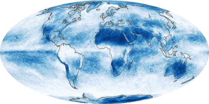
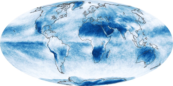
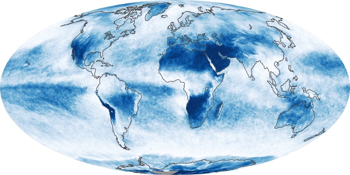
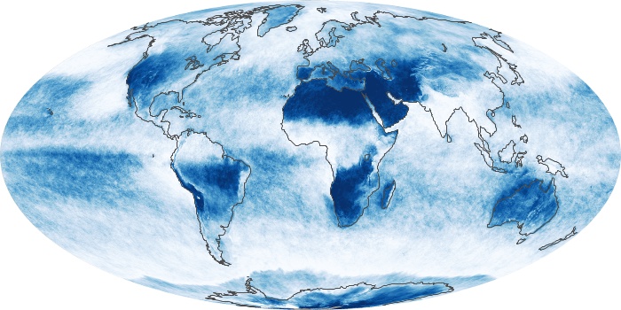
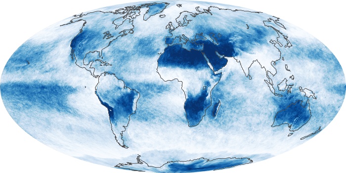
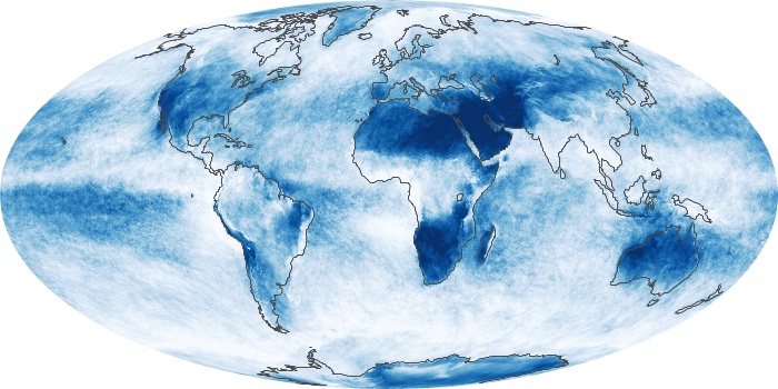
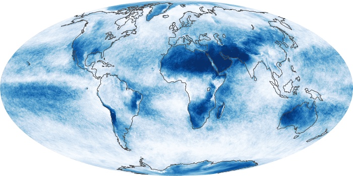

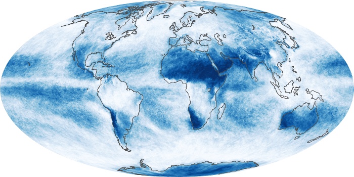
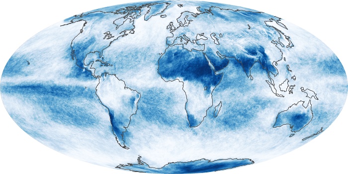
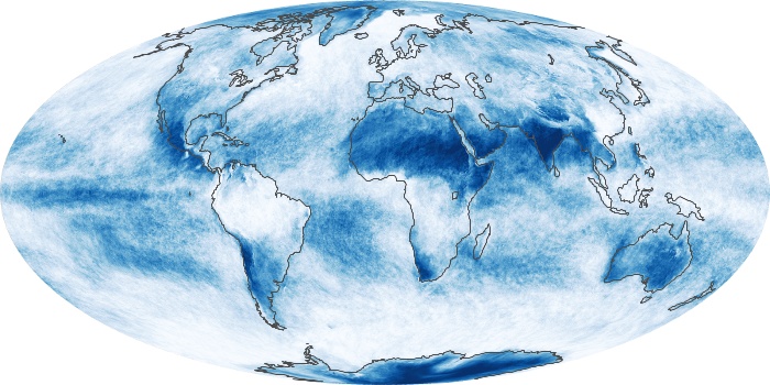
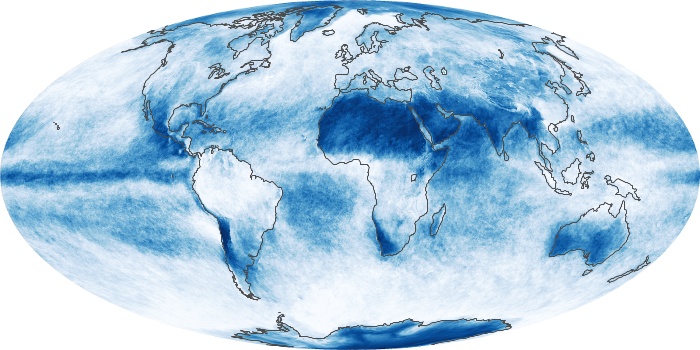
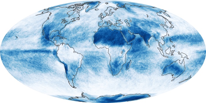
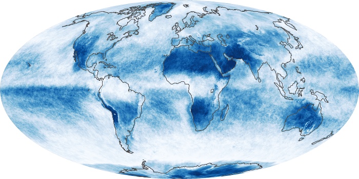
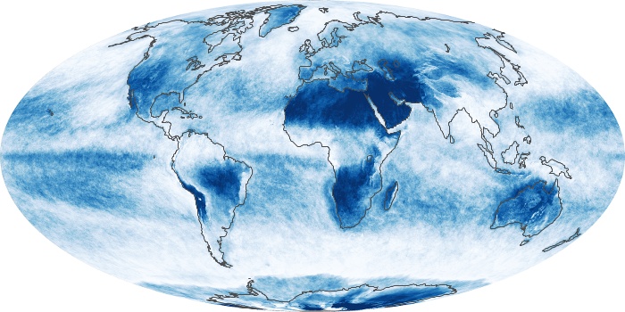
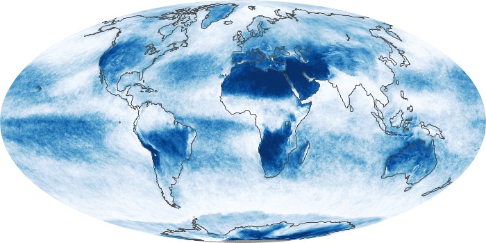
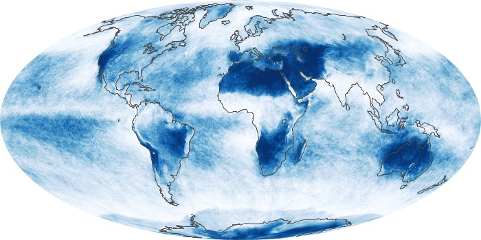
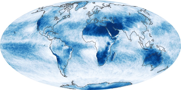
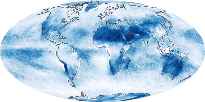
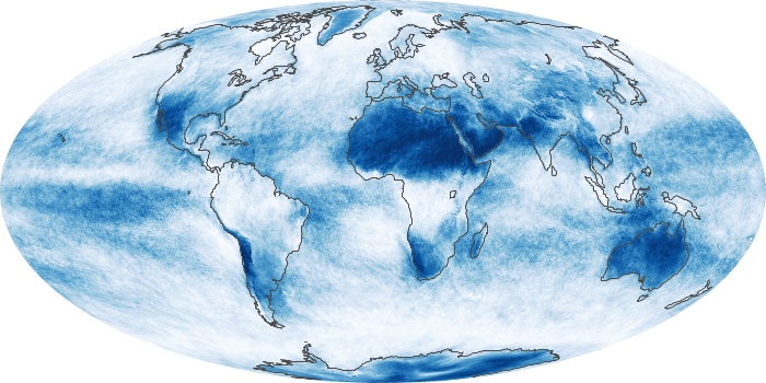
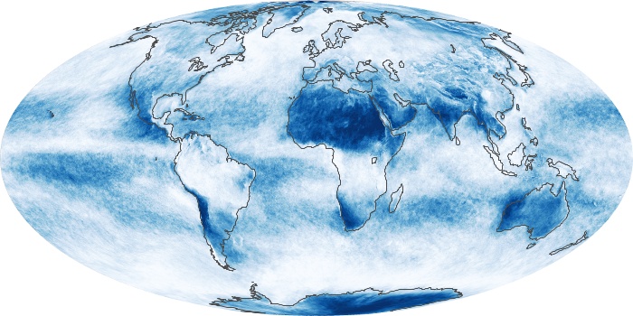
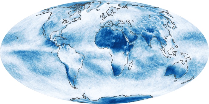
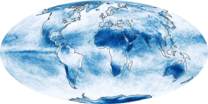
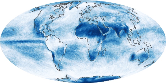
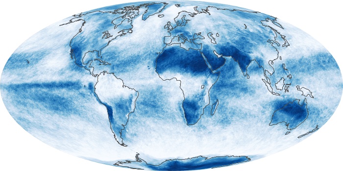
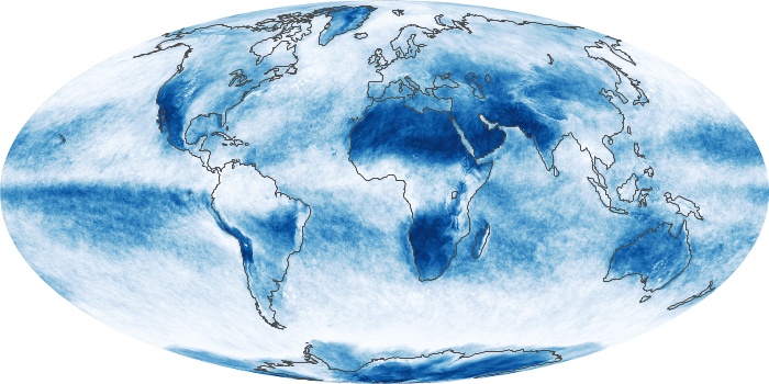
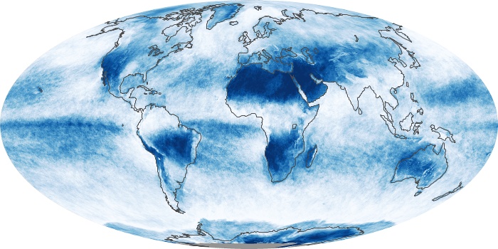
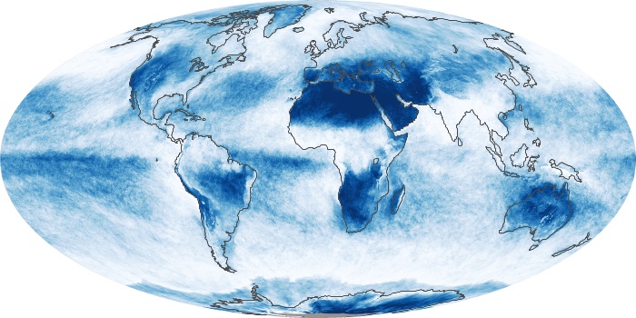
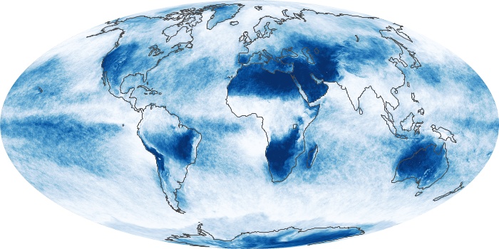
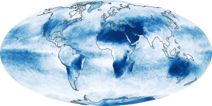
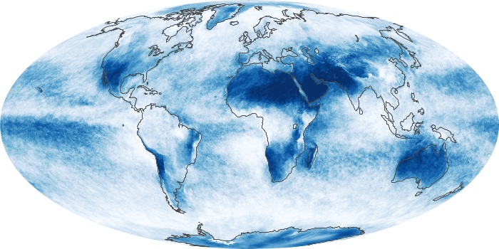
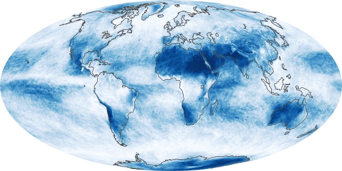
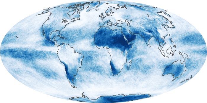
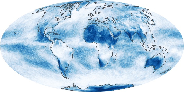
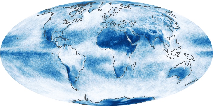
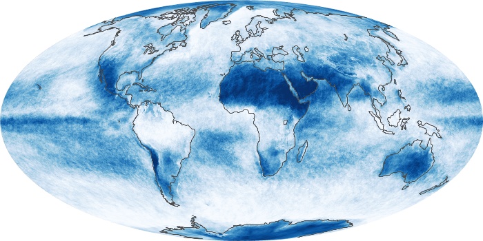
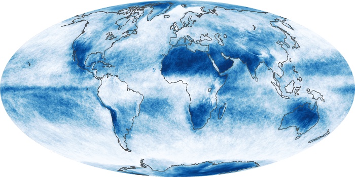
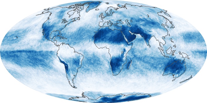
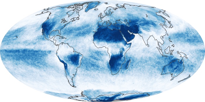
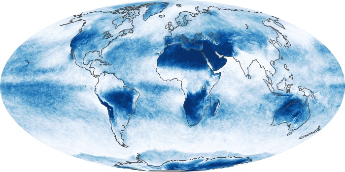
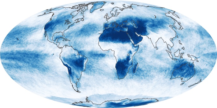
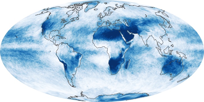
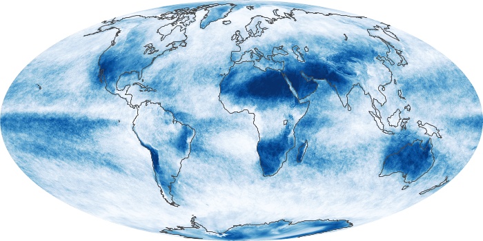
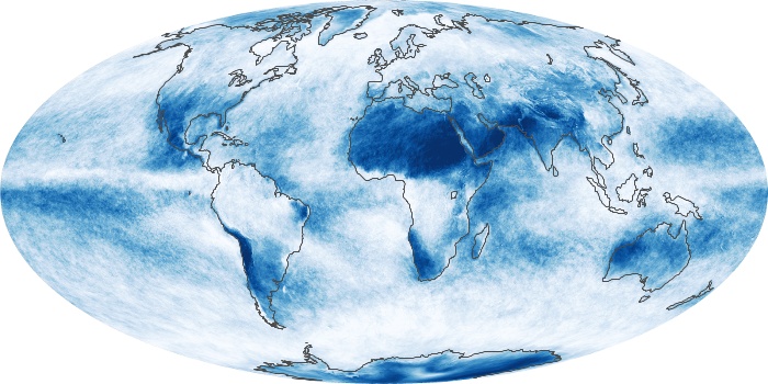
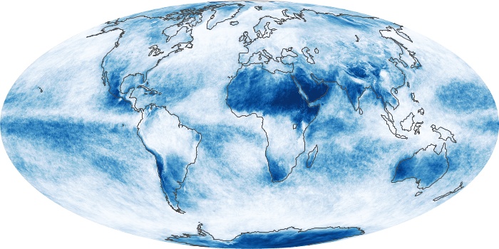
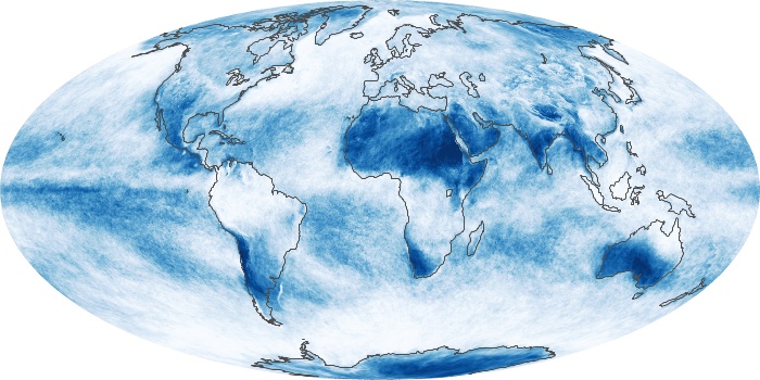
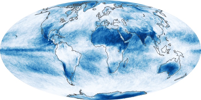
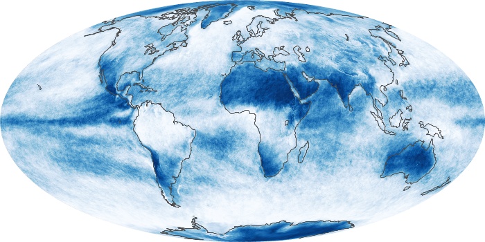
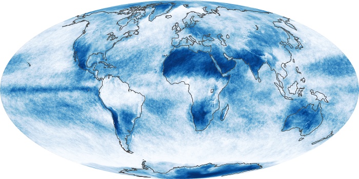
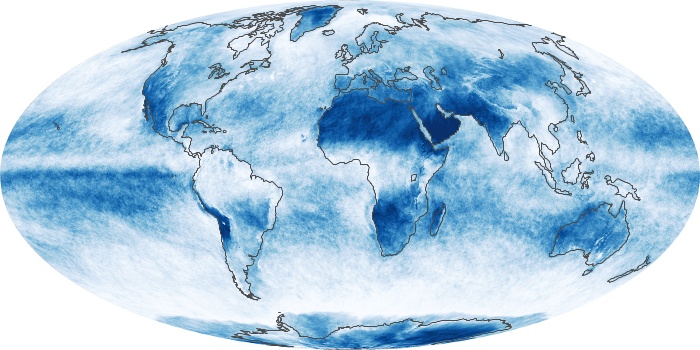
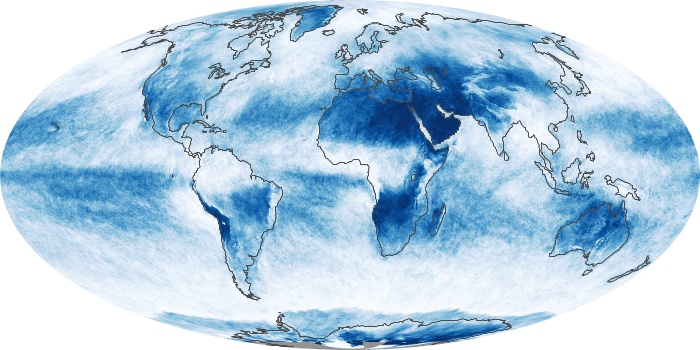
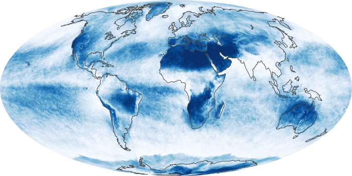
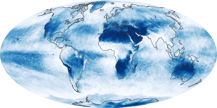
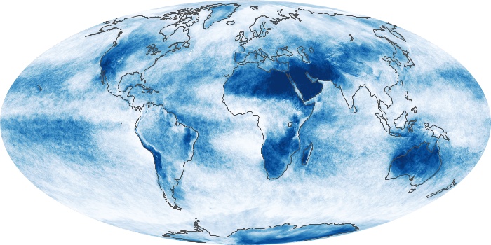
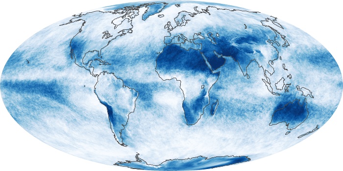
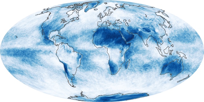
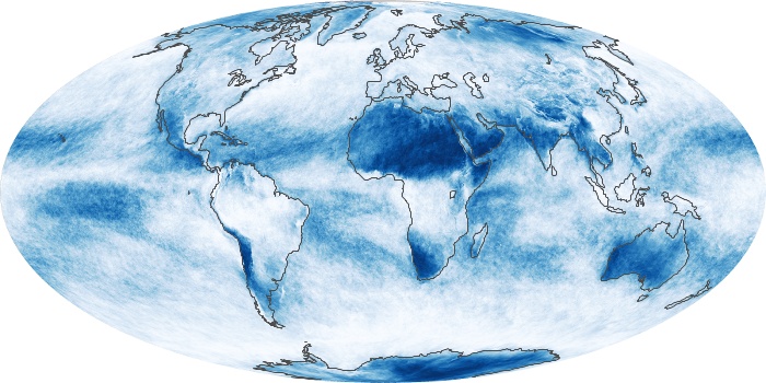
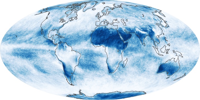
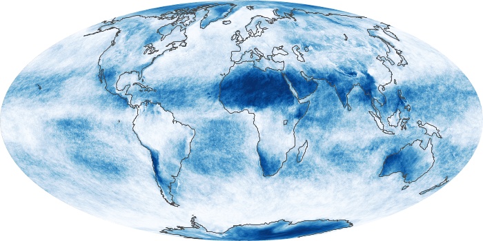
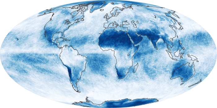
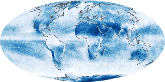
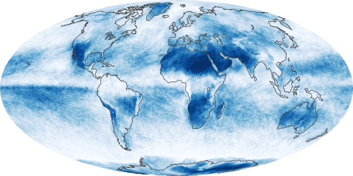
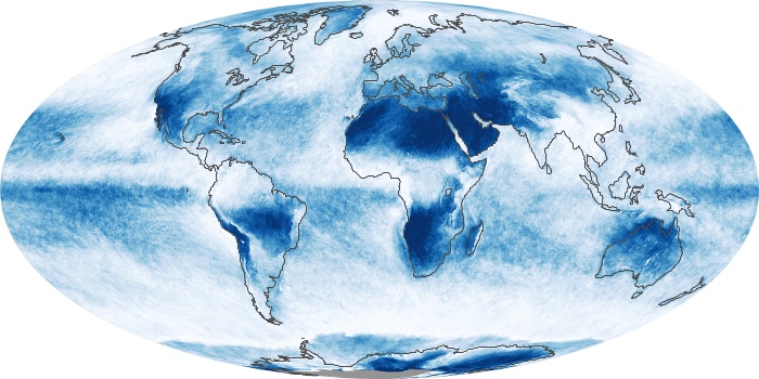

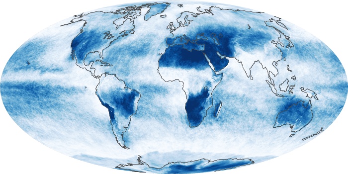
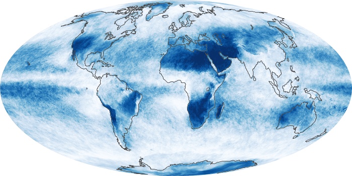
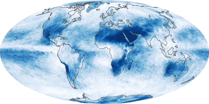
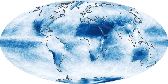
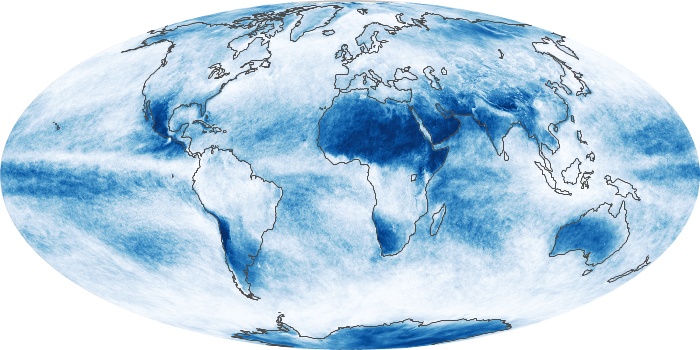
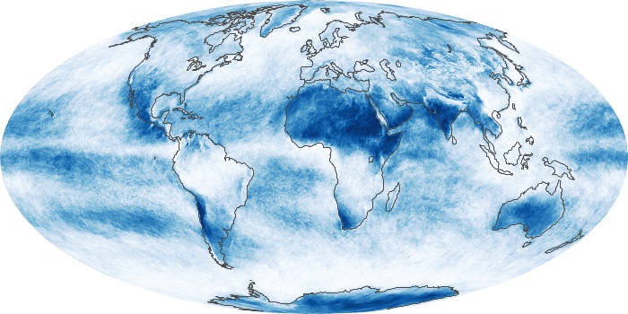
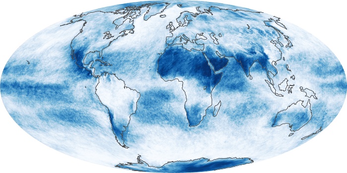
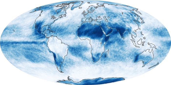
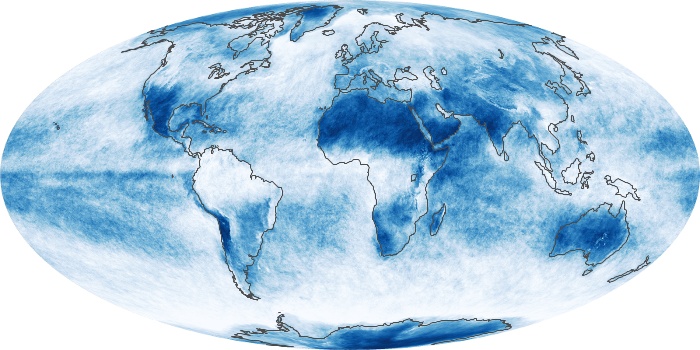
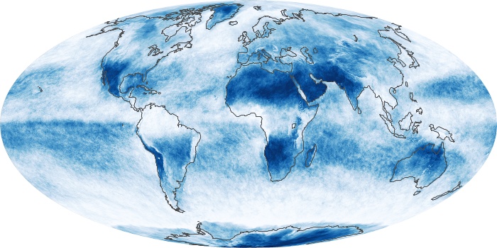
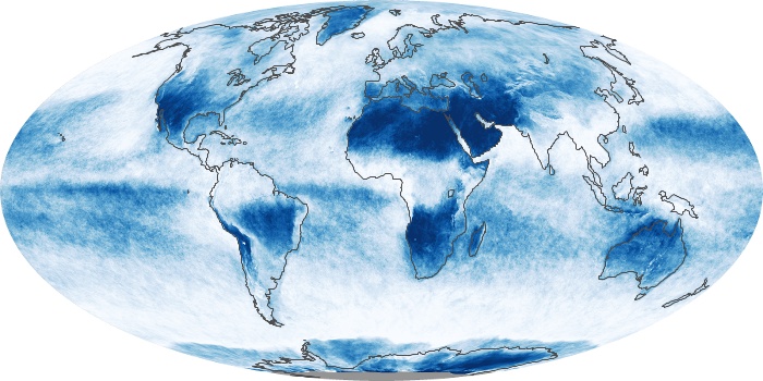
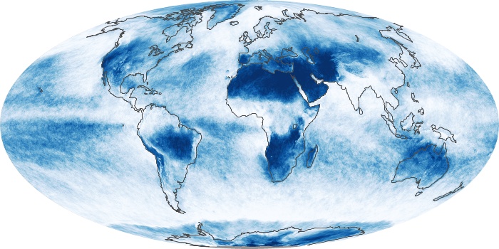
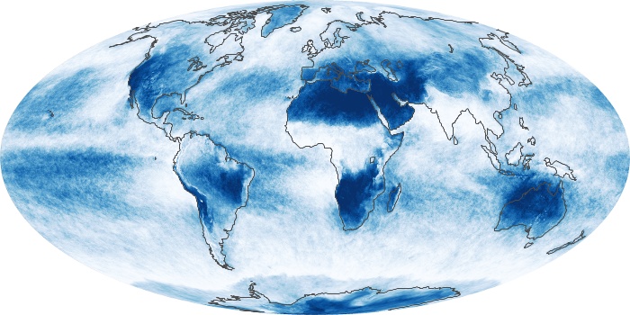
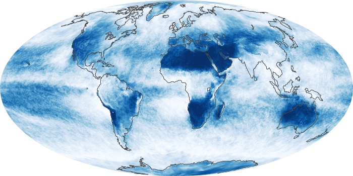
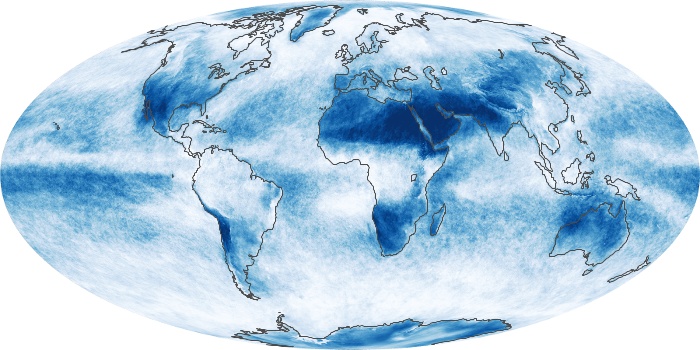
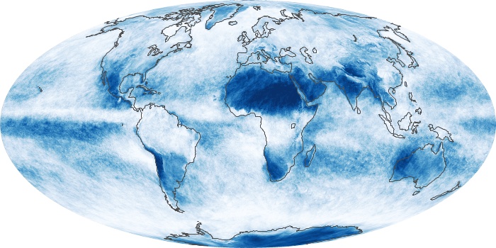
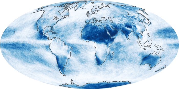
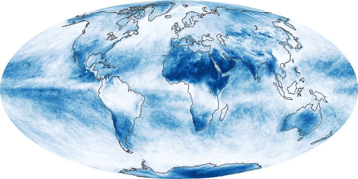
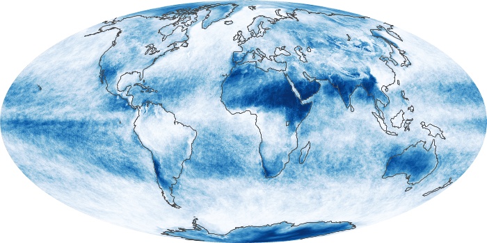
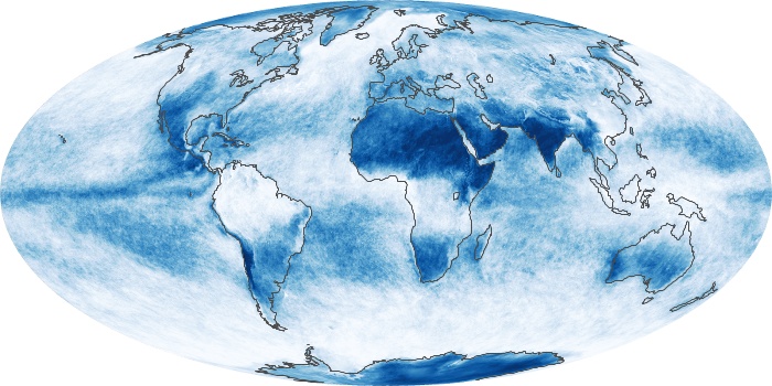
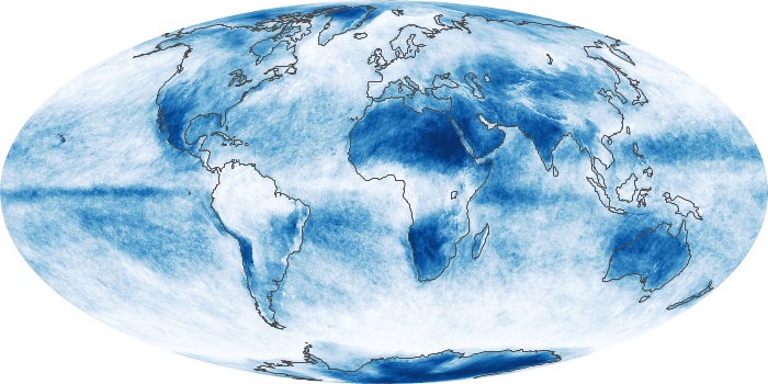
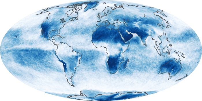
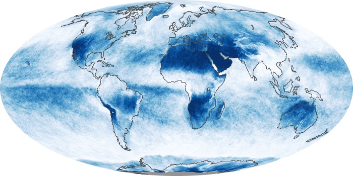
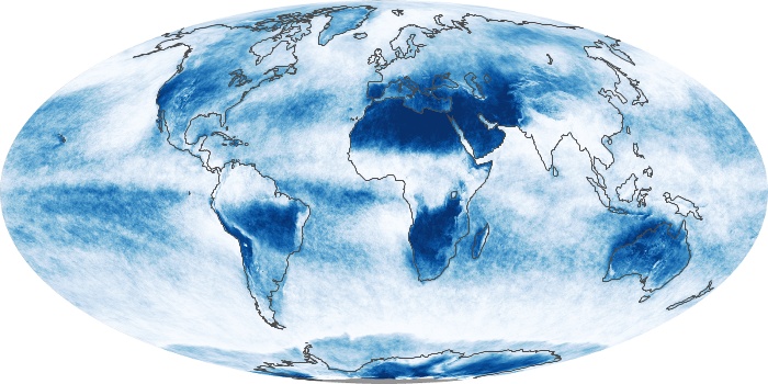
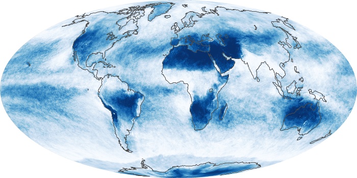
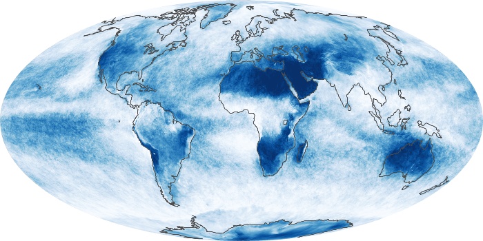
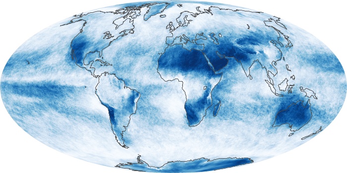
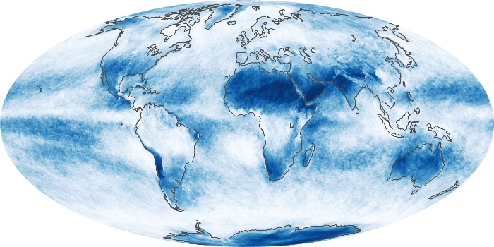
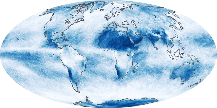
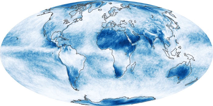
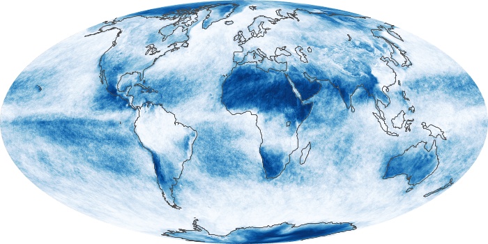
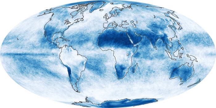
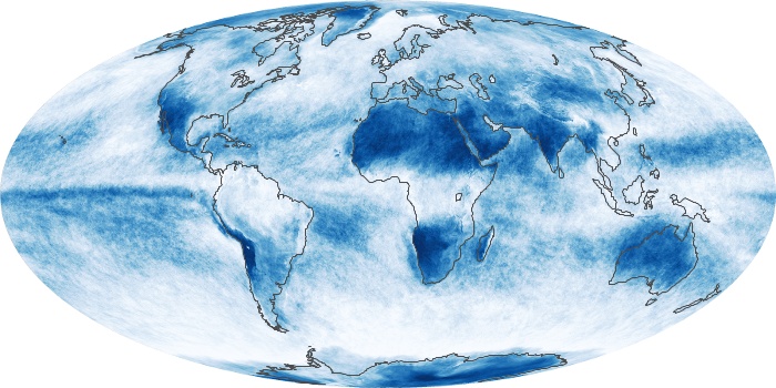
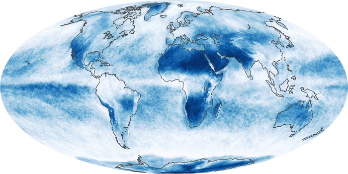
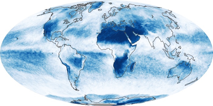
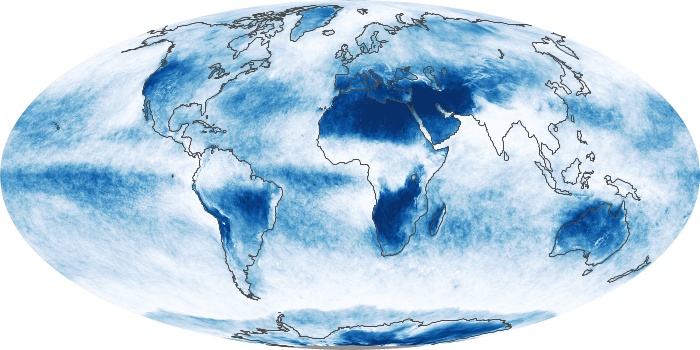
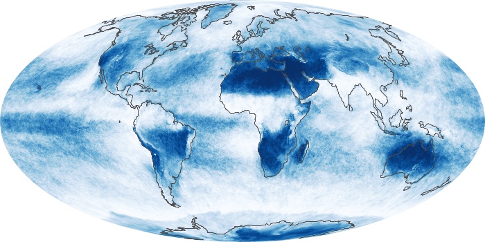
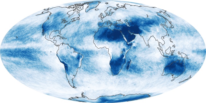
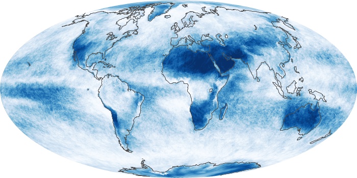
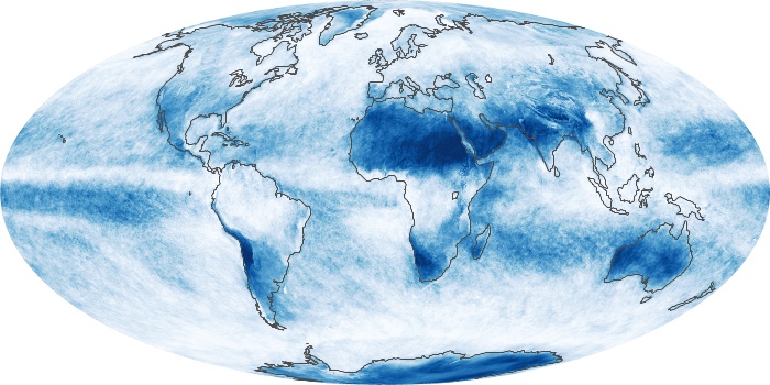
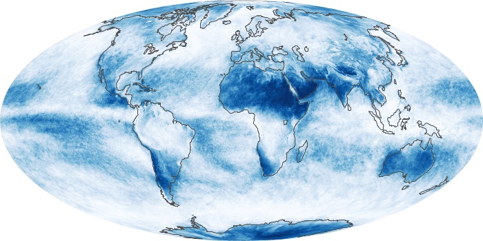
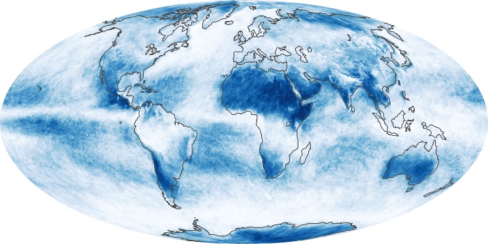
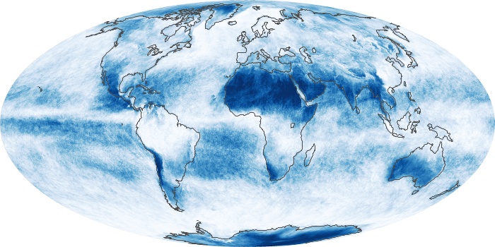
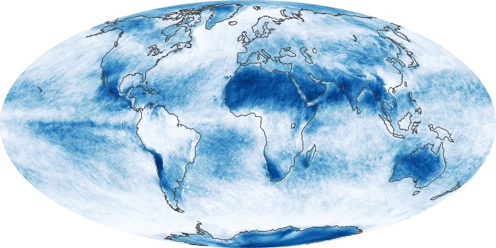
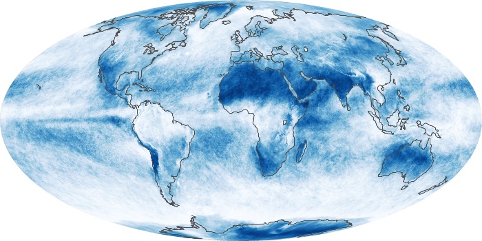
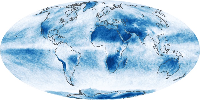
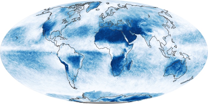
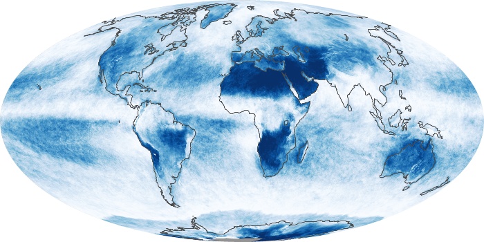
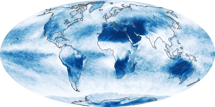
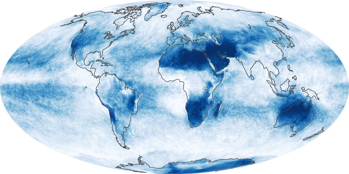
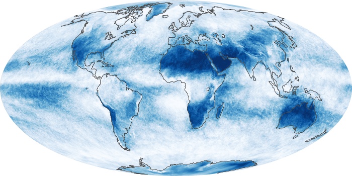
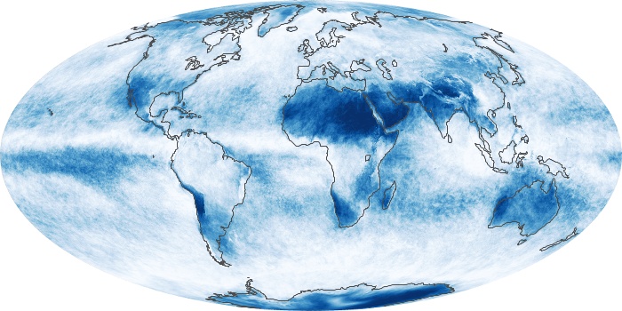

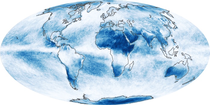
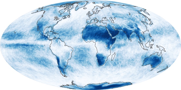
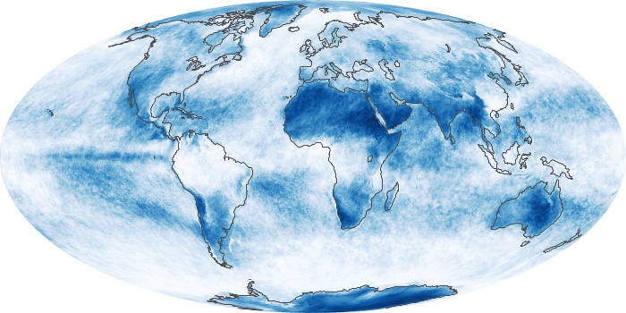
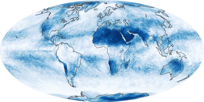
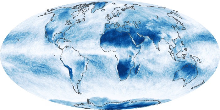
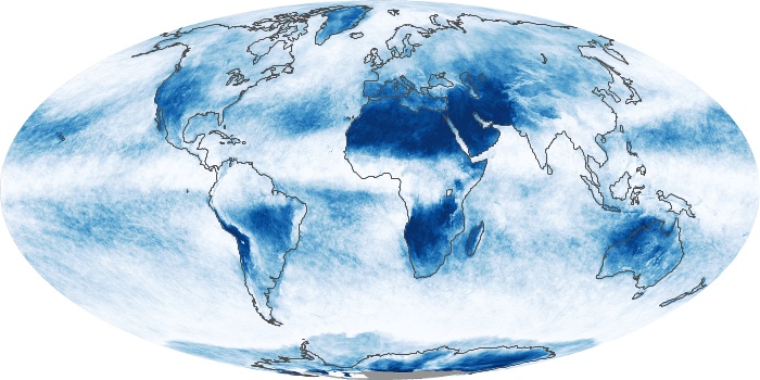
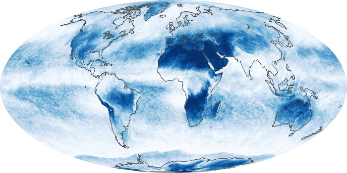
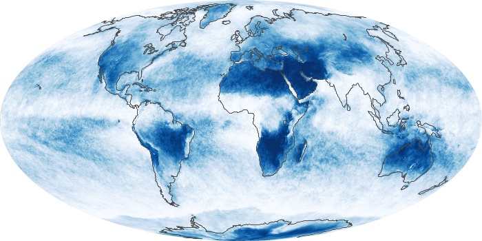
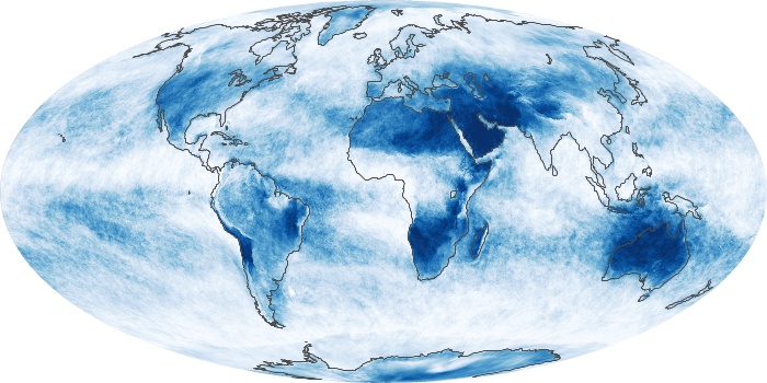
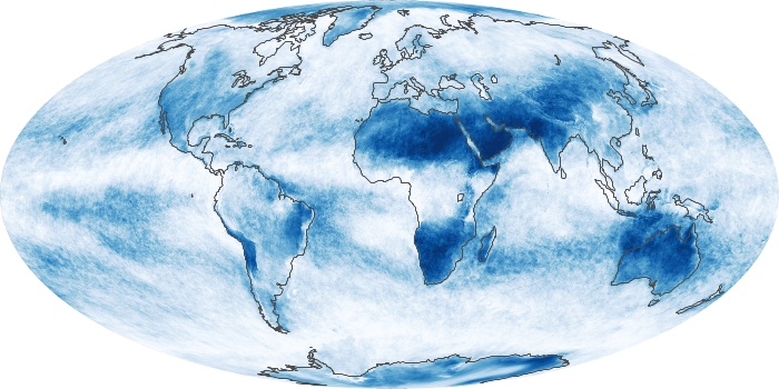
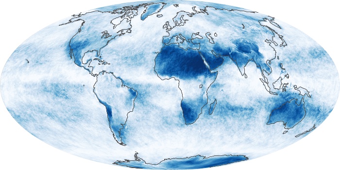
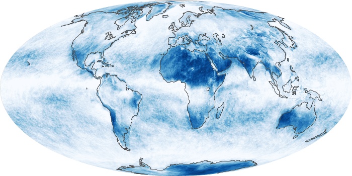
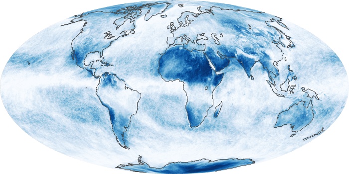
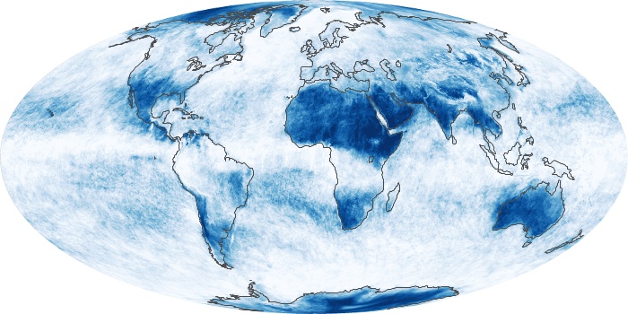
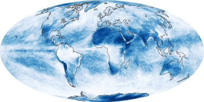
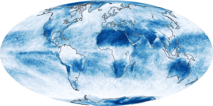
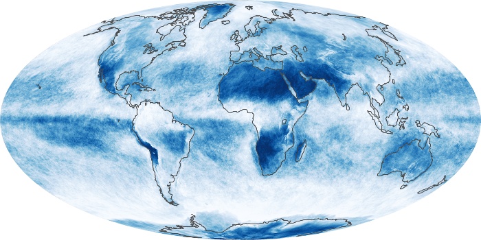
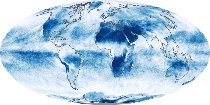
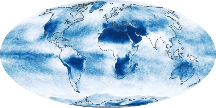
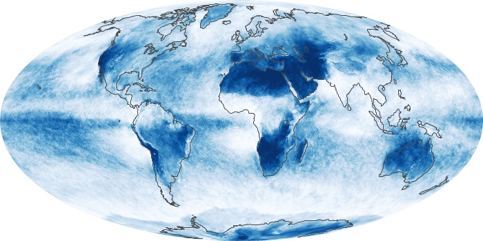
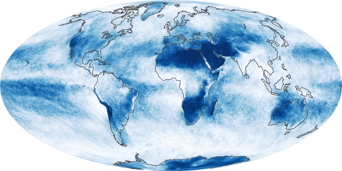


The cloud maps show what fraction of an area was cloudy on average for the month. The measurements were collected by the MODIS sensors on NASA's Terra and Aqua satellites. Colors range from blue (no clouds) to white (totally cloudy).
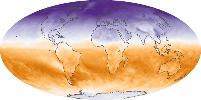
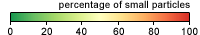
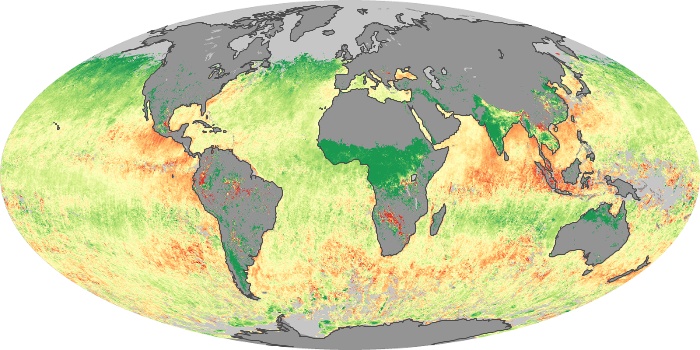
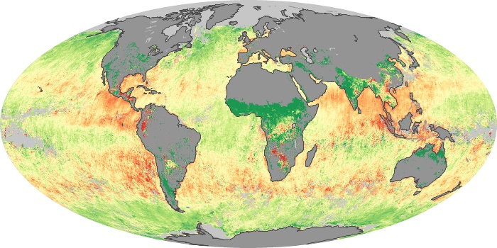
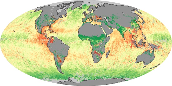
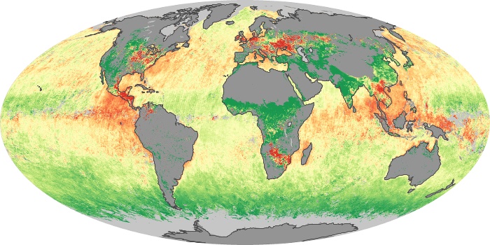
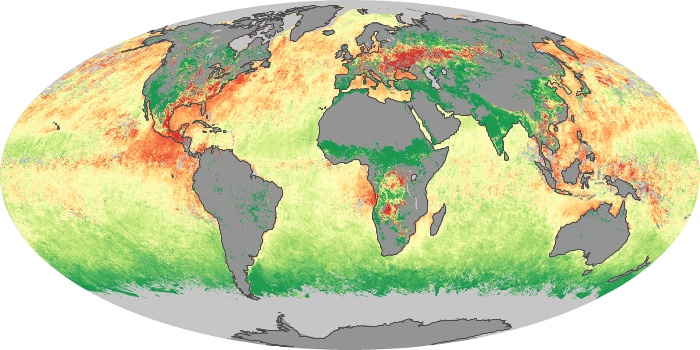
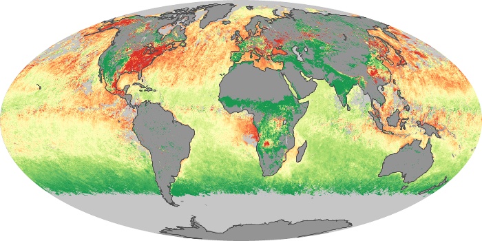
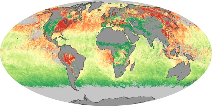
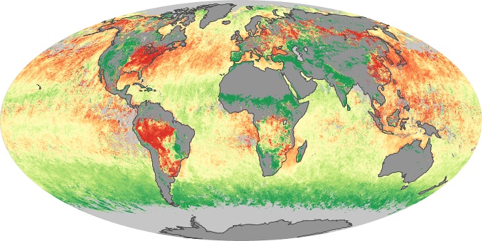
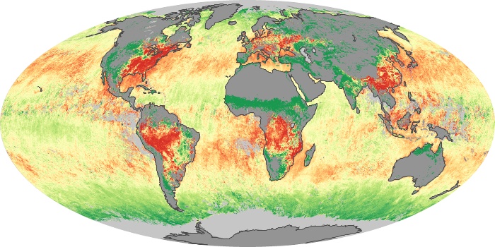
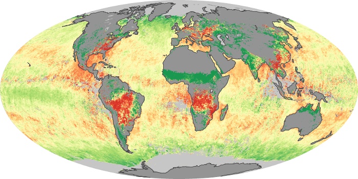
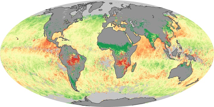
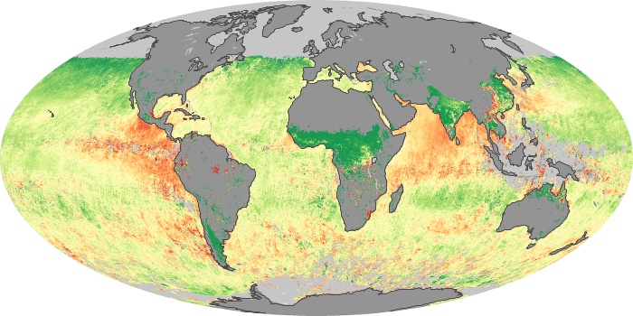
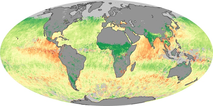
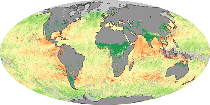
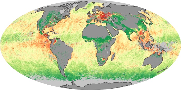
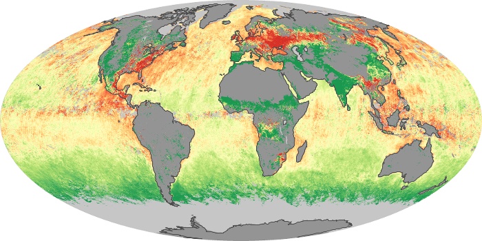
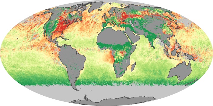
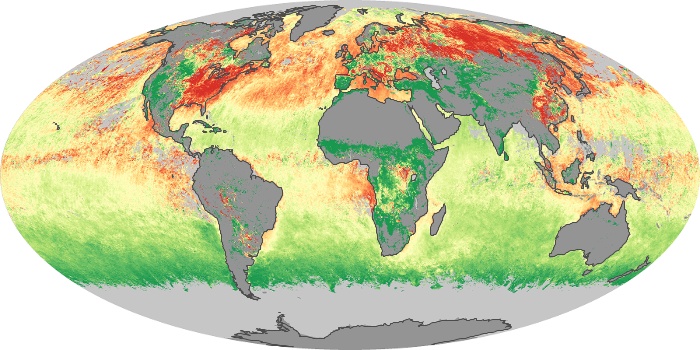
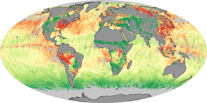
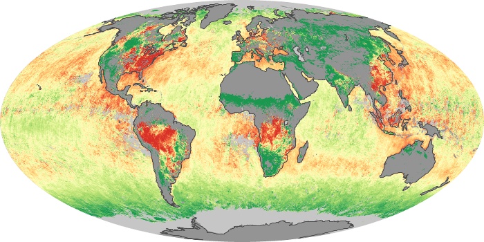
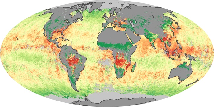
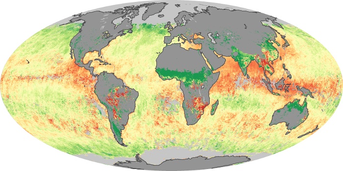
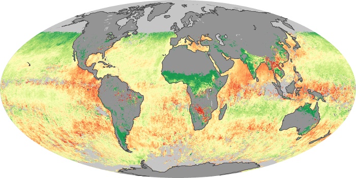
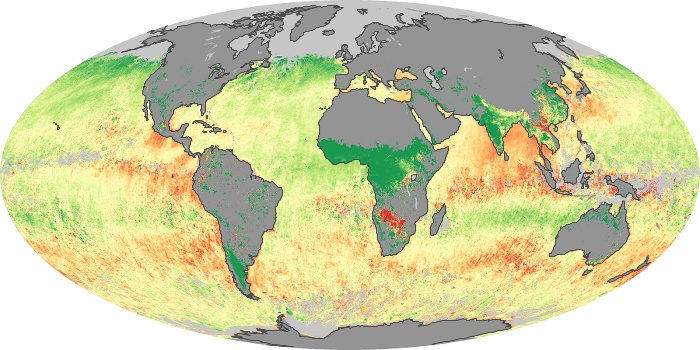
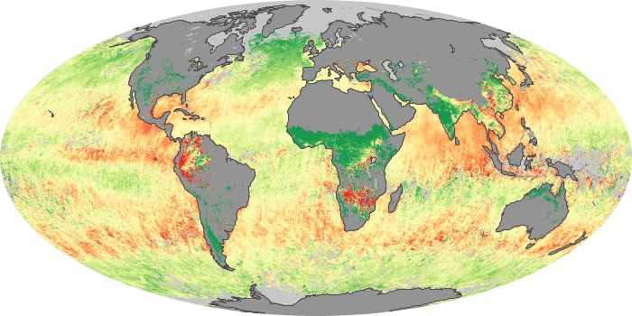
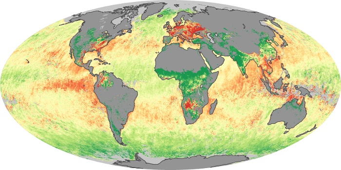
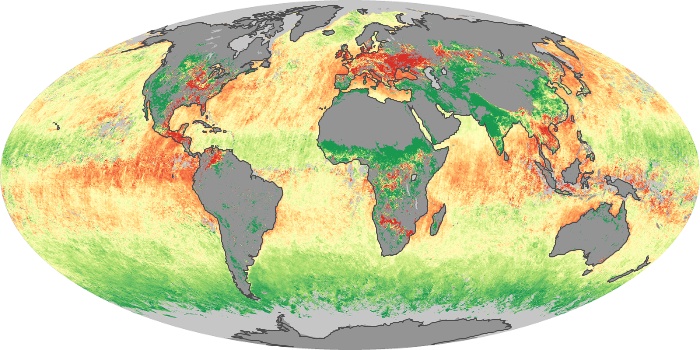
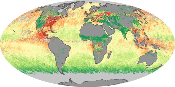
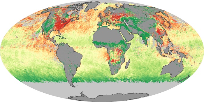
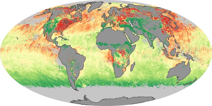
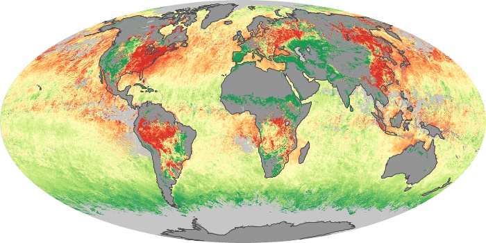
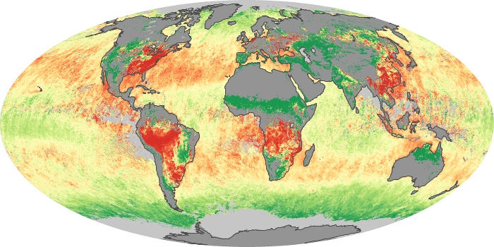
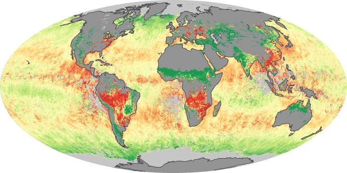
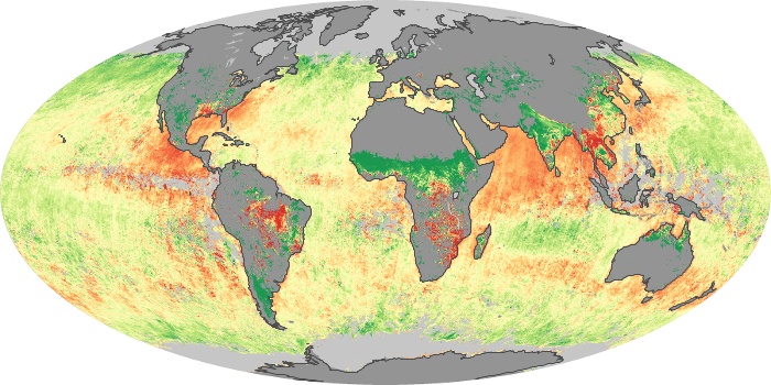
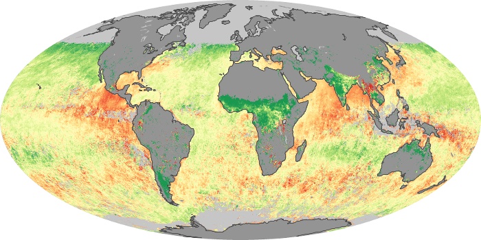
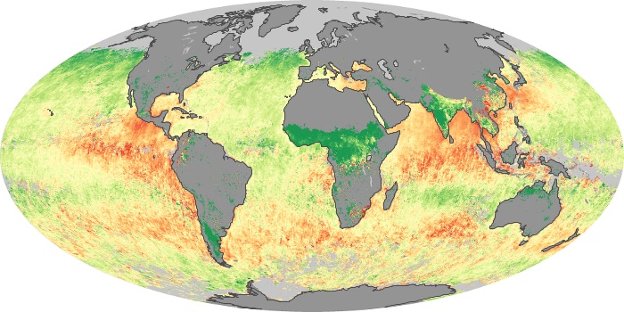
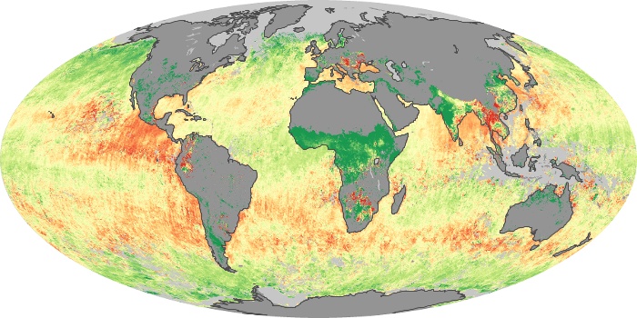
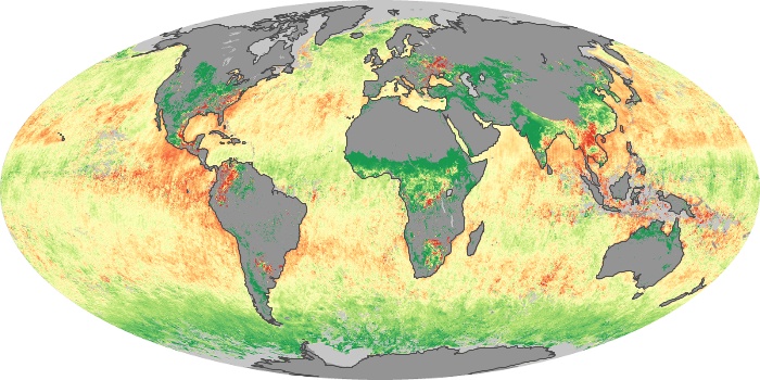
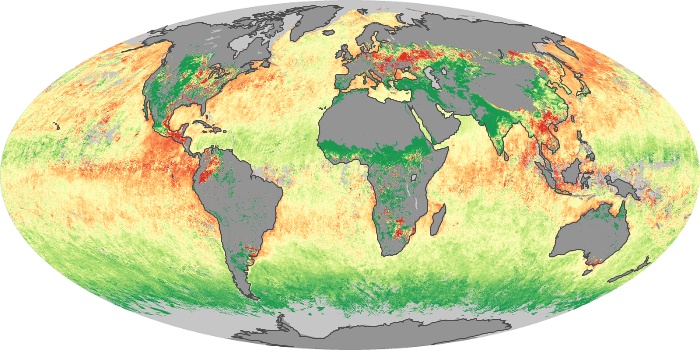
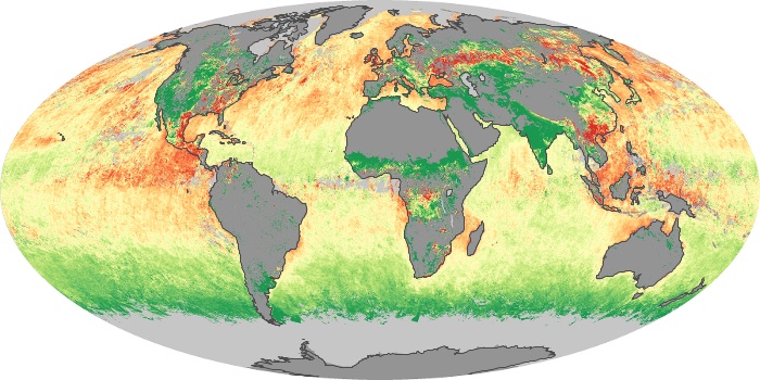
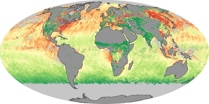
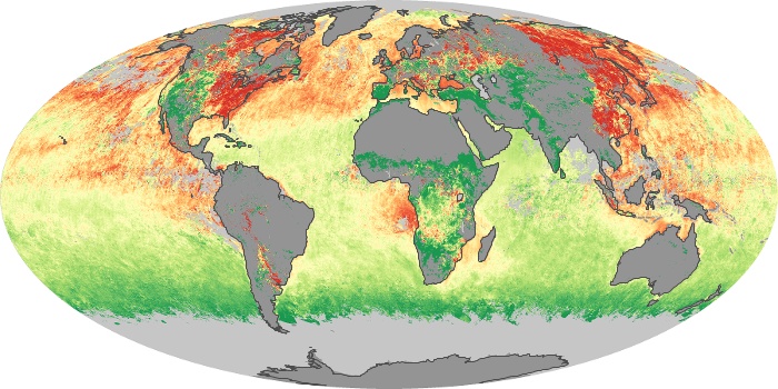
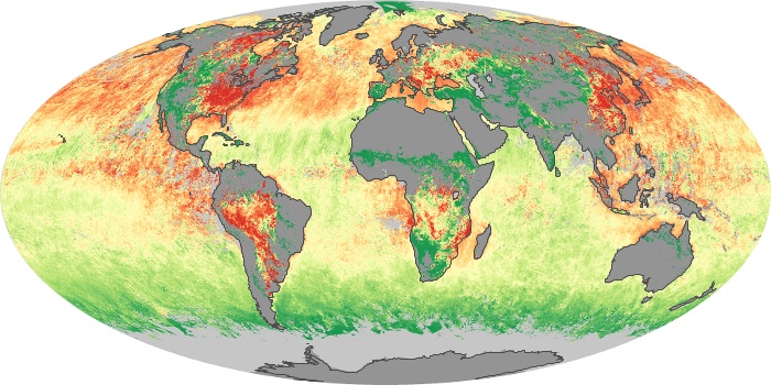
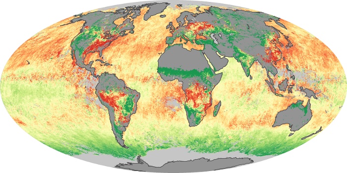
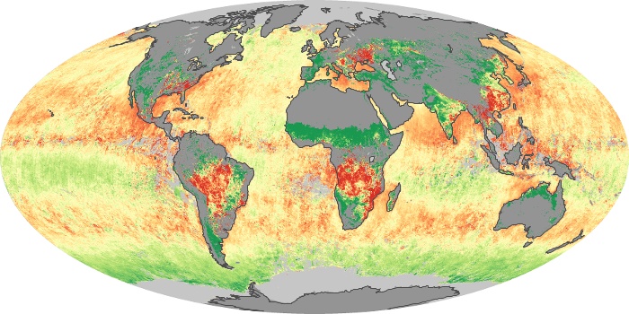
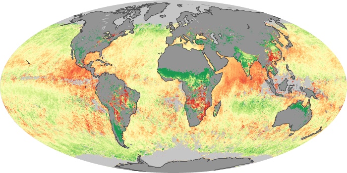
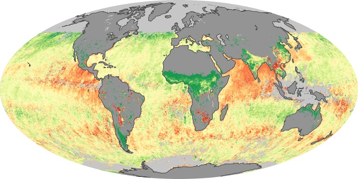
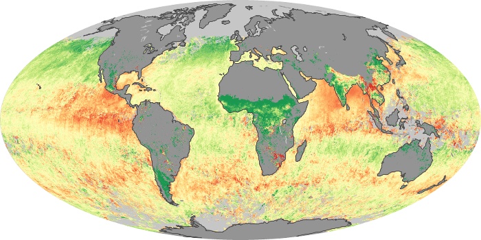
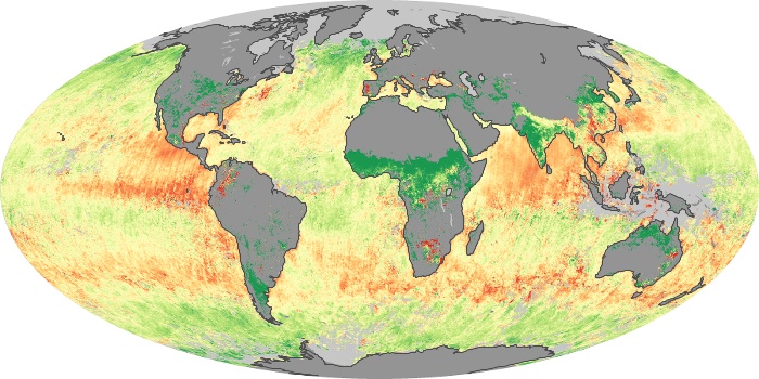
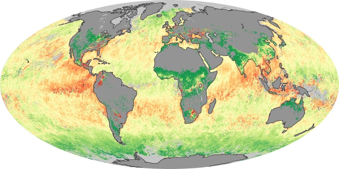
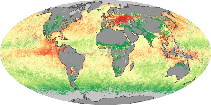
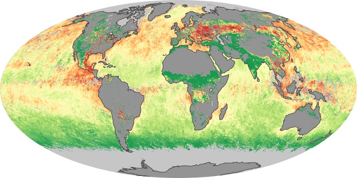
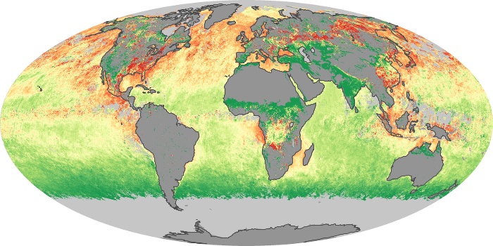
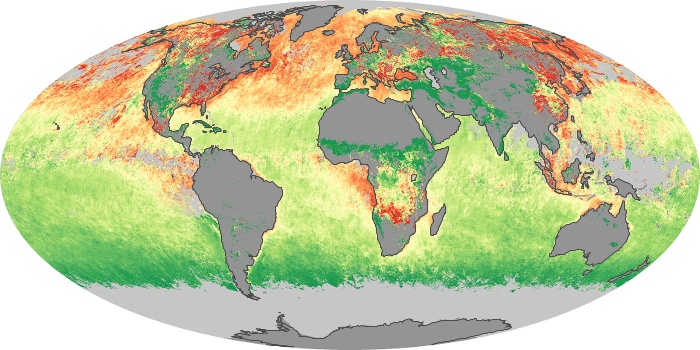
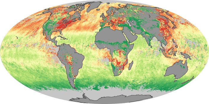
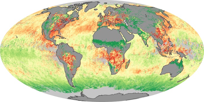
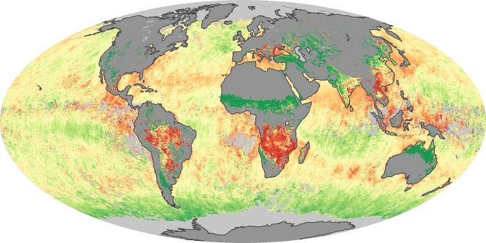
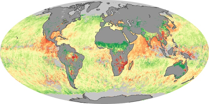
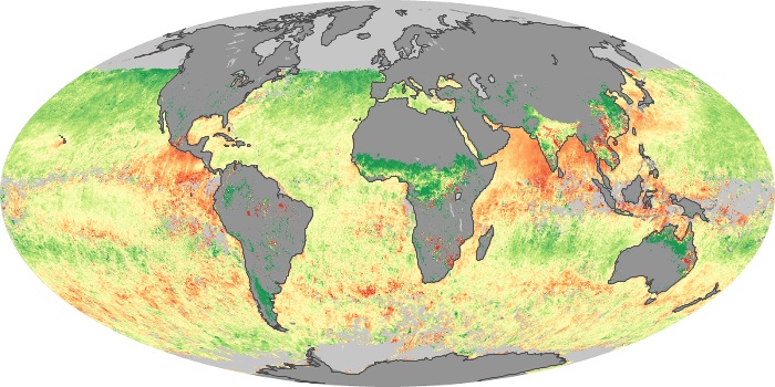
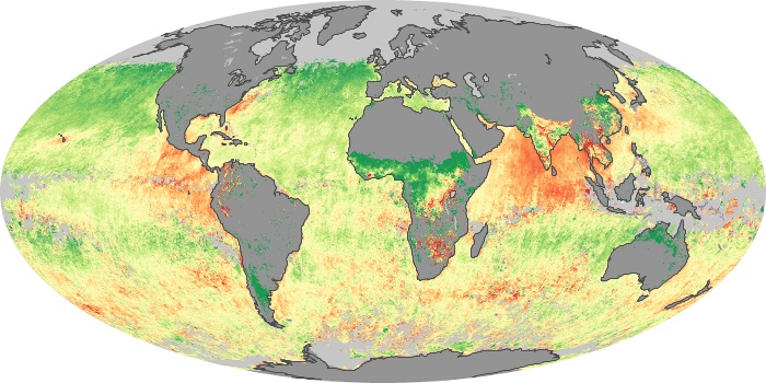
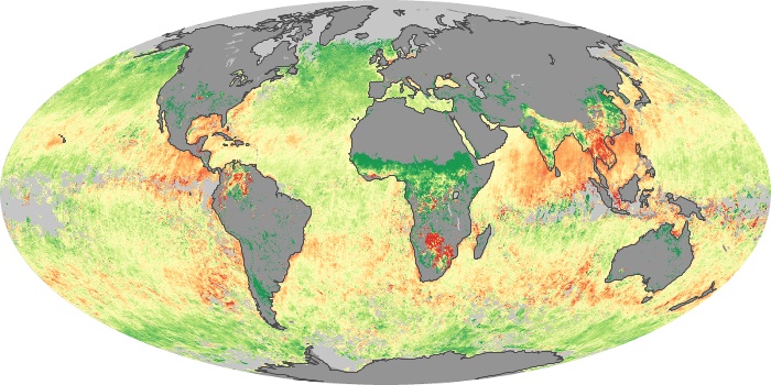
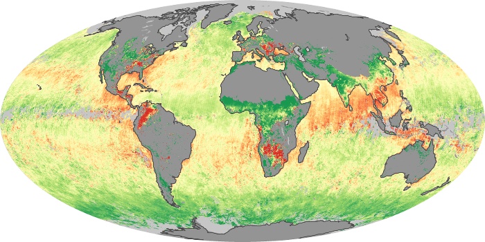
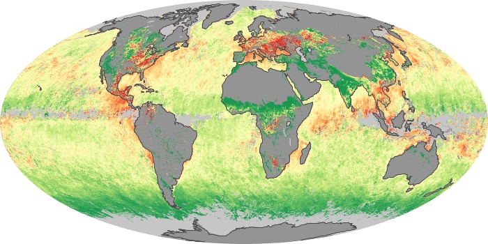
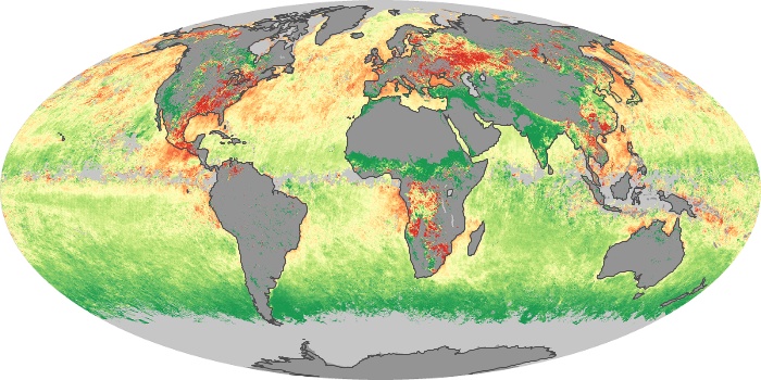
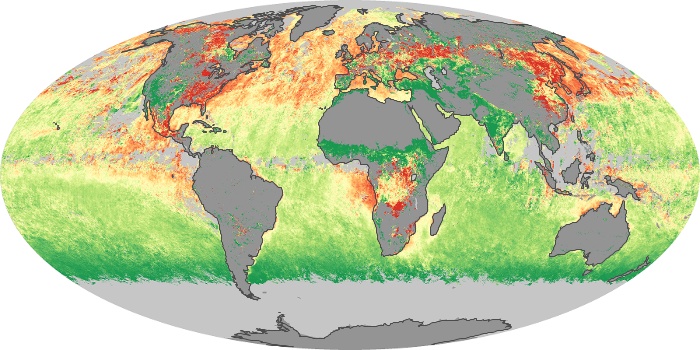
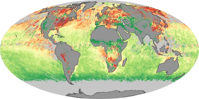
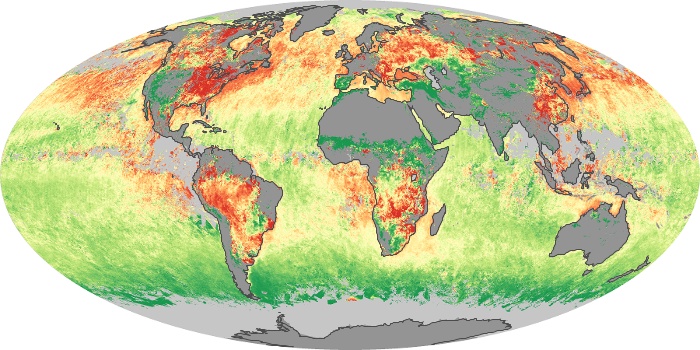
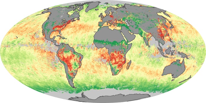
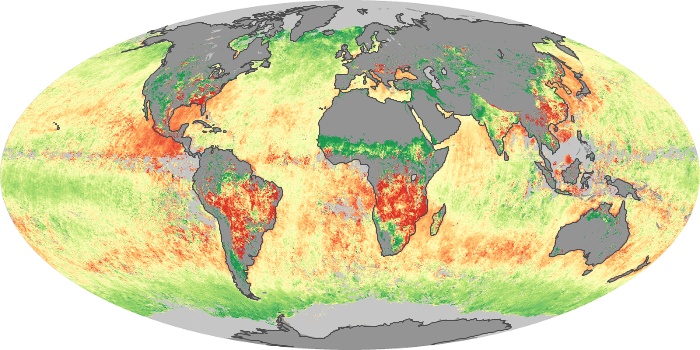
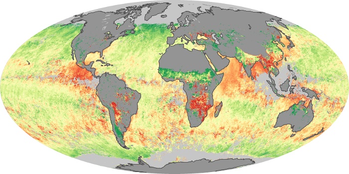
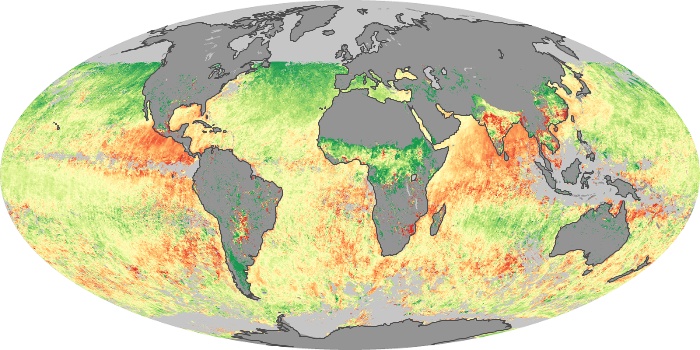
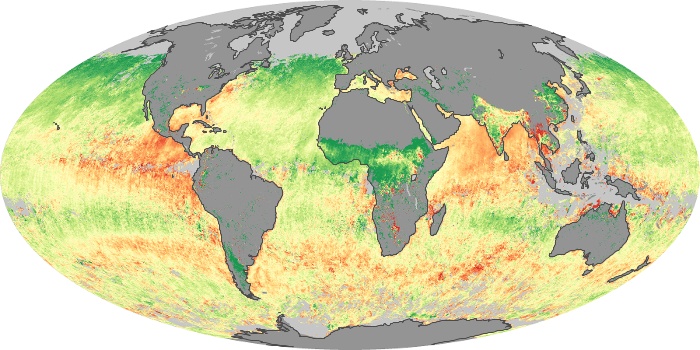
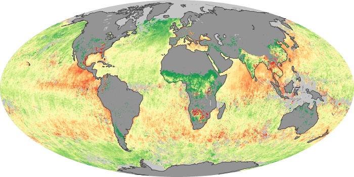
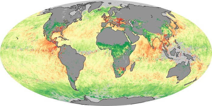
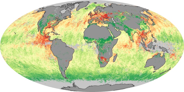
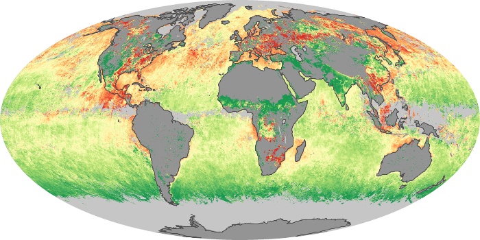
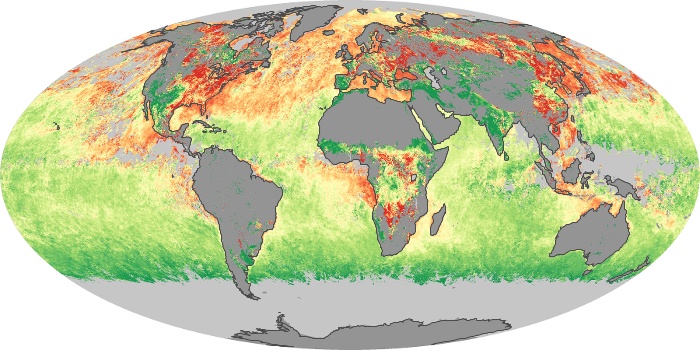
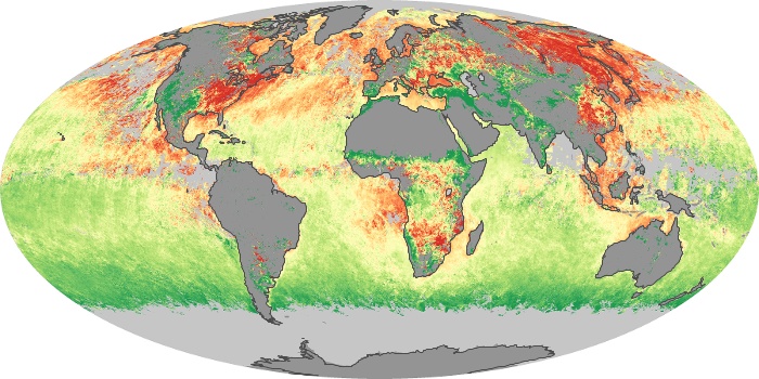
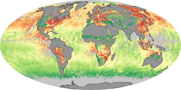
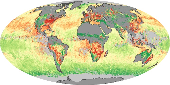
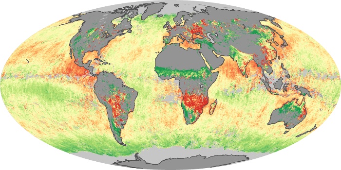
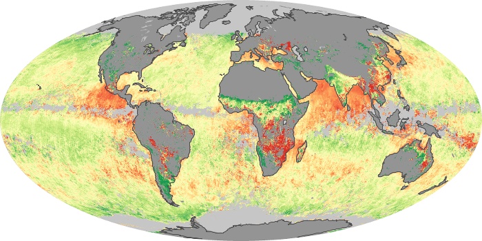
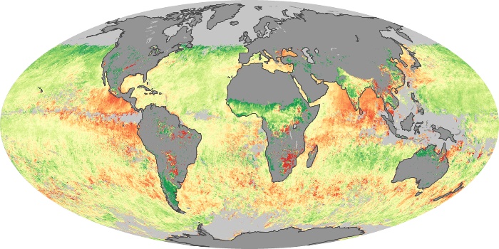
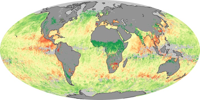
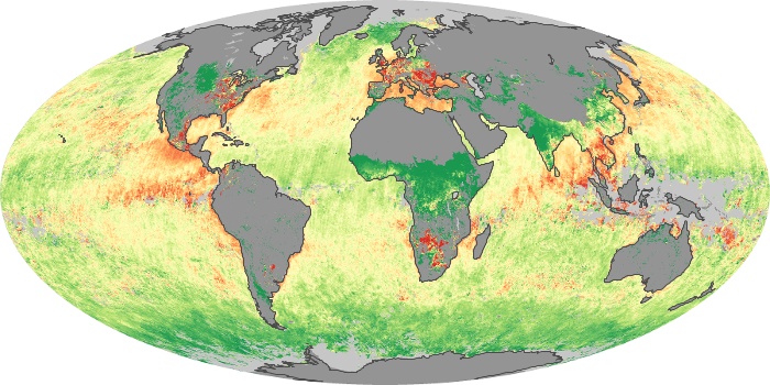
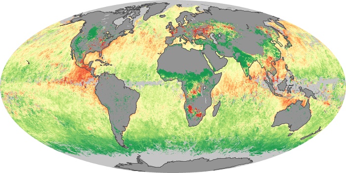
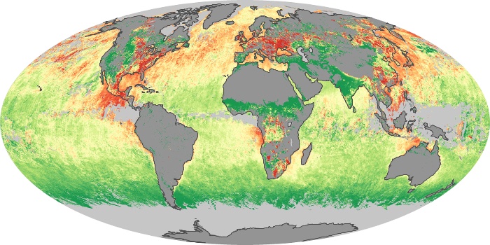
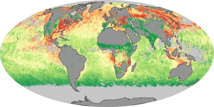
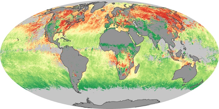
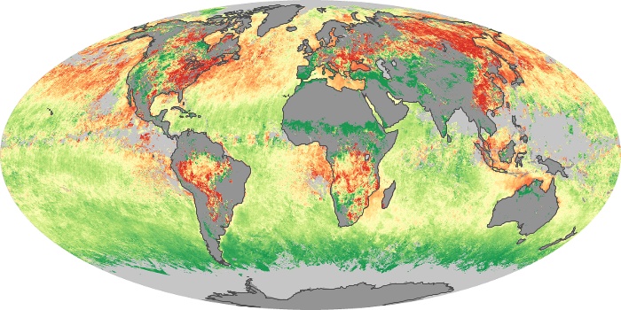
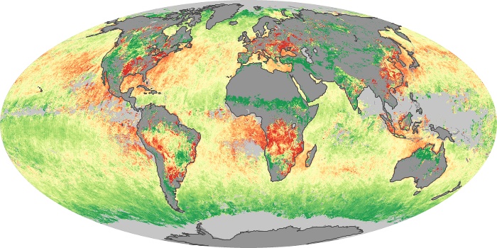
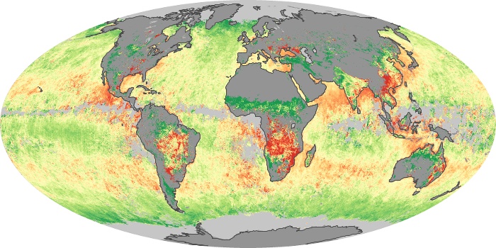
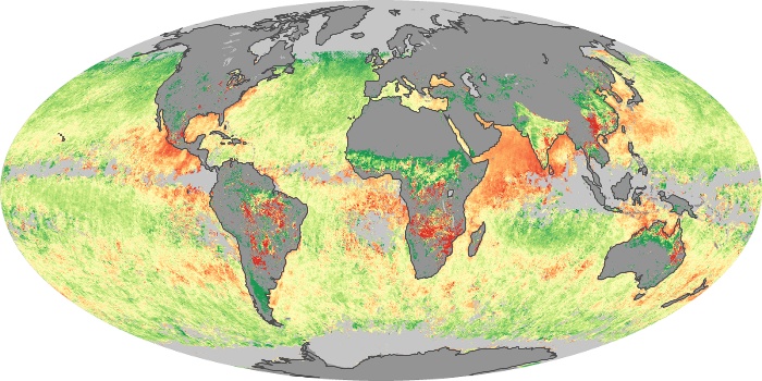
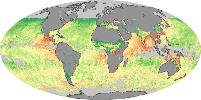
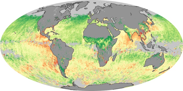
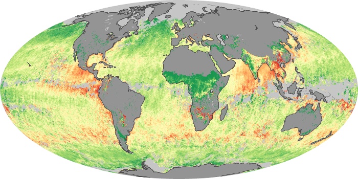
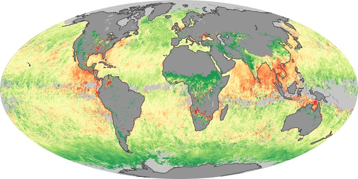
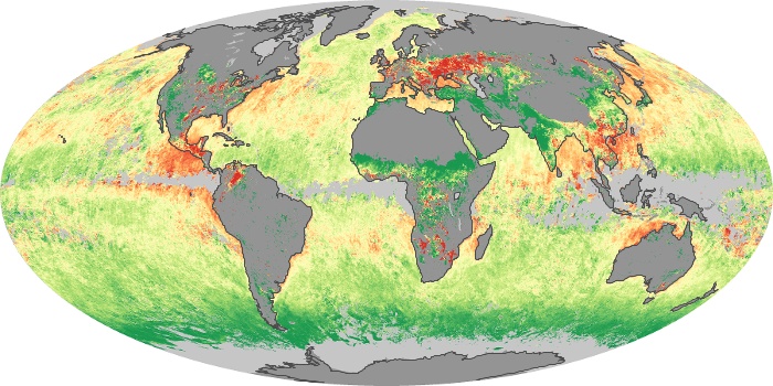
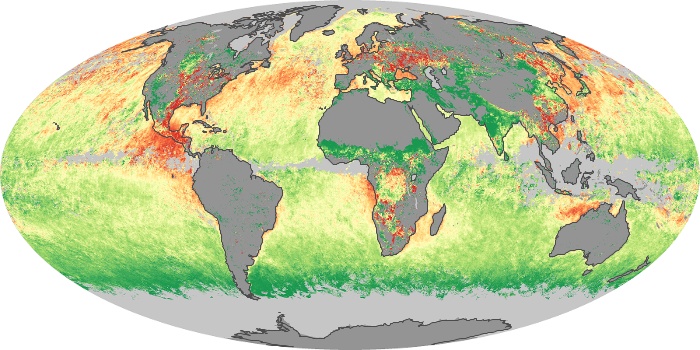
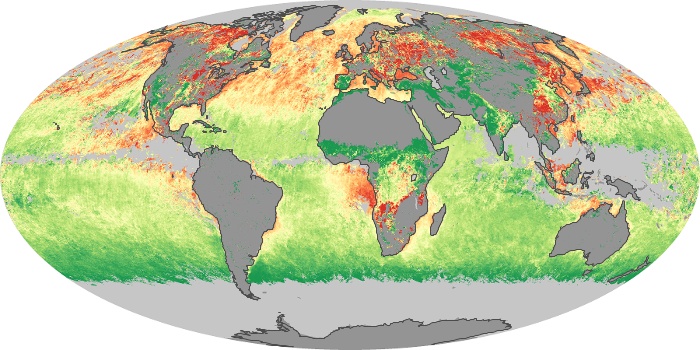
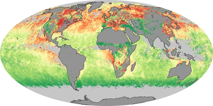
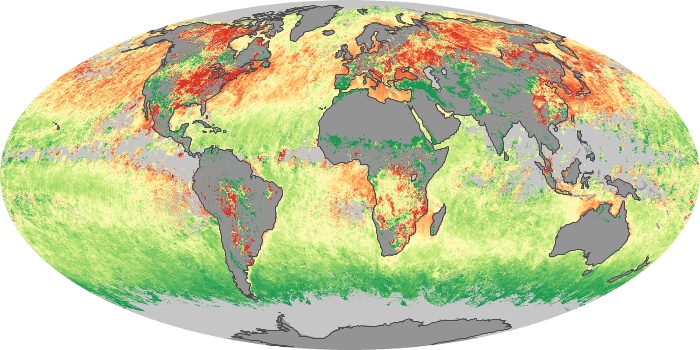
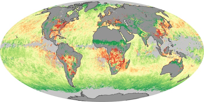
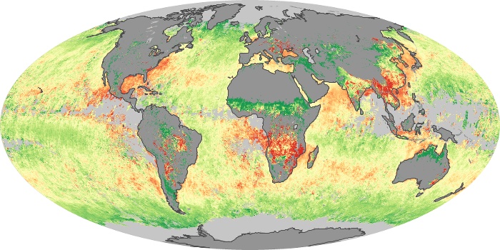
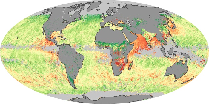
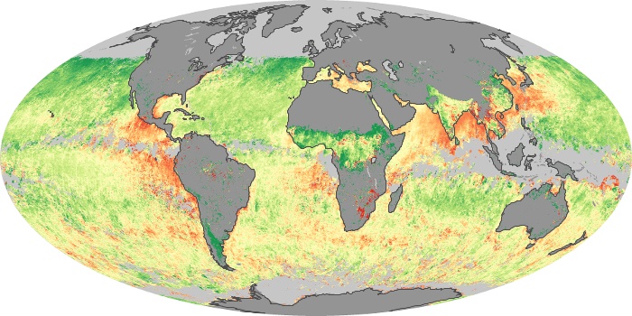
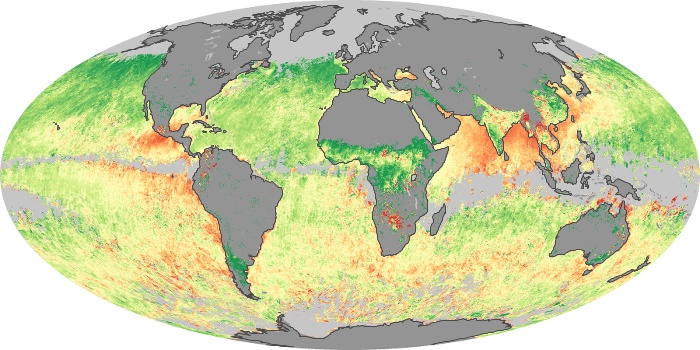
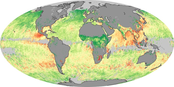
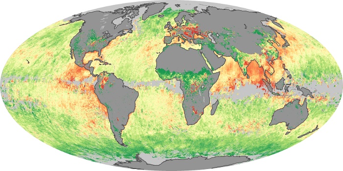
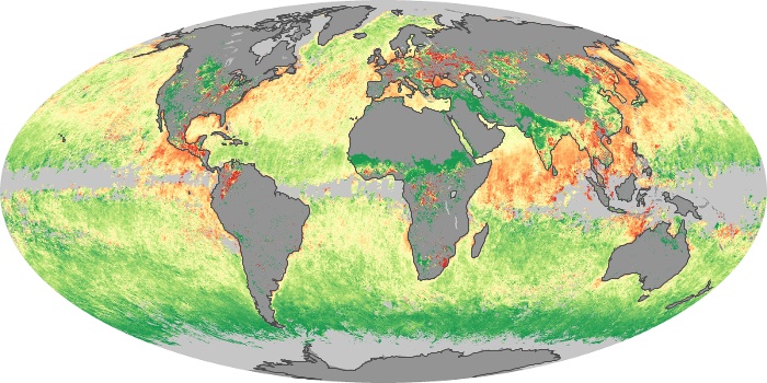
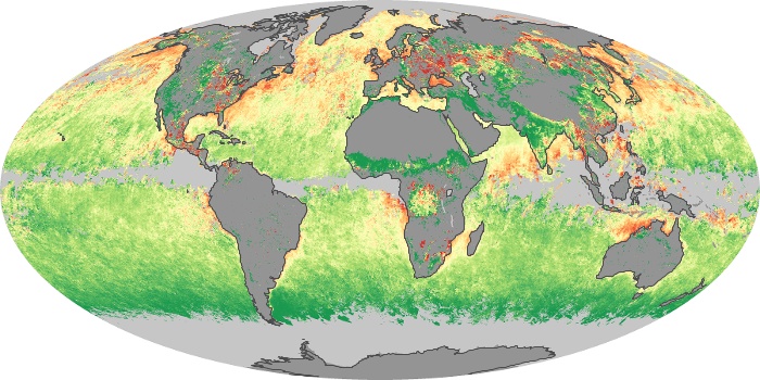
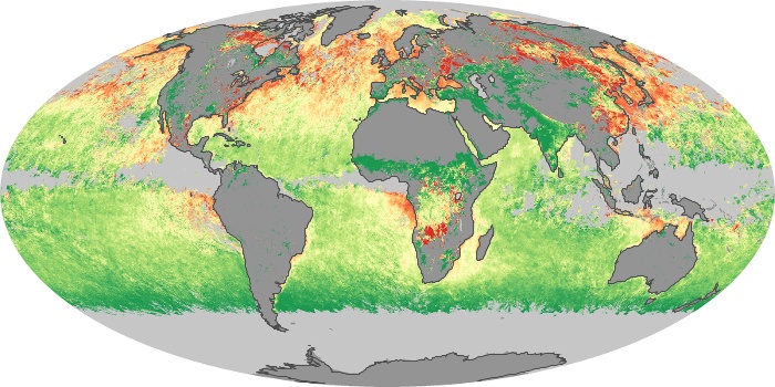
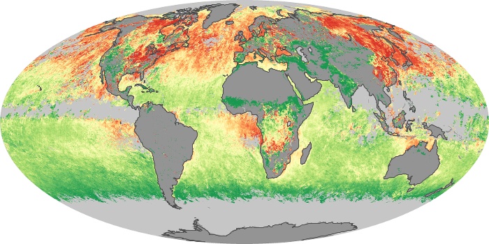
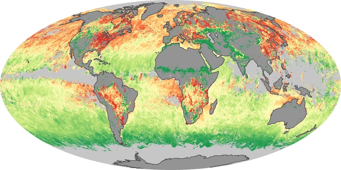
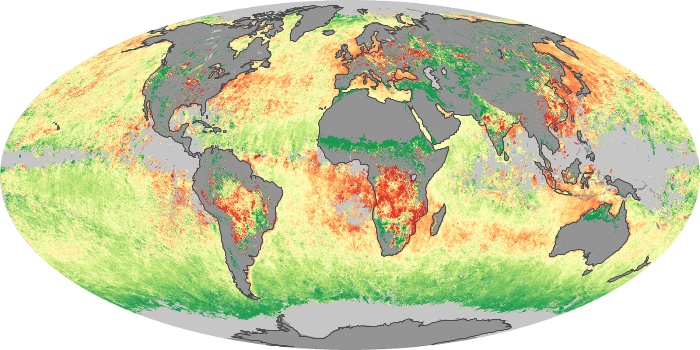
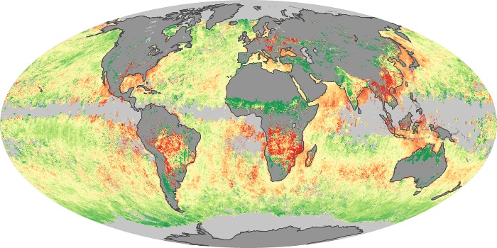
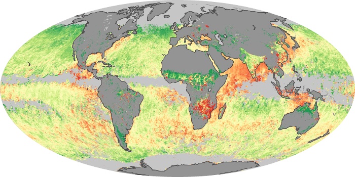
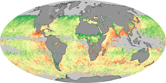
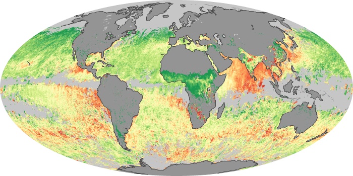
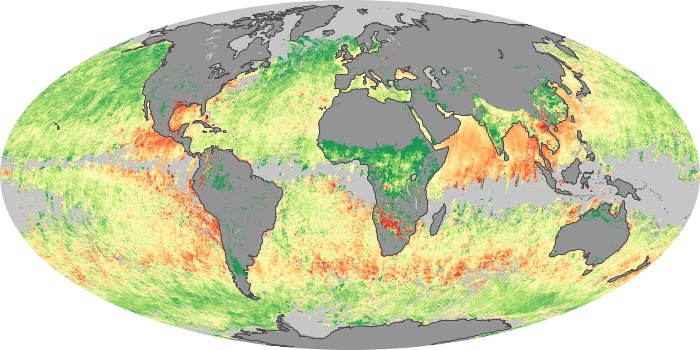
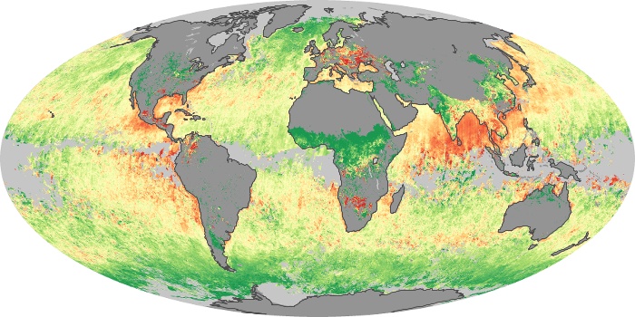
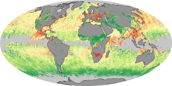
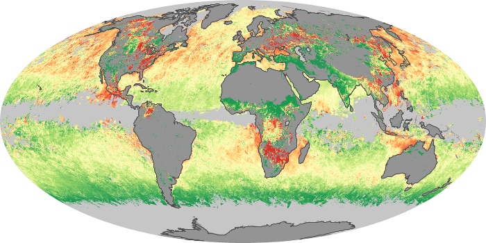
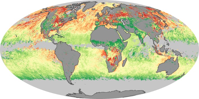
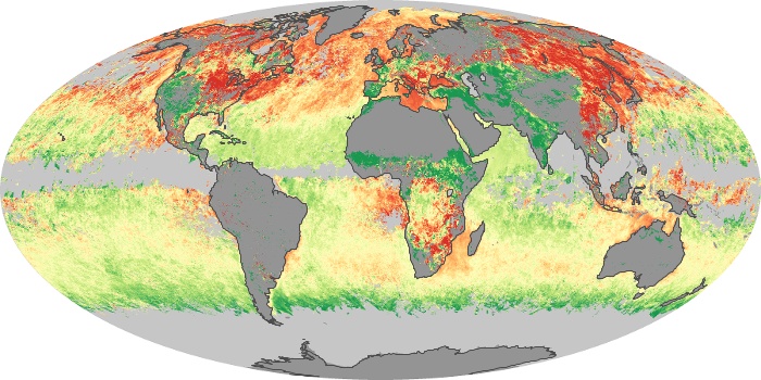
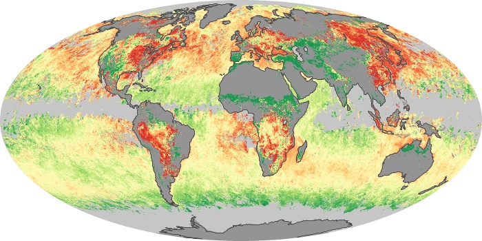
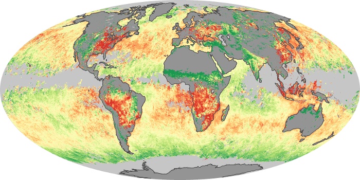
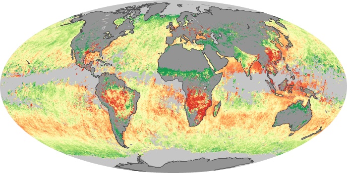
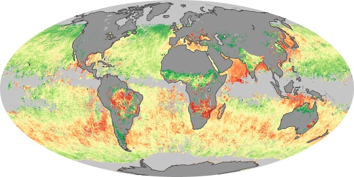
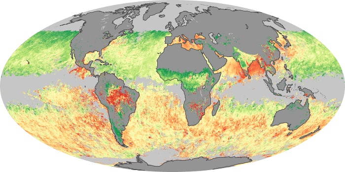
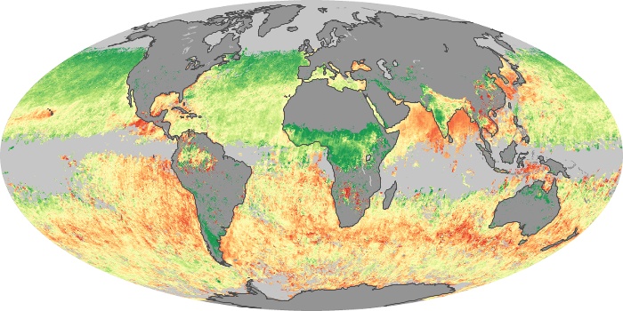
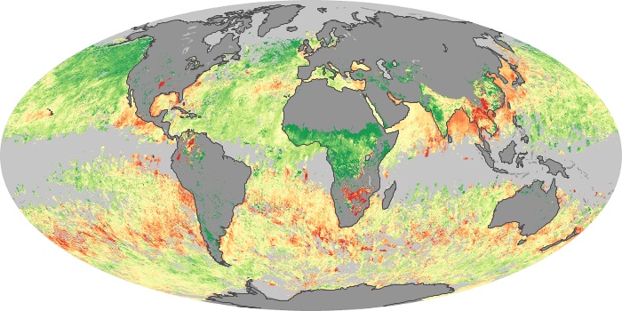
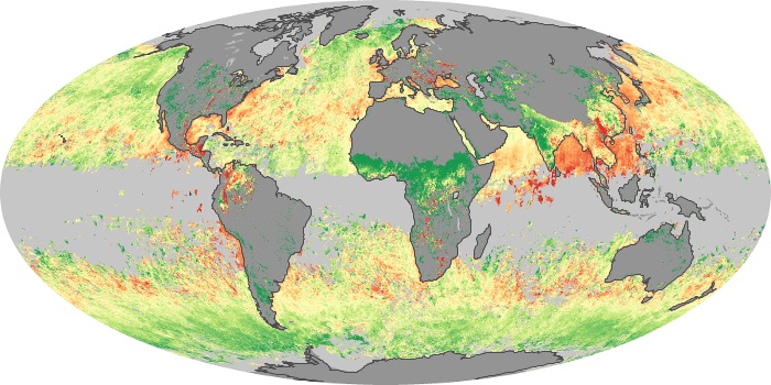
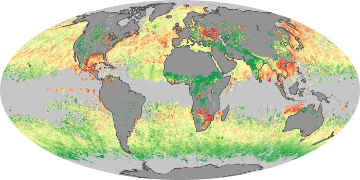
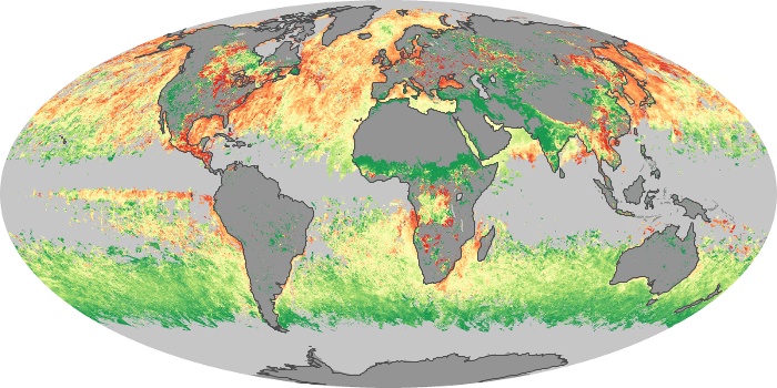
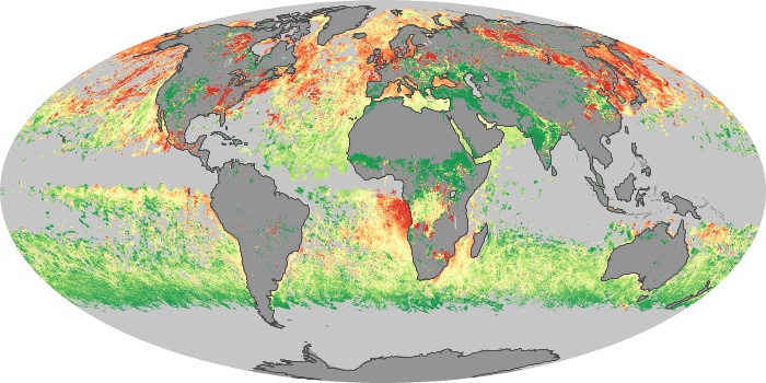
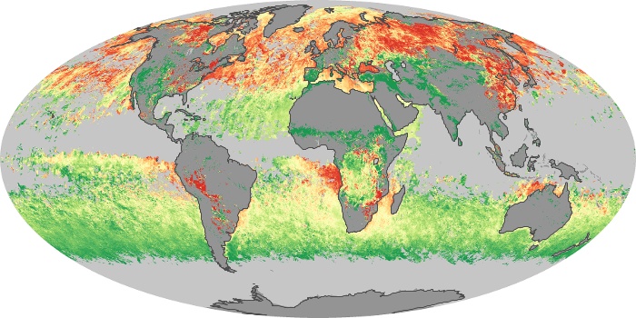
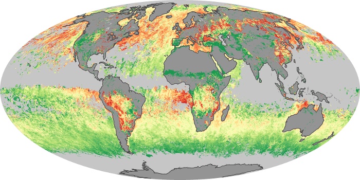
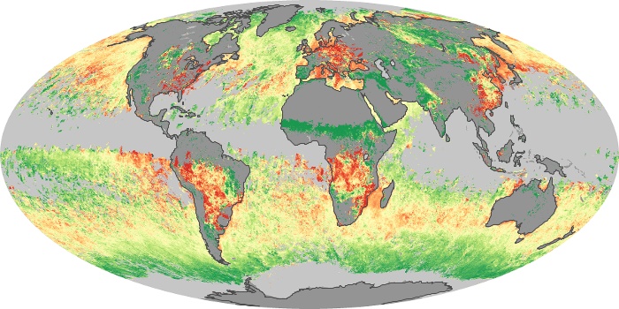
Earth’s atmosphere contains tiny liquid and solid particles called aerosols. Natural aerosol particles, such as dust and sea salt, tend to be larger than human-produced aerosols, such as particle pollution from burning fossil fuels. These aerosol size maps are based on data from the Moderate Resolution Imaging Spectroradiometer (MODIS) on NASA’s Terra satellite. Green areas show where the aerosols that were present were mostly larger particles. Red areas show where aerosols consisted mostly of small particles. Yellow areas show plumes with an even mix of small and large particles. Gray shows where the sensor did not collect data.
View, download, or analyze more of these data from NASA Earth Observations (NEO):
Cloud Fraction
Aerosol Size