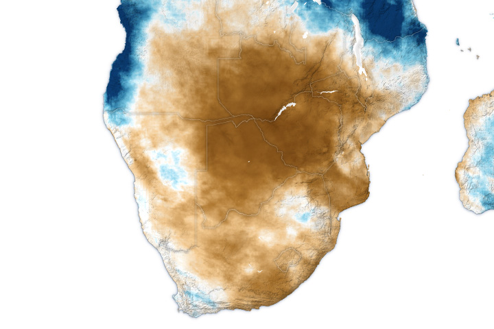
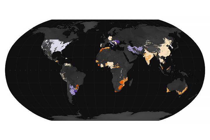
A prolonged dry spell in early 2024 has parched rivers and soils across much of Zambia, threatening food security and electricity supplies for millions of people. Satellite images show how diminished rainfall has changed waterways and wetlands in the southern part of the African nation.
From late January through mid-March, central and southern parts of Zambia received half or less of their typical rainfall, according to researchers at the Climate Hazards Center (CHC) at the University of California, Santa Barbara. February 2024 was especially dry. The researchers found it was the driest February in a 40-year precipitation record for much of the country.
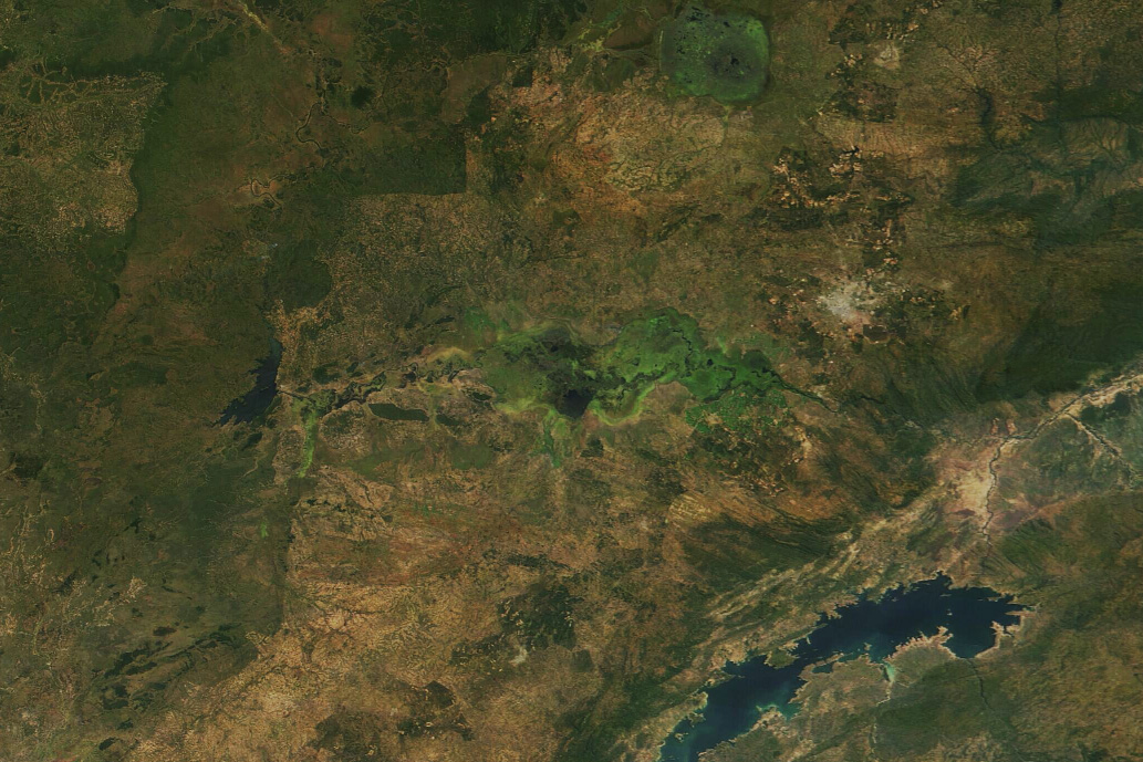
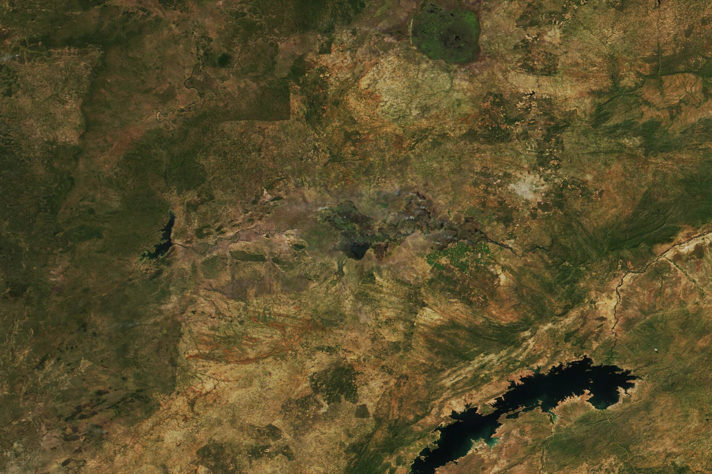
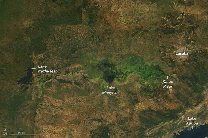
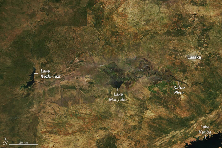
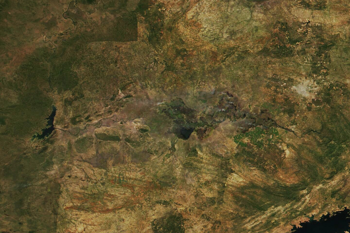
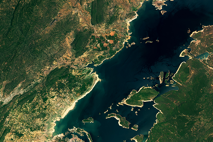
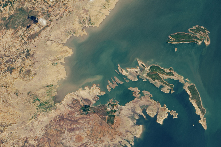
Evidence of severe drought can be seen along the Kafue River—the longest river flowing entirely within southern Zambia. The river winds more than 1,500 kilometers (900 miles) until it joins the Zambezi River at Zambia’s border with Zimbabwe. These satellite images show the Kafue’s west-to-east course through a flat, shallow floodplain, known as the Kafue Flats, in April 2024 (right) compared to April 2023 (left).
In the 2023 image, green vegetation surrounds an inundated network of channels and lagoons spanning the floodplain, which measures about 240 kilometers (150 miles) long and up to 50 kilometers (30 miles) wide. In the April 2024 image, green vegetation has diminished, and Lake Itezhi-Tezhi has reduced in size. The images were acquired by the MODIS (Moderate Resolution Imaging Spectroradiometer) on NASA’s Terra satellite (left), and the VIIRS (Visible Infrared Imaging Radiometer Suite) on the NOAA-20 satellite (right).
Water levels in the Kafue River typically rise during Zambia’s rainy season, from November to April, and usually peak toward the end of the season. This year, water levels peaked in January and measured about a meter below typical peak levels, according to the Database for Hydrological Time Series of Inland Waters (DAHITI). The DAHITI database uses water level altimetry data from the European Space Agency’s Sentinel-3 satellite.
The Kafue River and its vast wetland flats touch nearly every part of life in southern Zambia. The two dams on either side of the flats—the Itezhi-Tezhi and the Kafue Gorge Dam—produce about half of the country’s electricity. The region is home to one-fifth of the nation’s cattle and supports almost two-thirds of national irrigation. Green areas southeast of the flats are sugar cane fields, which depend on Kafue for irrigation water.
The recent dry conditions in Zambia and other countries in southern Africa have been driven in large part by El Niño. Based on previous research by the Famine Early Warning Systems Network (FEWS NET), El Niño conditions are known to shift rainfall patterns in southern Africa and lead to lower-than-average maize (corn) yields.
Maize is the single most important cereal crop in southern Africa, accounting for most of the region’s cereal production and 21 percent of the average person’s diet. Drought in Zambia came during a critical time in the growing season, when crops need ample water to grow and produce grain. Insufficient rainfall led to the withering of 1 million hectares of maize—almost half of the country’s maize-growing area. The European Commission estimated in April 2024 that at least 2.3 million people in Zambia were unable to meet their daily food needs.
NASA Earth Observatory images by Wanmei Liang, using MODIS data from NASA EOSDIS LANCE and GIBS/Worldview and VIIRS data from NASA EOSDIS LANCE, GIBS/Worldview, and the Joint Polar Satellite System (JPSS). Story by Emily Cassidy.


