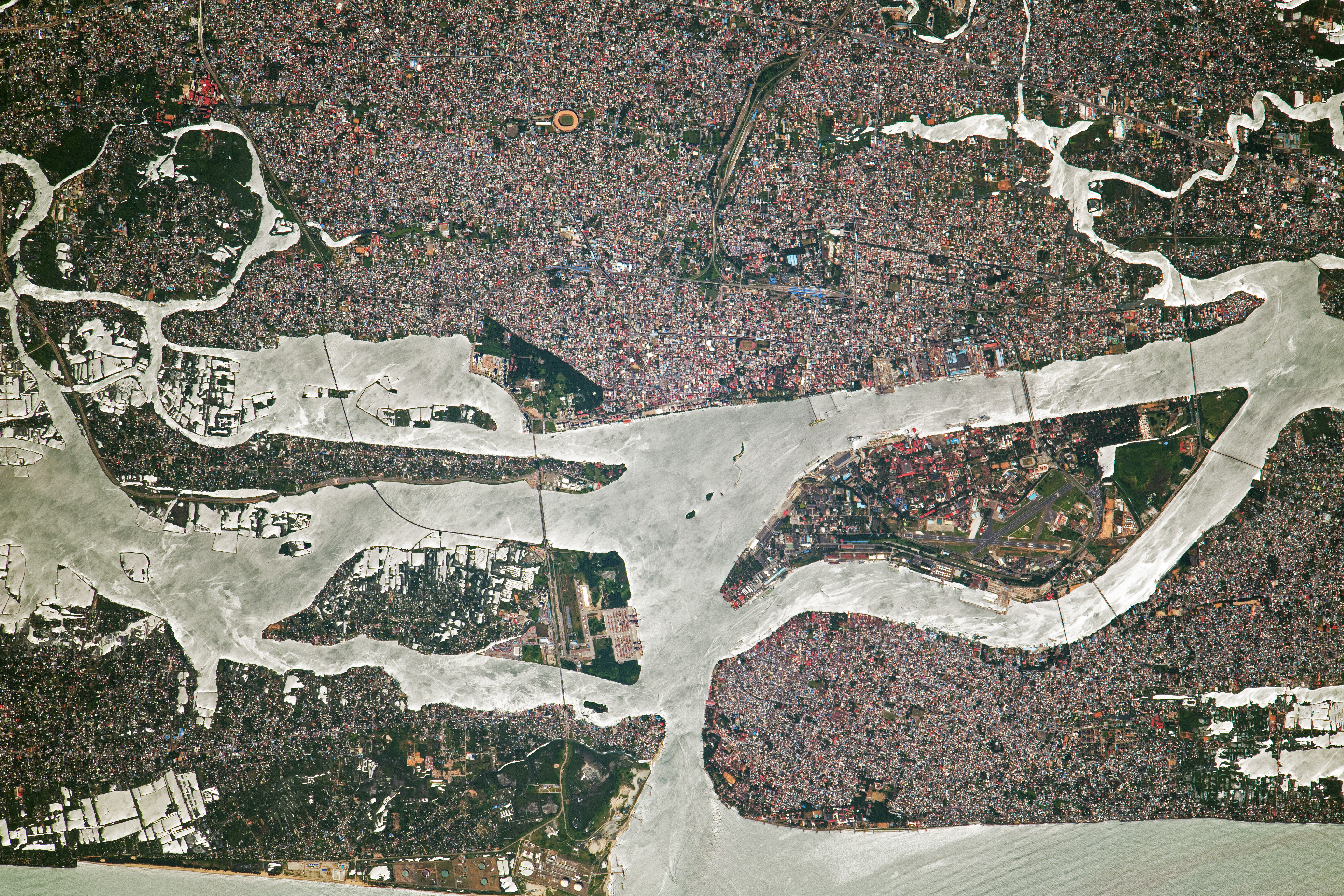
An astronaut aboard the International Space Station took this photograph of Kochi, a city along India’s southwestern coast in the state of Kerala. The densely populated mainland and its barrier islands intermingle with backwaters along this part of India’s coastline.
The city of Kochi (also known as Cochin) is nestled between the Arabian Sea and rivers flowing toward the ocean. Extensive infrastructure including housing, refineries, and stadiums cover areas along the coast and inland across the Ernakulam district. The extent of land modification is further highlighted by Willingdon Island, an artificial island that serves as a naval base and port to the city.
The Kollam-Kottapuram waterway runs nearly parallel to the coastline, protected from rougher ocean waters by the barrier islands. The labyrinth of connected waterways is used for navigation, tourism, and aquaculture. Fisheries and paddy fields are also concentrated throughout the waterways. Sunglint, which illuminates the water in this scene, helps distinguish thin vegetated barriers between the farms.
Astronaut photograph ISS069-E-82075 was acquired on August 23, 2023, with a Nikon D5 digital camera using a focal length of 1150 millimeters. The image was provided by the ISS Crew Earth Observations Facility and the Earth Science and Remote Sensing Unit at Johnson Space Center. The image was taken by a member of the Expedition 69 crew. It has been cropped and enhanced to improve contrast, and lens artifacts have been removed. The International Space Station Program supports the laboratory as part of the ISS National Lab to help astronauts take pictures of Earth that will be of the greatest value to scientists and the public and to make those images freely available on the Internet. Additional images taken by astronauts and cosmonauts can be viewed at the NASA/JSC Gateway to Astronaut Photography of Earth. Caption by Andrea Wenzel/Jacobs-JETS II Contract at NASA-JSC.