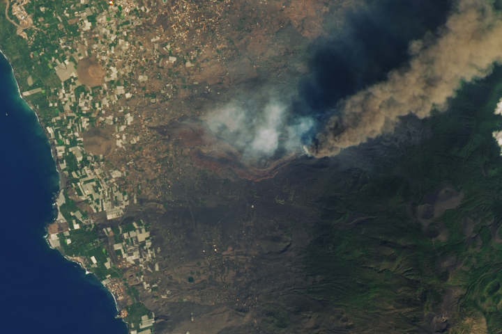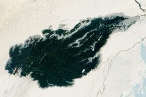
An astronaut aboard the International Space Station took these photographs of La Palma island while in orbit over the North Atlantic Ocean. La Palma is part of Spain’s Canary Islands, located about 480 kilometers (300 miles) off the coast of Morocco and Western Sahara. The island is a basaltic shield volcano that is composed of two volcanic centers: the older collapsed Caldera de Taburiente and the younger active Cumbre Vieja.
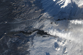
From September through December 2021, a strong eruption on the southwestern flank of Cumbre Vieja produced lava flows, lava fountains, and ash clouds. The activity lasted about 85 days, giving astronauts aboard the space station the opportunity to capture photos of ash plumes and nighttime glowing lava flows.
In total, lava flows and ash covered more than 12 square kilometers (5 square miles) of La Palma extending 5 kilometers (3 miles) from the fissure to the coastline. The ash and lava damaged more than 3,000 buildings and several banana plantations, and caused the yellowing of pine forests.
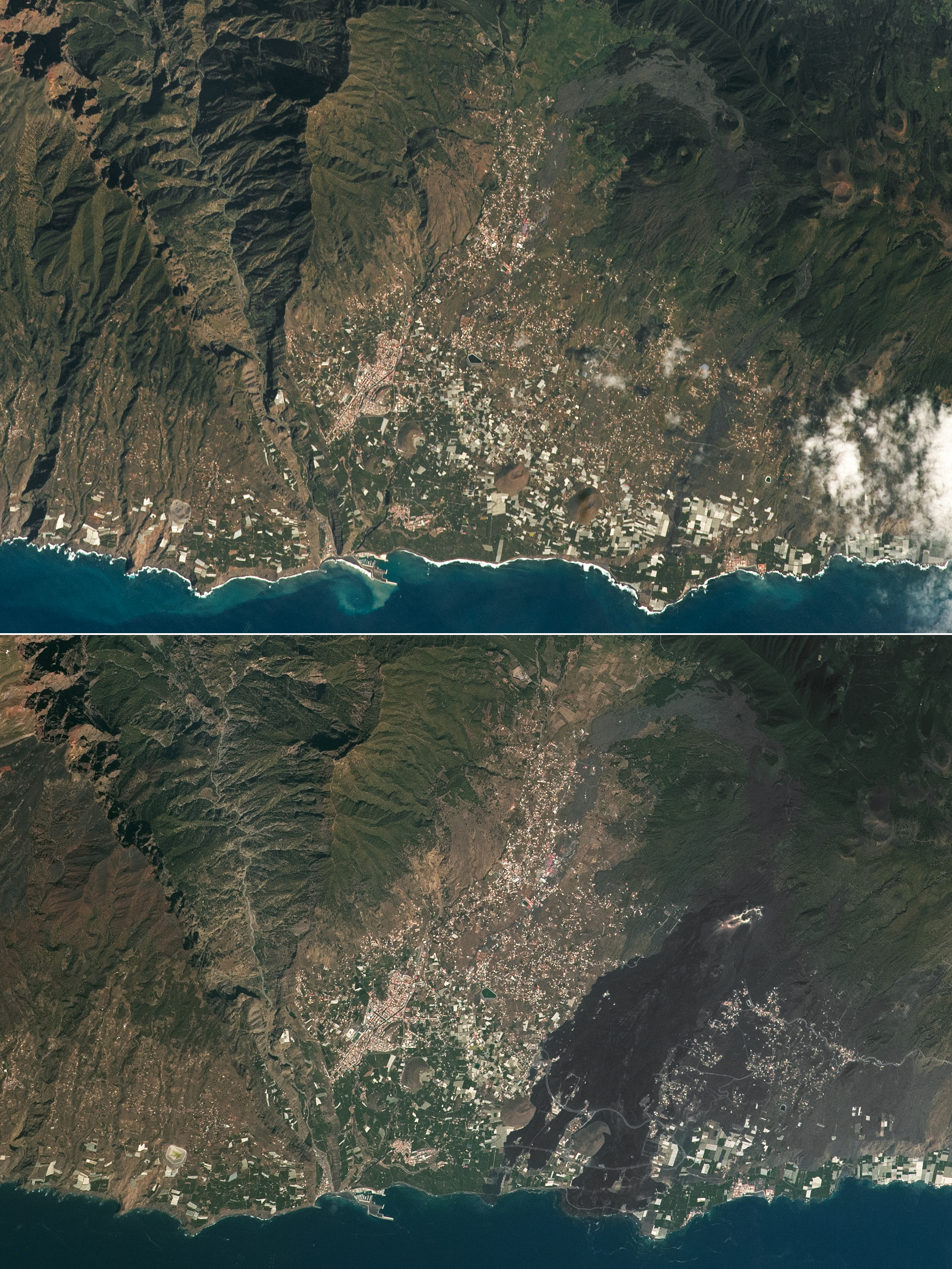
These photos, taken in February 2016 (top) and August 2023 (bottom), show the landscape several years before and after the eruption. In the two years since the eruption, some roads have been reconstructed, visible as thin, light-colored lines cutting through the lava flow. The roads reconnect the towns of Los Llanos de Aridane with Puerto Naos and other nearby communities. The eruption fissure is evident in this photo as a brighter, linear feature midway up the volcanic flank.
Although not noticeable at the spatial resolution of these images, sparse trees and shrubs continue to grow amidst the deposited ash, including the Canary Island pine (Pinus canariensis). This fire-resistant serotinous conifer, endemic to the Canary Islands, relies on heat from fires to melt the resin enclosing its pine cones to yield viable seeds.
Astronaut photograph ISS069-E-62382 was acquired on August 18, 2023, with a Nikon D5 digital camera using a focal length of 400 millimeters. Astronaut photograph ISS046-E-40929 was acquired on February 13, 2016, with a Nikon D4 digital camera using a focal length of 400 millimeters. The images are provided by the ISS Crew Earth Observations Facility and the Earth Science and Remote Sensing Unit, Johnson Space Center. The images were taken by a member of the Expedition 69 crew and the Expedition 46 crew. The images have been cropped and enhanced to improve contrast, and lens artifacts have been removed. The International Space Station Program supports the laboratory as part of the ISS National Lab to help astronauts take pictures of Earth that will be of the greatest value to scientists and the public, and to make those images freely available on the Internet. Additional images taken by astronauts and cosmonauts can be viewed at the NASA/JSC Gateway to Astronaut Photography of Earth. Caption by Cadan Cummings, Jacobs, JETS II Contract at NASA-JSC.