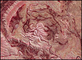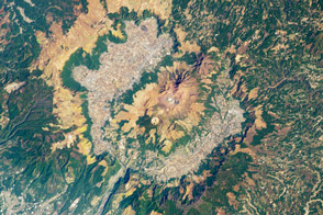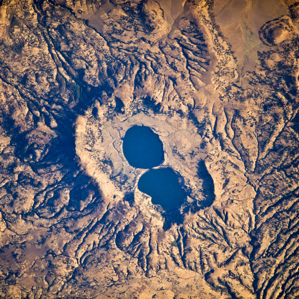
The Dendi Caldera is located on the Ethiopian Plateau, approximately 86 kilometers southwest of Addis Ababa. A caldera is a geological feature formed by the near-total eruption of magma from beneath a volcano. Following the eruption, the volcanic structure collapses into the empty magma chamber. This collapse typically leaves a crater or depression where the volcano stood, and later volcanic activity can fill the caldera with younger lavas, ash, sediments, and pyroclastic rocks (rocks made from fragments of shattered volcanic rock). Much of the volcanic rock in the area is basalt erupted as part of the opening of the East African Rift, but more silica-rich rock types, characterized by minerals such as quartz and feldspar, are also present.
The approximately 4-kilometer-wide Dendi Caldera includes some of this silica-rich volcanic rock: the rim of the caldera, visible in this astronaut photograph, is mostly made of poorly consolidated ash erupted during the Tertiary Period (approximately 65–2 million years ago). Two shallow lakes have formed within the central depression (image center). This image also highlights a radial drainage pattern surrounding the remnants of the Dendi volcanic cone. Radial drainage patterns commonly form around volcanoes, as rainfall can flow down slope on all sides of the cone and incise channels. There are no historical records of volcanic eruptions at Dendi, but the Wonchi Caldera, 13 kilometers to the southwest (not shown), may have been active as recently as AD 550.
Astronaut photograph ISS016-E-19239 was acquired on December 29, 2007, with a Kodak 760C digital camera fitted with a 400 mm lens, and is provided by the ISS Crew Earth Observations experiment. The image was taken by the Expedition 16 crew and is provided by the Image Science & Analysis Laboratory, Johnson Space Center. The image in this article has been cropped and enhanced to improve contrast. Lens artifacts have been removed. The International Space Station Program supports the laboratory to help astronauts take pictures of Earth that will be of the greatest value to scientists and the public, and to make those images freely available on the Internet. Additional images taken by astronauts and cosmonauts can be viewed at the NASA/JSC Gateway to Astronaut Photography of Earth. Caption by William L. Stefanov, NASA-JSC.