Researchers used satellite data to calculate the depth of water in this transient freshwater body.
Published Apr 16, 2024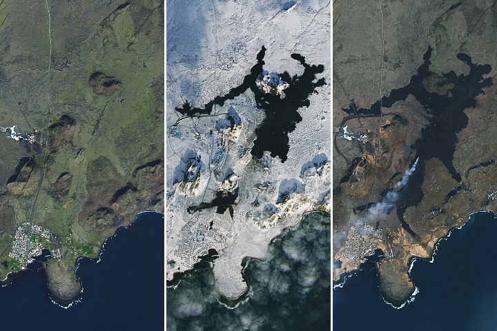
The latest fissure eruption on Iceland’s Reykjanes peninsula was the largest of four recent bouts of activity near the town of Grindavík.
Published Apr 3, 2024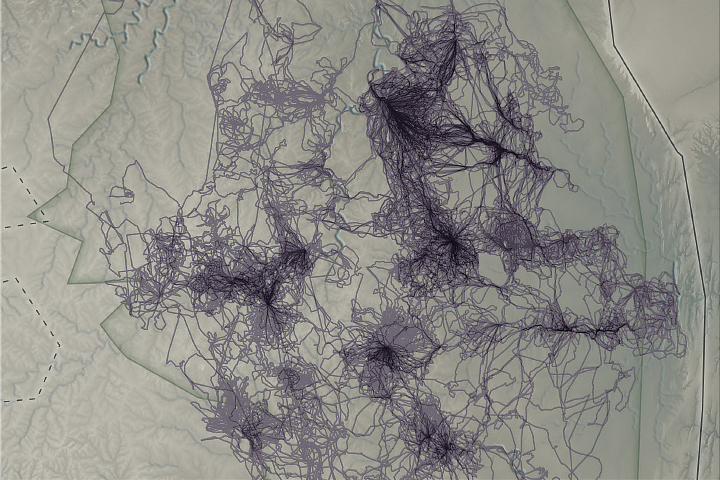
Researchers are leveraging troves of data collected by animal-borne sensors to complement satellite observations, expand weather measurements, and better understand wildlife ecology in a changing climate.
Published Mar 12, 2024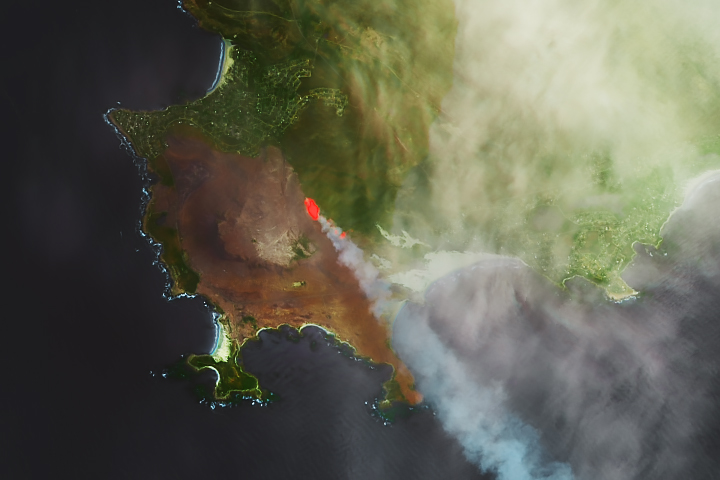
Hot, windy weather has fueled outbreaks of fire in South Africa’s Western Cape.
Published Feb 1, 2024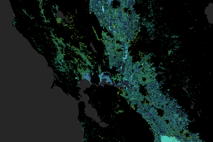
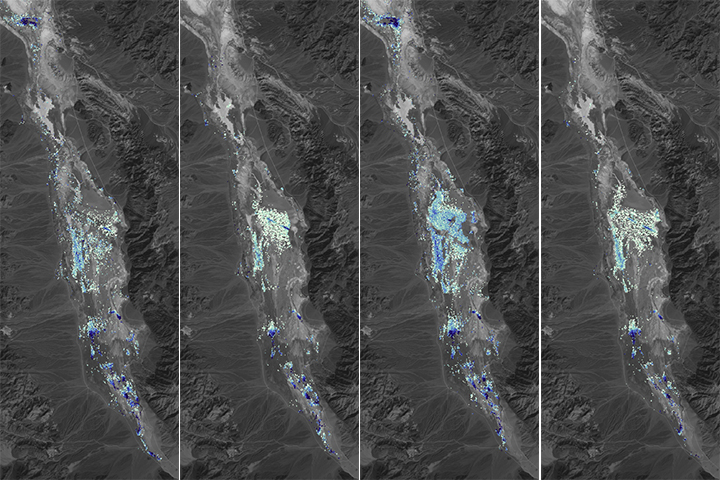
A moisture measurement tool known as OpenET is improving the way farmers, ranchers, and water resource managers steward one of Earth’s most precious resources.
Published Feb 2, 2024