Economists are using satellite data to help make more accurate price predictions of important crops.
Published Sep 20, 2018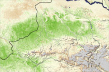
A vegetation index image shows areas of above-average crop growth in northern Afghanistan, following beneficial rains in March and April 2009.
Published Jun 12, 2009
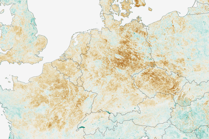
The impact of the drought on plants in Moldova and parts of Ukraine and Romania is illustrated by this pair of images. The images are vegetation anomaly images, which indicate how quickly plants were taking in light and growing.
Published Oct 6, 2007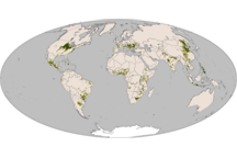
Native to America, corn is now a staple in diets around the world. This map shows the global distribution of corn in 2000.
Published Nov 25, 2010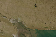
This pair of natural-color (photo-like) images from the Moderate Resolution Imaging Spectroradiometer (MODIS) on NASA’s Terra satellite contrasts 2009 conditions in southern Buenos Aires province with the conditions in 2008, a more normal year.
Published Feb 24, 2009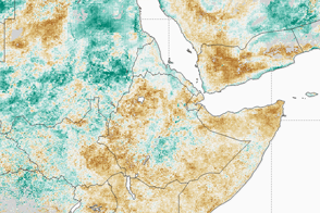
War, food distribution problems, and drought have come together to push millions of people to the brink of starvation.
Published Feb 28, 2017
These vegetation maps show the impact of yellow rust, a fungus infection, on plants in Syria, Turkey, and Iraq in the spring of 2010.
Published Jul 3, 2010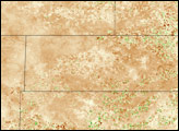
As of early August 2008, the Oklahoma panhandle was experiencing its driest year (previous 365 days) since 1921, according to records kept by the Oklahoma Climatological Survey. Through July, year-to-date precipitation in Boise City, in the heart of Cimarron County, was only about 4.8 inches, barely half of average and drier than some years in the 1930s, the height of the Dust Bowl.
Published Aug 14, 2008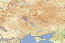
Under the one-two punch of a dry fall and a frigid winter, winter crops in Ukraine were in poor condition in April and May 2006. This vegetation anomaly (difference from normal) image was created from data collected by MODIS. Widespread brown indicates that plants throughout the region had grown less compared to the average growth for 2000-2005. The Foreign Agricultural Service, a division of the U.S. Department of Agriculture, estimated that only 10 metric tons of winter wheat, the primary crop growing here, would be harvested in July and August. That figure was down about 46 percent from the 18.7 metric tons harvested in 2005.
Published May 25, 2006