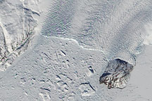
The heavily crevassed terminus of Kong Oscar Glacier in northwestern Greenland crumbles into a mélange of icebergs in the Davis Strait.
Published Aug 25, 2010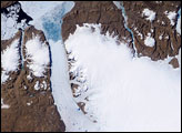
On Greenland, tens of thousands of years of snowfall have settled and solidified into a massive sheet of ice. Each summer, snow retreats briefly at low elevations, and a narrow strip of rocky coastline emerges. While some seasonal thawing is typical on Greenland, more dramatic changes are probably in store for the Greenland Ice Sheet in coming decades and centuries.
Published Aug 30, 2007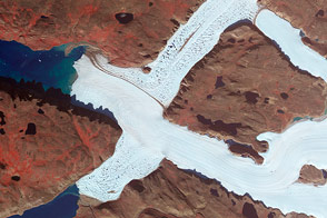
Crisscrossing glaciers in northwest Greenland flow along the path of least resistance.
Published Jan 22, 2015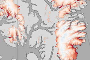
These color-coded maps show ice mass changes in the northern Canadian Arctic Archipelago from 2004 to 2009.
Published Jun 1, 2011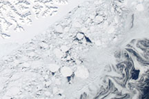
Acquired March 27, 2010, this natural-color image shows part of the southeastern coast of Greenland, fringed by multiple forms of sea ice: fast ice, multiyear ice fragments, and small pieces of ice shaped into swirls by currents.
Published Apr 2, 2010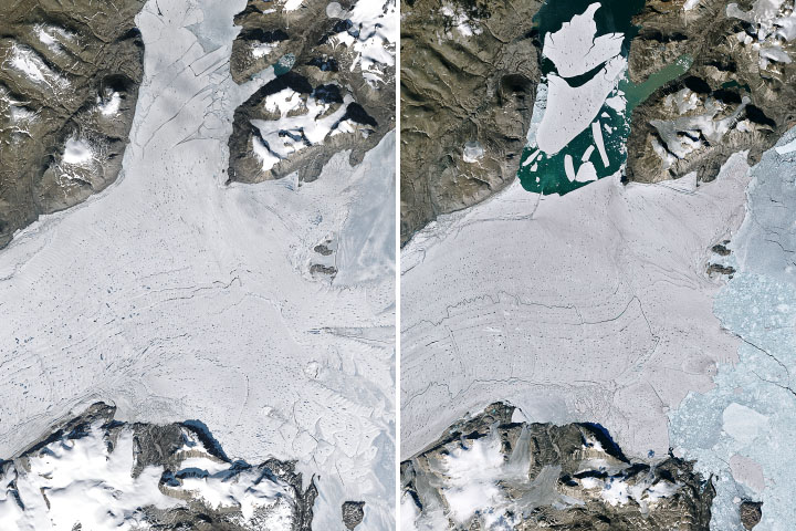
In summer 2020, a huge piece of ice split off from the Arctic’s largest remaining ice shelf.
Published Oct 1, 2020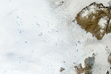
To understand ice sheets, glaciologists venture both below the surface with ice cores, and into the sky with satellites. Satellite imagery of the Greenland Ice Sheet reveals melt ponds that can affect glacier flow and sea level.
Published Oct 29, 2008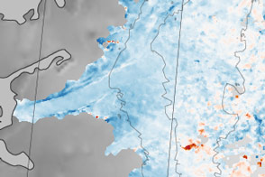
Sections of the Greenland Ice Sheet that end on land are slowing—a sliver of good news for sea level rise.
Published Oct 30, 2015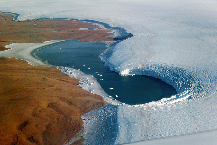
Summer snowmelt along the flank of Greenland’s Humboldt Glacier exposes layers of ice from ancient climate periods.
Published Sep 28, 2019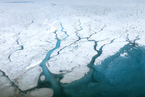
A summer field campaign examines the hydrology of the water streaming across the top of the ice sheet.
Published Aug 30, 2015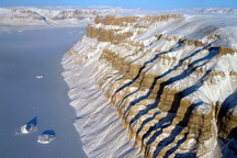
Acquired March 29, 2011, this photograph shows canyons along the coast of northwestern Greenland.
Published May 1, 2011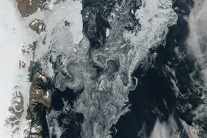
Sea ice and glacial ice mixes off the northeast coast of the great island.
Published Aug 24, 2014