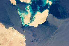
The narrow strait between Egypt’s Sinai Peninsula and Saudi Arabia is an important passage for ships trying to reach Israel and Jordan.
Published Aug 5, 2013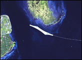
The city of Gallipoli sits at a crossroads between the Marmara and Aegean Seas, connected by the Dardanelles Strait. he urbanized area of modern Gallipoli is visible as a light gray to pink region at the entrance to the Dardanelles Strait.
Published Jan 22, 2007
Between the island of Sicily and mainland Italy runs a narrow strip of water, the Messina Strait. The Messina Strait’s strong currents can rip seaweed from the ocean floor. The main current runs from south to north, but a smaller current runs in the opposite direction. The currents alternate about every six hours, and the strait’s complicated wave patters can be seen from space.
Published Apr 29, 2007
Carved out by ancient glaciers, this portion of the coastal Andes is rich with glacial fjords, complex shorelines, active volcanoes, and marine life.
Published Sep 13, 2020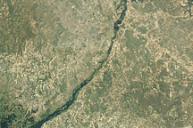
Acquired April 16, 2011, this natural-color image shows water flowing through the Bukalo Channel toward Lake Liambezi in easternmost Namibia.
Published Apr 25, 2011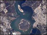
This astronaut photograph depicts the San Jacinto River portion of the Houston Ship Channel, one of the United States’ busiest sea ports. The channel is a conduit between the continental interior and the Gulf of Mexico for both petrochemical products and Midwestern grain. The original watercourse for the channel, Buffalo Bayou, has its headwaters thirty miles to the west of the city of Houston. It has been used to move goods to the sea since at least 1836. Wakes of ships traveling along the channel are visible to the south of the Goat Islands (bright, oblong islands at top center of image). The close proximity to Texas oilfields led to the establishment of numerous petrochemical refineries along the waterway, such as the ExxonMobil Baytown installation on the eastern bank of the San Jacinto River.
Published Dec 26, 2005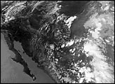
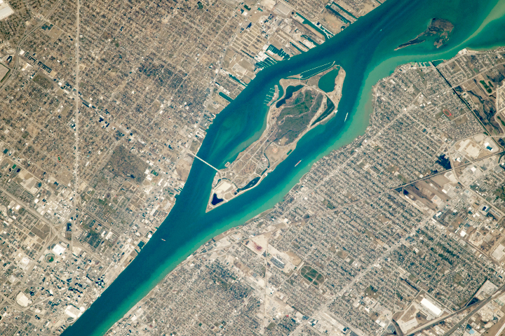
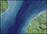
Cars, commerce, and countries connect along the Detroit River.
Published Sep 2, 2018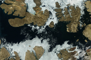
Acquired August 2, 2012, this image shows a largely open Northwest Passage.
Published Aug 6, 2012
As sea ice around Russia’s New Siberian Islands thins and breaks-up each summer, it takes on the appearance of stained glass.
Published Nov 23, 2018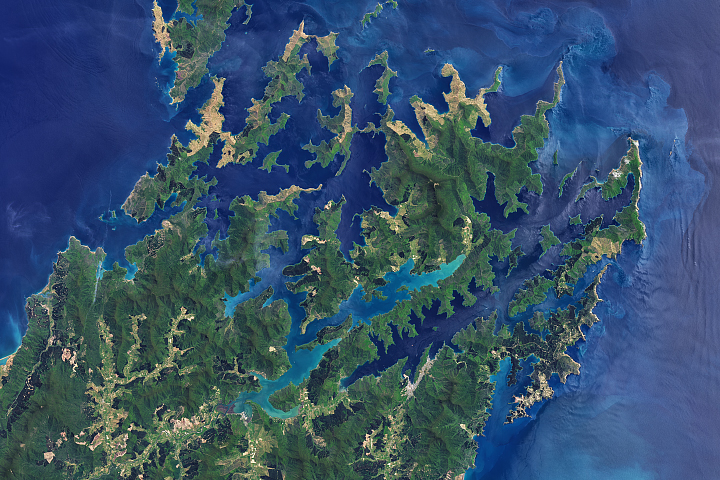
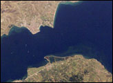
Strong tidal currents, changes in the sea floor, and winds funneling through Cook Strait stir complicated flow patterns off of New Zealand’s South Island.
Published Feb 2, 2018