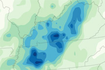
A map of rainfall totals between May 1 and May 3, 2010, shows a line of heavy rain following the path of severe thunderstorms across Tennessee and Kentucky.
Published May 5, 2010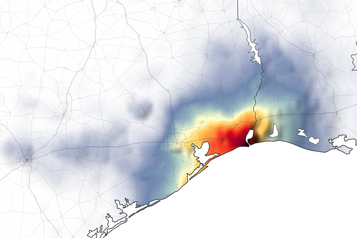
Parts of Houston and Beaumont are underwater after the remnants of Tropical Storm Imelda moved through the area.
Published Sep 20, 2019Image of the Day Land Water Floods Severe Storms Human Presence Remote Sensing
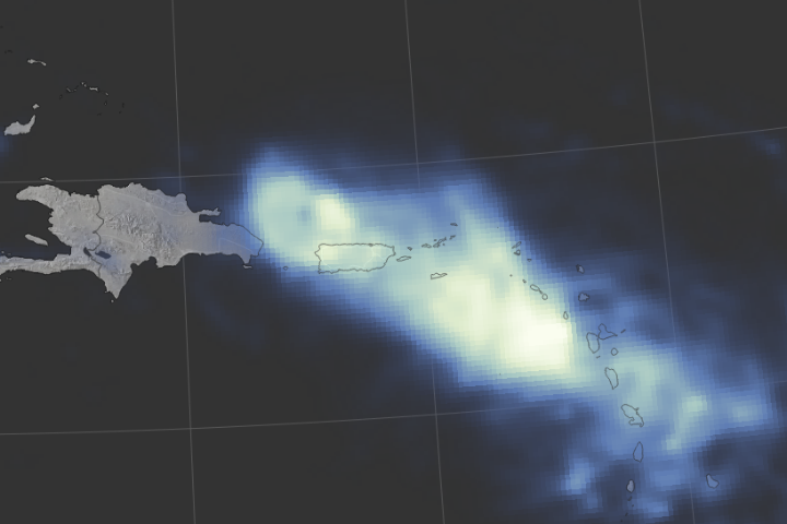
Hurricane Maria delivered a tremendous amount of rain in a short period of time.
Published Sep 24, 2017Image of the Day Land Water Severe Storms Human Presence Remote Sensing
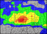
Record rainfall in the Houston area led to severe flooding.
Published Apr 21, 2016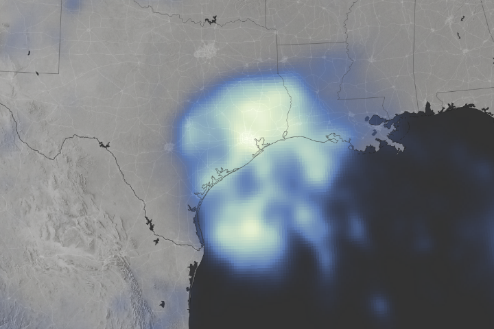
Space-based measurements show regions where Harvey delivered unprecedented rainfall.
Published Aug 30, 2017Image of the Day Land Water Severe Storms Human Presence Remote Sensing
More than two feet of rain fell in parts of southeast Brazil during December, resulting in widespread flooding.
Published Jan 7, 2014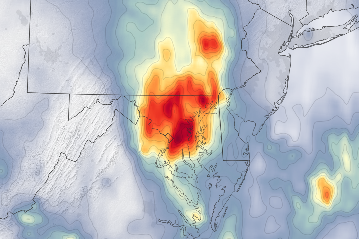
A dip in the jet stream pulled moist, tropical air from the Caribbean to the Eastern Seaboard and triggered several days of intense rains.
Published Jul 25, 2018Image of the Day Water Floods Severe Storms Human Presence Remote Sensing

This color-coded map shows approximate rainfall amounts over Japan, where unprecedented floods struck some areas in early July 2012.
Published Jul 13, 2012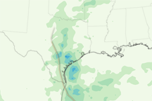
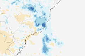
Tropical Hermine’s track inland is defined by a trail of heavy rain in this rainfall map from September 2-8, 2010.
Published Sep 11, 2010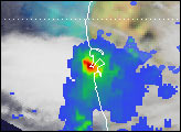
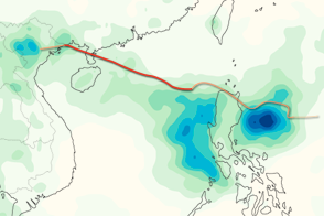
This color-coded image shows rainfall totals and the storm track for Typhoon Kai-tak in August 2012.
Published Aug 20, 2012