
A wildfire in Fresno County, California has burned more than 28,000 acres.
Published Jul 20, 2020
Temperature, humidity, and winds contributed to the rapid spread of fire in Lake County, about 100 miles northwest of Sacramento.
Published Jun 27, 2018
The blaze is the largest in Arizona this year and the largest in the United States right now.
Published Jun 16, 2020Image of the Day Heat Land Fires Human Presence Remote Sensing

The fast-moving King fire burned in Eldorado National Forest in September 2014.
Published Sep 18, 2014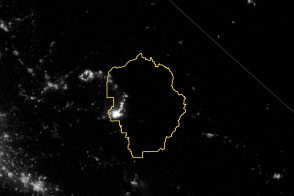
The VIIRS instrument on the Suomi NPP satellite tracked the growth of the fire between August 20 and September 4.
Published Sep 8, 2013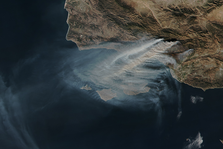
The Thomas fire is now the fourth largest wildfire on record in California.
Published Dec 15, 2017
This image from June 9, 2011, shows Arizona’s Wallow Fire in the White Mountains near the border with New Mexico.
Published Jun 10, 2011
An expansive, destructive wildfire north of Los Angeles is visible from space by day and night.
Published Jun 28, 2016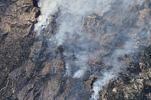
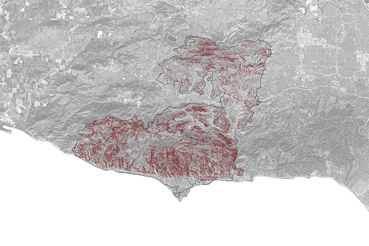
This false-color image illustrates the extent of the Station Fire in southern California.
Published Sep 15, 2009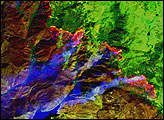
A NASA project is providing maps of satellite data to emergency response teams during the Woolsey Fire.
Published Nov 16, 2018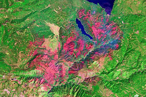
One of a number of large wildfires that have affected northern California in 2012, the Chips fire burned more than 75,000 acres by the time firefighters had contained it.
Published Sep 5, 2012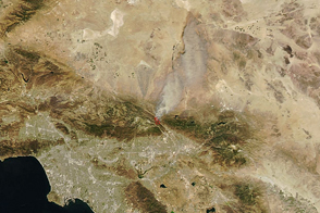
Dry, windy weather intensified the blaze near San Bernardino.
Published Aug 17, 2016
A wildfire burning in Los Padres National Park charred more than 500 acres—including the home of Big Sur’s fire chief.
Published Dec 17, 2013