Wildfires continue to menace Southern California.
Published Dec 8, 2017
An expansive, destructive wildfire north of Los Angeles is visible from space by day and night.
Published Jun 28, 2016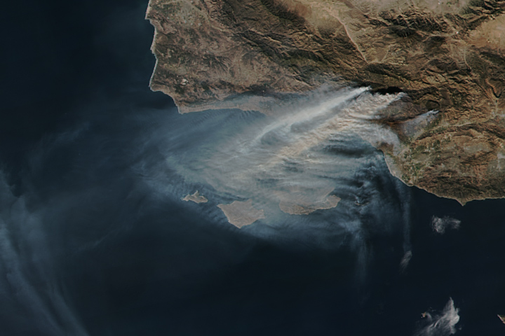
The Thomas fire is now the fourth largest wildfire on record in California.
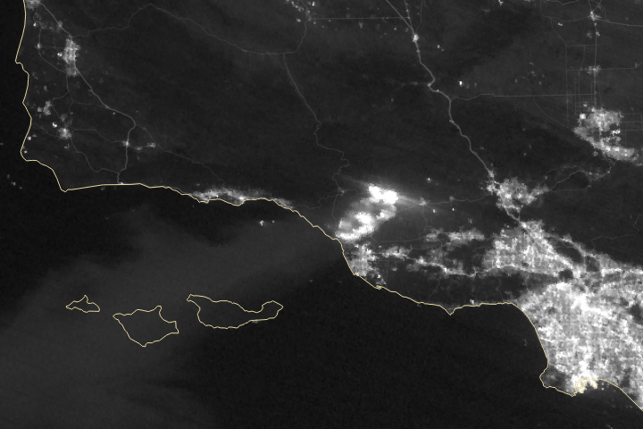
Published Dec 15, 2017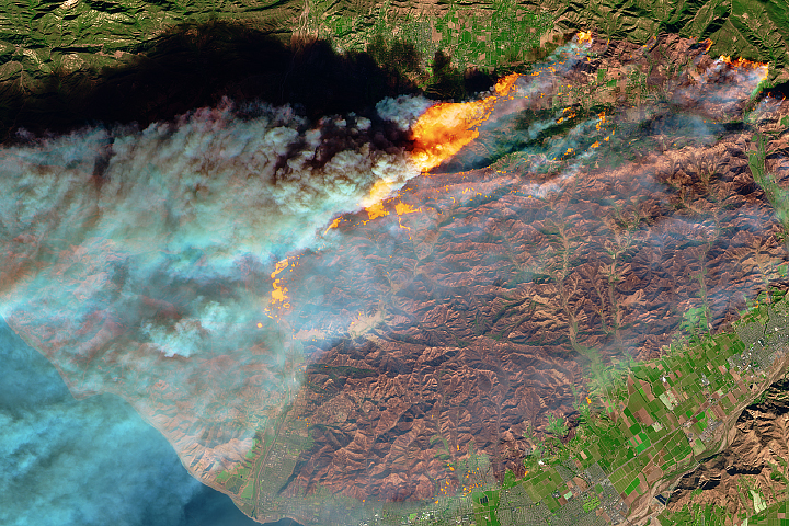
In December 2017, thick smoke streamed from several fires burning in southern California.
Published Dec 7, 2017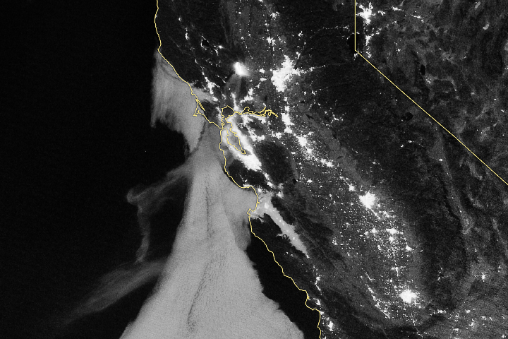
As smoke streamed toward San Francisco, more than 1,000 fire personnel were at the scene fighting the blaze.
Published Jul 4, 2018Image of the Day Atmosphere Land Fires Human Presence Remote Sensing
The fast-moving Delta Fire is one of several that have cast a pall of smoke over the region this summer.
Published Sep 7, 2018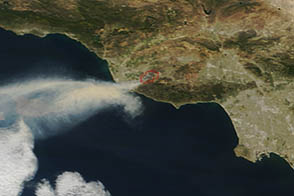
On May 2, 2013, the MODIS instrument on the Terra satellite captured this image of wildfire burning near Los Angeles, California.
Published May 4, 2013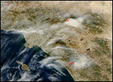
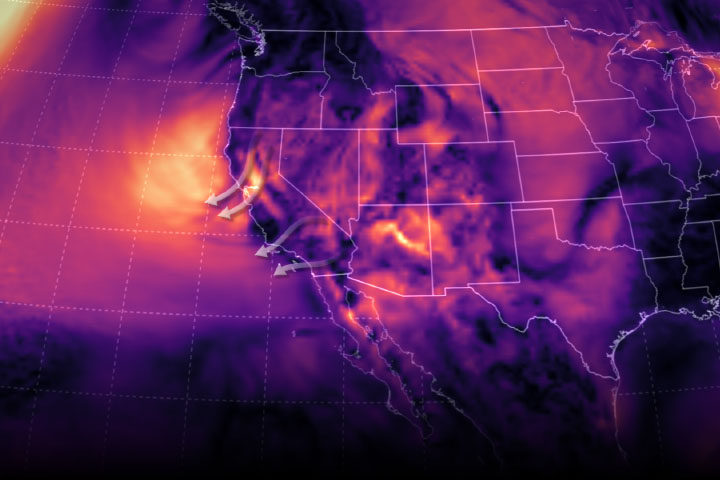
Fierce Diablo winds helped fan flames, which have consumed more than 75,000 acres.
Published Oct 29, 2019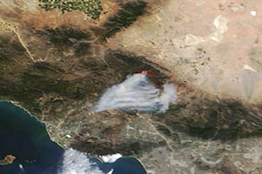
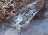
A wildfire burned in steep terrain north of Los Angeles near Palmdale on May 31, 2013.
Published Jun 3, 2013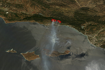
Acquired on May 8, 2009, this true-color image shows fire locations and smoke plumes from the Jesusita Fire near Santa Barbara, California.
Published May 8, 2009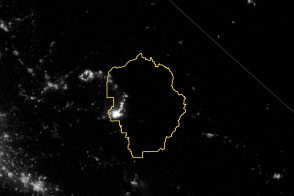
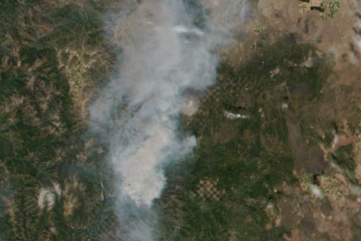
The VIIRS instrument on the Suomi NPP satellite tracked the growth of the fire between August 20 and September 4.
Published Sep 8, 2013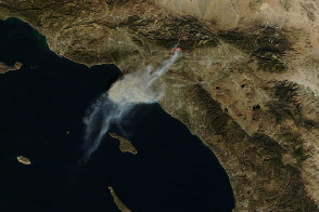
A smoky wildfire began burning just northeast of Los Angeles on January 16, 2014.
Published Jan 16, 2014
The Thomas fire has set new records while ravaging several communities.
Published Dec 24, 2017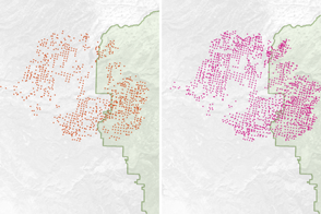
Scientists have found a way to detect nighttime fires even sooner, when they are still relatively small.
Published Apr 7, 2017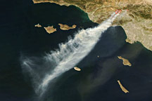
Driven by powerful Santa Ana winds, wildfires raged near Los Angeles, California, in mid-October 2008.
Published Oct 15, 2008