Ice cover surpassed 80 percent for the first time in 20 years.
Published Feb 21, 2014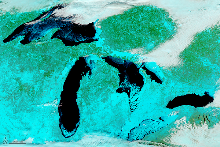
Lake Erie is usually the first to freeze over because it is shallower than the other Great Lakes.
Published Feb 18, 2018Image of the Day Atmosphere Temperature Extremes Sea and Lake Ice
The spring thaw is underway in the Great Lakes region of North America.
Published Mar 27, 2019
These images of the five Great Lakes show ice beginning to build up around the shores of each of the lakes, with snow on the ground across virtually the entire scene.
Published Jan 28, 2005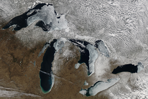
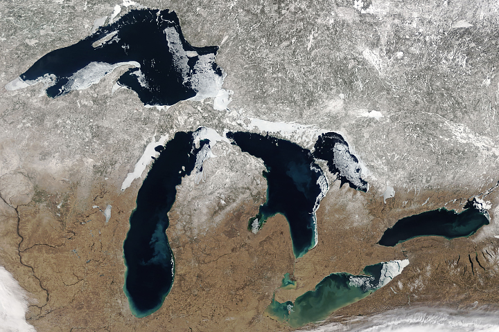
The extent of ice on North America's Great Lakes is past its annual peak, but remains above the average maximum extent.
Published Mar 18, 2015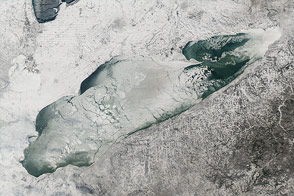
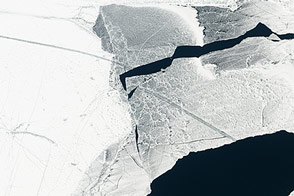
Nearly 90 percent of the lake was ice-covered on January 9, 2014.
Published Jan 15, 2014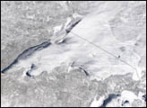
Huge sheets of ice carved out the U-shaped valleys that hold New York’s Finger Lakes. When they retreated north about 10,000 years ago, glaciers left deposits of gravel that dammed streams and caused the depressions to become lakes.
Published Nov 30, 2013
Across the rippling, crevassed whitescape of the East Antarctic Ice Sheet, two unusual shapes appear in this grayscale satellite image of the frozen continent.
Published Feb 4, 2006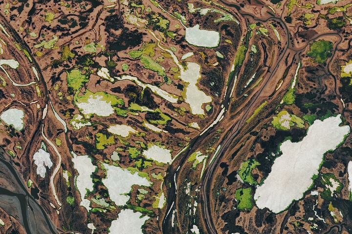
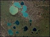
Tens of millions of small lakes dot frigid tundra landscapes in the Arctic—like the swampy Yana River Delta.
Published Jul 28, 2018
In early January, ice covered most of the lake and prevented the formation of extensive lake-effect clouds.
Published Jan 10, 2018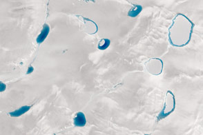
When it comes to the blue hue of meltwater lakes, darker means deeper; satellites can help scientists discover just how deep.
Published Sep 9, 2015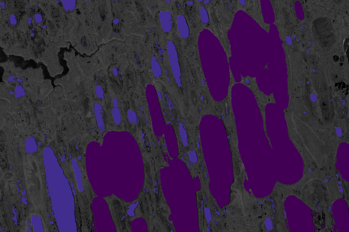
Synthetic Aperture Radar is offering scientists a new way to measure how much of the potent greenhouse gas is bubbling up from frozen Arctic lakes.
Published Jul 14, 2020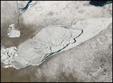
Lake Erie’s shallowness not only makes it more prone to fluctuating water levels, but also enables this lake to freeze and thaw more readily than its neighbors.
Published Mar 16, 2007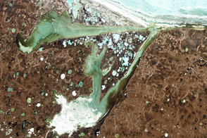
Acquired June 15, 2009, this natural-color image shows Omulyakhskaya and Khromskaya Bays along the coast of Northern Siberia.
Published Aug 14, 2011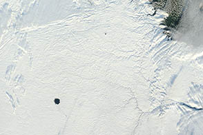
Usually the lake within Pingualuit Crater freezes by mid-September. In 2012, its circular blue surface still appeared to be free of ice in late-November.
Published Nov 29, 2012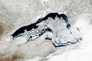
Ice cover on the world’s largest freshwater lake remains significantly above average for mid-April.
Published Apr 24, 2014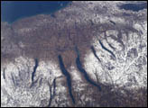
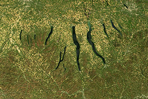
A late fall snowstorm frosted the hills of the Finger Lakes region of central New York in early December, 2004. Shapes of the snow-covered hills are accented by the low Sun angles, and contrast with the darker, finger-shaped lakes filling the region’s valleys. The steep, roughly parallel valleys and hills of the Finger Lakes region were shaped by advancing and retreating ice sheets that were as much as 2 miles deep during the last ice age (2 million years to about 10,000 years ago). River valleys were scoured into deep troughs; many are now filled with lakes. The two largest lakes, Seneca and Cayuga, are so deep that the base of their lakebeds are below sea level.
Published Dec 20, 2004