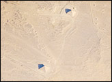
While the pyramids of Giza are perhaps the most famous, there are several other ancient Egyptian royal necropolis (“city of the dead”) sites situated along the Nile River and its delta. One of these sites is near the village of Dashur, illustrated in this astronaut photograph.
Published Aug 11, 2008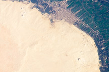
This detailed astronaut photograph illustrates a portion of the Nile Delta that includes two royal cemeteries, Abusir and Saqqara-North.
Published Dec 1, 2008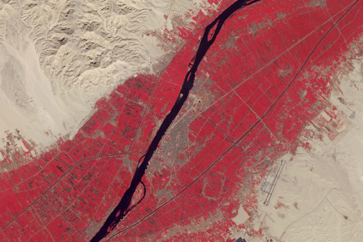
Modern Luxor is full of relics and reminders of ancient Egypt.
Published Jun 3, 2019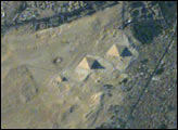
All astronauts are interested in observing unique human footprints from space, and especially those reflecting thousands of years of human activities. The region of the Great Pyramids of Giza—the last remaining wonder of the Seven Wonders of the Ancient World—is a favorite target. Although the pyramids have been imaged many times before by astronauts, each new image provides a unique look at the archeological monument, depending on the viewing angle from the ISS and the illumination from the sun. In this view, the shadows from afternoon sun provide directional arrows that point east. For scale, the current length of the large pyramid at the base is 227 meters (745 feet), and the height is 137 meters (449 feet).
Published Sep 7, 2003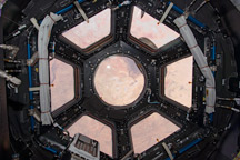
Primarily designed to give astronauts a way to see the outside of the ISS, it also provides stunning panoramic views of Earth and space.
Published Feb 20, 2010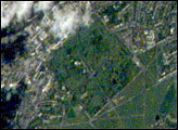
Greenwich is situated on the south shore of a sharp bend in the River Thames, just southeast of the City of London and is part of Greater London. Here is located the world famous Royal Observatory where the Prime Meridian, dividing East and West Longitude, was defined by international agreement in 1884.
Published Jul 29, 2001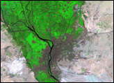
This part of the eastern Sahara is very dry, but greenery has been cropping up in recent decades.
Published Mar 11, 2017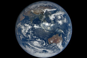
When the DSCOVR mission was conceived in the late 1990s, one of the central ideas was to provide daily, natural-color views of the entire Earth so that everyday citizens could see it. Seventeen years later, we have that view.
Published Oct 23, 2015
The desert darkness contrasts starkly with the brightly lit street grid of Las Vegas in this photo from the International Space Station.
Published Dec 13, 2010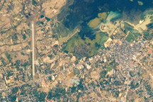
NASA recently improved the view from the space station, as displayed in this January 2011 photograph of That Choeng Shum, Thailand.
Published Mar 5, 2011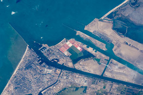
Modern international shipping meets the ancient world in the famous canal.
Published Nov 16, 2015
From one million miles away, the DSCOVR satellite returned its first view of the entire sunlit side of Earth.
Published Jul 21, 2015
America's first space station was launched forty years ago. Astronauts on Skylab conducted some the first comprehensive visual studies of Earth’s surface.
Published May 14, 2013
With much of their time committed to construction of the International Space Station, astronauts and cosmonauts are also beginning their first scientific studies. The Destiny Laboratory just joined to the International Space Station includes the best optical quality window ever flown on a human-occupied spacecraft. The window will eventually host a number of remote sensing experiments that will use a special rack system, the Window Observational Research Facility or WORF, for mechanical and electrical support (Eppler et al. 1996). Until the WORF is complete in June 2002, astronauts are photographing the Earth’s surface as part of an early project, Crew Earth Observations.
Published Feb 16, 2001