Though the Aral Sea has been steadily shrinking over the past decade, this true-color image from August 2010 shows slight growth in the southern sea as water flowed into it from the Amu Darya for the first time since 2008.
Published Oct 30, 2010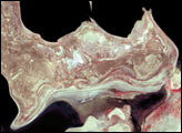
The sequence of images shows the dramatic changes to the Aral Sea between 1973 and 2000.
Published May 5, 2001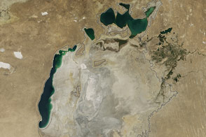
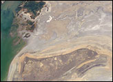
Once part of the fourth-largest lake in the world, the eastern lobe of the southern Aral has dried up for the first time in modern history.
Published Sep 26, 2014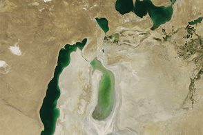
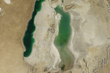
Once the world’s fourth largest lake, the rapidly shrinking Aral Sea has fragmented into four bodies of water. The Southern Aral Sea and Tsche-Bas Gulf show the most dramatic change in 2011.
Published Sep 11, 2011
In the first half of the twentieth century, it was the world’s fourth-largest lake. By August 2009, virtually nothing remained of the largest lobe.
Published Aug 27, 2009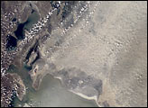
The Aral Sea has shrunk to less than half its size since 1985. It receives little water (sometimes none) from the two major rivers that empty into it—the Syr Darya and Amu Darya. Instead, the river water is diverted to support irrigation for the region’s extensive cotton fields. Recently, water scarcity has increased due to a prolonged drought in Central Asia. As the Aral Sea recedes, its former seabed is exposed. The Aral’s sea bed is composed of fine sediments—including fertilizers and other agricultural chemicals—that are easily picked up by the region’s strong winds, creating thick dust storms. The International Space Station crew observed and recorded a large dust storm blowing eastward from the Aral Sea in late June 2001. This image illustrates the strong coupling between human activities (water diversions and irrigation), and rapidly changing land, sea and atmospheric processes—the winds blow across the Sea and pick up dust (former sea bottom sediments) as soon as the blowing air masses hit land.
Published Dec 30, 2001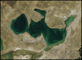
The North Aral Sea owes its rebirth to the Kok-Aral Dam, an $85.8 million project bolstered by a loan from the World Bank. The dam separates the North Aral Sea from its saltier and more polluted southern half. In early 2006, the Embassy of the Republic of Kazakhstan announced that the Aral Sea had shown dramatic recovery in just months, rather than the five to ten years originally predicted.
Published May 4, 2007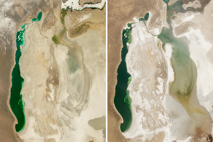
The eastern basin of the South Aral Sea is shallow and more prone to size fluctuations than its neighbors.
Published May 21, 2018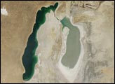
A Soviet-era plan to turn the arid plains of Kazakhstan, Uzbekistan, and Turkmenistan into fertile cropland resulted in the near-total diversion of the water that once fed the Aral Sea. Prior to the scheme, two rivers—the Amudar’ya in the south and the Syrdar’ya in the north—flowed out of distant mountains and pooled in a desert basin in what is now southern Kazakhstan and northern Uzbekistan. The irrigation project began in the mid-1900s, and by 1960, the sea had already begun to dry out.
Published Aug 26, 2008
stronauts aboard the International Space Station (ISS) took this image of a major dust storm (image center and right) along the east side of the Aral Sea while passing over central Asia in the spring of 2007. The white, irregular lines along the bottom of the image are salt and clay deposits on the present coastline. The day that the ISS crew shot the image, winds were blowing from the west (lower left).
Published Nov 5, 2007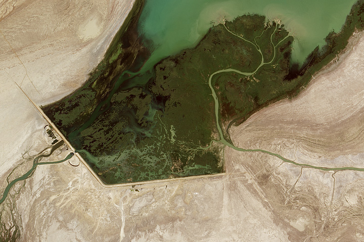
A wet year can bring a surge of water to this inland lake in Central Asia.
Published Sep 1, 2017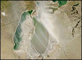
The arrow-shaped island in the Aral Sea used to be a 35-kilometer-long visual marker, indicating the Aral Sea to astronauts. An image from the present International Space Station increment shows how much the coastline has changed as the sea level has dropped during the last three decades.
Published Aug 15, 2005