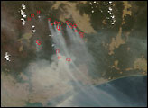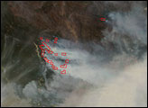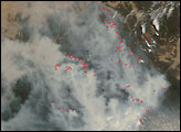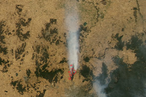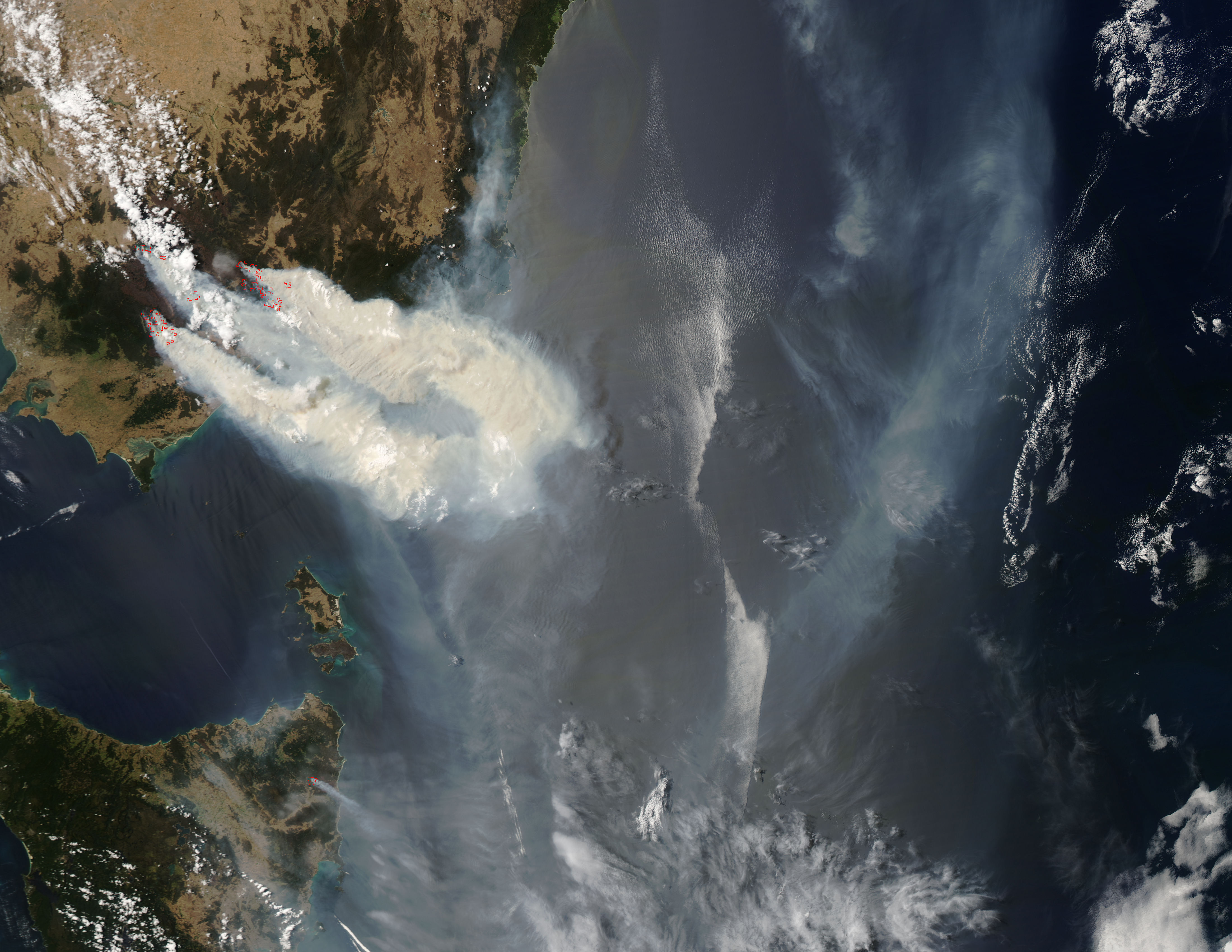
Rivers of smoke up to 50 kilometers (31 miles) wide poured from burning areas in Victoria’s Great Dividing Range Mountains on January 11, 2007, when the Moderate Resolution Imaging Spectroradiometer (MODIS) on NASA’s Aqua satellite passed overhead and captured this image. Places where MODIS detected actively burning fires are outlined in red. Many fires were burning dangerously close to Lake Thomson, the principal source of water for the city of Melbourne (beyond the western edge of the image).
According to news reports on the Australian Broadcasting Corporation Website, a change in winds overnight between January 11 and 12 eased the fire threat somewhat, but both stock and pasture were lost to flames in previous days. The moderated conditions allowed firefighters to conduct backburns (controlled burns of areas in the path of the wildfires) and build containment lines. Still, the danger of these fires, some of which have been burning in the region since early December 2006, remains high.
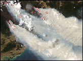
Hundreds of thousands of hectares (1 hectare is about 2.5 acres) have been burned in Victoria since late 2006. Extremely dry, windy, and hot conditions since spring have kept the fire danger extreme across much of the region for weeks at a time. According to the Australian Bureau of Meteorology, extreme fire conditions in the area are more common during years when El Niño events occur. During the fall and early winter (2006-2007), an El Niño likely influenced the area’s climate. However, according to the Bureau’s most recent (January 10, 2007) update, the ongoing El Niño appeared to be weakening, which they said “bodes well for a switch towards wetter conditions across Australia sometime in the late summer or autumn.”
NASA image by Jeff Schmaltz, MODIS Rapid Response Team, Goddard Space Flight Center.