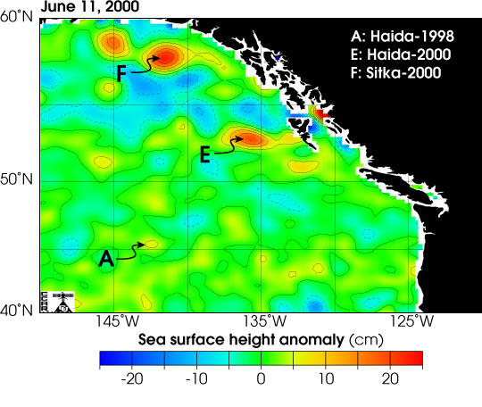


This image shows eddies in the Gulf of Alaska as measured by the TOPEX/Poseidon and ERS-2 satellites. Each eddy is indicated by the year and location where it formed.
Eddies are roatating masses of water in the ocean that typically form along the boundaries of ocean currents. In the Gulf of Alaska eddies of warm water, filled with nutrients from shallow coastal water, mix with the cold water off the continental shelf. The mixing fertilizes the nutrient-poor water of the gulf, resulting in blooms of phytoplankton (microscopic ocean plants.)
Satellites monitor movement and evolution of eddies continuously. Using radar that sees through clouds, the TOPEX/Posedion mission and the European Remote-Sensing Satellite-2 (ERS-2) produce maps of sea surface height. Since eddies that are warmer than the surrounding water are higher than the usual sea surface height they appear on these maps. This image shows the difference from normal sea surface height for the Gulf of Alaska. Warm core eddies appear as red circles.
See Tracking Eddies that Feed the Sea
(Image courtesy Colorado Center for Astrodynamics Research)