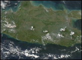
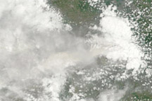
After weeks of activity, Merapi had appeared to be calming down when a new eruption forced fresh evacuations of nearby villages, according to news reports. On June 14, 2006, the volcano spewed a cloud of volcanic ash, covering a village several kilometers away. On June 16, news reports announced two casualties from Mount Merapi. Two men who had been assisting in the evacuation of a nearby village sought refuge in one of the emergency bunkers on the volcano’s slopes. The bunkers were designed to provide temporary shelter from clouds of hot volcanic gas, but were not designed to withstand the heat produced by the June 14 eruption.
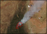
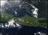
The Moderate Resolution Imaging Spectroradiometer (MODIS) flying onboard NASA’s Terra satellite captured this image of Merapi on June 15, 2006. In this image, a thick cloud of volcanic ash blows westward away from the volcano. At the volcano’s summit is a hotspot outlined in red. This hotspot shows where the satellite sensor detected an area much hotter than its surroundings.
NASA image created by Jesse Allen, Earth Observatory, using data obtained from the Goddard Earth Sciences DAAC.