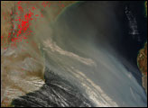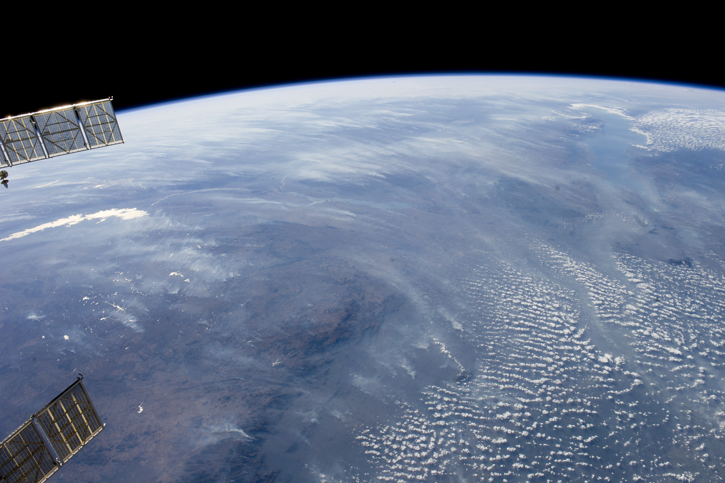
A smoke pall dominates this view of tropical southern Africa, one of the most fire-prone regions of the world. Numerous fires give rise to regional smoke palls every dry season. Fires are both natural (started by lightning) and set by local people to clear woodlands for agricultural fields.
This oblique, northwest-looking view from July 2011, at the end of the dry season, shows the extent of the smoke on the African plateau—from central Zimbabwe (image lower left) to northern Malawi more than 1,000 kilometers away (image top right), and in the wide coastal plains of the lower Zambezi River valley of Mozambique (image lower right). Here smoke can be seen blowing inland, channeled up the Zambezi River valley and contributing to the pall on the plateau. The light gray smoke plumes contrast with higher altitude, brighter patchy cloud cover at image lower right.
The smoke palls obscure the details on the land surface so that Lake Malawi, one of Africa’s Great Lakes, is barely visible. The same goes for Lake Cahora Bassa, Africa’s fourth largest reservoir, in the Zambezi valley. The sun’s reflection off the surface of Lake Kariba makes it prominent in the view at image left. Kariba is 220 kilometers long and is the world’s largest artificial reservoir by volume. The steep, shadowed, mid-afternoon faces of the Inyanga Mountains on the Mozambique-Zimbabwe border protrude above the smoke layer at image lower left. Solar panels extending from Russian spacecraft docked at the International Space Station are visible at image left.
Astronaut photograph ISS028-E-18675 was acquired on July 23, 2011, with a Nikon D3S digital camera using a 28 mm lens, and is provided by the ISS Crew Earth Observations experiment and Image Science & Analysis Laboratory, Johnson Space Center. The image was taken by the Expedition 28 crew. The image has been cropped and enhanced to improve contrast. Lens artifacts have been removed. The International Space Station Program supports the laboratory as part of the ISS National Lab to help astronauts take pictures of Earth that will be of the greatest value to scientists and the public, and to make those images freely available on the Internet. Additional images taken by astronauts and cosmonauts can be viewed at the NASA/JSC Gateway to Astronaut Photography of Earth. Caption by M. Justin Wilkinson, Jacobs/ESCG at NASA-JSC.