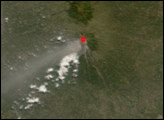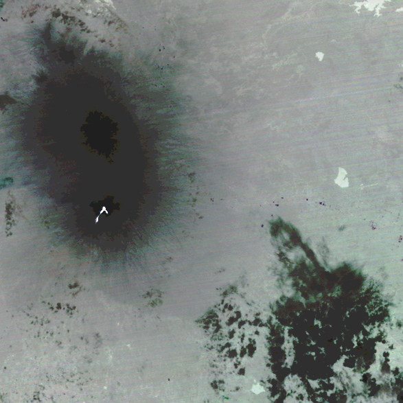
A nighttime view of Mount Merapi, on the island of Java, shows characteristics of the volcano not usually seen during the day. The Advanced Spaceborne Thermal Emission and Reflection Radiometer (ASTER) on NASA’s Terra satellite captured this thermal image of the volcano on May 30, 2006. Shown mostly in shades of gray, this image shows the summits of Mount Merapi and nearby Mount Gunung. Just south of Mount Merapi’s summit is a network of thermal hotspots.
This ASTER image indicates cooler areas with darker colors and warmer areas with lighter colors. Clouds often contain ice crystals, and the clouds in the lower-right corner of the picture are nearly black, indicating their low temperature. The summits of Gunung and Merapi are cool for a different reason: altitude. Moving away from the summits, the colors in this image gradually lighten, indicating warming surface temperatures. A lake on the right edge of the image has even warmer temperatures. The hottest areas, however, are the brilliant white hotspots on Mount Merapi, almost certainly caused by volcanic activity.
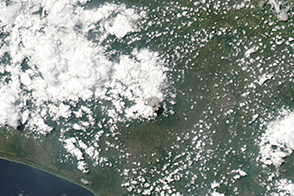
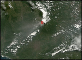
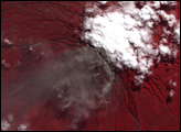
Mount Merapi showed signs of unrest beginning in April 2006. While officials and many local inhabitants prepared for a possible eruption, an earthquake struck the island of Java on May 27, 2006. According to news reports, the quake killed more than 5,000 people.
NASA image created by Jesse Allen, Earth Observatory, using data provided courtesy of the NASA/GSFC/METI/ERSDAC/JAROS and U.S./Japan ASTER Science Team.