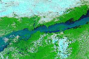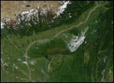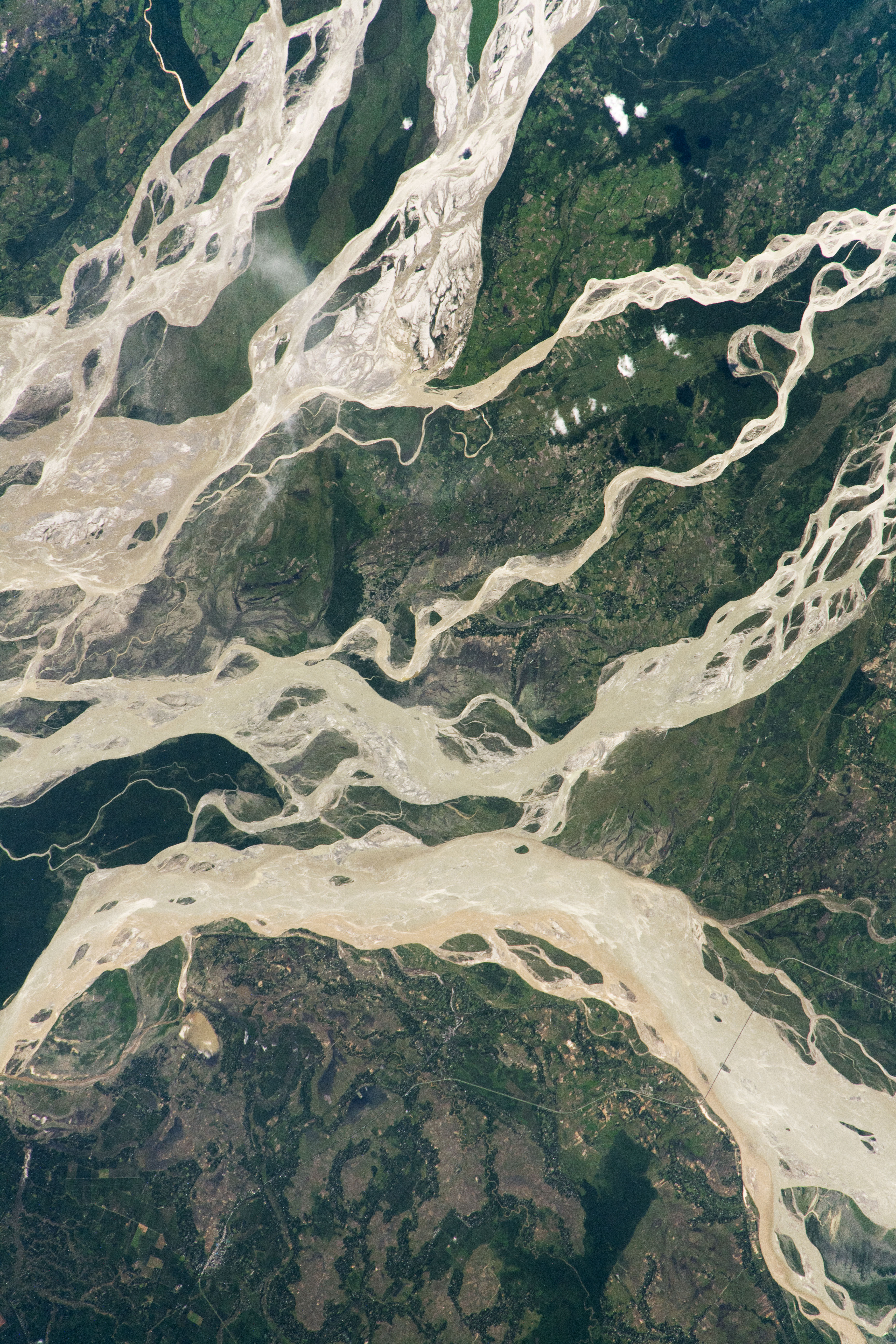
An astronaut took this near-nadir photograph of one of Asia’s largest rivers, the Brahmaputra. The mighty river appears as two major channels; several small islands sit within them and a large island separates them. Together they form a Brahmaputra floodplain that measures fully 10 kilometers (6 miles) in width. The channels appear brighter than those of the other rivers in this photo because they are near the Sun’s glint point.
Two big tributaries, the Dibang and Lohit Rivers, flow nearby and join the Brahmaputra just outside the photo to the left. (The flow of the rivers in this scene is broadly west.) The Brahmaputra eventually joins the Ganges River in Bangladesh about 850 kilometers (525 miles) to the southwest, and both empty into the Bay of Bengal. The Brahmaputra is Asia’s second largest river by discharge, after the Changjiang River in China. As measured at its confluence with the Ganges, the Brahmaputra River discharges 612 billion cubic meters per year, or 135 trillion gallons.
South Asia’s monsoon rainfall regime brings heavy rain to this part of India from March through June, feeding the river and floodplain. Tropical forest is the natural vegetation of this landscape.
Human-built features seem minuscule here compared to the river channels. Most of the area includes land under cultivation, which appears as numerous small and irregular plots. Farms along the riverbanks are especially prone to damage and destruction by floods and by the persistent erosion of the banks. Linear features include roads and a 4-kilometer (2.4 mile) long bridge crossing the Lohit River.
Note, however, that the sector of the Brahmaputra floodplain (top left) displays no agricultural plots. It is a protected natural area within the Daying Ering (also known as D’Ering) Memorial Wildlife Sanctuary.
Astronaut photograph ISS063-E-19838 was acquired on May 28, 2020, with a Nikon D5 digital camera using a focal length of 500 millimeters. It is provided by the ISS Crew Earth Observations Facility and the Earth Science and Remote Sensing Unit, Johnson Space Center. The image was taken by a member of the Expedition 63 crew. The image has been cropped and enhanced to improve contrast, and lens artifacts have been removed. The International Space Station Program supports the laboratory as part of the ISS National Lab to help astronauts take pictures of Earth that will be of the greatest value to scientists and the public, and to make those images freely available on the Internet. Additional images taken by astronauts and cosmonauts can be viewed at the NASA/JSC Gateway to Astronaut Photography of Earth. Caption by Justin Wilkinson, Texas State University, JETS Contract at NASA-JSC.