Editor’s note: Read more about this project in A Grand New Dam on the Nile.
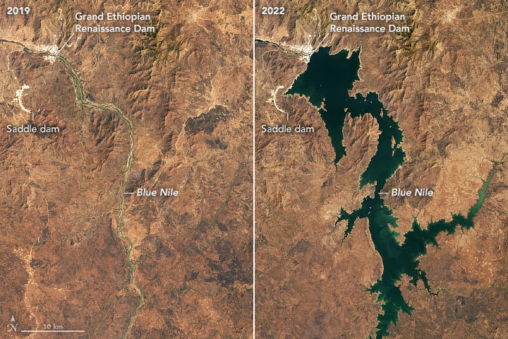
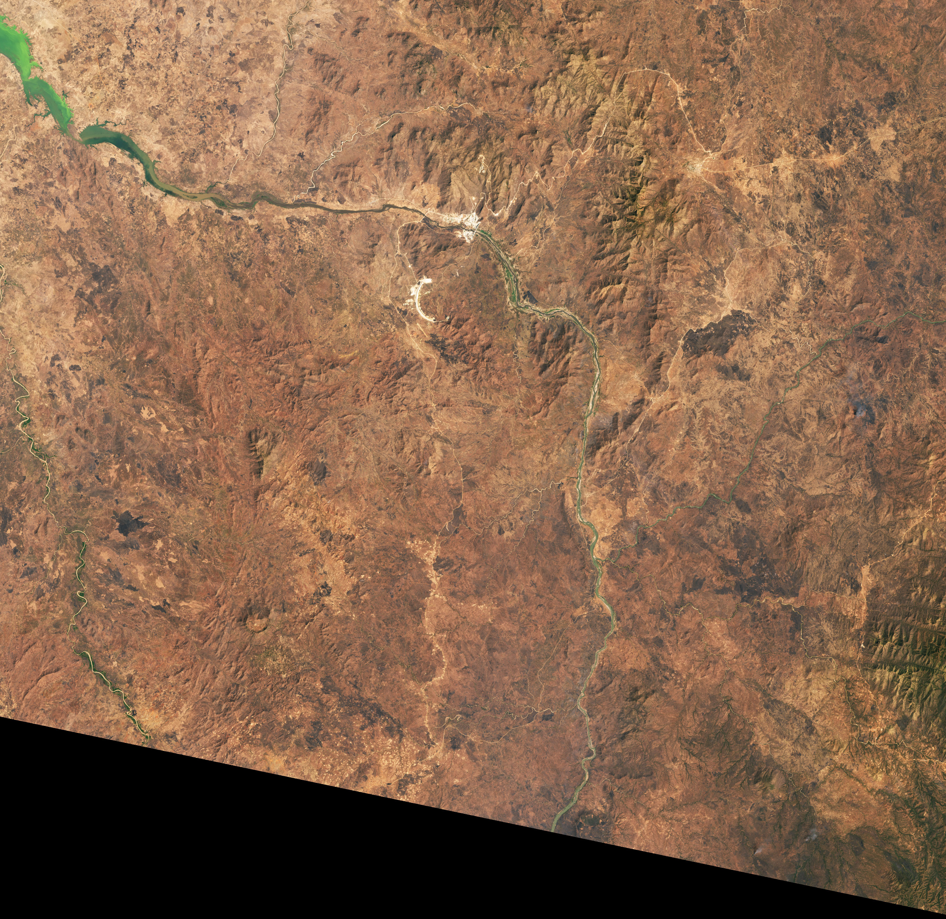
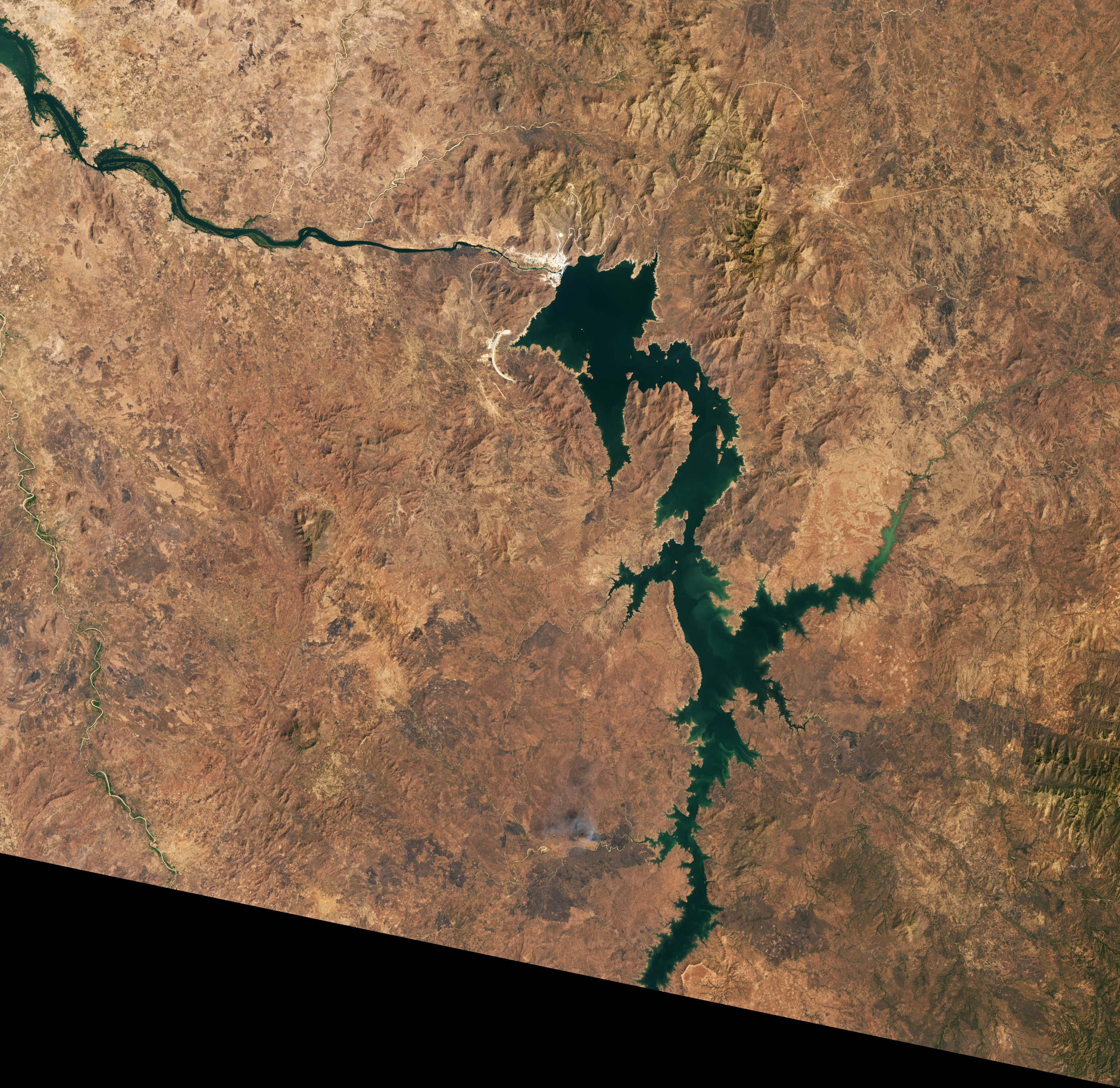
As the Grand Ethiopian Renaissance Dam (GERD) in Ethiopia nears completion, the giant structure on the main stem of the Blue Nile is expected to bring new electricity, economic activity, and development to Ethiopia. It should help regulate and prevent some destructive flooding in Sudan, while also bringing changes in the timing and volume of water flowing to farmers and others living downstream in Egypt.
NASA-funded researchers are developing satellite-based tools and techniques to make it easier to monitor and manage the new dam. Their goal is to help minimize ecological impacts and maximize economic benefits to the countries and people across the watershed. Satellites offer one of the best ways to assess what is happening in real time.
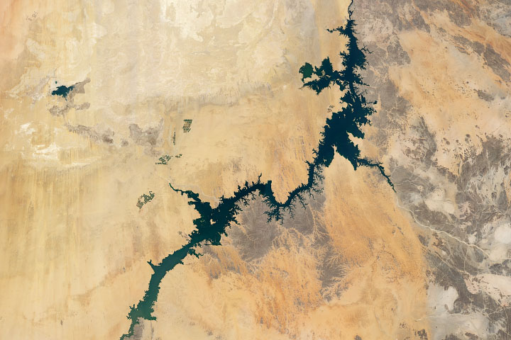
Hisham Eldardiry, a research associate at the Pacific Northwest National Laboratory (PNNL), is one of the scientists examining the dam from a distance. With support from NASA’s Applied Sciences program, Eldardiry authored multiple studies on whether satellites can be used to monitor reservoir height and discharge rates from dams like GERD. His research also examined how water managers could manage the rate of filling the GERD reservoir to minimize downstream effects on the High Aswan Dam in Egypt. He also investigated whether the Blue Nile has enough water for GERD’s 13 turbines to generate electricity to their full capacity.
In one of Eldardiry’s projects (conducted when he was a research assistant at the University of Washington), he developed a web tool called the Nile Basin River Advisory System (NiBRAS); in Arabic, the word nibras means “light.” The system draws together data from several satellites and models to provide near real-time information about key variables—such as water depth, temperature, and sediment—at points along the Nile, including the GERD reservoir and Lake Nasser. NiBRAS also includes a suite of forecasting tools that ingest recent weather data to predict reservoir outflows and storage. It also assesses how changes to land cover, climate change, or the management of other dams could affect dam operations.
“There is a huge opportunity and need for the remote sensing community to provide reliable, transparent data to all stakeholders,” said Eldardiry. “The output from tools like NiBRAS should be able to help with situational awareness and reservoir management during droughts and floods. Perhaps it can even benefit multilateral negotiations and help turn conflict into cooperation.”
Eldaridiry sees remote sensing tools like NiBRAS playing a particularly important role if drought returns to the Nile River Basin. The past few years have been quite wet—making it fairly easy to start filling the reservoir without causing serious impacts to water users downstream, he said. However, a severe drought like the one that afflicted the region in the 1970s and 1980s could make it more difficult to strike the right balance.
Even an average year for rainfall could cause problems downstream. “We had extremely high rainfall in 2019 and 2020—nearly 1.8 standard deviations above the norm,” said Hesham El-Askary, a professor of remote sensing and earth system science at Chapman University. “If you remove that positive anomaly and replace it with a normal amount of rain, you see that even the amount of filling that happened in those two years would have been enough to reduce water levels downstream in Lake Nasser. If we had been in a drought, we would have seen drastic drops in water levels.”
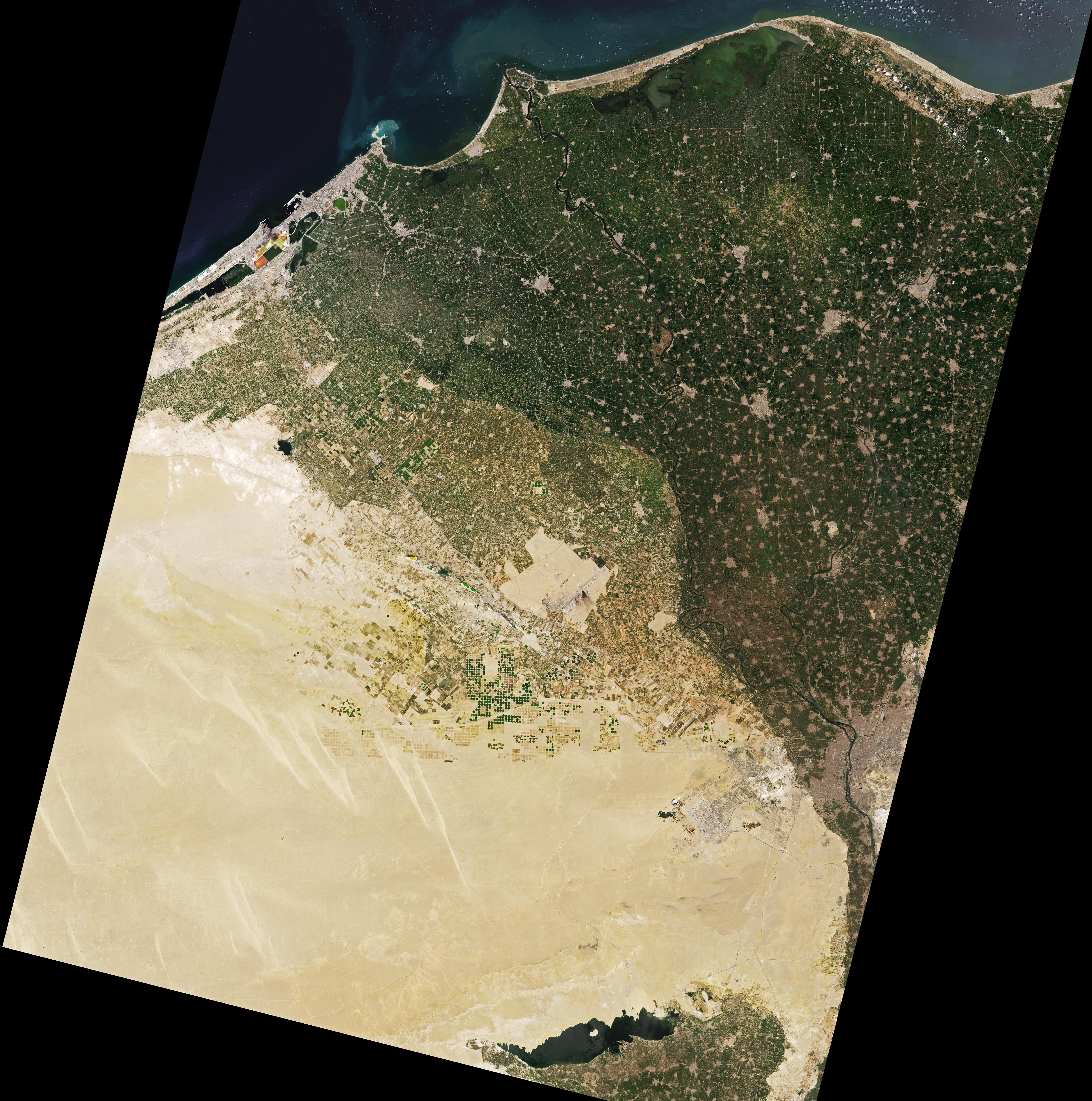
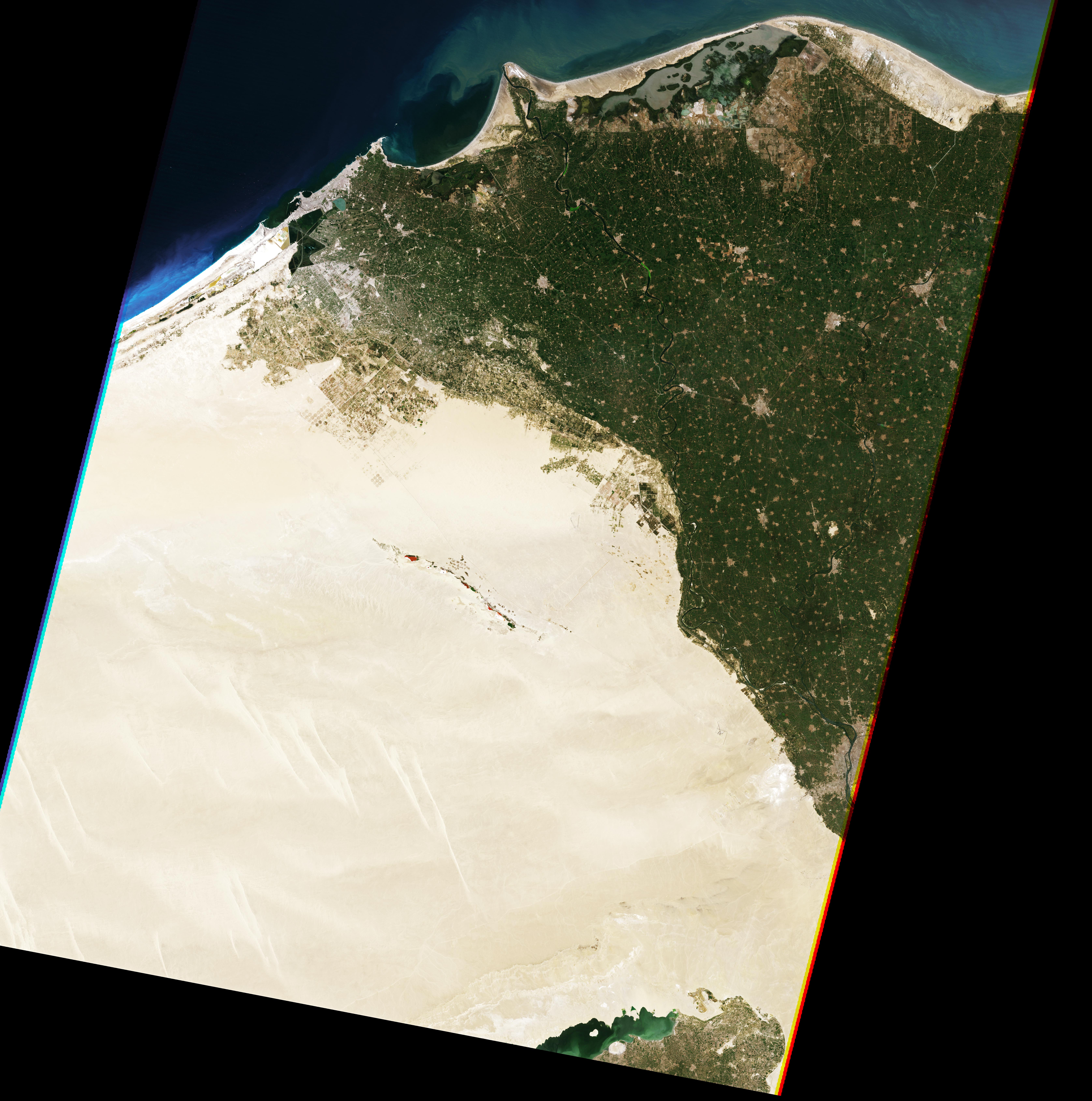
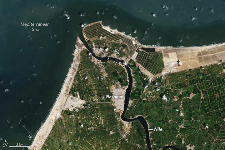
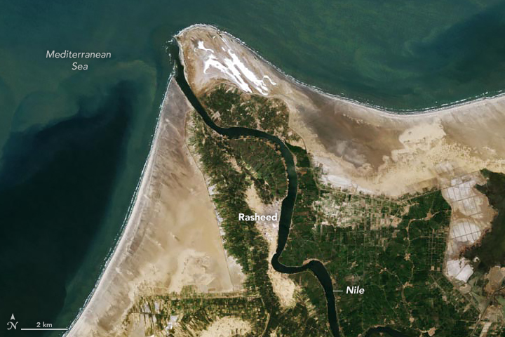
Essam Heggy, a scientist at NASA’s Jet Propulsion Laboratory and the University of Southern California, agrees that satellites and remote sensing have a key role to play in monitoring how major dams might alter Nile River ecosystems. After the Aswan High Dam was built in the 1970s, satellites like Landsat helped track declines in the devastating floods that once routinely swamped the region.
“On the other hand, we have also seen the tip of the Nile River Delta disappearing year by year because of the reduction in sediment that came down the river after the Aswan High Dam was built,” Heggy said. The pair of Landsat images at the top of the page, from 1984 and 2021, shows this loss of land.
“Over the long term, there’s still a lot we don’t know about how GERD might contribute to changes in the river dynamics, sediment flows, and precipitation patterns in the Nile Basin in ways that can affect the ecosystem, soil fertility, and other environmental factors,” added Heggy. “While we already have some powerful satellites and sensors for monitoring changes, there are other tools we still need. We desperately need a satellite with a radar that is capable of detecting shallow aquifers—something we have on the Mars Reconnaissance Orbiter but not yet for Earth.”
He is working to change that as principal investigator for a proposed mission called Orbiting Arid Subsurfaces and Ice Sheet Sounder (OASIS). The sensor would map shallow aquifers much more effectively than any other satellite in NASA’s Earth science fleet.
“We can expect to see conflicts and tensions over water rights in the future as climate changes, and as desert regions expand and become drier, less hospitable places for people,” Heggy said. “We need to be ready to confront all the changes that are coming with the best possible tools and science.”
NASA Earth Observatory images by Lauren Dauphin, using Landsat data from the U.S. Geological Survey. Story by Adam Voiland.


