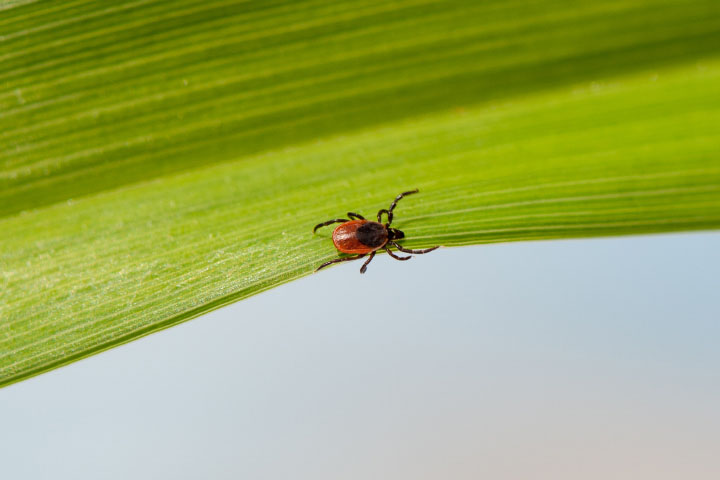
Lyme disease is one of the most common vector-borne diseases in North America, affecting thousands of people per year. The species of deer ticks (Ixodes scapularis) that carry Lyme-causing bacteria are found in warm, forested areas in the Northern Hemisphere. As global climate warms, deer ticks are migrating north, which means more people are at risk of contracting the disease.
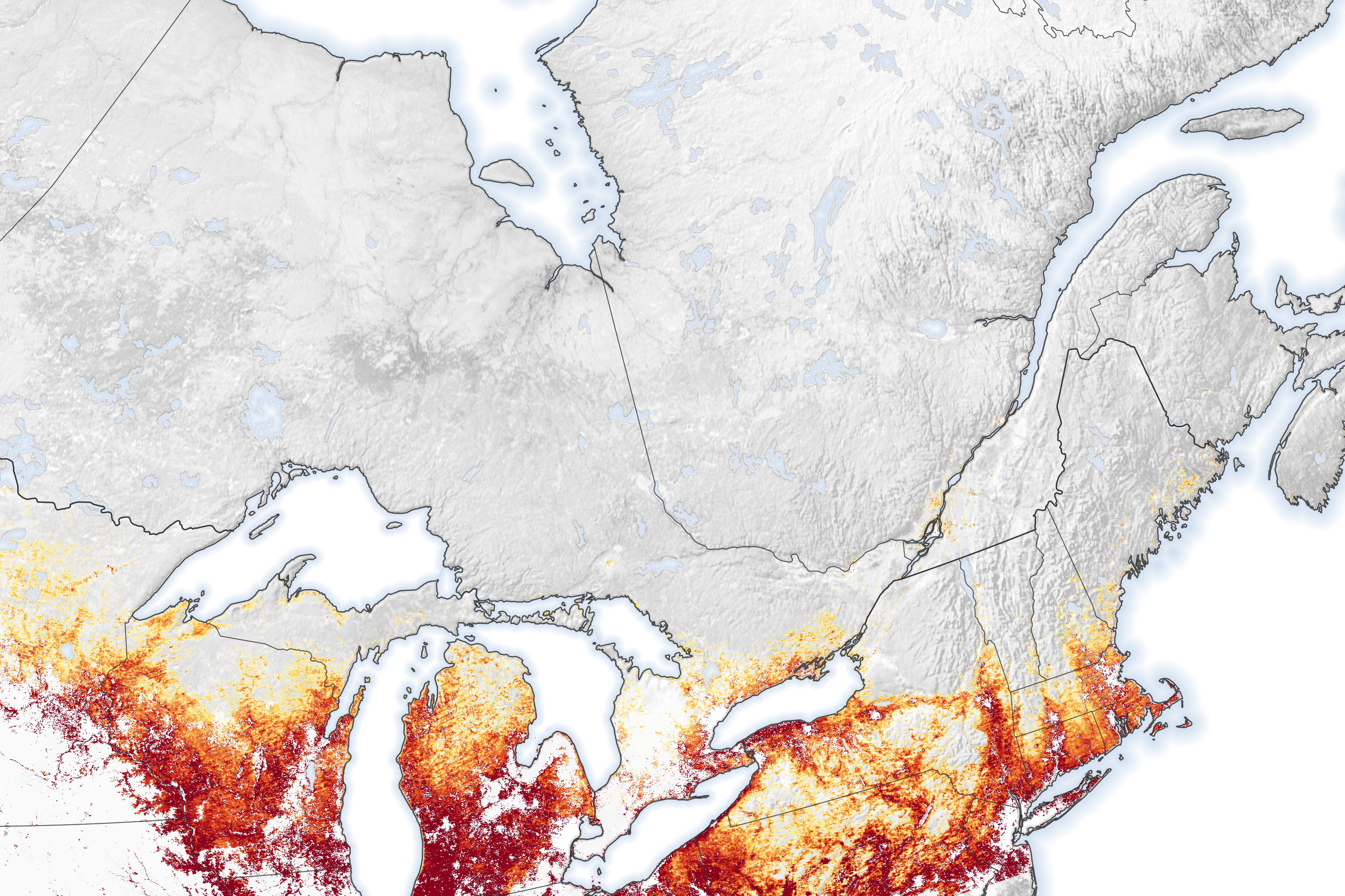
Serge Olivier Kotchi of the Public Health Agency of Canada has been studying how climate change affects the incidence of vector-borne diseases in Canada, including Lyme and West Nile Virus. The medical geographer and his colleagues recently published a study in Remote Sensing which showed that the risk of Lyme disease is expanding north in Canada as temperatures change. In particular, they found that between 2000 and 2015, Lyme risk doubled in the province of Quebec and tripled in Manitoba.
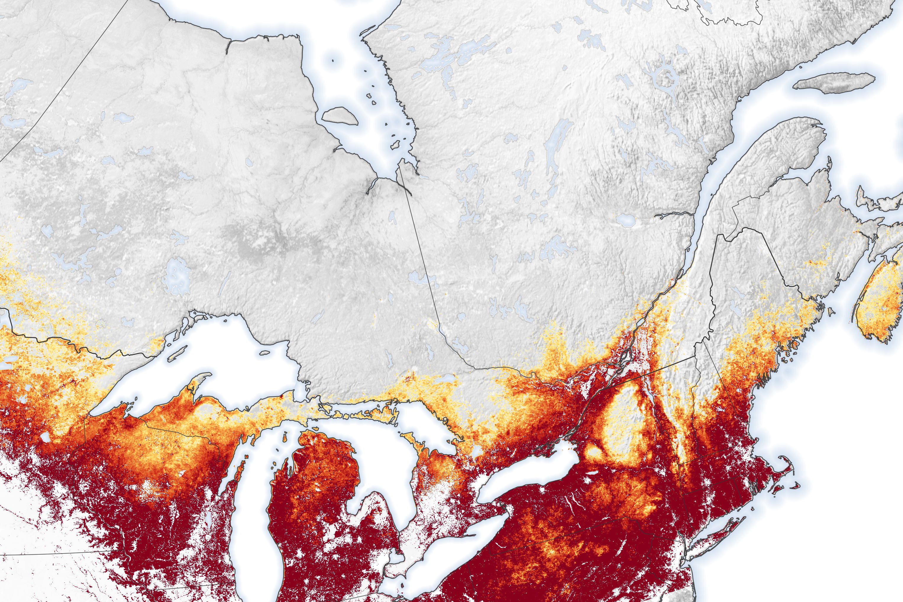
The maps above show the average risk of encountering Lyme-disease carrying ticks in central and eastern Canada; the risk is directly related to the number of adult deer ticks per square kilometer. Note how the highest risk values (dark red) expanded significantly on the southern half of the 2015 map. Kotchi and colleagues mapped where Ixodes scapularis has become established by combining field data of tick surveillance from previous research, satellite data, and temperature data from meteorological stations.
Previous field research in Canada used a technique called “drag sampling” to determine the presence of deer ticks. Researchers drag a square-meter sized cloth through the woods and count the number of ticks that fall on it. The sampling technique also involves capturing rodents in live traps and examining them for ticks and Lyme exposure.
In order to map Lyme risk over large areas at 1-kilometer resolution, Kotchi and colleagues combined the field data with land surface temperature and land cover data from the Moderate Resolution Imaging Spectroradiometer (MODIS) instruments on NASA’s Terra and Aqua satellites.
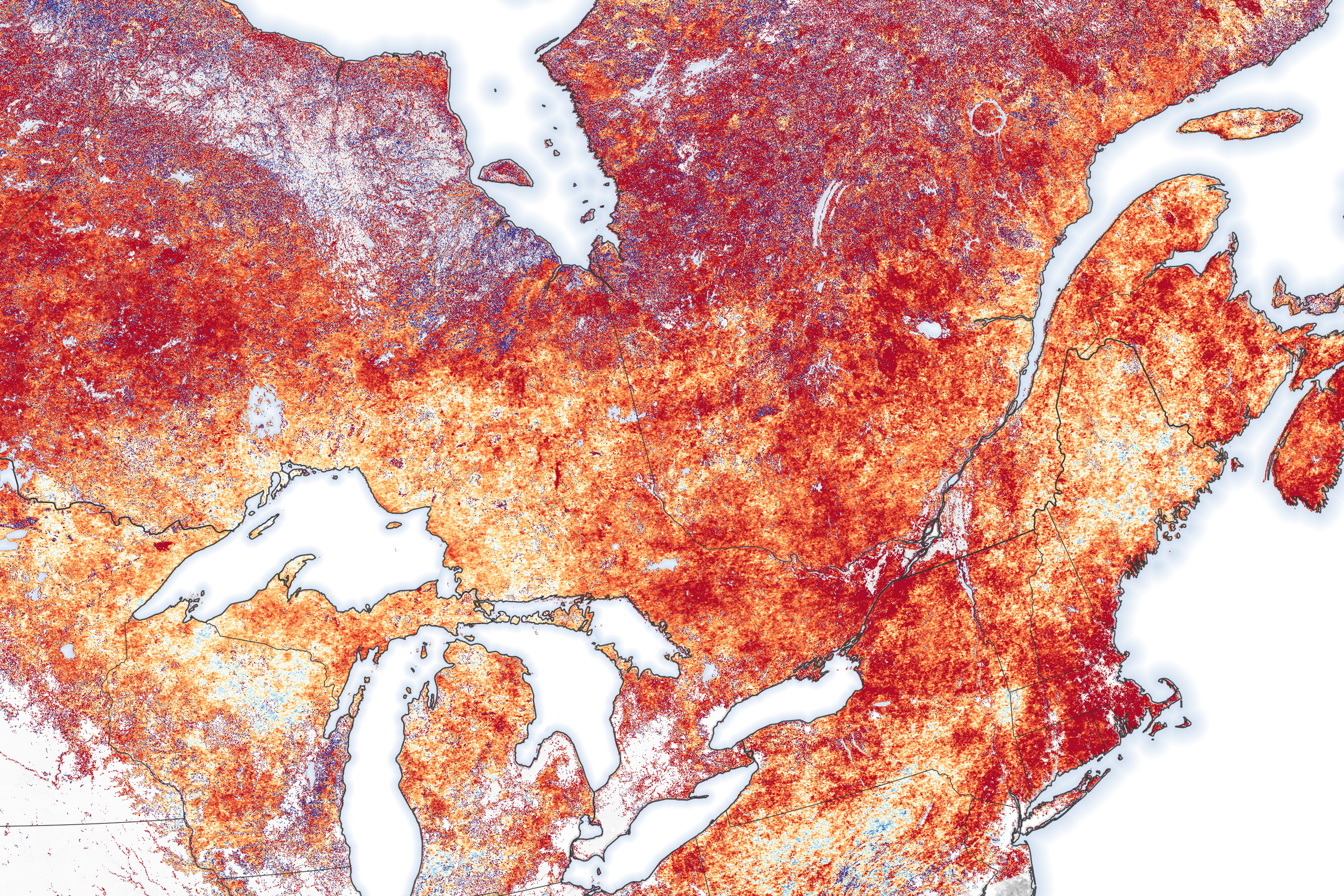
Deer ticks die off in freezing temperatures, but warmer winters in Canada and New England are now allowing ticks to establish habitat farther north. The authors used MODIS data to predict suitable deer tick habitat, looking at average temperatures for each day and summing the degrees above 0° Celsius over the whole year (a measurement known as degree days). The map shows the change in degree days above 0°C from 2000 to 2015.
The authors found that much of central and eastern Canada warmed by 15 to 35 degree days per year, making these areas more habitable to deer ticks. Some places in southern Manitoba, Ontario, and Quebec warmed more than 35 degree days per year. Using these calculations, the research team developed an algorithm to predict the risk of tick occurrence. They estimate that the average number of adult deer ticks per square kilometer in Quebec province rose from 56 in 2000 to 103 in 2015. In Manitoba province, the number increased from 36 per square kilometer to 110.
As global climate continues to warm, Lyme disease risk in Canada is expected to increase even more. “The first cases of Lyme disease in Quebec were in the late 1990s,” said Kotchi. “Lyme has been expanding in Canada ever since.” According to the Public Health Agency of Canada, Lyme disease cases in Canada increased from 144 people infected in 2009 to 992 in 2016.
NASA Earth Observatory images by Lauren Dauphin, using data from Kotchi, Serge, et al. (2021). Tick photograph by Catherine Bouchard, Public Health Agency of Canada. Story by Emily Cassidy, NASA ESDS Science Writer.


