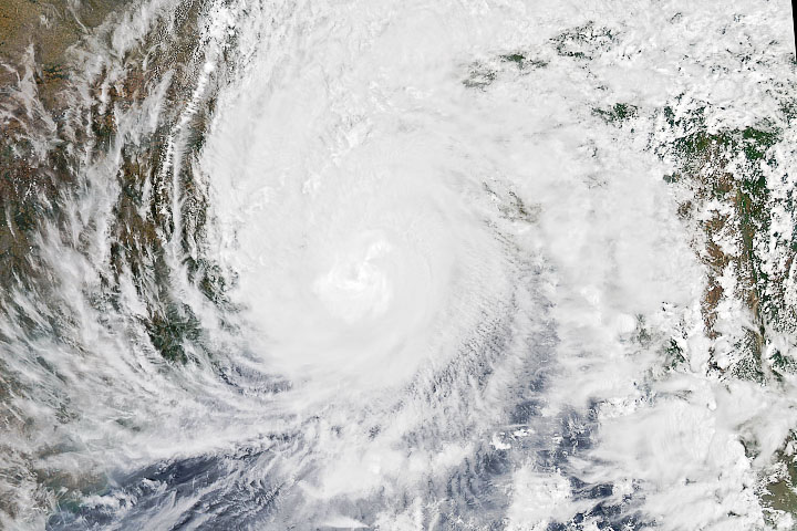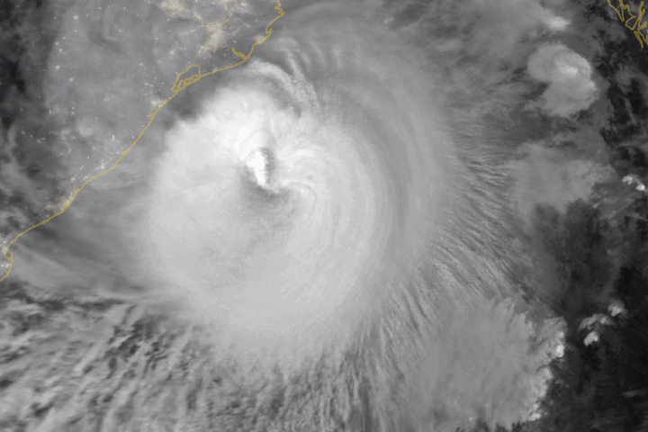
Amphan, the first tropical cyclone of the 2020 season in the North Indian basin, made landfall on May 20, 2020. The deadly storm slammed ashore near the border of eastern India and Bangladesh, delivering substantial storm surge to coastal areas.
The storm is visible in this natural-color image, acquired at 1 p.m. India Standard Time (07:30 Universal Time) on May 20 with the Moderate Resolution Imaging Spectroradiometer (MODIS) on NASA’s Aqua satellite. The extremely severe cyclonic storm had sustained winds around the time measuring 90 knots (165 kilometers/105 miles per hour)—equivalent to a category 2 storm on the Saffir-Simpson wind scale.
Winds decreased as Amphan moved north-northeast over land, but the storm remained powerful enough to destroy buildings, uproot trees and crops, and down powerlines. According to news reports, the winds pushed up a 5-meter (16-foot) storm surge that flooded coastal areas, including the Sundarbans, an area of mangrove forests and critical tiger habitat in the delta spanning the India-Bangladesh border.
On May 18, Amphan quickly intensified into a category 5 storm with sustained winds of 265 kilometers (165 miles) per hour as it churned over the Bay of Bengal. Amphan and other cyclones in the North Indian Ocean with winds surpassing 220 kilometers (140 miles) per hour are considered “super cyclonic”—the highest classification in the basin. Prior to Amphan, the last super cyclonic storm was Odisha in 1999.
Tropical cyclones are less likely to form in the Indian Ocean than in the Atlantic or Pacific basins. But storms that do form in the warm, shallow waters of the Bay of Bengal have a reputation for being unusually destructive. That’s in part because the Bay is semi-enclosed, so storms that form there are likely to strike land because they have not outlet for moving back out to sea. Also, much of the coastline is densely populated and low-lying, so damage tends to be considerable when storms make landfall.
NASA Earth Observatory image by Joshua Stevens, using MODIS data from NASA EOSDIS/LANCE and GIBS/Worldview. Story by Kathryn Hansen.