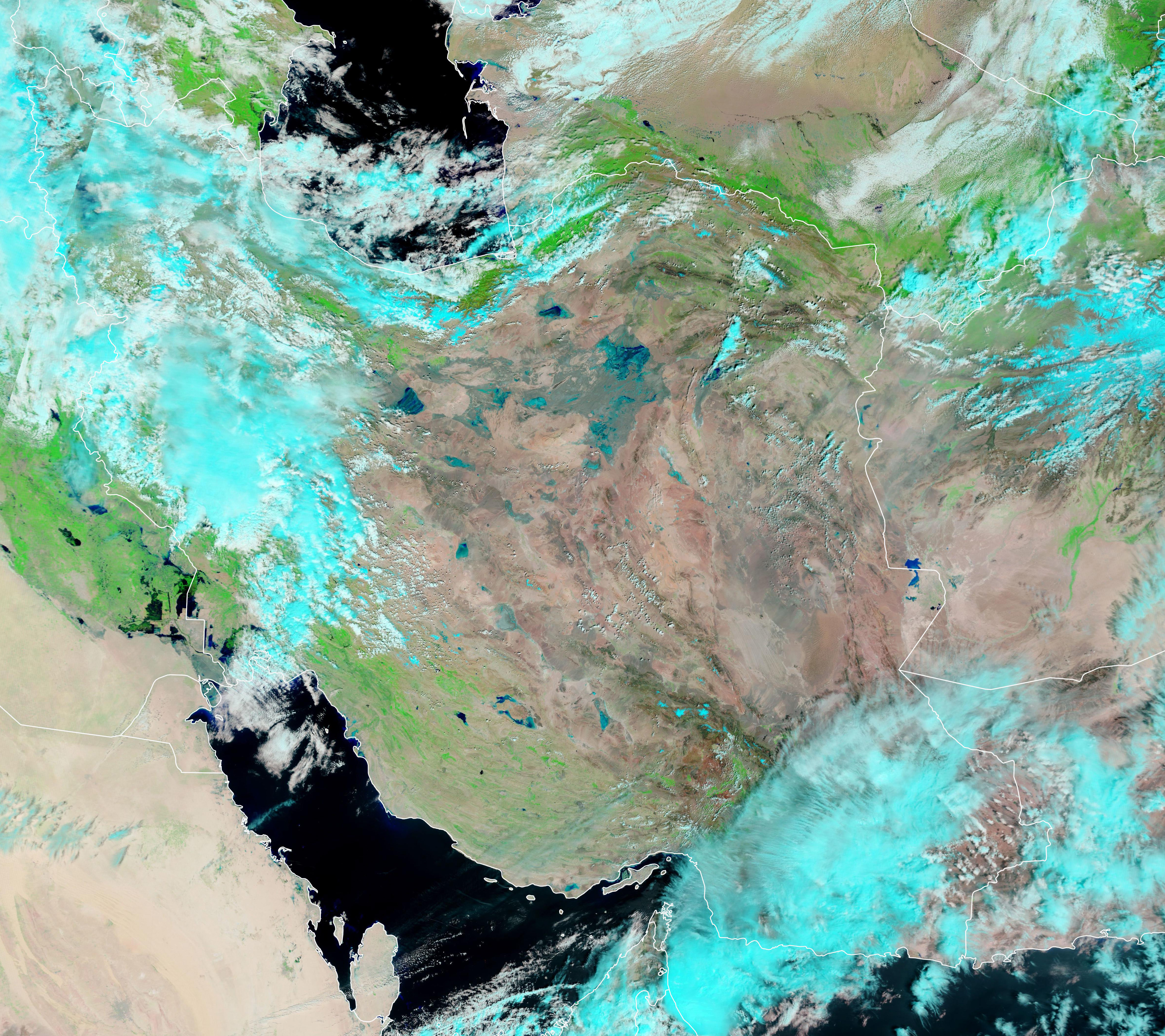
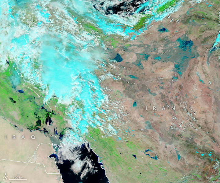
Unusually heavy and persistent rain doused several Middle Eastern countries in late March and early April 2019. At the same time, mountains were beginning to lose their snow cover to melting. Though the end of winter and start of spring have brought seasonal floods here since ancient times, this spring has been severe in some areas of Iraq, Iran, Syria, and Afghanistan.
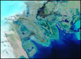
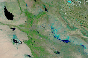
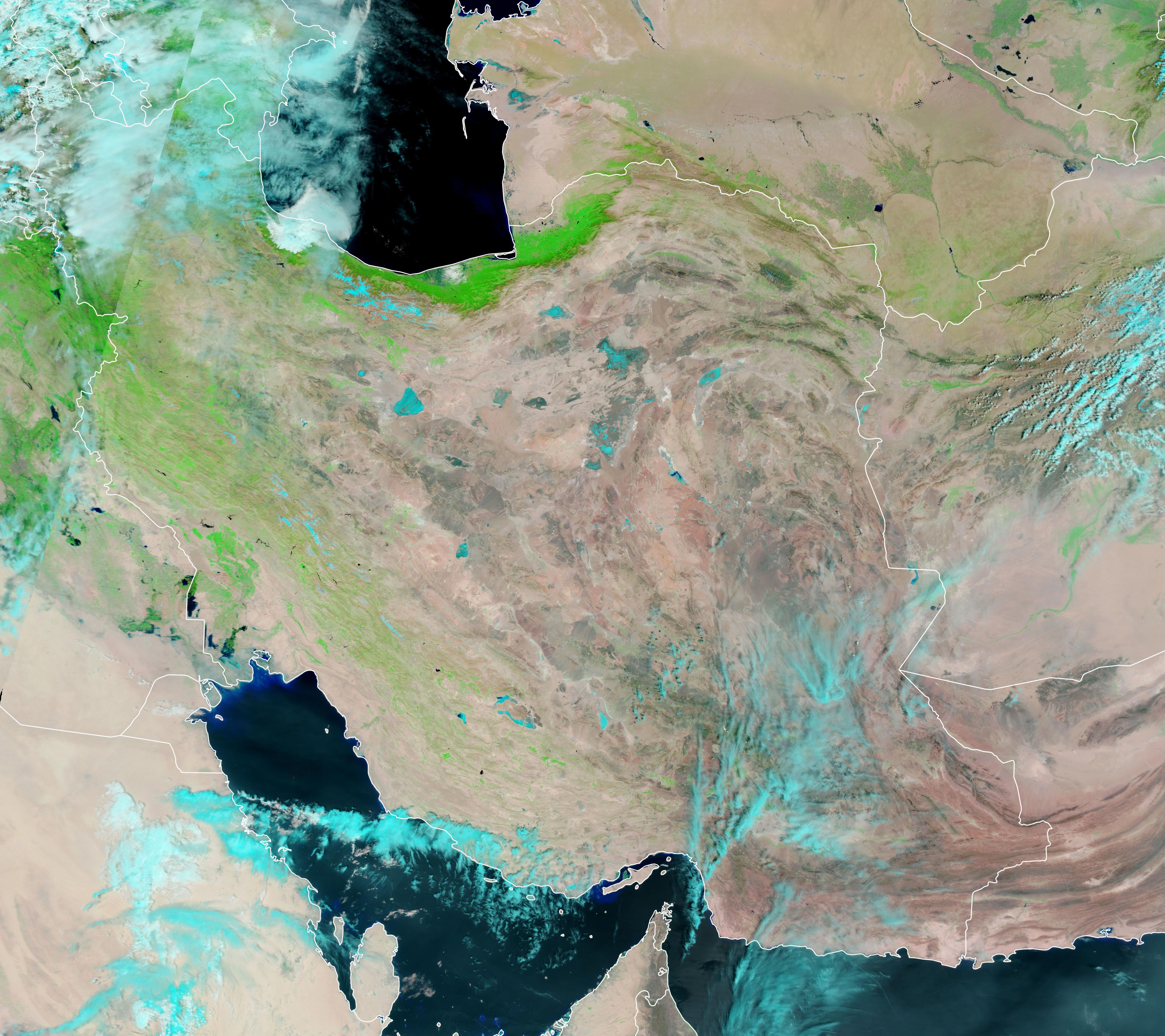
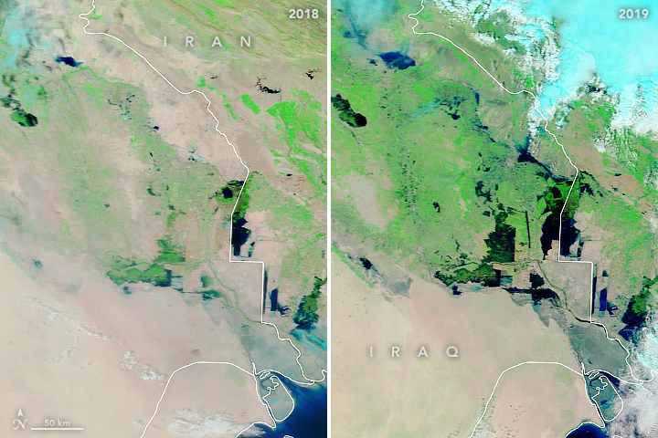
The Moderate Resolution Imaging Spectroradiometer (MODIS) on NASA’s Terra satellite acquired these false-color images on March 28, 2019, and April 3, 2018 (for comparison of more typical seasonal conditions). The combination of near-infrared and visible light (MODIS bands 7-2-1) makes it easier to see rivers out of their banks and water spread across flood plains and salt pans.
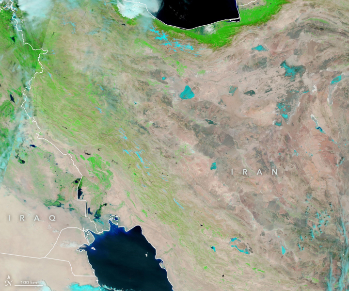
According to news accounts and relief agencies, at least 1,900 cities and villages across 26 of Iran's 31 provinces have been affected by flooding, which has killed more than 60 people and displaced thousands of others. Farms have been severely damaged across the country, with flood waters causing hundreds of millions of dollars in damages and lost crops.
Parts of Golestan Province received 70 percent of their annual rainfall in one day. Flash flooding was particularly severe near Shiraz. Several dams in southwestern Iran were in danger of overflowing for a time, and hundreds of roads and bridges have been washed away.
In Iraq, central and northern regions were worst affected in late March, with authorities warily watching a dam in Mosul. (It survived without issue.) Those flood waters have since swollen the Tigris and Euphrates rivers in their lower reaches.
NASA Earth Observatory images by Lauren Dauphin, using MODIS data from NASA EOSDIS/LANCE and GIBS/Worldview. Story by Mike Carlowicz.