The Impact of City Landscapes on Rain | |||
“There’s a debate about how cities affect rainfall,” Shepherd answers. “There are several hypotheses about what is going on, but they primarily involve the urban land use and urban aerosols.” The first hypothesis deals with the urban “heat island” effect. Cities are made of heat-absorbing materials like concrete, steel, and asphalt. Add to that the heat pumped into the atmosphere by the machines that are concentrated in cities and a lack of cooling vegetation, and the temperature goes up. Average temperatures in a city can be as much as six to eight degrees Fahrenheit higher than surrounding rural and suburban landscapes. Called the urban heat island effect, this increased temperature may provide a source of unstable air. If air over a city is warmer than the air surrounding it, it wants to rise. As the city-warmed air rises, it cools and forms rain-producing clouds that soak the area downwind. |
|||
 | |||
Second, cities may be disrupting the flow of air over the Earth’s surface. “If you blow air over a nice pristine wheat field in Kansas, that air at a very low level is going to blow in a straight line,” says Shepherd. But blow that same air over a city, and you get chaos, literally. “Cities tend to have buildings, particularly tall buildings, that cause the air to converge, or pile up,” says Shepherd. “Think of two trains colliding; their front ends go up. That’s convergence.” So the city’s buildings provide a source of lift to push warm, moist, surface air into the cooler air above it, where it can develop into rain clouds. |
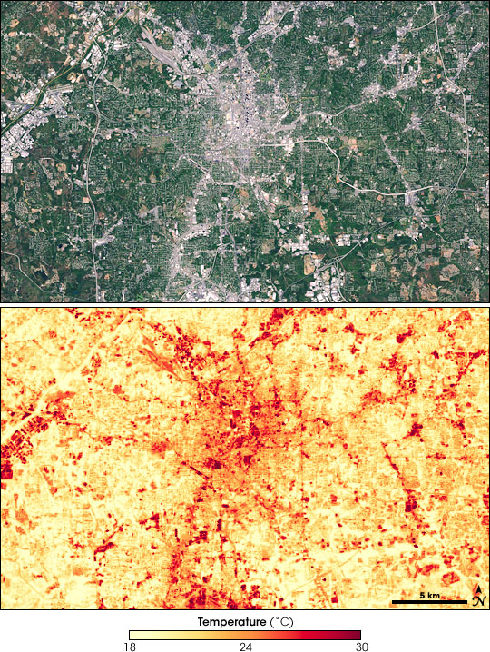
The roofs, concrete, and asphalt of a city absorb heat during mid-day, raising the surface temperature up to 10°C. This pair of satellite images shows Atlanta on September 28, 2000. In the true-color image (top), the urban areas are gray, and wooded suburbs and open fields are green. The map of surface temperature (bottom) shows the urban heat island. Yellow areas are relatively cool, while red areas are hot. (NASA images by Marit Jentoft-Nilsen, based on Landsat-7 data.) | ||
 | |||
The third hypothesis runs along the same lines, but instead of causing the air to pile up, the city divides the air. “Storms that are approaching Atlanta or Baltimore from the west basically split or ‘bifurcate’ around the cities because of the physical structure of the buildings or because of the thermodynamic environment [the urban heat island],” says Shepherd. When the two halves of the storm come back together downwind of the city, the air is pushed up like the two colliding trains. The rising air forms rain clouds. |
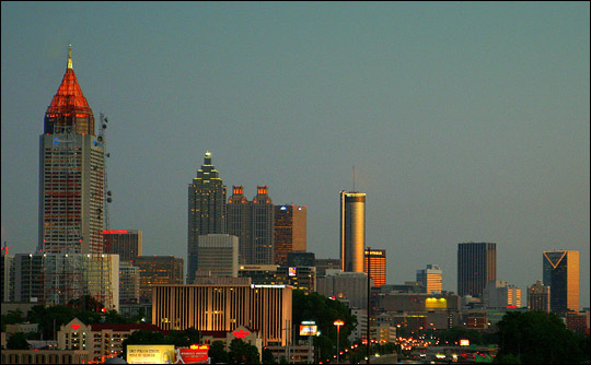
The concentrations of buildings in urban landscapes are an obstacle to surface winds. Air is forced to go around or over the city center, creating a disturbance that leads to rain clouds forming downwind. (Photograph copyright adsullata.) | ||
