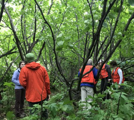
This week while the GLiHT crew continued collecting data over the Susitna and Tanana valleys, we focused on collecting on-the-ground data on spruce beetle infestation. Our first day out proved rainy and cold, but we pressed on, only sheltering in the car during a particularly hard spell. Aside from the occasionally torrential rain, we also dealt with clambering over downed logs nearly invisible under thick grasses and ferns, as well as waist-high patches of Devil’s club. This nasty understory shrub is covered in painful thorns tough enough to penetrate through clothing. We often found ourselves having to backtrack and find a different route to our desired tree after realizing we were wading into a sea of the spiky shrubs. As a testament to this somewhat failed effort, my legs were covered in scratches and bruises later that evening.
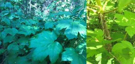
A Devil’s club patch to be avoided.
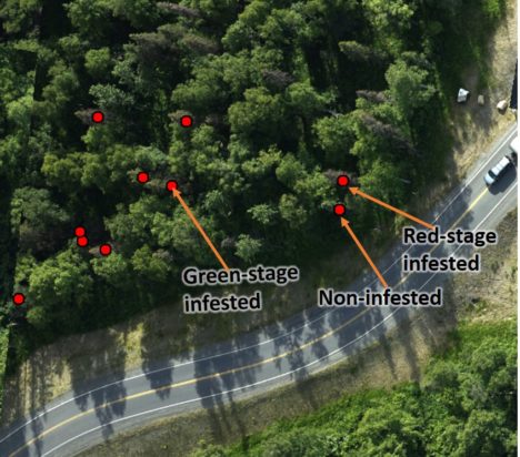
Our task was to find and GPS spruce trees within the collected GLiHT imagery and record their infestation status and size so that they can later be used to develop infestation detection algorithms for aerial and satellite imagery. Spirits were running fairly low until we found a big patch of both green-stage infested trees (those that are infested with spruce beetles but have yet to show visual signs in their needles) and non-infested spruce trees. This find was especially exciting because these infested and non-infested trees were experiencing similar site and weather conditions, so differences that we detect in the GLiHT imagery will likely be due to the effects of the beetles, giving more confidence to the infestation detection algorithms that we develop.
An image captured by GLiHT as it flew over a beetle infested area. We have been working on identifying the infestation stage of spruce trees present in this imagery
On our second day the sun was shining brightly through only a few clouds, promising warmer and drier conditions for the day. We were joined by scientists from American University who were flying unmanned aerial vehicles (UAVs) over the beetle infested areas. The UAVs have visible, near-infrared, and thermal cameras mounted on them, which will provide a high resolution look at how trees respond to infestation. Together, the ground surveys, UAV flights, and GLiHT imagery provide information about infestation at broader and broader spatial resolutions, and should help to scale even further towards detecting spruce beetle infestation in satellite imagery.
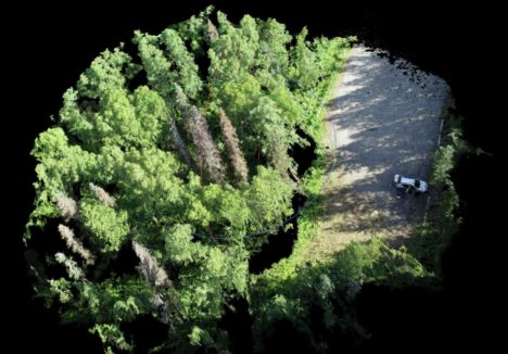
A 3D image created from the UAV flights. We can see gray/brown infested trees in the middle of the patch of trees, surrounded by other healthy and green-stage infested spruce.
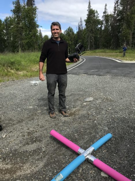
Professor Mike Alonzo from American University getting ready to fly a UAV with a visible and near-infrared sensor. The pool noodle X helps to post-process and correct the collected imagery
The American University team introduced us to some “field equipment” I never thought I would be using: foam pool noodles bolted together in an X formation. They are used as targets in the UAV imagery along with high-accuracy GPS points to post-process the collected imagery. A GPS point is collected at the center of the pool-noodle X, and then later the image is warped so that the center of the X (the bright pool noodles make for highly visible targets) matches the GPS’d point. This process makes sure the image is spatially accurate, and also makes for some entertaining field work.
Another objective of this field campaign is to describe the structure and biomass composition of alder and willow stands in south-central Alaska. Because alders and willows are shrub species (i.e. not trees), they are generally not monitored as frequently or intensely. Recently, however, these shrubs have been growing at much higher rates, with some stands reaching over 10 ft in height. This means there may be a lot of biomass going un-accounted for. With a combination of intensive field sampling, and correlation of that data to imagery from GLiHT and the UAVs, we can try to determine the biomass and structure of shrub stands across the region.
Because of the odd structure of alders and willows, the field sampling is particularly tricky. Each stem and large fork branching off from a main stem must be measured for diameter and length, and this process can take quite a long time and involve scrambling in and under a tangle of branches and woody debris.
An alder forest we sampled along the coast. The complicated mess of stems and branches made for a long day.
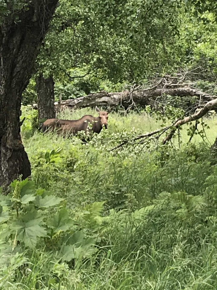
Back at “base camp” we seemed to have gained a couple new neighbors: a female moose with gangly baby in tow. We snapped photos of the pair, and while the female didn’t really seem to pay us any mind, the baby alternated between wanting to be near his mom (who was ambling up the path alongside our cabin) and being afraid of getting any closer to us.
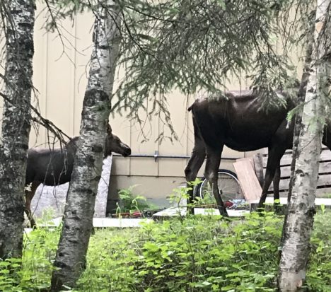
The mom and baby moose who liked to frequent our cabins.
Fieldwork in Alaska also has the major perk of spectacular views during afternoon and evening breaks. After a particularly long day of sampling in Denali State Park, we opted to stay in the area rather than drive the long three hours back down to Anchorage and were blessed with a beautiful view of “sunset” over the Alaska Range.
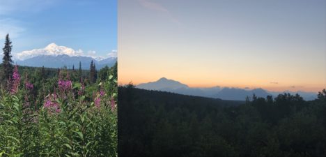
We finally had clear enough skies to get a full view of Denali, and that evening got a great glimpse of an Alaskan Range sunset (at midnight).
This summer a team of scientists from NASA Goddard, American University, and the Forest Service are conducting joint field work and flights with Goddard’s LiDAR, Hyperspectral, and Thermal Imager (G-LiHT) within south-central Alaska to study the ongoing spruce beetle outbreak and develop methods for early detection of beetle infestation. The spruce beetle is an aggressive bark beetle that feeds and reproduces in the inner bark of various species of spruce trees. Currently, spruce beetles are affecting over 400,000 acres in the Matanuska-Susitna Valley, resulting in widespread mortality of spruce trees. This infestation has been ramping up over the past few years in Alaska, causing concern for both scientists and Alaskans. Data collected by G-LiHT may provide the ability to detect early stages of infestation, before they would be visible in aerial surveys conducted by the Forest Service, which would allow forest managers and scientists to better predict future infestation locations and extent.
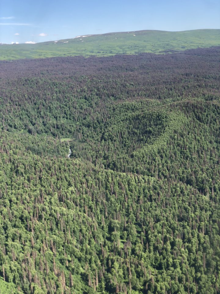
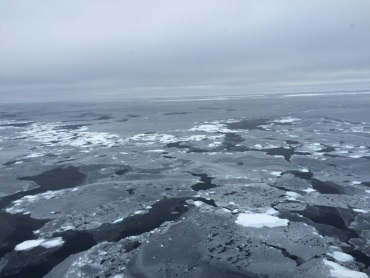
As we pass over the Susitna Valley we can see how far this outbreak has spread. The red-brown and gray trees have been infested for several years. Some of the green trees may be the early stages of spruce beetle infestation.
This past week we have been flying with G-LiHT and visiting areas where G-LiHT data was collected to identify and GPS trees infested with spruce beetles. The infested trees can later be located and analyzed within the collected imagery. This summer, the G-LiHT instrument is flying on a King Air A90. The pilots have to maintain an altitude of 1,100 feet for the best imagery, and this makes for quite an exciting ride over the various mountain ranges in Alaska. The swoops and dives the plane makes as it follows the terrain feel more like a roller coaster than a plane ride.
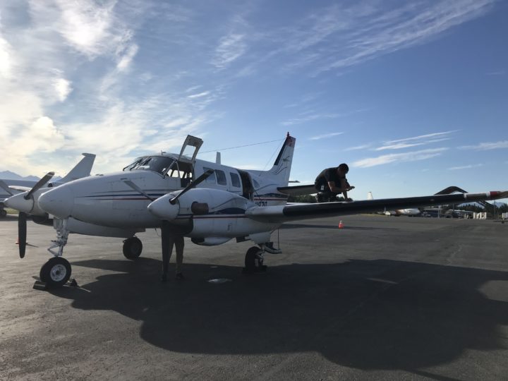
Our pilot Justice Pousson (on the wing) and co-pilot Sam Wilson (behind the propeller) work on the King Air A90 before take-off.
Outside the windows we get a full view of Alaskan landscape. We pass over the jagged peaks of the Talkeetnas into rolling spruce forests. From up here we can really see the extent of the beetle outbreak. Tendrils of red-brown and gray trees climb northward up the Matanuska-Susitna Valley. The red trees have likely been infested for over a year, and these needles will after three years turn gray and eventually fall off the tree. Though there are still some green spruce that we can see from the plane, there’s a good possibility that many of them are in fact already infested, as infested spruce trees generally maintain green needles for at least a year. The aerial Forest Service surveys can detect trees that have red or gray needles, but detecting trees that have only been infested for one year currently requires on-the-ground inspection of tree trunks. We are hoping these flights with G-LiHT will provide the imagery required to develop algorithms for green-stage detection.
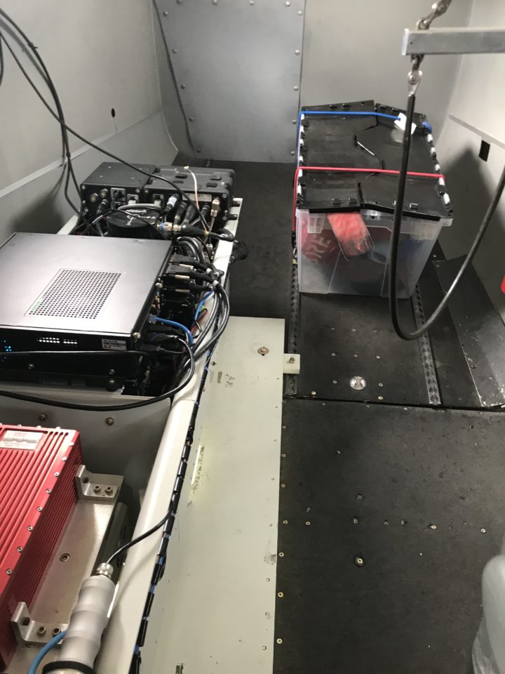
The G-LiHT instrument in the back of the plane. It includes a 3 cm camera and a hyperspectral, thermal, LiDAR, and solar-induced fluorescence sensor.
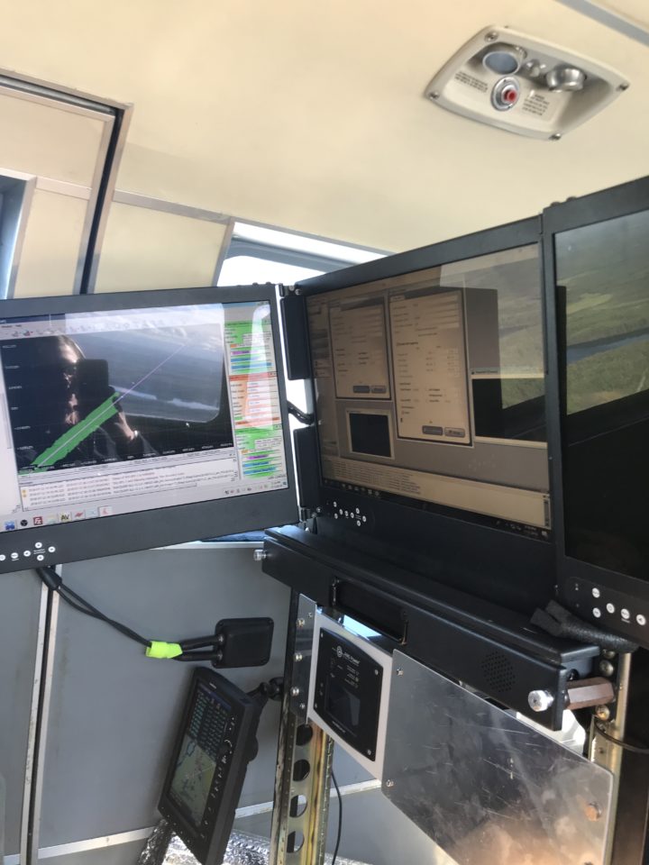
The computer used to operate G-LiHT during flights. We have to make sure we turn on and off all the sensors at the right times.
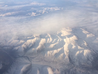
The weather sometimes prevents us from completing all of that day’s planned flight lines. On Thursday we had hoped the clouds that had been hanging low over the Chugach Mountains would dissipate as the day wore on, but we ended up having to turn back after only a few flight lines were collected. While this was disappointing, on the way back to the airport we got a spectacular view of Denali rising above the clouds.
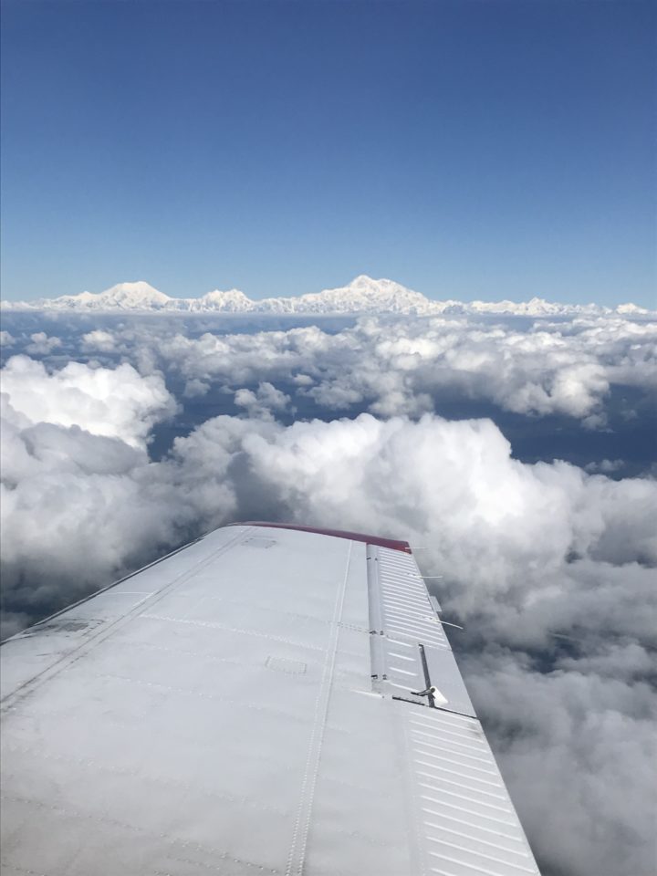
As we transited home we got a great view of Denali to the west.
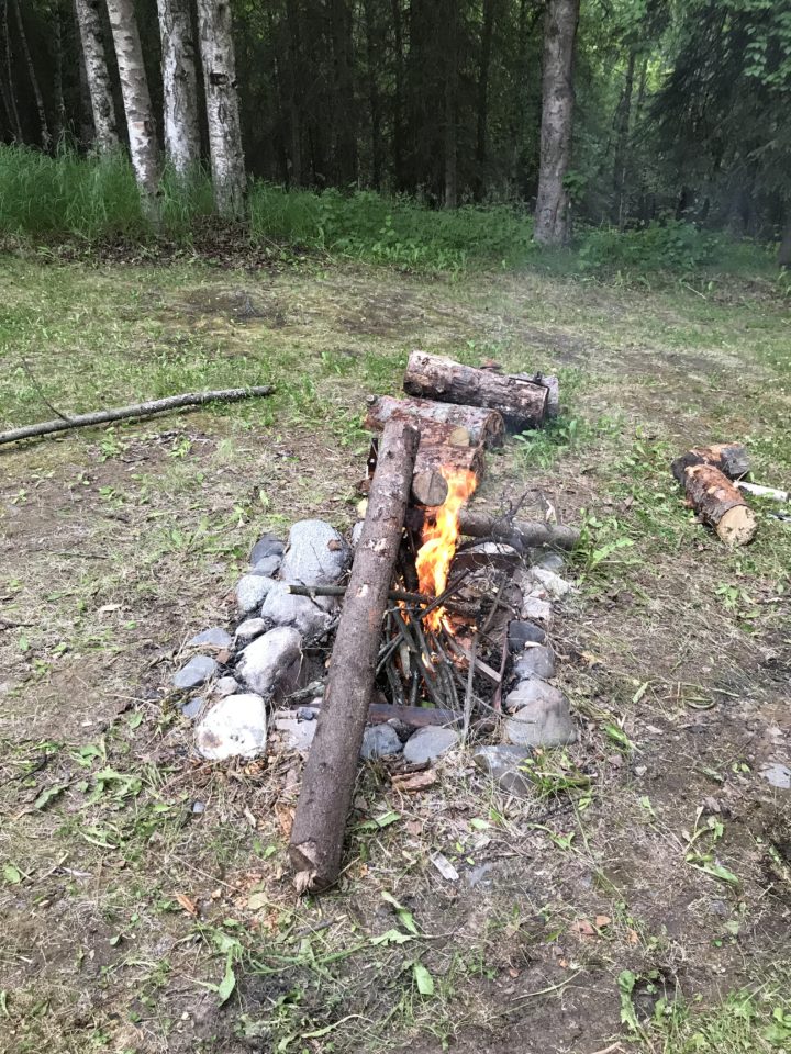
Earlier this week we drove north from our base at Alaska Pacific University in Anchorage towards Denali State Park, armed with a Trimble GPS, DBH tape, and plenty of bear spray. We stopped off where G-LiHT had flown overhead the previous week and found trees to GPS. As we made our way around moose droppings and hoped not to come upon any bears, we picked out the infested from the healthy spruce trees and measured their position and size. We can identify the infested trees by the characteristic globs of pitch-out sap running down the trees’ trunks as well as red-brown dust along the bark crevices and at the base of the tree. The sap is a defense mechanism used by the trees to trap and kill the attacking beetles. Young, healthy trees are usually successful at fending off these attackers, however older or more stressed trees often succumb to the beetles’ offensive. Swarming pheromones given off by the beetles attract others in a “mass attack” which can overwhelm the defenses of even the more vigorous trees. This snowballing effect of more and more beetles attacking more and more trees, which then leads to more beetles reproducing and attacking in subsequent years is the mechanism behind the growing spruce beetle outbreaks.
Back at the cabins where we are staying we relax by a campfire and grill steaks, veggies, and salmon. I’m still trying to get used to the sunrise and sunset times in Alaska. With a sunrise time of 4:50am and a sunset time of 11:20pm, it barely gets dark at all. On the plus side this allows us to stay out later in the field collecting data without having to worry about daylight hours. On the down side it makes it pretty difficult to discern the time of day (or when you should probably head to bed…).
Our campfire (note: it was 9pm when I took this picture).
Next week we have more plans for field work, including flights with some unmanned aerial vehicles to collect data over the infestation areas. Also on my to-do list: more moose and other wildlife sightings!
A moose we spotted during field work
Editor’s note: The following is a first-hand account of ARISE survey flights by one of the mission’s researchers. To see the first two days’ accounts, visit:
http://earthobservatory.nasa.gov/blogs/fromthefield/2014/09/17/flying-with-arise/
Day 3 (Sept. 16, 2014)
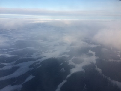
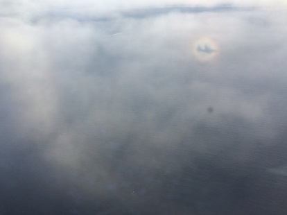
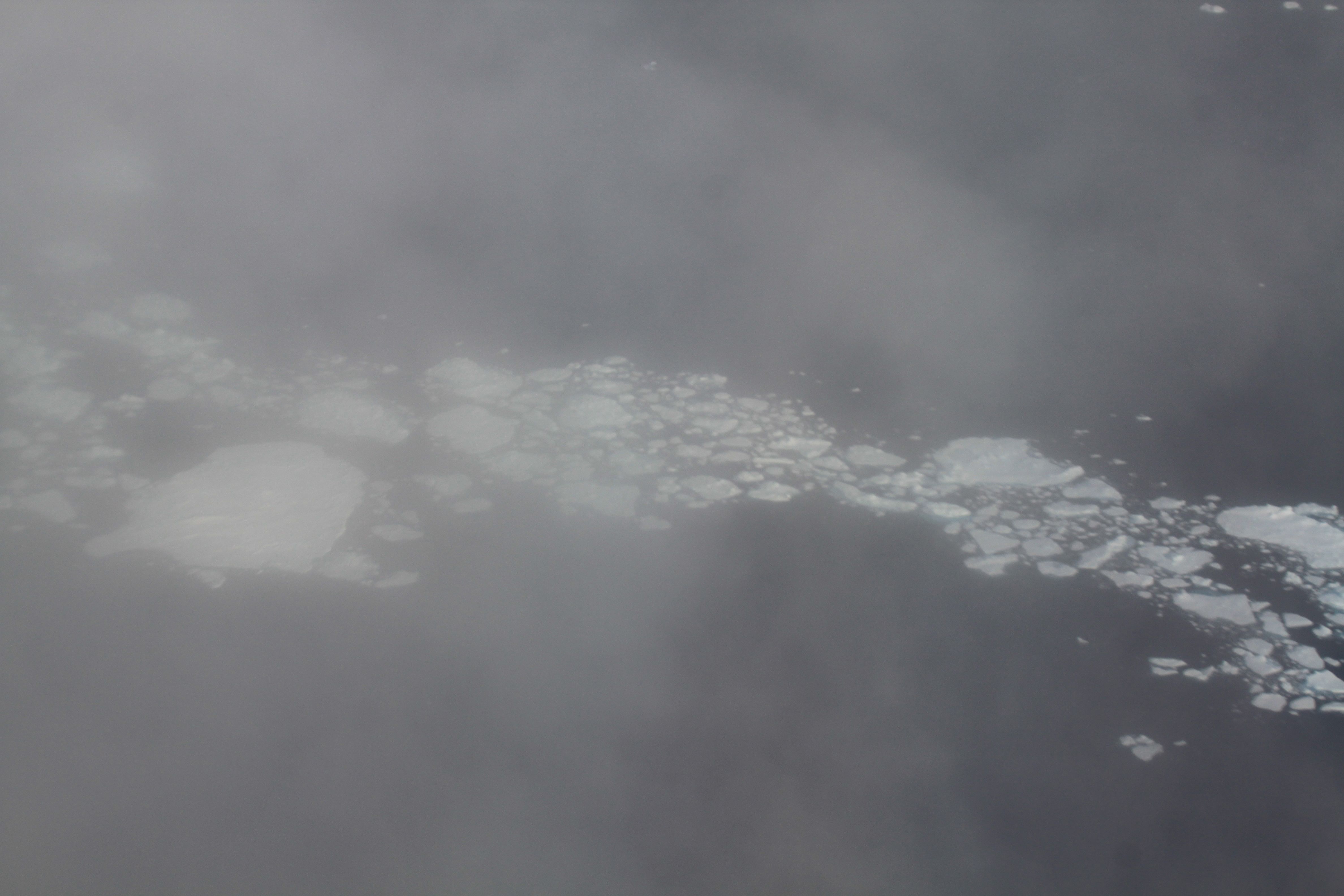
Today was a long flight day. It started off by trying to guess where the high clouds (i.e. cirrus) will move in. We had to choose between three options, and our choice turned out to be a good bet. We flew to the edge of the sea ice to try to characterize both its exact mapping and see whether the clouds look different or have different characteristics, height and composition (i.e. water and ice) above the sea-ice versus open ocean. We had a mix of high clouds above ice but also clear regions, with black and white ice, as seen in the pictures. The sun was posing for us and we got to see some halo forming around the sun. This means that we had ice clouds (cirrostratus) with particular ice shapes of smooth hexagonal crystals are reflecting and refracting the sun rays to form this circle of light surrounding the sun.
Day 4 (Sept. 18, 2014)
Today was a challenging day. We were after clouds, and oh, they are “hard-to-get” into a specific posture. We flew high to check the area and had a gorgeous stratus deck below us. The word stratus in Latin means “spread out” and boy, they were spread out all right.
At some point we saw an opportunity to dive below the clouds, and cruising over the broken sea-ice, we felt like we were in a Star Trek episode.
Clouds are so diverse and changeable, so we want to sample them as often as possible to get a feel for their heights, thicknesses and what type of particles they include (water, ice or a mixture of both). This is important because their location in the atmosphere (how high or low they are) and their composition dictates the amount of radiation they absorb or scatter back into space and how they affect the surface below, either warming or cooling. This was a challenging and bumpy flight from all perspectives, but all in all it ended well.
Summary
We had many more flights, some I flew myself, some were flown by my 4STAR team fellows. All flights were magnificent in that they covered pristine sea ice regions, where human access is difficult and low and high clouds over these regions (especially at this time of year) means even the satellites often cannot take measurements. We had some weather and technical hurdles some days, but we succeeded in most of our goals, which were to measure sea-ice formation and state, study sunlight and thermal energy over the sea-ice and open ocean, and characterize cloud spread and type in this complex and important region.
Our final science flight was on Oct. 2, and was dedicated to instrument calibration. It lasted for almost nine hours and ended after sunset, since some of the instruments (including our own SUN-photometer) needed to be calibrated by the sun, looking at the wide range of sunlight intensity during sunrise or sunset period. We flew over some dormant volcanos in the southern part of Alaska, over glaciers and Denali park. What a great finale to a great campaign! Looking forward for next year’s one already.
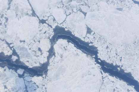
The dark blue in this image is a lead, or opening in sea ice. If you look closely you can see where the lead is starting to refreeze at the edges. Credit: NASA
Flying above, below and through clouds in the Arctic gives the ARISE C-130 a different perspective on the world below. Nowhere is this more apparent than through the lenses of ARISE’s digital camera instrument. This instrument – one of many ARISE uses – captures views of clouds, ocean and ice that are both scenic and scientifically important.
The heart of the digital camera instrument would look familiar to a casual observer. It is made up of two off-the-shelf digital cameras that point down through a clear window in the underside of the aircraft. These cameras are connected to a computer with software that allows the operator to preview images and change camera settings and to a hard drive for storing photographs. An average ARISE flight yields roughly 100 gigabytes of images.
Although the cameras are the same make and model, their lenses are different. Group photos and distant landscape shots call for different size lenses, and low-altitude and high-altitude flights do the same. One camera has a 14 millimeter, wide-angle lens to capture views of the surface during low-level flights. The other camera’s lens has a 50 millimeter focal length, making it useful higher up.
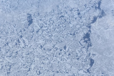
A collection of broken sea ice pieces floating together. Far from static, sea ice moves, flexes and breaks under the strain of winds and ocean currents. Credit: NASA
Similarly, the rate at which the shutters snap ranges between one per second to roughly one every three seconds. From high up the surface seems to pass slower than at low altitude, much like the way telephone poles beside the highway are a blur while far away mountains barely seem to move. Instrument operators can fine-tune this rate to best match the situation and can be managed in flight.
While many of the images these cameras capture are breathtaking, they are also useful in several ways. Researchers can use them to measure how much light is reflected from clouds and ice, also known as albedo. The images also show where there are leads, or openings, in sea ice. ARISE measures ice surface height using the Land, Vegetation and Ice Sensor, which bounces a laser off of the surface and times how long it takes to return to the plane. Locating leads gives scientists a reference for local sea level, helping ensure that measurements are accurate.

Larger chunks of sea ice, some with melt ponds on the surface. Credit: NASA
Laser altimeters and other instruments can reveal a great deal about the surface, but through photographs the variety of conditions ranging from open stretches of water to broken bits of floating ice to solid white expanses. The images captured by these cameras benefit researchers studying sea ice, but the views can also be breathtaking.
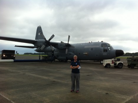
ARISE project manager Christy Hansen stands in front of the NASA C-130. Credit: NASA
Eielson Air Force Base, Fairbanks, Alaska, day 9 of our deployment: We are currently sitting together in our mission support and flight planning room, next to the Thunderdome Hangar on base. We have appropriately named this room, where we dedicate up to 10 hours each day, our WAR room – where we passionately discuss which ARISE science objectives we’ll fly each day. Our broad instrument suite provides us with a great number of options for interesting science flights, yet ironically poses additional challenges, as each instrument requires meteorological conditions that often conflict with one another. It is here where we follow the C-130 as it flies our science trajectories, a combination of radiation cloud studies and cryospheric sciences. We can communicate with the science team on board via a basic chat system, send them occasional updated satellite imagery, track their flight, and talk on a satellite-based phone system.
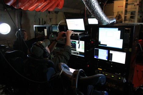
Members of the ARISE team operating scientific gear aboard the C-130 during a survey flight. Credit: NASA / Richard Moore
It is the first NASA airborne science mission of its kind, combining a unique instrument suite that would have been unlikely to fly together on the same airborne platform in missions past. And this is what makes ARISE a very exciting mission from a scientific standpoint. New data sets will be combined and studied at the conclusion of this mission. Our general science goal is to develop an understanding of the Arctic regional energy budget. The amount of sea-ice contributes to how much sunlight is reflected back to space, and thus is an important factor in the radiation balance of the Earth. In additional, we are hoping to learn more about how clouds might interact with sea ice to build a more comprehensive understanding of the Arctic energy budget as a whole. Why is this important? Because it will help us better understand our Earth system; changes to atmospheric and ocean circulations, precipitation and temperature patterns, and potential sea level rise.
A view of broken sea ice through low clouds. Credit: NASA / Richard Moore
We are surrounded by F-16 and F-18 jets taking off and landing all day, against a radiant and beautiful sky. We see an occasional moose on base and along the interstate during our drives in and out, all the while reminding us we are far away from home. We greet the plane as it lands each day – with a swarm of gnats in our face.
I love it when a plan comes together.
As the Project Manager for ARISE, I am reflecting on how far this team has come is such short time. In less than seven months, ARISE has evolved from the initial concept phase, to a fully operational airborne science mission – collecting unique data sets in the Arctic. This includes identifying science objectives, identifying team members, identifying instruments to meet the mission goals, defining data products, selecting an aircraft, performing research to establish a base of operations that could meet our C-130 aircraft and science team requirements, obtaining country diplomatic clearances, flight planning, performing C-130 aircraft engineering modifications, completing field logistics, testing and re-testing, and all associated approvals. Bringing a large unique team together, to meet a new set of NASA science goals and requirements, in a challenging environment, within regulations and expected timelines – from start to finish, is what my job is all about.
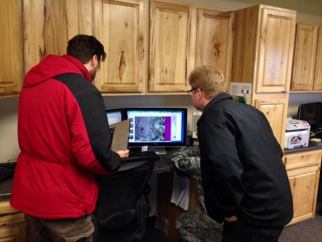
ARISE mission planners and a member of the Eielson Air Force Base weather office review forecasts before a survey flight. Credit: NASA / Christy Hansen
The team of professionals and experts I work with each day, from scientists, to flight crew and aircraft maintainers, to logistics teams, and engineers to managers – have each contributed a unique puzzle piece to the overall mission picture. In just one week, we have completed six new science missions together. And “together” means that greater than 30 people have to work together, on time, in a changing and challenging environment with tight deadlines, every single day. Without all pieces of the puzzle working together well, the mission would not be complete.
This first week has proven that we can do it – we have met all initial obstacles and challenges as a team together. We have been moved from our location on base twice, scraped frost from our windows using credit cards, over-heated and froze all in the same day, laughed and politely argued together, heated up ramen noodles and pizza to get us through — all while remembering that we are here together to do GREAT science.
