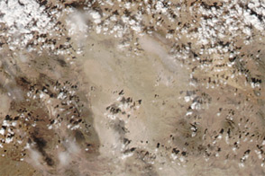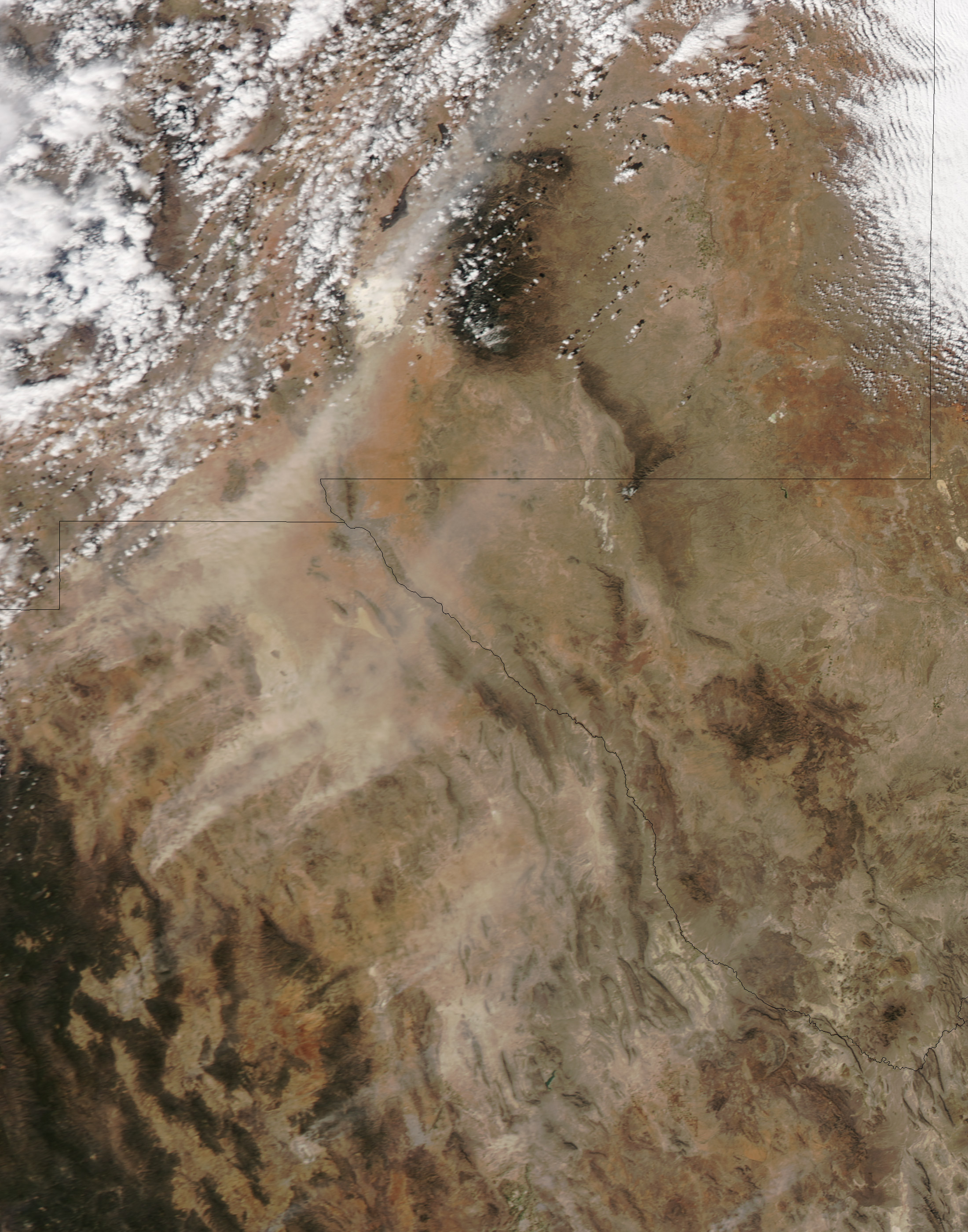
On February 20, 2013, dust plumes arose in northern Mexico and southern New Mexico. The plumes blew toward the northeast, some of them mingling with clouds north of New Mexico’s White Sands National Monument. The Moderate Resolution Imaging Spectroradiometer (MODIS) on NASA’s Aqua satellite captured this natural-color image the same day.
The dust storms extended far into northern Mexico (visible in the large image), and continued an intermittent pattern of dust-storm activity in the region, including dust plumes in the same region on January 29 and February 9, and a dust storm along the Kansas-Colorado border in early January.
The dust storms occurred against the backdrop of unusually dry conditions. As of February 19, the U.S. Drought Monitor reported, parts of Texas and all of New Mexico were suffering varying levels of drought conditions, part of a large-scale drought affecting the Great Plains and the western United States. In discussing a dust storm that struck western Texas in late December 2012, the National Weather Service stated:
While it is quite common to see wind events with the same velocities as those observed on the 19th, the dust was much denser. Was it the storm, which was so strong that it lofted the dust? Actually, the scenario for a high-density dust event has been in the making for some time. With the low precipitation totals experienced the past two years, the amount of vegetation is somewhat reduced. Thus, there is less to hold the dirt in place.
NASA image by Jeff Schmaltz, LANCE/EOSDIS MODIS Rapid Response. Caption by Michon Scott.