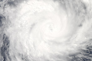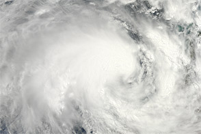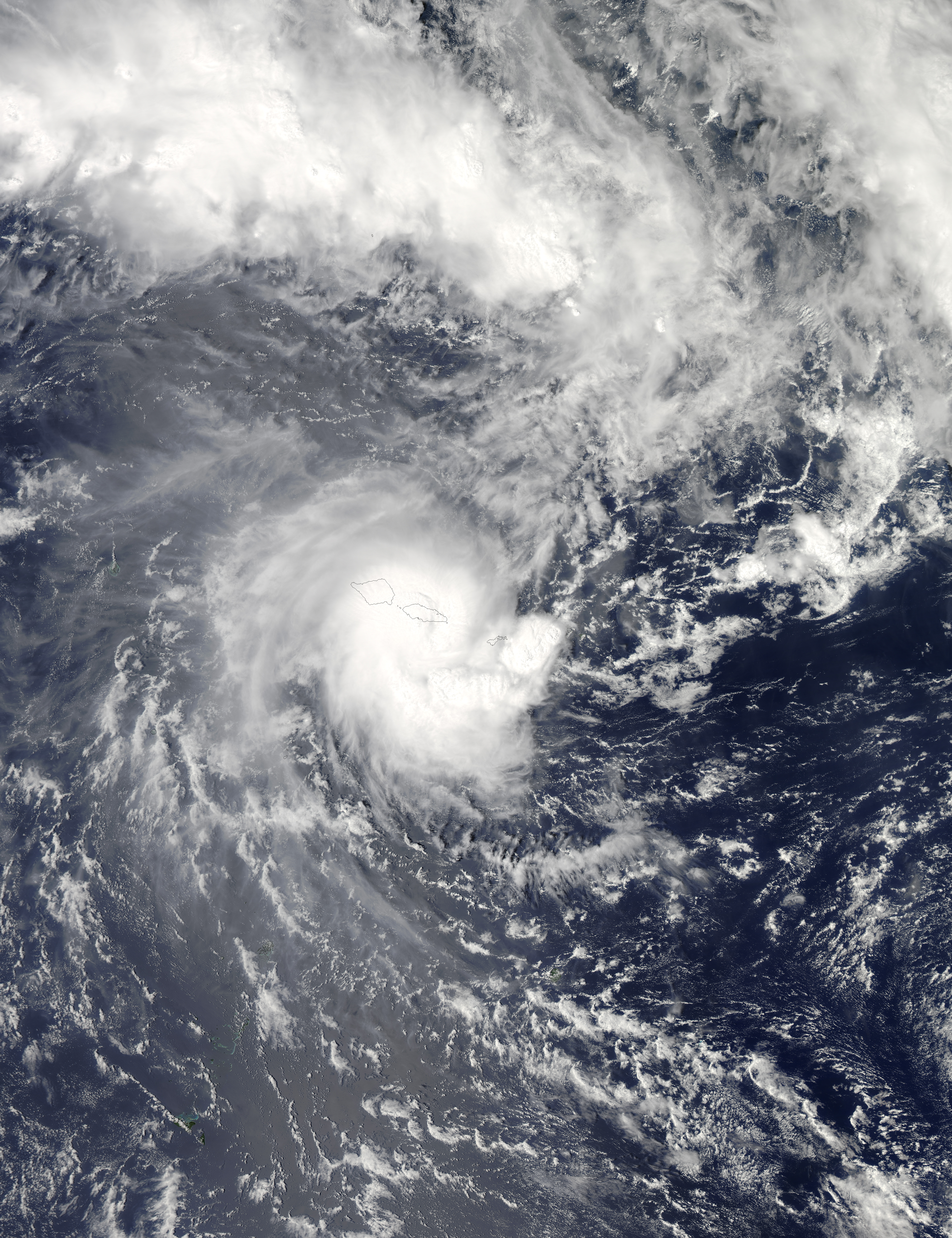
Tropical Cyclone Evan brought strong winds and floods to Samoa in early December 2012. Two people had been killed by December 13, news reports said. Evan made landfall in Apia, prompting authorities to close the airport. The strong, slow-moving storm destroyed homes, downed trees, flooded rivers, and severed roads. It was perhaps the worst to strike Samoa in 20 years.
The Moderate Resolution Imaging Spectroradiometer (MODIS) on NASA’s Aqua satellite captured this natural-color image on December 13, as Evan hovered over Samoa and neighboring American Samoa.
On December 13, the U.S. Navy’s Joint Typhoon Warning Center (JTWC) reported that Evan had maximum sustained winds of 90 knots (165 kilometers per hour) and gusts up to 110 knots (205 kilometers per hour). The JTWC forecast that Even would strengthen, with maximum sustained winds peaking around 110 to 115 knots (205 to 215 kilometers per hour) over the next 72 hours.
The JTWC forecast map issued December 13 showed Evan moving toward Fiji in the next few days, but Samoa’s Ministry of Natural Resources warned that the storm could turn around and strike Samoa again, ABC News Australia said. AccuWeather reported that the storm was almost stationary over eastern Upolu.
NASA image courtesy Jeff Schmaltz, LANCE MODIS Rapid Response. Caption by Michon Scott.