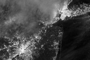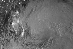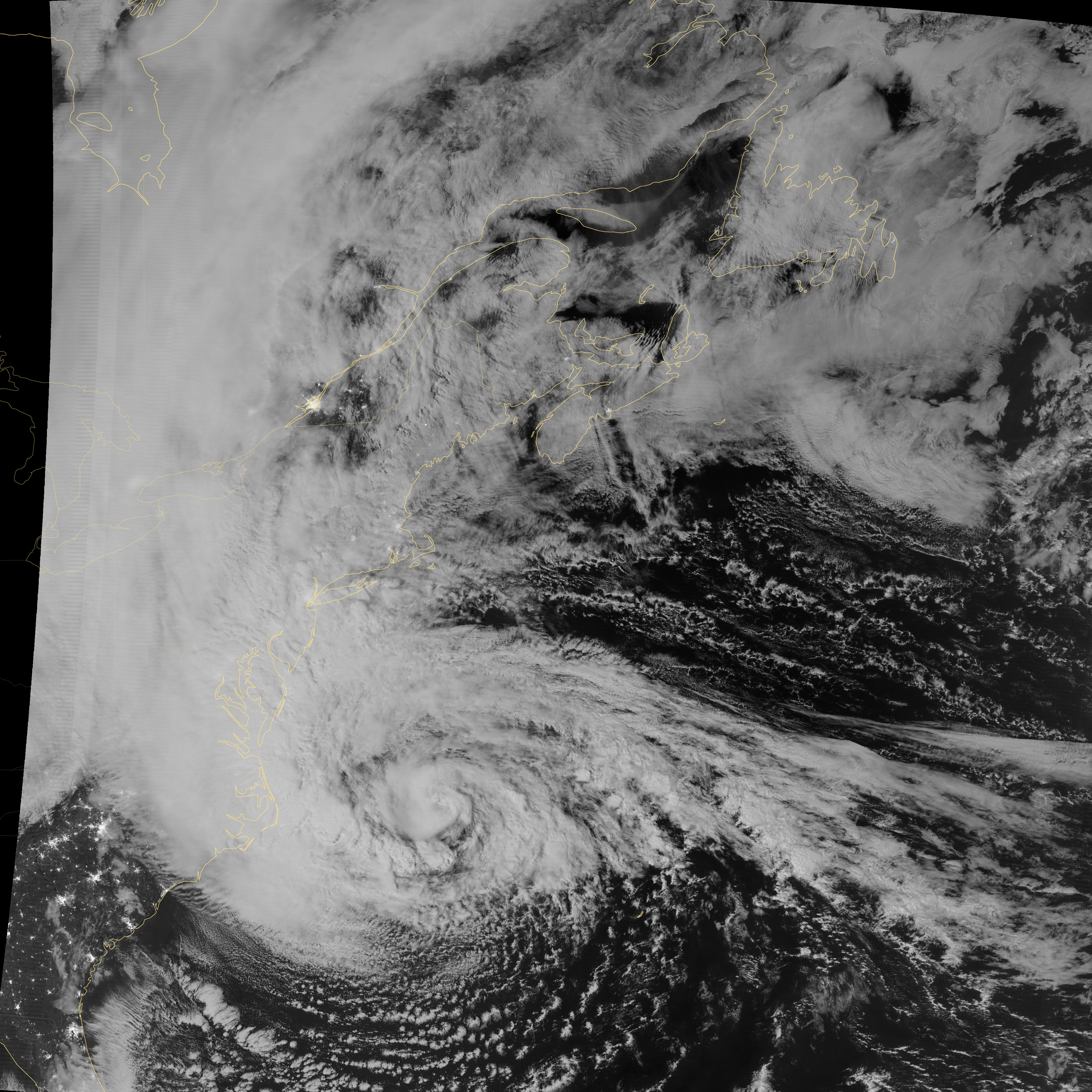
This image of Hurricane Sandy was acquired by the Visible Infrared Imaging Radiometer Suite (VIIRS) on the Suomi NPP satellite around 2:11 a.m. Eastern Daylight Time (06:11 Universal Time) on October 29, 2012.
The storm was captured by a special “day-night band,” which detects light in a range of wavelengths from green to near-infrared and uses filtering techniques to observe dim signals such as auroras, airglow, gas flares, city lights, fires, and reflected moonlight. In this case, the cloud tops were lit by the full Moon. Some city lights in North Carolina and South Carolina are also visible through the clouds.
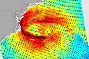
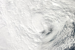
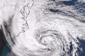
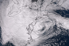
At 2:00 p.m. on October 29, 2012, the U.S. National Hurricane Center estimated Sandy’s location to be 38.3° North and 73.1° West, 110 miles (180 kilometers) southeast of Atlantic City, New Jersey, and moving northwest at 28 miles (44 kilometers) per hour. Maximum sustained winds were 90 miles (150 kilometers) per hour, and the minimum central barometric pressure was 940 millibars (27.76 inches).
For more views of the storm—including a time-lapse video of the storm from dawn to dusk on October 28—visit our Hurricane Sandy event page and the NASA Hurricane Resource Page. The National Hurricane Center, operated by NOAA, provides the official U.S. storm forecasts and regular updates on conditions on its home page.
NASA Earth Observatory image by Jesse Allen and Robert Simmon, using VIIRS Day-Night Band data from the Suomi National Polar-orbiting Partnership (Suomi NPP). Suomi NPP is the result of a partnership between NASA, the National Oceanic and Atmospheric Administration, and the Department of Defense. Caption by Adam Voiland.