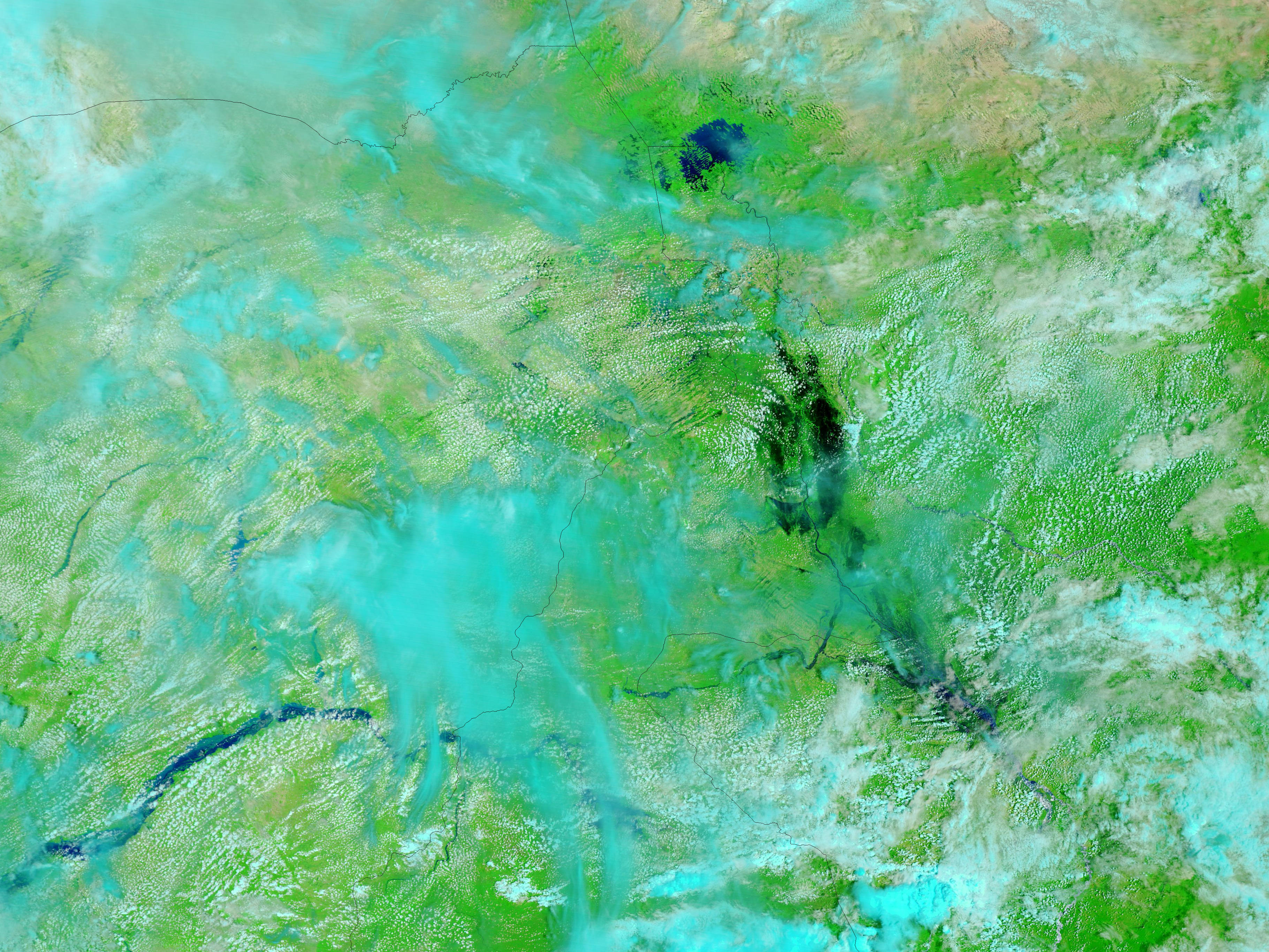

Flooding had affected tens of thousands of people in western and central Africa by mid-September 2012, the United Nations Office for the Coordination of Humanitarian Affairs (OCHA) reported. Flood conditions extended from Senegal eastward to Chad, and the affected region included northern Cameroon. On September 17, CNN reported that heavy rainfall had persisted in this area for almost a month. Floods had claimed nearly 30 lives, and the death toll was expected to rise.
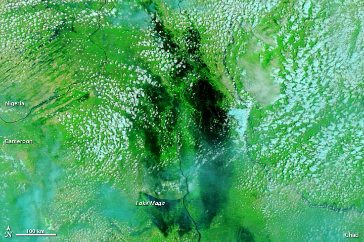
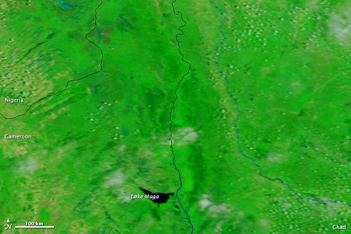
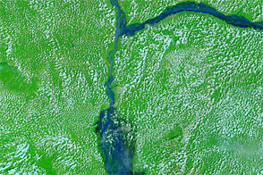
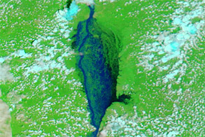
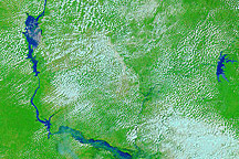
These images show Cameroon’s Far North Region in between Nigeria and Chad. The area pictured is just south of Lake Chad. The top image shows flooded conditions on September 17, 2012. The bottom image shows the same area a year earlier, on September 18, 2011. Both of these images use a combination of visible and infrared light to increase contrast between water and land. Water is navy blue. Vegetation is bright green, and bare ground is pinkish beige. Clouds appear in shades of blue-green, an some clouds cast shadows onto the land surface below.
In September 2011, Lake Maga was the only significant body of water in the region. A year later, that lake was nearly engulfed in a much larger floodwater lake that spread across the border into Chad.
CNN reported that flooding in northern Cameroon had displaced more than 4,000 people, and affected more than 26,000 residents in some way. Authorities worried about the spread of diseases such as cholera and malaria in the wake of the flooding. On September 16, the Associated Press reported that authorities in northeastern Nigeria had recovered 25 corpses from the Benue River, and suspected the bodies had been carried to that region from severely flooded areas in Cameroon.
NASA image courtesy LANCE MODIS Rapid Response Team at NASA GSFC. Caption by Michon Scott.


