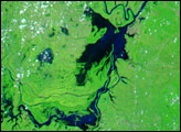
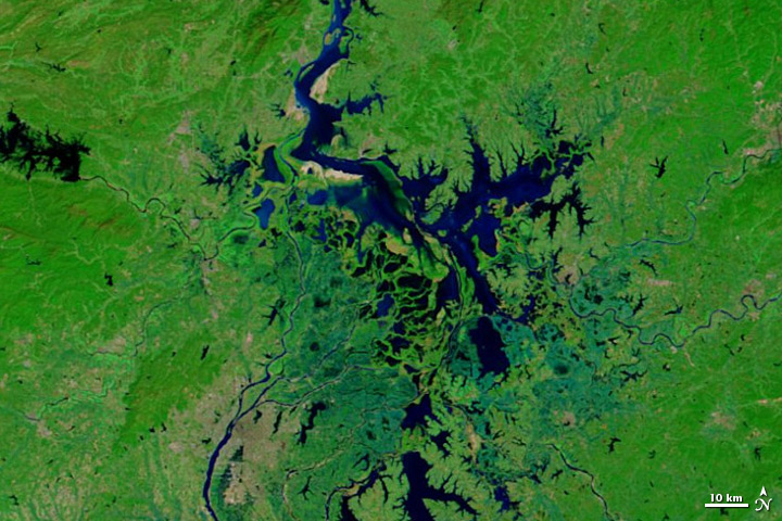
In January 2012, news reports described the dried-out beds of Poyang Lake in Jiangxi Province of southeastern China, where drought had shrunk the lake to a fraction of its former area. After a year of poor rainfall, the lake covered less than 188 square kilometers (73 square miles), according to China Daily. The next few months, however, brought heavy rains. On May 2, 2012, China.org.cn reported that Poyang Lake’s area had quadruped over the previous month, rising from 668 to 2,370 square kilometers (258 to 915 square miles). Forecasts called for more frequent, heavy rains after April.
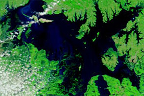
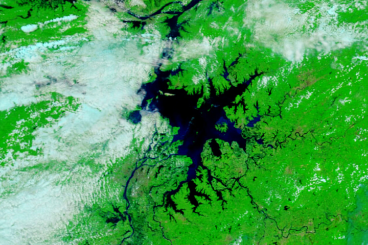
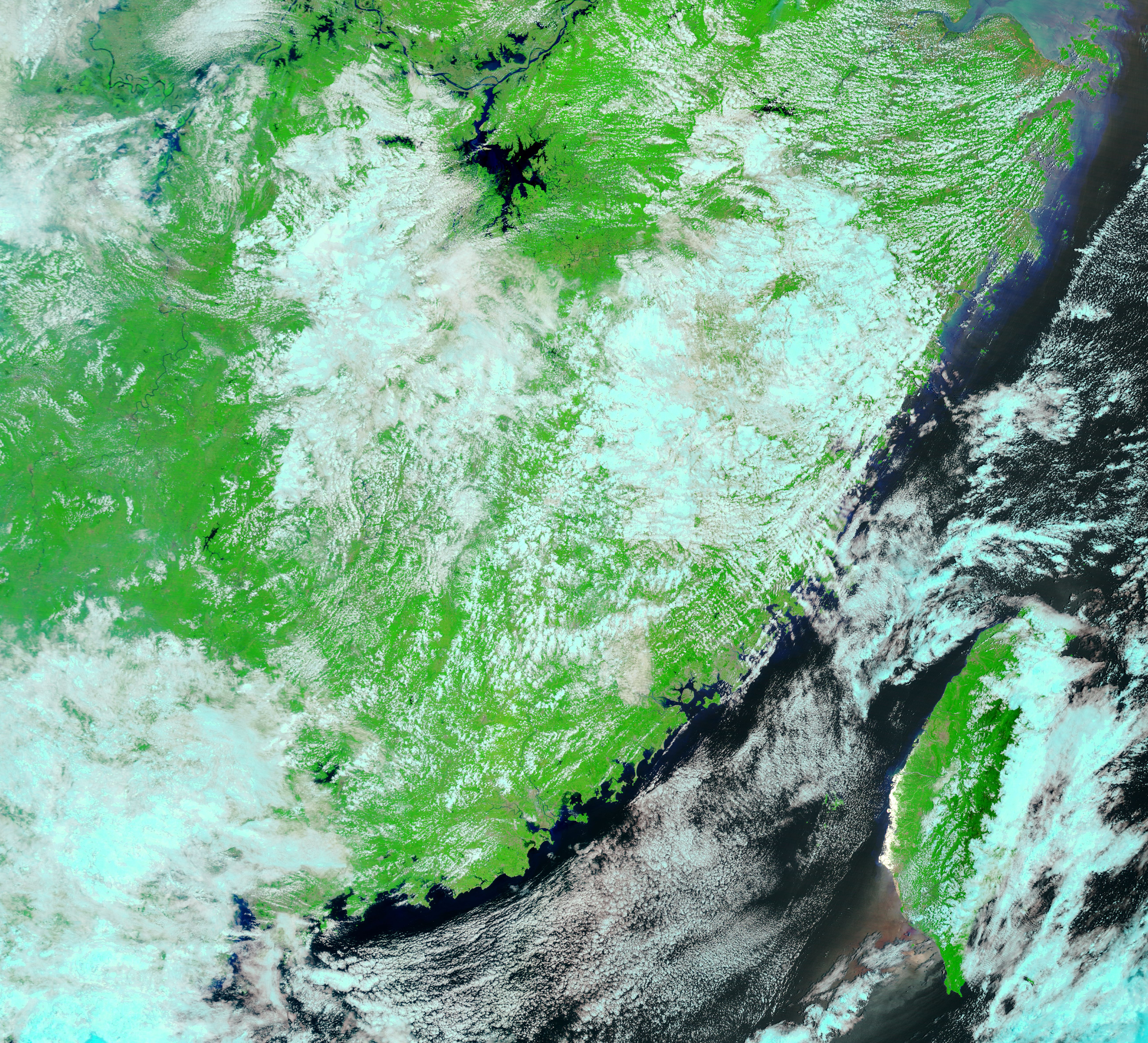
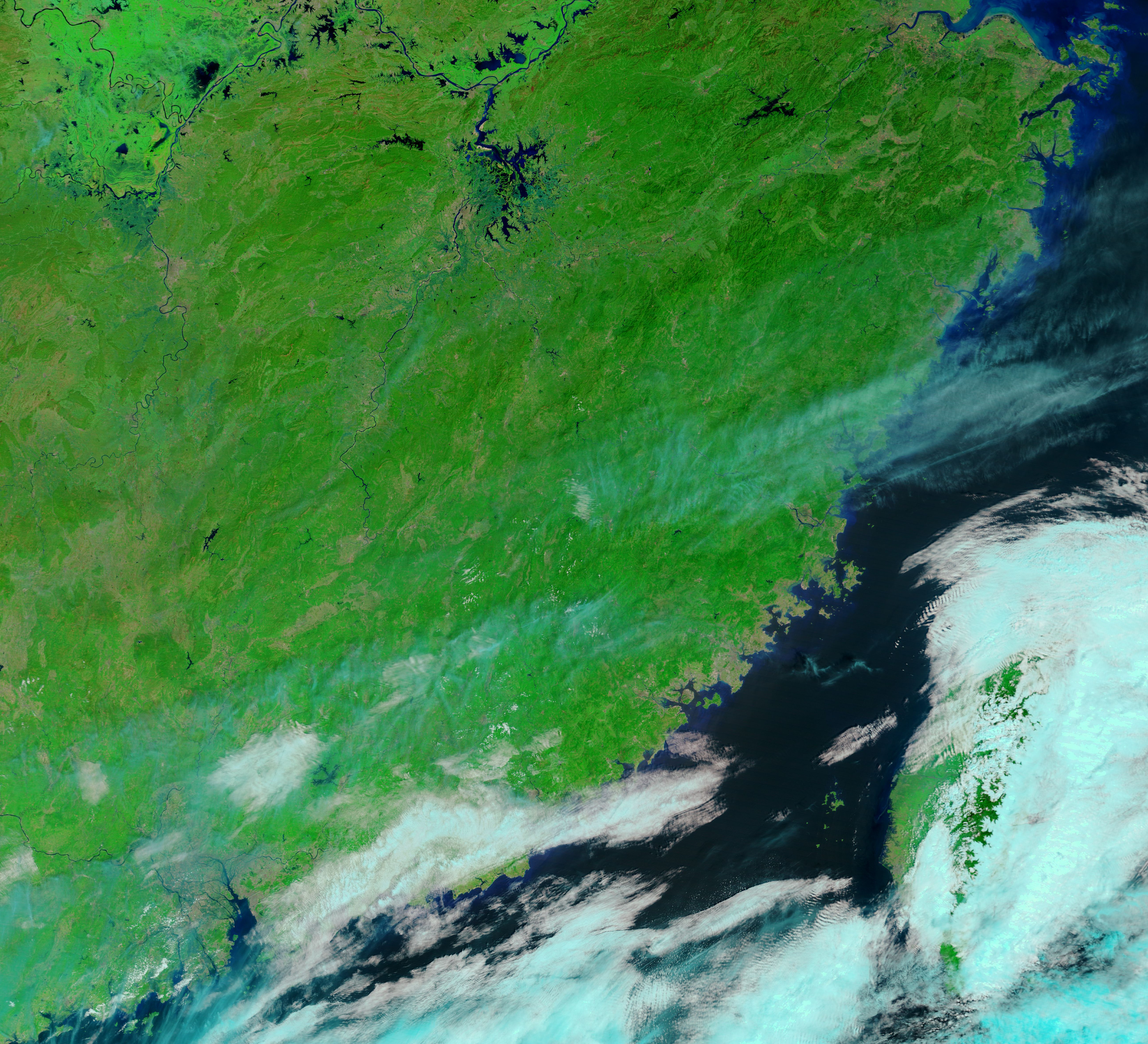
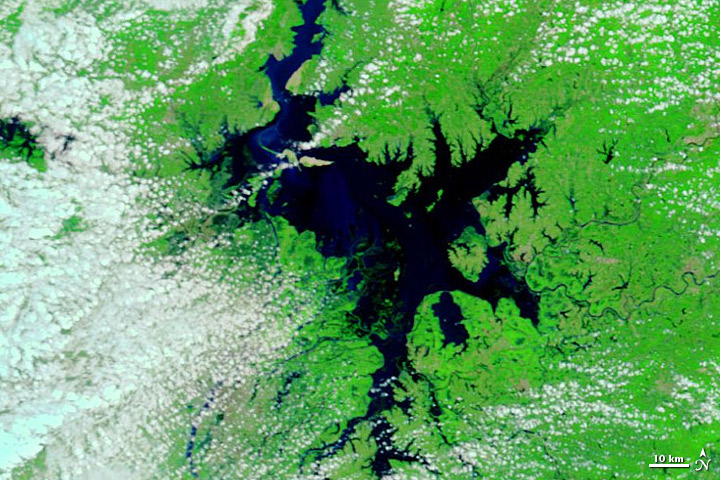
Rain indeed arrived in southern China in May 2012. By May 21, Poyang Lake was visibly swollen compared to its extent in early April. The Moderate Resolution Imaging Spectroradiometer (MODIS) on NASA’s Terra satellite captured these images of Poyang Lake on April 1 (top) and May 21 (bottom). Both images use a combination of visible and infrared light to better distinguish between water and land. Water varies from electric blue to navy. Vegetation is bright green and bare ground is earth-toned. Clouds range in color from pale blue-green to nearly white and cast shadows.
Heavy rains caused widespread destruction in southern China in May 2012, and China.org.cn reported that Jiangxi rainfall from January through April 2012 was 35 percent above average. But the differences in Poyang Lake shown here are probably at least partly normal seasonal changes. Fed by multiple rivers, the lake’s level can vary throughout the year, and the region’s rainy season typically starts in April and continues through June.
NASA images courtesy LANCE MODIS Rapid Response Team at NASA GSFC. Caption by Michon Scott.