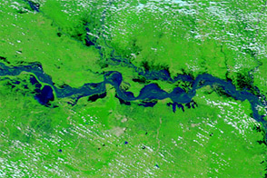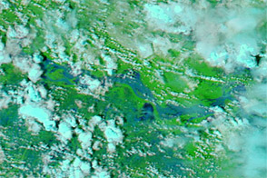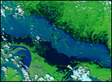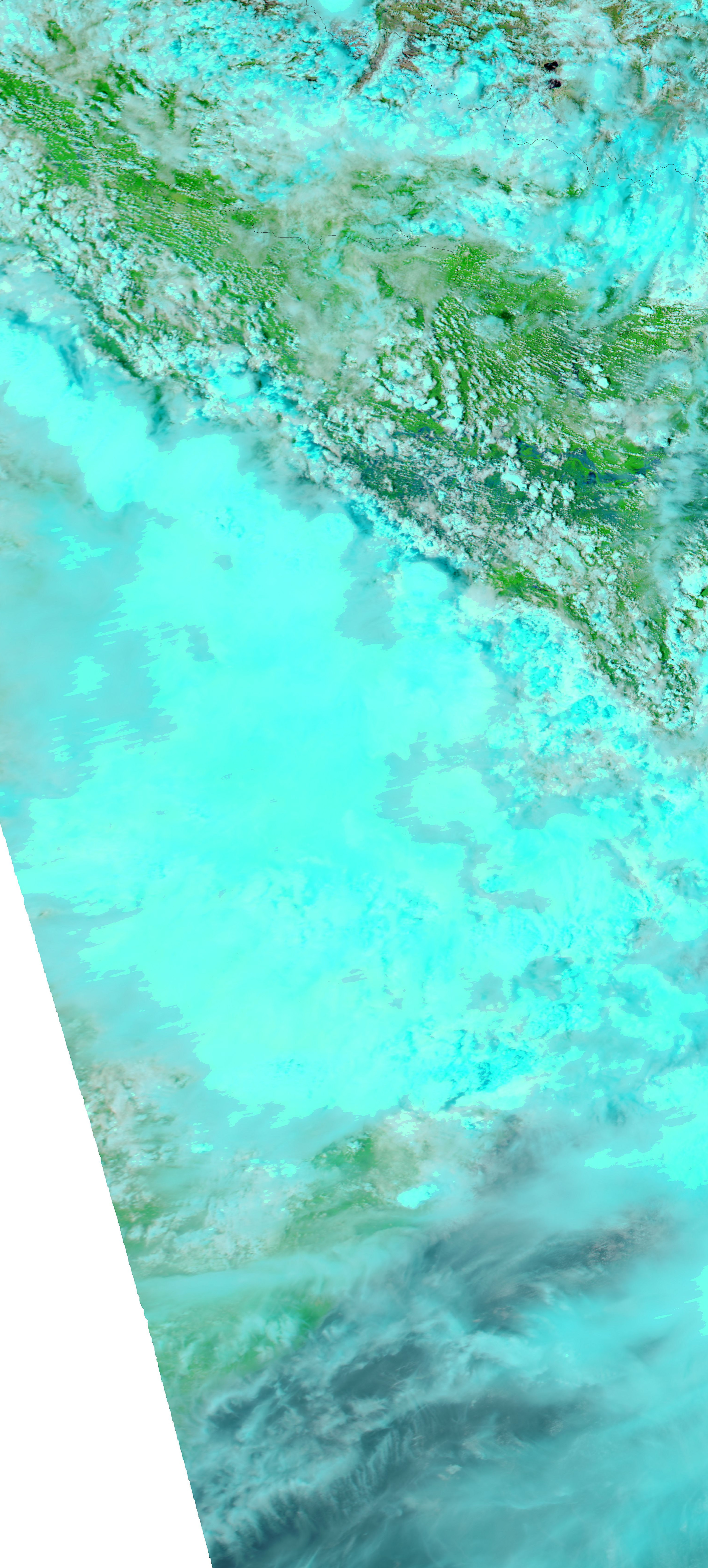
Water rose on the Ganga (Ganges) River in the Indian state of Bihar in early August 2011. The Moderate Resolution Imaging Spectroradiometer (MODIS) on NASA’s Aqua satellite captured these images of the river in the vicinity of Patna on August 11, 2011 (top), and July 13, 2011 (bottom).
These images use a combination of infrared and visible light to increase contrast between water and land. Water ranges in color from electric blue to navy. Vegetation is green. Clouds are pale blue-green. Despite some cloud cover, the Ganga River is clearly higher in August than in July, especially east of Patna. Wide areas of standing water are also apparent south of the river.
Rising water levels on the Ganga are not unusual during India’s monsoon season. On August 11, 2011, however, The Times of India reported that the Ganga River had been observed rising more frequently during the 2011 monsoon. The Times noted that water levels on the river usually rise two or three times from late June through September. By August 11, 2011, the river had already risen a third time, with two months left in the season.
The Ganga was not the only river to rise in northern India in the 2011 summer monsoon season. Elsewhere in Bihar, rising waters along the Kosi River had affected about 40,000 residents.
NASA images courtesy MODIS Rapid Response Team at NASA GSFC. Caption by Michon Scott.