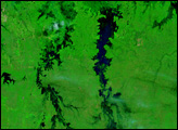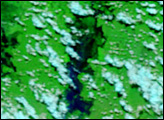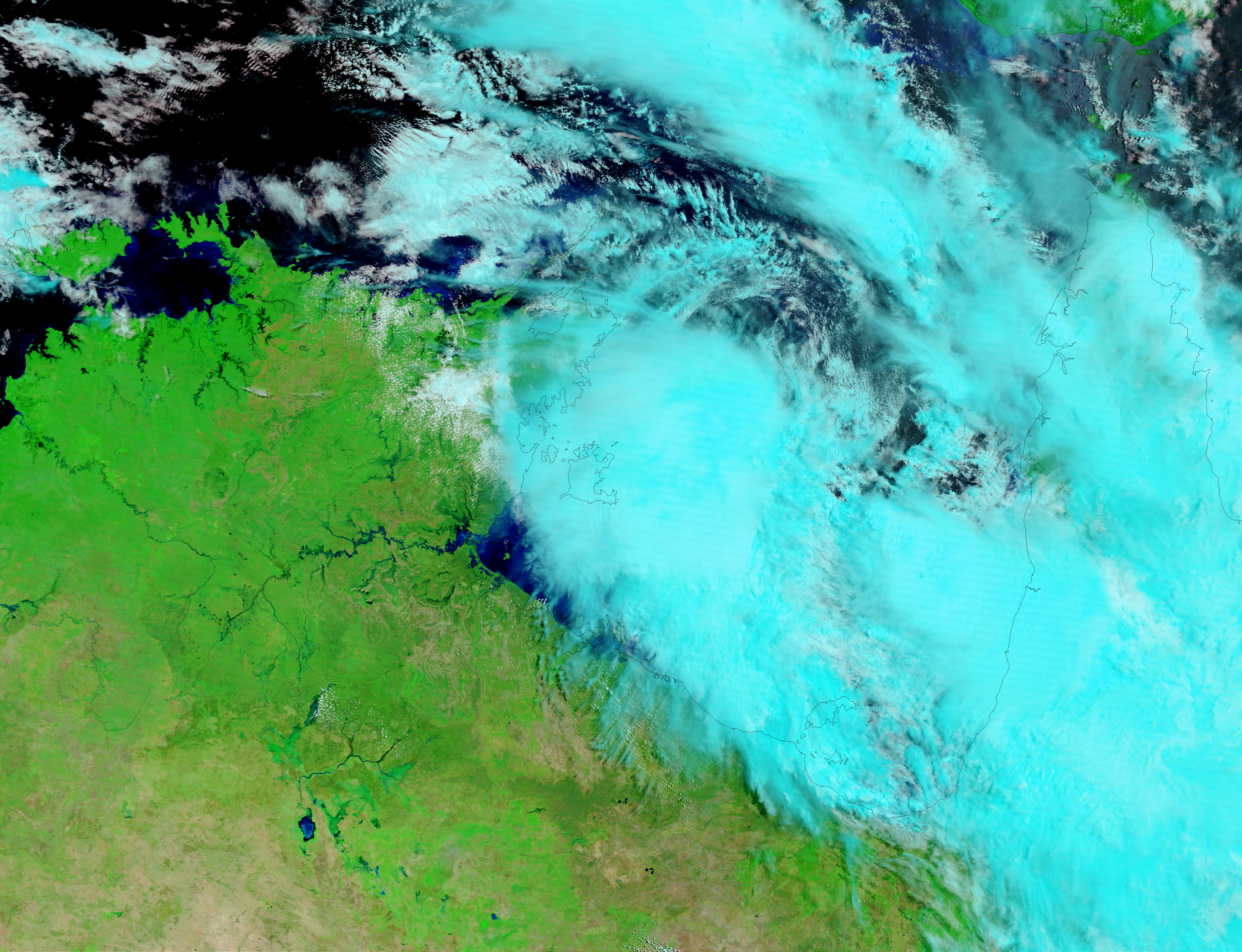
On March 11, 2003, Cyclone Craig passed across the northern tip of the Northern Territory in Australia, bringing torrential rains. The resulting floods can be seen in this false-color image taken on March 12 by the Moderate Resolution Imaging Spectroradiometer (MODIS) instrument aboard NASA’s Terra satellite. Normally, the rivers in the Northern Territory are much less swollen and hardly visible in MODIS images. In these false-color images, water is solid blue and black, land is green, and clouds are light blue and white.
Image courtesy Jacques Descloitres, MODIS Land Rapid Response Team at NASA GSFC.