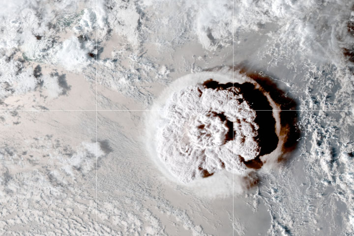
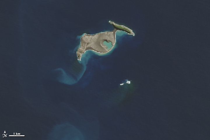
In December 2014, an undersea volcano exploded to life in the Polynesian island kingdom of Tonga. A month later, when the eruption had ceased and the ash cloud had cleared, experts began to get a better look at what the eruption had left behind—a new island.
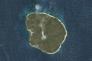
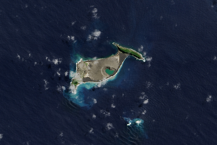
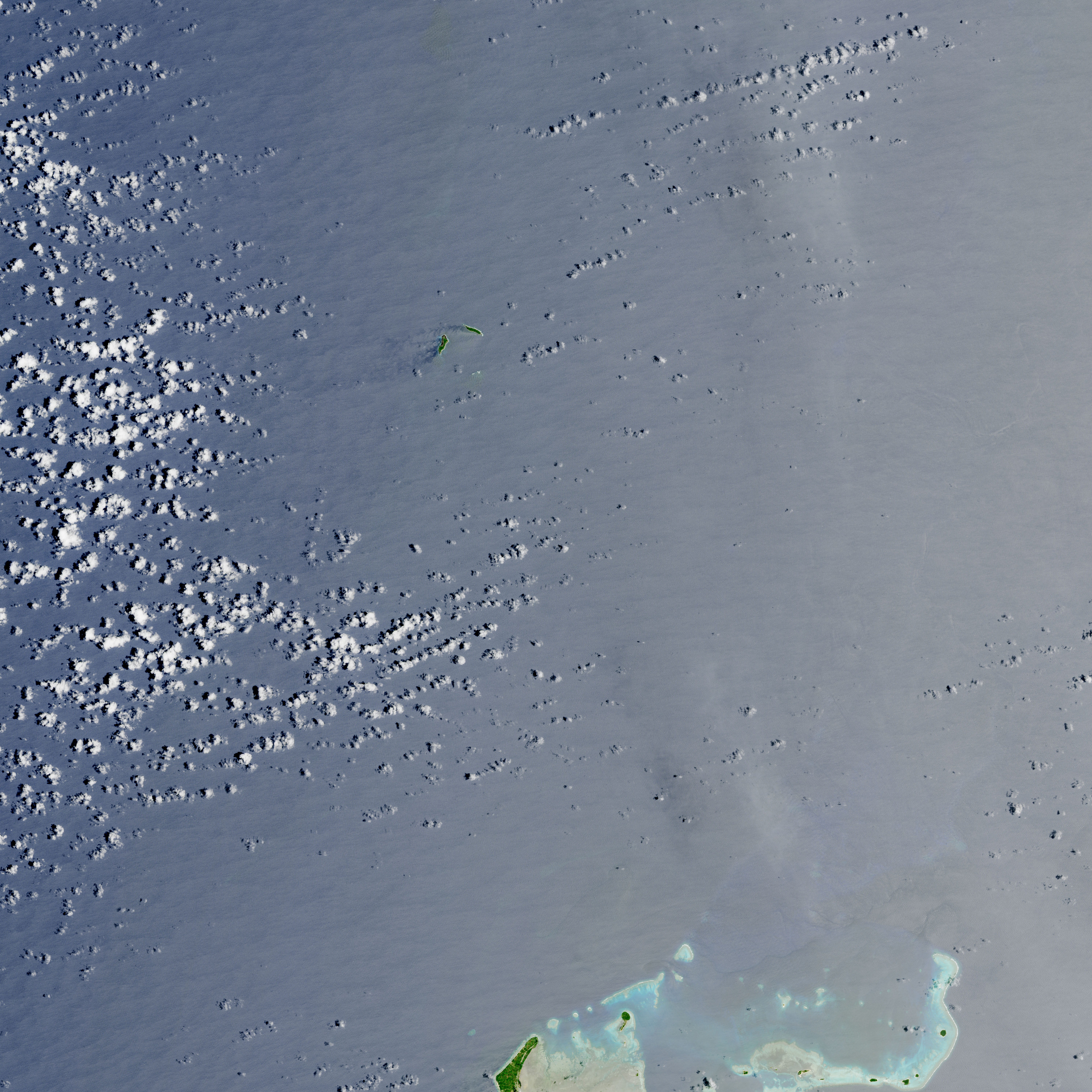
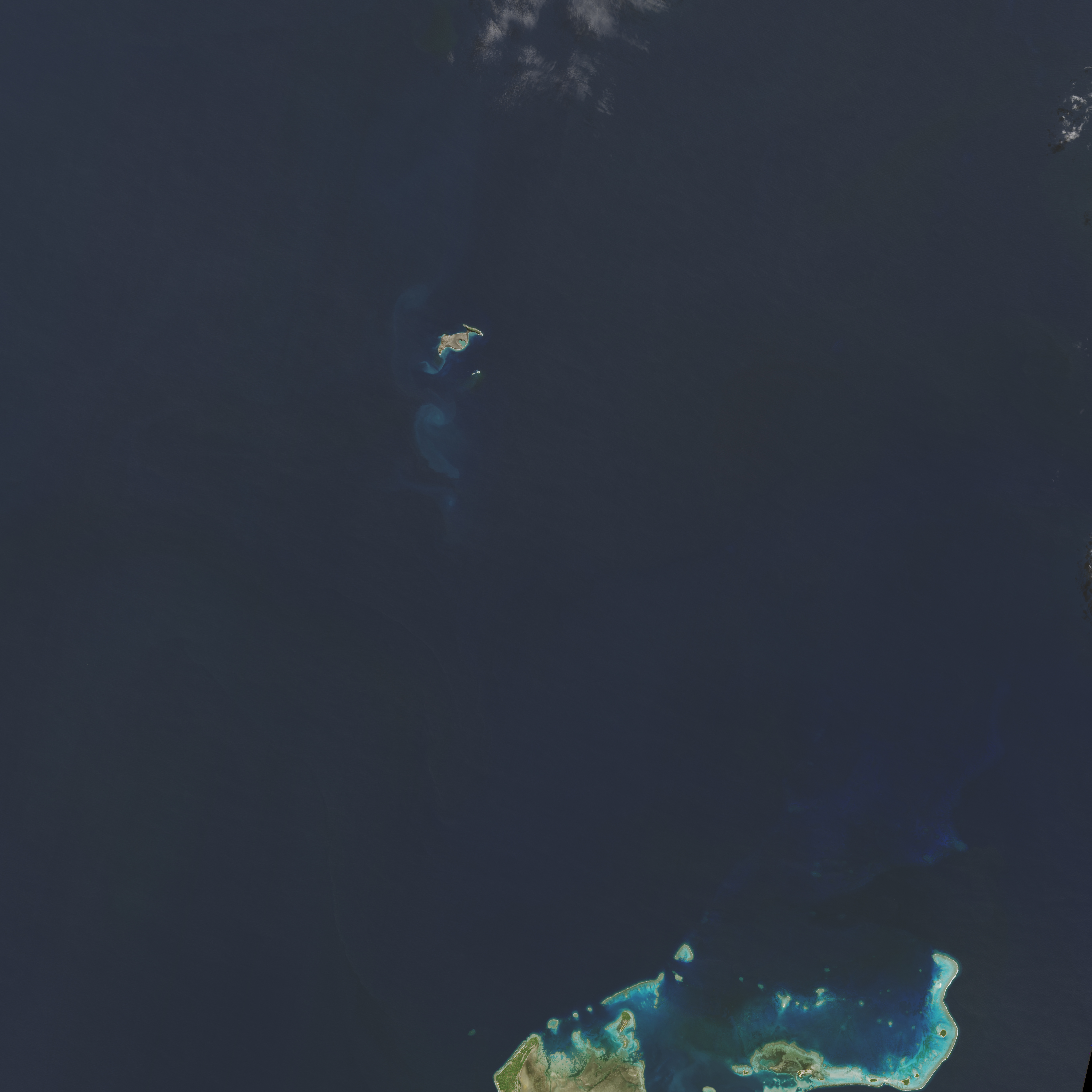
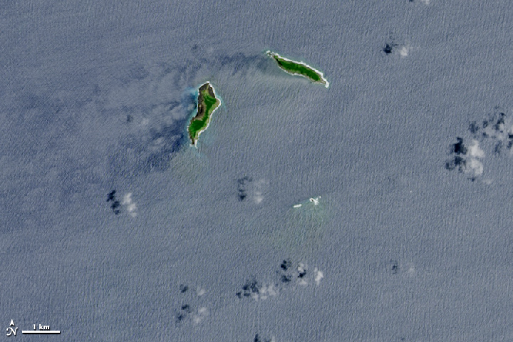
The images above were acquired by the Operational Land Imager (OLI) on the Landsat 8 satellite. The top image shows the area on December 2, 2013, one year prior to the eruption. At that point, the small islands of Hunga Tonga (right) and Hunga Ha’apai (left) were separated by the South Pacific Ocean. The second image shows the same area on April 28, 2015, four months after the eruption—and the first time that Landsat got a cloud-free view.
According to a report in January from the Tongan Ministry of Information & Communications, the new island between Hunga Tonga and Hunga Ha’apai rose about 120 meters (390 feet) above sea level. It measured just 1.5 kilometers (0.9 miles) from north to south, and 2 kilometers (1.2 miles) from west to east. And while volcanic material connected the new island with Hunga Ha’apai to the west, it was a few hundred meters short of connecting with Hunga Tonga.
Already, the island has received visitors. The Australian Broadcasting Corporation ran a series of photographs taken by a group that explored the island in March 2015.
NASA Earth Observatory image by Jesse Allen, using Landsat data from the U.S. Geological Survey. Caption by Kathryn Hansen.