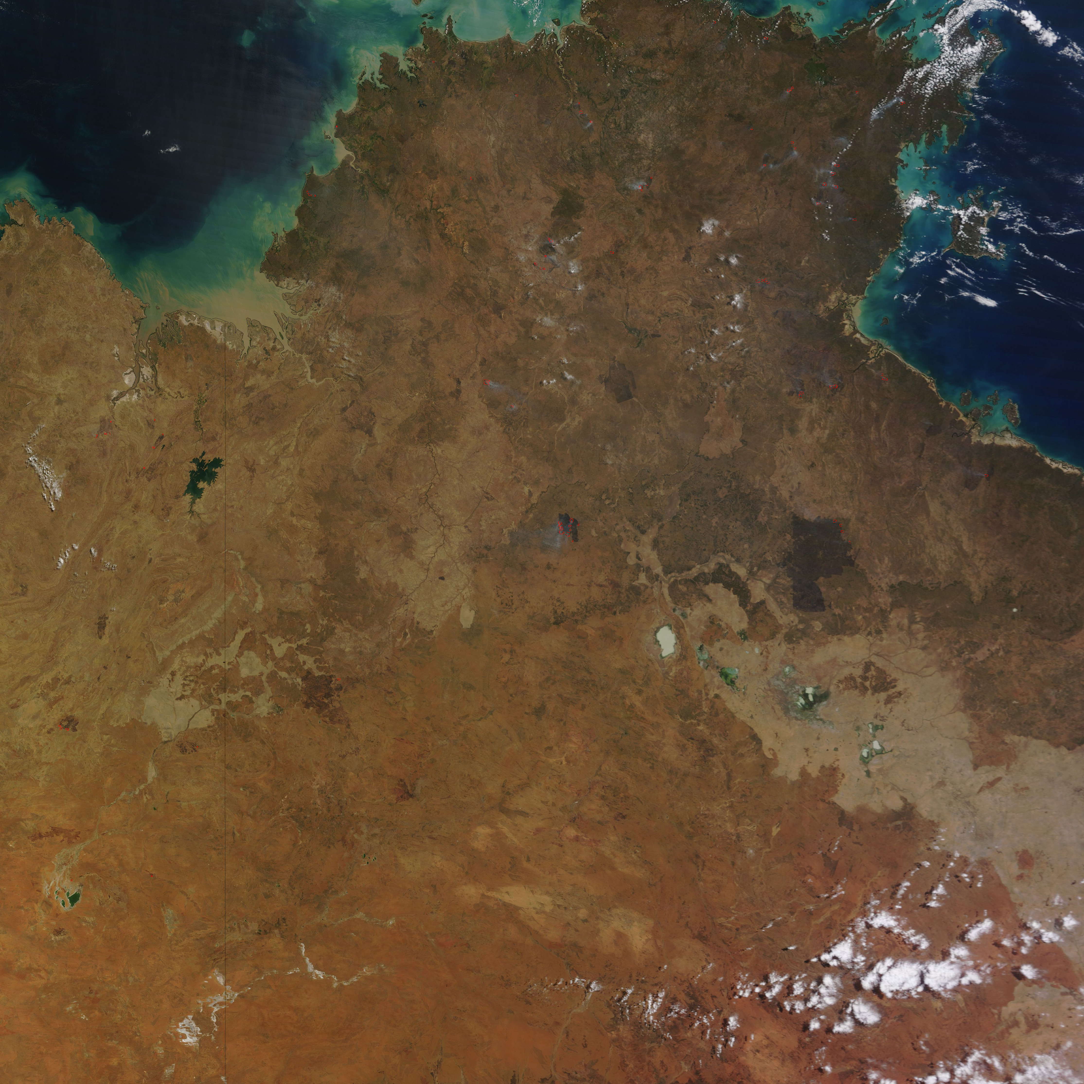
The intense bushfires that strike southern Australia in the summer usually attract the most headlines, but the country’s largest and most frequent blazes actually occur in northern Australia in the spring. In fact, in terms of sheer area burned, satellite observations show that over 98 percent of large fires in Australia occur well outside of densely populated southeastern and southwestern parts of the country.
A fire that began burning in Northern Territory on September 10, 2014, offers a prime example of just how expansive fires from this part of the continent can become. After racing through grasslands for just a few weeks, the fire had charred an area about the size of Massachusetts by October 8, 2014.
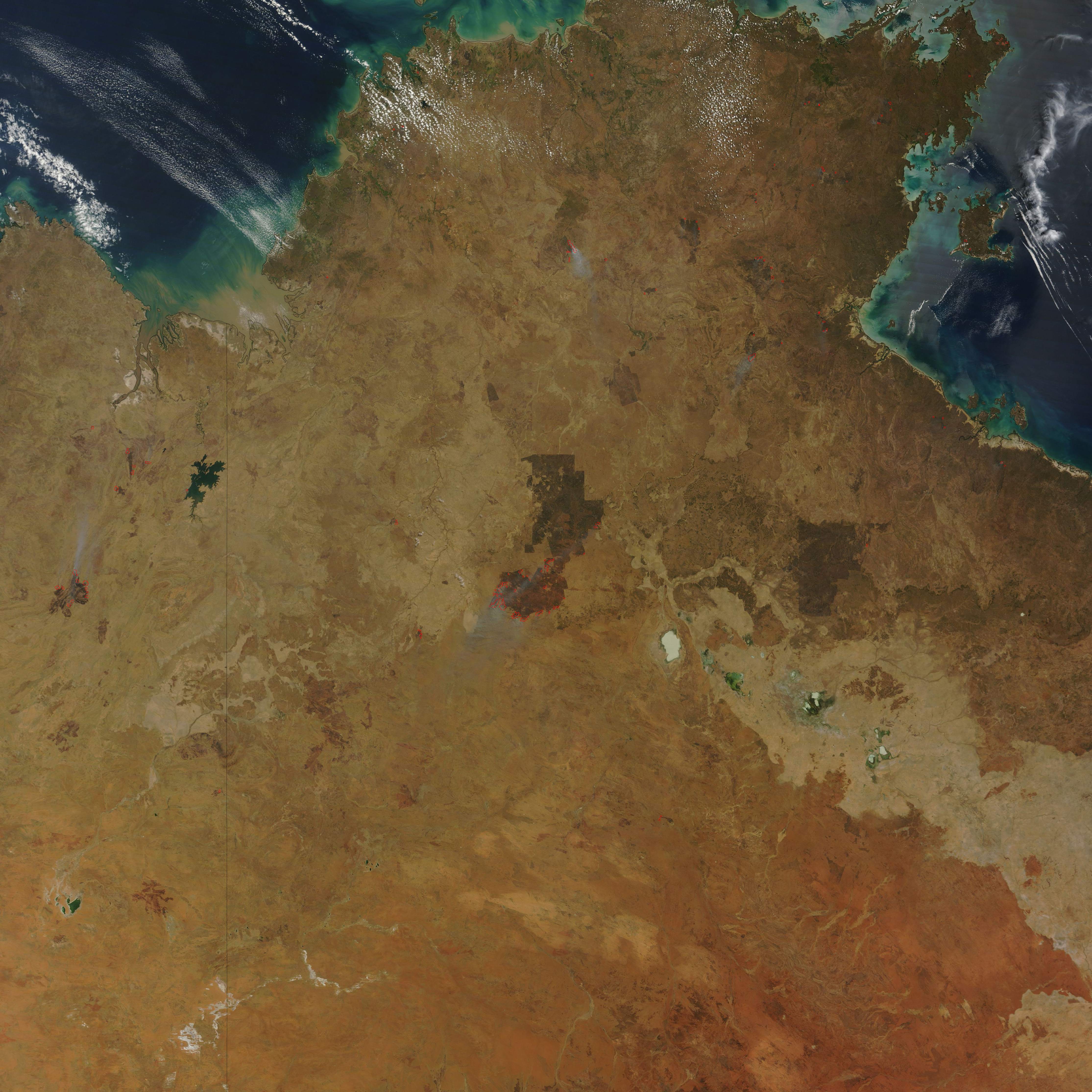
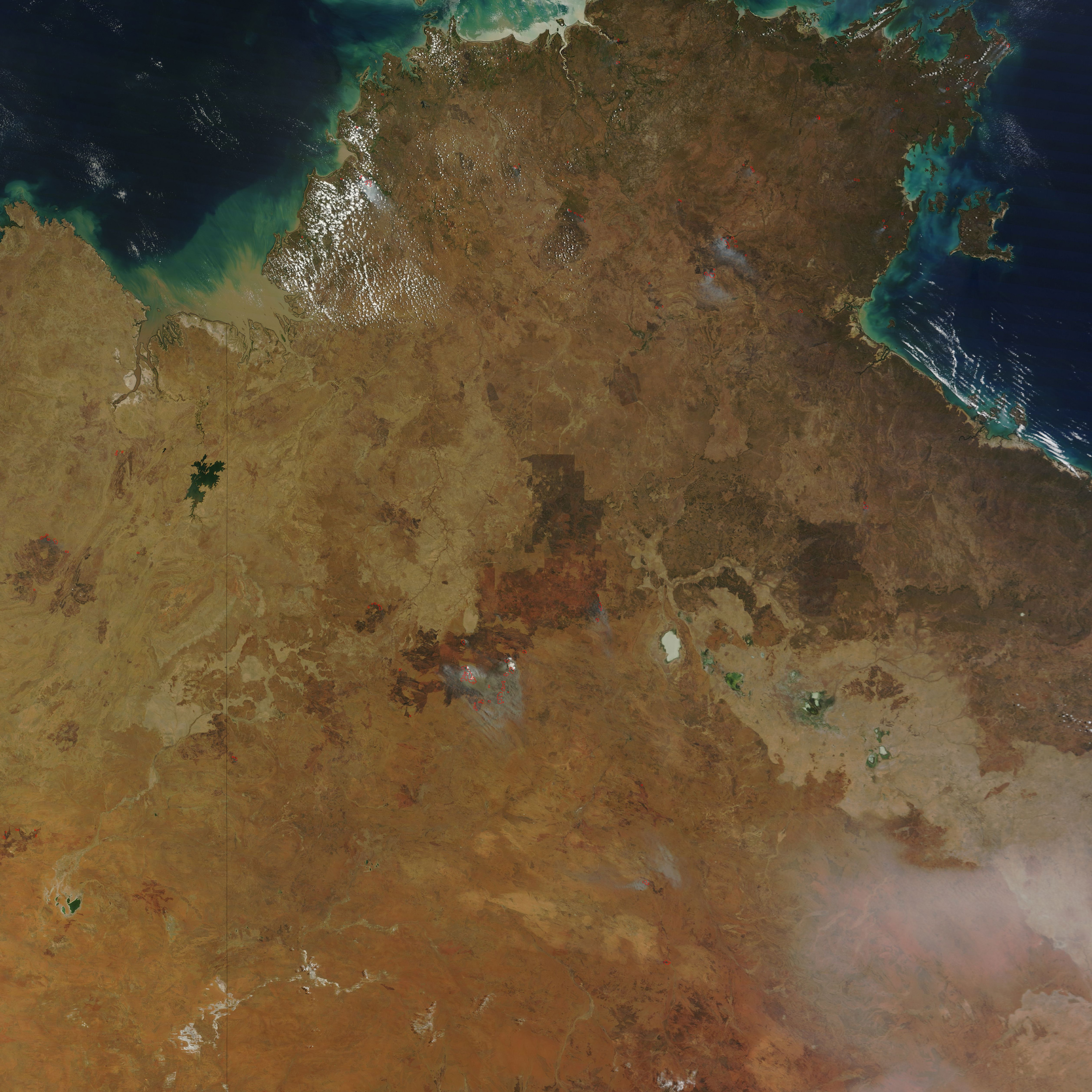
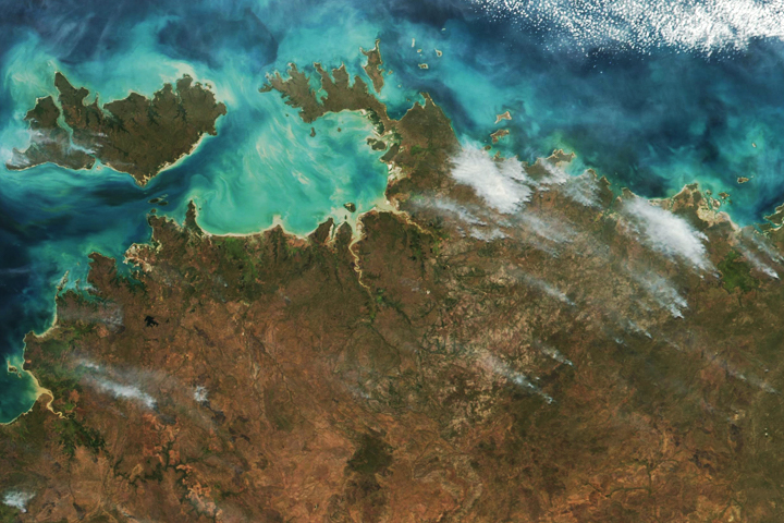
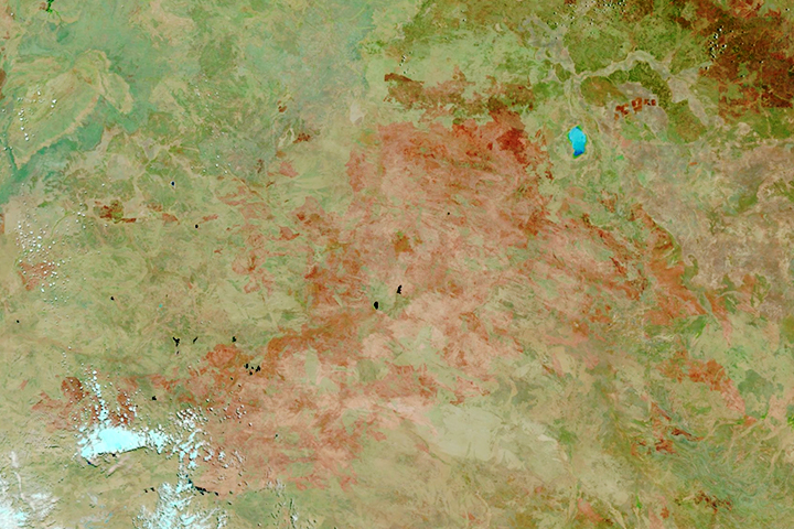
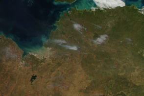
The Moderate Resolution Imaging Spectroradiometer (MODIS) on NASA’s Terra satellite captured this sequence of images showing the progression of the fire. MODIS acquired the top image on September 12, 2014, the middle image on September 23, 2014, and the bottom image on October 7, 2014. Red outlines indicate hot spots where MODIS detected unusually warm surface temperatures associated with fires. Burned areas are dark brown and black.
The fire burned in enclosed pastureland for the first few weeks and then transitioned into desert grasslands to the south. “When you look at the October 7 image, notice that the northern part of the burn scar has edges that appear to follow block fence lines or some other barrier,” explained Rick McRae, a risk analyst for the Australian Capital Territory Emergency Services Agency. “But then in the southern part of the scar, you see a distinct change in land cover. You also start to see less regular ‘fractal’ boundaries showing where, each day, there were breakaways driven by prevailing winds.” Since the southern part of the scar is in a desert grassland as opposed to pastureland, the fire had an opportunity to burn naturally in that area, according to McRae.
Wildfires in this part of Northern Territory are extremely common, with most areas burning every few years. This part of Northern Territory is the third most prolific hotspot-producing region in Australia, according to McRae. “In fact, if you look at the surrounding area, you will see that the entire region is a mosaic of old and large burn scars,” he said.
NASA image courtesy Jeff Schmaltz, LANCE MODIS Rapid Response Team at NASA GSFC. Caption by Adam Voiland, with information from Daniel Lindsey (NOAA) and Rick McRae (Australian Capital Territory Emergency Services Agency).

