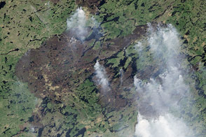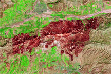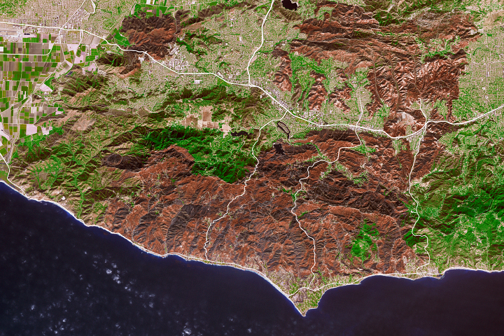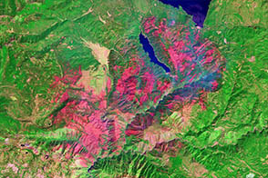
On June 23, 2013, the Advanced Land Imager (ALI) on the Earth Observing-1 (EO-1) satellite captured this natural-color view of a burn scar left by the Doce fire, which burned in June 2013 near Prescott, Arizona.
The fire burned through an area that contained heavy timber and brush. In the image above, charred vegetation appears grey, while unburned areas are dull green. Areas with minimal vegetation are tan. The rust-colored band along the northern edge of the burn perimeter is the residue of flame retardants dropped by aircraft.
Firefighters used two DC-10 air tankers to battle the blaze, flying a total of 75 sorties that delivered nearly 335,000 gallons of retardant. It is unusual for flame retardant residue to be visible in satellite imagery, but “at 12,000 gallons per drop, DC-10’s paint quite a strip,” noted Jan Johnson, a scientist at the Remote Sensing Applications Center.
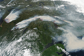
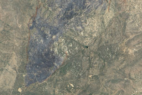
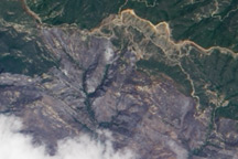
The lower image is a photograph of the retardant trail taken by firefighters on the ground.
NASA Earth Observatory image by Jesse Allen and Robert Simmon, using EO-1 ALI data provided courtesy of the NASA EO-1 team. Lower photograph courtesy of the Southwest Area Type 1 Incident Management Team. Caption by Adam Voiland, with information from Mike Struble.