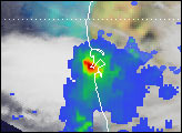

In mid-June 2013, unusually severe monsoon rain caused devastating flooding in northern India and Nepal. By June 21, news outlets reported at least 600 people dead and tens of thousands stranded or missing in rugged, inaccessible terrain on the edge of the Himalayas. Extremely high waters, particularly in the state of Uttarakhand, undermined roads and houses, while landslides wiped out others.
Landslide researcher David Petley noted on his blog: “Whilst mid-June is monsoon season in this area, the most intense rainfall usually occurs later than this. Unfortunately, this high intensity rainfall event will have saturated the ground in these areas, making them more vulnerable to landslides later in the summer.”
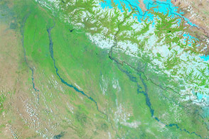
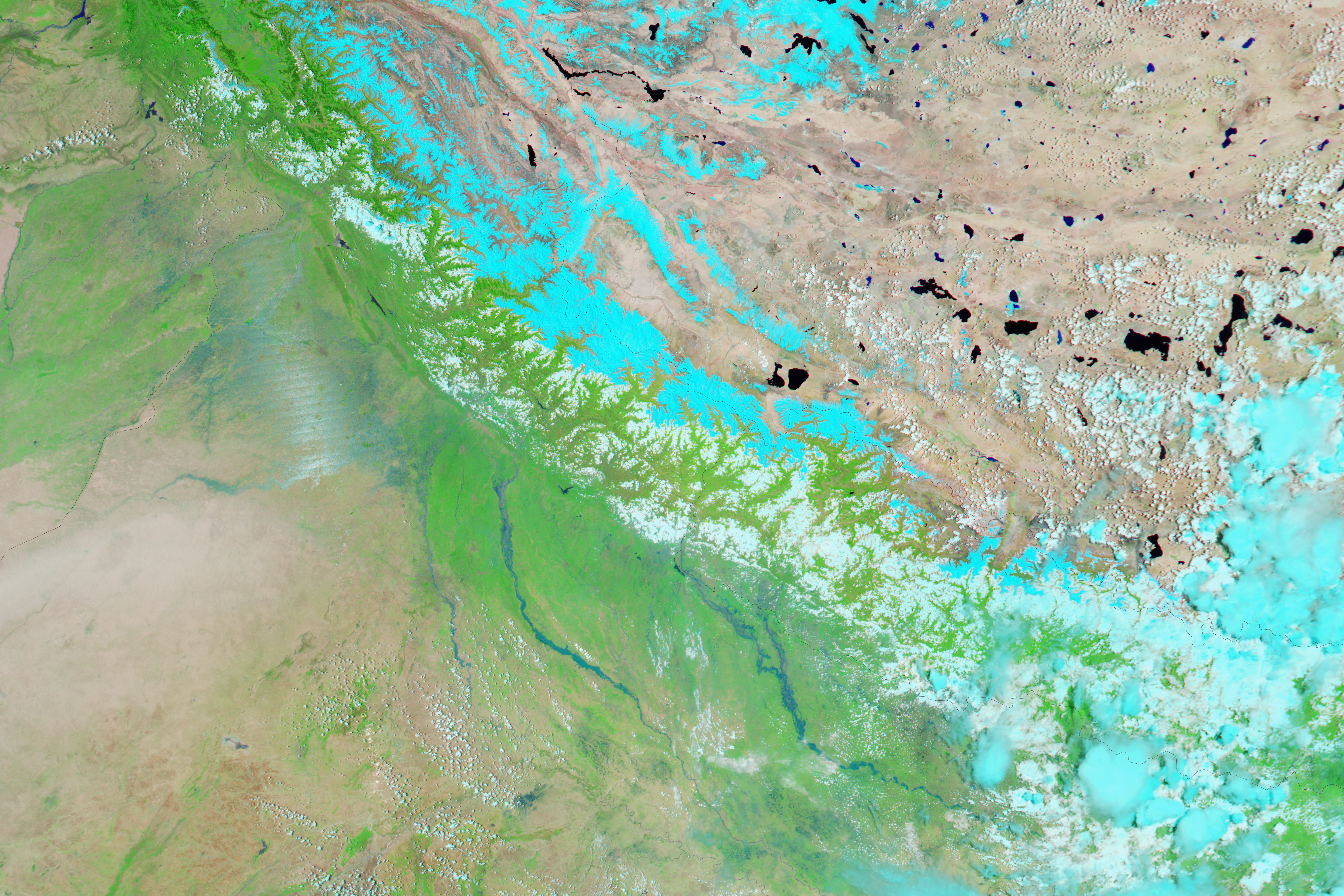
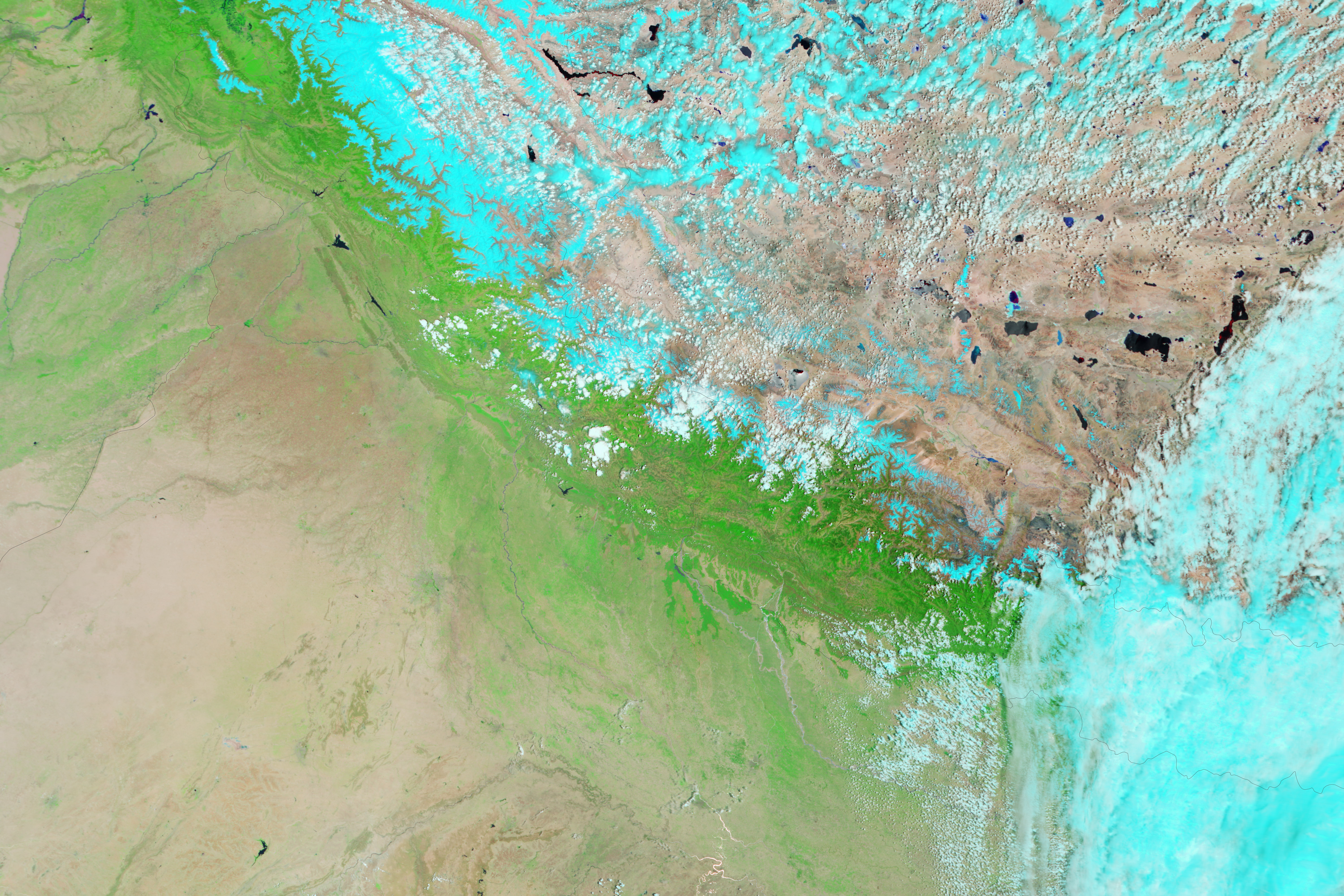
The Moderate Resolution Imaging Spectroradiometer (MODIS) on NASA’s Aqua satellite observed the flooding on June 21, 2013 (top). For comparison, the lower image shows the same area on May 30, 2013. These false-color images use a combination of visible and infrared light to make it easier to distinguish between water and land. Water appears blue and vegetation is bright green. Clouds (lower left) are pale blue-green and cast shadows. Glacier ice and snow in the Himalayas are pale blue to cyan.
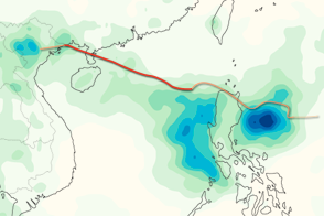
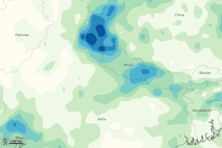
The third image is a map of rainfall totals in India, Nepal, and surrounding countries from June 14-20, 2013. The heaviest rainfall—greater than 300 millimeters (12 inches)—appears in dark blue. The lightest rainfall (less than 15 millimeters, or 0.6 inches) appears in light green. Trace amounts of rain appear in yellow.
The map is based on data from NASA’s Multisatellite Precipitation Analysis (MPA), which estimates rainfall by combining measurements from several satellites and calibrating them using measurements from the Tropical Rainfall Measuring Mission (TRMM). Because it is an estimate of rainfall over a very large area and based on when satellites pass overhead, the MPA may miss pockets of heavy rain in smaller areas, or short periods of more or less intense rain. As a result, local rainfall totals measured from the ground may differ from the estimates shown here.
NASA Earth Observatory image by Jesse Allen, using data from the Land Atmosphere Near real-time Capability for EOS (LANCE). Caption by Mike Carlowicz.